 | | Report (volume) |
| General features____________________________ Coosa County _________ ____________________ Randolph County...Cherokee County_____________________________ 72 Elbert County _____________________________ 75 Hall County__...County_______________________________ 76 Hart County. ___ __ __________________ 77, Lumpkin and Union counti...___________ S3 Pickens County _______-______________________ 83 Rabun County-_____________________________...____________ 86 Troup County ________________________________ 86 Upson County _______________________________ |
 | | Report (issue) |
| ____________________________ _ _ Carolina gneiss ________________________ _ Mica schist _______________________..._______ _ Kyanite schist ________ --~- _________ _ Limestone and graphitic schist _______ _ Roan gneiss...chlorite schist _________________ _ Wedowee formation ____________________ _ Ashland mica schist ____________________...__________________________________ _ ~ orth Carolina and South Carolina ______ ____ _ Georgia ______________...___ _______________________ _______ _ Fauquier County ____ ______ ______ _____ _____ _ Franklin ____ |
 | | Report (issue) |
| ____ Districts in Appalachia__________________ North Carolina_____________________ South Carolina_____________________...___________ Ne~ 1:ork_________________________ North Carolina__ _ ________ __ ______ __ Ohio________...Cox_________________ Talc, soapstone, pyrophyllite, and sericite schist, by Helmuth Wedow, Jr., and John W. Sweeney___... Pyrophyllite in Appalachia ____ ----_Sericite schist in Appalachia__________ Resource potentiaL _________________...Georgia_________________ Deposits in North Carolina__________ Deposits in South Carolina and Virginia____________________________ |
 | | Report (issue) |
| BULLETIN 71 Mineral Resources of Taos County, New Mexico by JOHN H. SCHILLING Description of mineral............................. Graphite gneiss and schist ....................................................................................... Cedros prospect ............................................................................................. Prospect along lower Cabresto Canyon ........................................ Cabresto Lake prospect ........................................................ |
 | | Report (issue) |
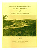
| M INERAL RESOURCES and ROCK MATERIAL of CURRY COUNTY,OREGON 1977 STATE OF OREGON DEPARTMENT OF GEOLOGY...Conservation and Development Commission to Curry County GOVERNING BOARD Leeanne MacColl Portland Robert...- - G a l ice Formation (Jg, J gv) Col ebrooke Schist ( J c , J cv) U l tramafic rocks (J ur) - - - -...ures l. 2. 3. 4. 5. 6. 7. 8. I ndex map of Curry County - - - Horse Sign B utte - - - - - - - Sma l l dacite...data - - Other c h rom ite occurrences i n C urry County Other gold a nd s i lver occurren ces - - - - - |
 | | Book (volume) |
| and Benjamin Vaughan ......... 23 Charles Thomas Jackson: His Works and His Problems . ...................Duane L. Leavitt The Bennett Pegmatite, Oxford County, Maine . ........................................permanent photographic exhibits in the northeastern USA. The Shaubs have been active in ornithological research...tourmalinebearing Himalaya pegmatite at Mesa Grande, San Diego County, California. Most recently, Gene was gratified...Maine's treasure chest; Gems and minerals of Oxford County, second edition: Quicksilver Publications, West |
 | | Report (issue) |
| Topography, Geology and Mineral Resources.. Douglas County— Location and Topography.. Geology and Ore Deposits...Glance)..... U n iv e r s it y o f N e v a d a irmsby County— RBNO, NEVADA Location and Topography............Brunswick) Voltaire (Eagle Valley, Washoe) Vashoe County— Location and Topography................. 3 7 ...PAGE Figure 1—Marl Deposit near Zenobia, Washoe County, Nevada... 13 Figure 2—Gypsum Plant of the Pacific.................- 14 Figure 3—The Leadville Mine north of Gerlach........................... 15 Figure |
 | | Book |
| Yooroonah prospect (deposit 666) 108 Figure 33. Geology of the Yooroonah molybdenite prospect (deposit...area 112 Figure 36. Geology of the Willi Willi prospect 116 Figure 37. Geology and mineral deposits... f~ce 97 of antimony ore, Neill and Taylors prospect (868) TABLES 12 Table J. Stratigraphic summary...Coffs Harbour 1:250,000 sheet area. These are the north-northwesterly trending Gundle belt of hornblende...defonnalions are recognized: ?Iatesl Carboniferous (north-south-trending left-lateral shear system). early |
 | | Report (volume) |
| BUIJLETIN 528 GEOLOGY AND ORE DEPOSITS 1 OF LEMHI COUNTY, IDAHO BY JOSEPH B. UMPLEBY WASHINGTON GOVERNMENT.......................... 74 Mineralogy of Lemhi County ores....................................... 74...in Lemhi County.......................................... Mining districts of Lemhi County.............96 98 0 CONTENTS. Mining districts of Lemhi County Continued. Page. Texas district Continued. Mines...127 127 CONTENTS. 7 Mining districts of Lemhi County Continued. Page. Gibbonsville district. ...... |
 | | Report (volume) |
| TURNER (UK) Society Books Advisors MIKE BROWN (USA) ERIC BUFFETAUT (FRANCE) JONATHAN RETO CRAIG (ITALY)...Clearance Center, 27 Congress Street, Salem, MA 01970, USA: the item-fee code for this publication is 0305-8719/07/$15...Printed by MPG Books Ltd., Bodmin, UK Distributors North America For trade and institutional orders: The...AIDC, 82 Winter Sport Lane, Williston, VT 05495, USA Orders: Tel. +1 800-972-9892 Fax +1 802-864-7626...AAPG Bookstore, PO Box 979, Tulsa, OK 74101-0979, USA Tel. +1 918-584-2555 Fax +1 918-560-2652 E-mail: |
 | | Report (issue) |
| Hardiston, and Vernon in Sussex County, and Jefferson Township in Morris County. The towns of Franklin, Ogdensburg...preexisting fluvial erosion pattern. The area is north of the terminal moraine of the Wisconsin Glaciation...photograph of Beaver Lake and Lake Girard in the north-central part of the Franklin quadrangle, New Jersey...undifferentiated granular and layered gneisses such as occur north and southwest of Stockholm; and (6) Franklin White...including the Edison belt, curve westward just north of the termination of the Losee Pond granite, so |


