 | Hammarstrom, J.M., Meier, A.L., Jackson, J.C., Barden, Ryan, Wormington, P.J., Wormington, J.D., Seal, R.R. (1999) Characterization of mine waste at the Elizabeth Copper Mine, Orange County, Vermont. Open-File Report Vol. 1999 (99-564) US Geological Survey doi:10.3133/ofr99564 | Report (issue) | | | Orange County, VT 50 Kilometers Characterization of Mine Waste at the Elizabeth Copper Mine, Orange...Orange County, Vermont by Jane M. Hammarstrom 1 , Alien L. Meier2, John C. Jackson 1 , Ryan Barden 1 ,...SULFIDE DEPOSITS ........................ 2 THE ELIZABETH MINE .......................................................................................... 3 Mine history and previous studies ............................................................... 10 South pit area ...................................... |  | | Journal (article/letter/editorial) | | GRAND, ISLE: L Jirrwowwux/ lot* llMt UK* U'A VERMONT Mineral Locality Index VANDALL T. K I N G P.O....Massachusetts 01776 MASSACHUSETTS Figure J. Vermont political divisions map; adapted from U.S. Geological...of New Hampshire and Vermont (1972). 324 ROCKS & MINERALS he state of Vermont is relatively small,...ry in the world is in Rochester (Windsor Co.), Vermont. Min eral products mined "as is" for their final...maintained. (The disuse of cobblestone roads prevents Vermont from being a giant mining state today, but in the |  | | Report (issue) | | GEOLOGIST ON THE GEOLOGY AND MINERAL INDUS1RIE OF VERMONT 1945-1946 I TWENTY-FIFTH OF THIS SERIES Centennial...GEOLOGIST ON THE GEOLOGY AND MINERAL INDUSTRIES OF VERMONT 1945-1946 I TWENTY-FIFTH OF THIS SERIES Centennial...MON, The Vermont Geological Survey: 1844-1946 .......................I STATE OF VERMONT State Geologists...epartnient of Natural Resources, Mont pelier, Vermont, Zadock Thompson ...............................important technical study of the granites of Derby. Vermont. The mineral industries of the state reached new |  | | Book (edition) | | Mohs' Hardness Scale 6. Orthoclase 1. Talc 2. Gypsum 7. Quartz Topaz Corundum 10. Diamond 3. Colcite... mark on scale usually leave a scratch just gypsum or about will scratch apatite, as and a a ...feldspar quarries in pegmatite deposits, mines and mine dumps, and from "float" deposits, minerals loose...through matrix rock. Polished Fairburn agate from South Dakota. \\ jfc^ ^ ^ * Emerald in matrix. Emerald...Orbicular or "poppy" jasper with yellow, red, and orange patterns. How gems for I N planning a gem |  | | Journal (article/letter/editorial) | | scorodite, and some scorodite from the large Gold Quarry mine in Nevada contains significant phosphorus and vanadium...minerals are beaudantite, pharmacosiderite, vivianite, gypsum, and various iron sulfates. It is also a widespread...pegmatites including those near Georgetown, Sagadahoc County (King and Foord 1994); other occurrences include...Oxford County. Scorodite occurred in small, pale green masses in oxidized ore at the cobalt mine at Great...Middlesex County; the Booth bismuth mine at Monroe, Fairfield County; and the arsenic mine between Seymour |  | | Report (issue) | | in petroleum and natural gas, and anhydrite and gypsum--occur in great abundance in the United States...deposits, coal, industrial and refinery gases, and gypsum and anhydrite. The locations of the principal native...sulfur by superheated water through wells at Sulphur mine, Louisiana, are fully detailed. Exploration and...are included. Mineralogy of the salt, anhydrite, gypsum, and limestone parts of the domes are described...region: Texas Gulf Coast Oil Scouts Assoc. and South Louisiana Oil Scouts Assoc. , Bull. 1, 128 pp. The |  | | Journal (article/letter/editorial) | | Virginia 20192, USA U.S. Geological Survey, 973 Denver Federal Center, Denver, Colorado 80225, USA c Dartmouth...Dartmouth College, Dartmouth, New Hampshire, USA Accepted 1 June 2004 Abstract Weathering of metal-sulfide...eastern United States. The salts, which are present on mine wastes, tailings piles, and outcrops, include minerals...exploited the massive sulfide deposits in the Vermont copper belt, the Mineral district of central Virginia...sites). Geochemical modeling of surface waters, mine-waste leachates, and salt leachates using PHREEQC |  | | Book (edition) | | the con dition of affairs, more especially in the South and in the States and Ter ritories of the far West...mmed at Broken Arrow aud Trout creek, in Sc. Clair county. The strata in this field are more faulted und...extends from the south prong of Canoe creek, in St. Clair county, to Ha\sop creek, in Bibb county, a distance...distance of 60 miles. Down to Helena, in Shelby county, the field has an average width of 5 or 6 miles. Below...being in the latitud" of Blocton, in Bibb county. The south ern end of this field has a greater thickness |  | | Report (volume) | | ........Prof. B. L. Miller, Lehigh University, South Bethlehem, Pa. Florida............Dr. E. H. Sellards...Charles W. Brown, Providence. South Carolina.. .Dr. Earle Sloan, Charleston. South Dakota... .Prof. E. C. Perisho...Texas............Dr. William B. Phillips, Austin. Vermont..........Prof. George H. Perkins, Burlington. Virginia...See Bauxite and Hallpysite. Asbestos. Tallapoosa County, with corundum deposits near Dudleyville; not found...commercial quantity or quality. Asphalt. Colbert County, small quantity has been shipped from near Leighton; |  | | Journal (article/letter/editorial) | | ALABAMA—Cherokee County is' in northeastern Alabama. In the central part of Cherokee County is the little...10-yr. old subscriber, Buddy Stewart. "Cherokee County has a wide variety of minerals ranging from those...mica, quartz. Limestone also occurs. Cherokee County is full of minerals, so Buddy informs us, and to...around Rock Run, in the southeastern part of the county, and was mined extensively in recent years. The...over Cherokee County. "Lots of Indian relics are found too." A map of Cherokee County, prepared by Buddy |  | | Report (volume) | | ......... South Carolina......................................:.................... South Dakota.................................................... Vermont..................................................Arkansas, California, Colorado, New Mexico, Oregon, South Dakota, Tennessee, and Texas; to list all the literature...Catalogue of the mineral localities of South Carolina: South Carolina Geol. Survey, ser. 4, Bull. 2,...1908. Scott, Samuel, Map of the Black Hills of South Dakota and Wyoming, with full descriptions of mineral |  | | Report (volume) | | magnetic field strength. The warm colors (red, orange, and yellow) represent areas of magnetic field...origin of the Ely copper deposit, east-central Vermont By Terry W. Offield, John F. Slack, and Sarah A...silver, mercury, copper, and palladium in Lemhi County, east-central Idaho By George A. Desborough, William...localities (Maple Peak (West Tintic Mountains), south Cherry Creek, and Desert Mountain) are 8,000-10...Mountain contain blocks > 1,000 ft long, whereas, at south Cherry Creek, blocks are as much as 100 ft long |  | | Book (volume) | | ASHTABULA COUNTY CONNEAUT, area pits, quarries, rd. cuts, etc.⎯cone-in-cone Calcite. CLERMONT COUNTY MILFORD...CLINTON COUNTY WILMINGTON, area of Todd’s Ford, a mineral deposit⎯Hematite. COSHOCTON COUNTY AREA, townships...CUYAHOGA COUNTY CHAGRIN FALLS (on Geauga Co. line), area quarries⎯oilstone. DELAWARE COUNTY DELAWARE...nodules⎯Pyrite (crystals sharply cubic). FRANKLIN COUNTY COLUMBUS, area countywide exposures of blue clay...HIGHLAND COUNTY SINKING SPRING, area ore deposit (most important in Ohio) ⎯Hematite. HOCKING COUNTY AREA | 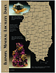 | | Journal (article/letter/editorial) | | Sphalerite and calcite, 5 cm across, Denton mine, Hardin County. Ross Lillie specimen. +!.+!+%% 34!2+ ...chalcopyrite, and sphalerite, 12.7 cm high, Hardin County. Marv Rausch specimen. 3(%,"9 -!#/50). /5 ....to the mid-1970s were documented with the exact mine or in many cases even the correct subdistrict. In...sprays of millerite associated with calcite. The coal mine dumps and waste piles scattered throughout much...Fluorite and barite, 6 cm high, Minerva No. 1 mine, Hardin County. Ross Lillie specimen. Figure 5 (above right) |  | | Book (volume) | | Location Guide for Rock Hounds in the United States SOUTH DAKOTA This northwestern Great Plains state varies...as the continental seas were advancing from the south, the Dakota sandstone represents topset beds, wave...instance, a single Spodumene crystal from the Etta Mine near Keystone on the east side of the Mount Rushmore...to the fascination of these pegmatites. 437 South Dakota The commercial production of minerals, principally...beds, excavations, etc.Selenite roses. BRULE COUNTY AREA: in the Oacoma zone of the Pierre Fm. On Elm |  | | Book (volume) | | ASHTABULA COUNTY CONNEAUT, area pits, quarries, rd. cuts, etc.⎯cone-in-cone Calcite. CLERMONT COUNTY MILFORD...CLINTON COUNTY WILMINGTON, area of Todd’s Ford, a mineral deposit⎯Hematite. COSHOCTON COUNTY AREA, townships...CUYAHOGA COUNTY CHAGRIN FALLS (on Geauga Co. line), area quarries⎯oilstone. DELAWARE COUNTY DELAWARE...nodules⎯Pyrite (crystals sharply cubic). FRANKLIN COUNTY COLUMBUS, area countywide exposures of blue clay...HIGHLAND COUNTY SINKING SPRING, area ore deposit (most important in Ohio) ⎯Hematite. HOCKING COUNTY AREA |  | | Journal (article/letter/editorial) | | top of a mountain in Fulton County, about 5 miles southwest of Elizabeth, Ark. W e first found pieces...pieces in the road."—on label. Elizabeth is in S/W Fulton County in northern Arkansas. CALIFORNIA—Art Tatum...call it black jasper. Some rockhounds from Kern County here have complete displays with the coal-black...inch in diameter. Bakersfield is in western Kern County in S.W. California. COLORADO—"I got this specimen...came off of the mountain on which is the Beidell Mine. What is the ROCKS AND MINERALS black mineral |  | | Catalog/List | | sunbust effect , cut and polished slab 2.5 xl .5 Mine de L' Etoile Congo £20 3. LEPIDOLITE, choice display...fine pale green fibrous mass with some quartz. 3x2 South Norway £6 Selasvatn 9. TOURMALINE dark green elongated...Franklinite, old time specimen 3x2x2 Franklin New Jersey USA £25 Actually quite attractive and with excellent...NATIVE SILVER thin sheet about lxl.5 inches La Noria mine, San Martin, Zacatecas Mexico £15 , 16. NATIVE COPPER...clear gypsum variety Selenite , nice Ix 2.5 inch exposed cleavage surface. Mission Mine, Pima County, Arizona |  | Seal, Robert R., Hammarstrom, Jane M., Johnson, Adam N., Piatak, Nadine M., Wandless, Gregory A. (2008) Environmental geochemistry of a Kuroko-type massive sulfide deposit at the abandoned Valzinco mine, Virginia, USA. Applied Geochemistry, 23 (2) 320-342 doi:10.1016/j.apgeochem.2007.10.001 | Journal (article/letter/editorial) | | sulfide deposit at the abandoned Valzinco mine, Virginia, USA Robert R. Seal II *, Jane M. Hammarstrom...Reston, VA 20192, USA Available online 7 October 2007 Abstract The abandoned Valzinco mine, which worked...Au–pyrite belt, contributed significant metal-laden acid-mine drainage to the Knight’s Branch watershed. The host...leaching studies of flotation tailings – the dominant mine waste at the site – indicated that they were acid...solution. Field studies of mine drainage from the site confirmed that mine drainage and the impacted stream |  | | Report (volume) | | cientlfica Circular Classe classification Company, County Collections Committee Communications Comparative...Schr----.----schweizer_..-_ Sci._---_--_-. series south, Survey Sallskapets Schrift schweizerisch Science...Abstracts nos. 5, 6. Bethlehem, Pa. Los Angeles County Museum: Publications nos. 4-7; Quarterly vol. 6...Md. South Carolina Research, Planning and Development Board Bulletin no. 15. Columbia, C. C. South Dakota...Experiment Station Bulletin 25. Salt Lake City, Utah. Vermont, Report of the State Geologist, 1943-44, 1945-46 |  | | Book | | Ohio Oklahoma Oregon Peru1Sylvania Rhode Island South Dakota Tennessee Texas Utah 1 11 18 23 39 41 47...231 240 252 256 264 265 273 279 299 iii Page Vermont Virginia Washington West Virginia Wisconsin Wyoming...Island ? South Carolina Division of Geology State Development Board Box 927 Columbia, South Carolina...publications; not indexed) South Dakota State Geological Survey Science Center Vermillion, South Dakota ,":>- 7 o0...Geological Survey East Hall, University of Vermont Burlington, Vermont C') 5l/ C / Virginia Division of Mineral |  | | Journal (article/letter/editorial) | | red vanadinite xls and coming from the Red Cloud mine (about 30 miles N . of Yuma), Yuma Co., Ariz., have...staring point, travel Highway 60-70-89 south to Litchfield cut-off south of Wickenburg. This is an all-paved...the mountain, for 3 miles. The gravel road is a county road, usually fair except after heavy rains. At...'ghost town' of Winterburg you are only a few miles south of Tonopah where gas, oil, water, etc may be obtained...novaculite pebbles (gravel). Of course, both north and south coastal plains and streams thereto, have pebbles |  | | Book (edition) | | describes sites under of the nearest town and county. and the many maps included book contain such...create a steady market and a sentithe abundant South mental regard for that gem. make Rarity helps...Maine, Connecticut, New Hampshire, North Carolina, South Dakota, liquid in the solidifying dike. and California...region, less At meet the rocks of and to the south the Mississippi delta and vast coastal plain. In...minerals. He will pick over stream beds, gravel pits, mine dumps, road cuts, and quarries. Some gems may also |  | | Book | | often are arrested there. At the Eldorado sapphire mine in Mon¬ tana the action of a million years is readily...intrudes a sloping bed of limestone. As the Yogo mine has been worked at various times in the past hundred...famous was the single beryl stone found in Oxford County in Maine that weighed 18 tons and was 18 feet in...parallel. A much-sought-after form of chalcedony, gypsum and hematite is called rosette because it resembles...in the bed of the stream. e. If it is possible to mine the bed of the stream itself this may prove to be |  | | Journal (article/letter/editorial) | | Dam, and my understanding is that it is out of a mine that is worked intermittantly. It could be that...that someone is working out the vugs in an old mine. "The crystals are peculiar in many respects. The unusual...Murfreesboro (Pike Co.), Arkansas. Here, in the diamond mine, I found a beautiful blue barite crystal about 1"...small brown xl is sphene which was found in the south end of Stratford (Fairfield Co.), Conn., in a lot...fl. a sort of orange. "The calcite is found in a rock quarry located almost due south of the little Brown |
|


