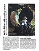
 | | Journal (article/letter/editorial) | | that bring together important locality data for Ohio minerals. It is a contri bution to the national...the Findlay Arch (northwestern Ohio) and Serpent Mound (southwestern Ohio) districts (Carlson 1990); thisvone...Kirwan Reservoir at mouth of Silver Creek near Edinburg, Portage County. Figure 1 (left). Rosanna Carlson...septarium, Copperas Mountain near Spargursville, Ross County. Ernest Carlson photo. Figure 3. Map showing mineral...in a northerly trending belt that runs from the Ohio River to Lake Erie (Monroeville and Spargursville |  | | Report (edition) | | GEOLOGICAL SURVEY 2045 MORSE RD., BLDG. C- 1 COLUMBUS, OHIO 43229-6693 (614) 265-6576 (614) 447-1918 (FAX)...L. Fox, MS, Seismologist Michael C. Hansen, PhD, Ohio Seismic Nelwork (OhioSeis) Coordinator An Equal... Minerals of Ohio by Ernest H. Carlson Bulletin 69 Second Edition STATE OF OHIO DEPARTMENT OF NATURAL...(formerly Stoneco, Inc.}, near Junction, Pau lding County, Ohio. Specimen is 3.8 x 2.4 cm with the largest crystal...citation: Carlson, E.H., 2015, Mineral s of Ohio (2d ed.): Columbus, Ohio Department of Natural Resources, Division |  | | Report (volume) | | publication] Page (A) Phosphatic rocks in the Deer Creek-Wells Canyon area, Idaho, by Wayne Russell L...(C) Limonite deposits near Scappoose, Columbia County, Oregon, by Preston E. Hotz___________________...Beryllium deposits of the Mount Antero region, Chaffee County, Colorado, by John W. Adams._________________________________...deposits of the Iron Mountain district, Washington County, Idaho, by J. Hoover Mackin________________________________...Geology of the Dover Magnetite district, Morris County, New Jersey, by Paul K. Sims___ _--------_____ |  | | Report (issue) | | GEOLOGIC MAP OF THE BLACKBIRD CO-CU-AU DISTRICT, LEMHI COUNTY, IDAHO -114° 24’ 0.5” 45° 11’ 15.2” 30 Ycabs...80 36 35 70 42 35 40 k fault 20 40 Big Deer Cree 50 60 fault Ledge 27 80 White 80 Ybs...upper part of the Lake Mountain member of the Apple Creek Formation of Burmester and others (2016). ª ¬...Slip ge Led te Whi Little fault Cr e ek Deer Big NE RI CR DG EE E K PI CO BA LT J M URE...downloaded in PDF format from www.idahogeology.org. Deer Creek Fault ¬ Iron Lake thrust plate ª ª 45° 4’ |  | | Report (volume) | | Fluorspar Deposits, Big Four Fault System, Crittenden County, Kentucky GEOLOGICAL SURVEY BULLETIN 1042-S...DEPOSITS OF THE BIG FOUR FAULT SYSTEM, CRITTENDEN COUNTY, KENTUCKY By GEORGE C. HARDIN, JR., and EGBERT...The most abundant vein minerals are fluorite and calcite with subordinate quantities of sphalerite, galena...came from veins composed mainly of fluorite and calcite. The ore bodies are the result of fissure filling...Kentucky-Illinois fluorspar district, which straddles the Ohio River in southern Illinois and western Kentucky |  | | Report (issue) | | . . . . . . . . . . . . . . . . . . 5 Helms Creek Section . . . . . . . . . . . . . . . . . . . .... . . . . . . . . . . . . . . . . . . 9 Old Deer Creek Quarry . . . . . . . . . . . . . . . . . . .... . . . . . . . . . . . . . . . . . 14 Liston Creek limestone . . . . . . . . . . . . . . . . . . ....itinerary. A lunch stop will be made in Peru, Miami County, Indiana. After lunch the caravan will reassemble...the Rockledge Quarry, southwest of Portland, Jay County, Indiana. No arrangements have been made for Sunday |  | | Journal (article/letter/editorial) | | preservation') are composed of calcitic bacteria, calcite crystals and organic material, and have been interpreted...collections from the Hamilton Lagerstatte (Greenwood County, Kansas, U.S.A.; Fig. la) gave the impression that...Hamilton Lagerstatte is situated in eastern Greenwood County, Kansas, U.S.A. (Fig. la). Exposures occur in a...abandoned and active quarries, in roadways, and along creek-cuts over a distance of more than 8 km (see French...palaeochannel is confined to a sequence of rocks from the Deer Creek Limestone at the base to the Topeka Limestone |  | | Journal (article/letter/editorial) | | Research Institute, Reno, NV, USA State of Nevada, Carson City, NV, USA c National Taiwan University,...000-yr δ18O and δ13C global climate records for calcite precipitated in Devils Hole, Nevada at the end...data, high-level tritium transport, and a vein calcite isotopic paleo-climate record. DIC 14C and DOC...000-yr global climate records of precipitated calcite. Determining the age of groundwater is critical...the Coastal Plain aquifers in southern Maryland, USA; Geyer et al. (1993) and Artinger et al. (1996) for |  | | Report (volume) | | 955-0 PHOSPHATE DEPOSITS OF THE DEER CREEK-WELLS CANYON AREA CARIBOU COUNTY, IDAHO BY CHARLES DEISS Contributions...ILLUSTRATIONS PLATE 5. Geologic map and sections of the Deer Creek-Wells Canyon area, Idaho____._-_ ___________...phosphatic shale member, Phosphoria formation, Deer Creek-Wells Canyon area__ In pocket 7. Columnar sections..._____ In pocket FIQTTRE 4. Index map of the Deer Creek-Wells Canyon area___________ 62 TABLES TABLE...TABLE 1. Analyses of samples from trench A, Deer Creek-Wells Canyon area. _______________________________________ |  | | Journal (article/letter/editorial) | | argillaceous rocks are represented by the Garden Creek Phyllite and Ramshorn Slate. Calcareous rocks are...Wood River area (box marked as Fig. 2), Beaver Creek area (box marked as Fig. 3), Carrietown area, and...the Wood River area showing the locations of Deer Creek, Bullion, Croesus, McCoy, Minnimoore, Silverstar...two-mica granite Thompson Creek, Deer Creek, McCoy, Croesus, Beaver Creek (Pilgrim, Silver King), Vienna...Vienna, Carrietown, Rooks Creek, Dead Wood, White Cloud Peak, Little Boulder Creek, Treasure Vault PennsylvanianPermian |  | | Report (issue) | | . . . . . . . . . . . . . . . . . . . . . . 1 County Listings. . . . . . . . . . . . . . . . . . . .... . . . . . . . 4 Mineral Localities Listed by County . . . . . . . . . . . . . . . . . . . . . . . .... . . . . . . . . . . . . . . . . . . 7 Beaver County . . . . . . . . . . . . . . . . . . . . . . . ... . . . . . . . . . . . . . . . . . 7 Box Elder County . . . . . . . . . . . . . . . . . . . . . . . .... . . . . . . . . . . . . . . . . . . 10 Cache County . . . . . . . . . . . . . . . . . . . . . . . |  | | Report (issue) | | .......................................... 18 Calcite .................................................The most common minerals in these sediments are calcite, clay minerals, dolomite, glauconite, goethite...examine a collection of geodes from Big Walnut Creek, Putnam County; and many quarry operators for granting...Indians knew of and used Wyandotte Cave in Crawford County (4).2 Ball (1941, p. 39) summarized the various...The Indians found that Wyandotte Cave, Crawford County, Ind., contained two desirable products, a jaspery |  | | Report (issue) | | ............................................... Ohio shale ................................................................................. 82 Sandy Creek fault................................................... '. 82 Minor fractures between the Sandy Creek and Columbia faults.................... 83 Evening......................................... 93 Eddy Creek fault............................................................................. 96 Livingston Creek fault.......................................... |  | | Journal (article/letter/editorial) | | second marine transgresindicates that the Rakes Creek Shale, Ozawkie sion during deposition of the Rock...(Redfield Anticline); the subsiding Forest City Ervine Creek Members. The megacyclic sebasin was located to the...evidence supporting these con- the end of Ervine Creek time. clusions includes the progressively decreased...and eastern Nebraska The interval from the Rakes Creek to the (Fig. 1) and to interpret their paleoecologic...the The authors examined the rocks in twelve Deer Creek Megacyclothem (Moore, 1936). Stratigraphic sections |  | | Journal (article/letter/editorial) | | mineral has been mined quite extensively in Clay County, Alabama, from one end to the other. It is quite...ARKANSAS—Brown jasper pebbles have been found in a creek bed near Benton, Saline Co., Ark. ROCKS AND MINERALS...south of Antimony Peak, near Hollister, San Benito County, California. While it might sound like exaggeration...black, radiating plates on massive smoky quartz. Calcite: white, cleavable (fl. yellowlong wave) on mica...ridge. A jeep road connects the mine with the Deer Creek road #435. It is approximately 4 miles from this |  | | Report (issue) | | ENVIRONMENTAL GEOLOGIC FACTORS AS AIDS TO PLANNING IN CASS COUNTY, INDIANA Special Report 22 State of Indiana Department...Environmental Geologic Factors as Aids to Planning in Cass County, Indiana By JOHN R. HILL ENVIRONMENTAL STUDY 16...formations on outcrop and beneath glacial drift in Cass County . . . . . . . . . . . . . . . . . . . . . . . ...Generalized bedrock stratigraphic column for Cass County . . . . . . . . . .3 3 Well log of bedrock units...topography of Cass County .7 7 Map showing distribution of unconsolidated deposits in Cass County .8 8 Map |  | | Report (issue) | | BEDROCK GEOLOGY AND MINERAL RESOURCES OF PUTNAM COUNTY, INDIANA Special Report 26 -- Special State... Bedrock Geology and Mineral Resources of Putnam County Indiana By JOHN R. HILL, MICHAEL C. MOORE, and...Edwardsville Formation Sanders Group . . . . . . Ramp Creek Formation Harrodsburg Limestone Salem Limestone...Reelsville Limestone . . Elwren Formation . . . Raccoon Creek Group and Mansfield Formation Industrial minerals...Page Map of Putnam County showing physiographic units .2 Map of Putnam County showing general distribution |  | | Report (volume) | | mine._______________________________________ Birch Creek district, Idaho__-_______._______________________-__...183 IV CONTENTS Mine descriptions Continued Deer Creek district, Montana_________________________ Divide...sections of the Trapper no. 1 claim, Beaverhead County, Mont__________________________ In pocket FIQTJEE...Idaho_____ 43. Geologic and index maps of the Birch Creek district, Montana______________ __ ._ 44. Geologic...Montana.. 45. Geologic and index maps of the Deer Creek district, Montana....__________._-__--__----------_---_-_--_ |  | | Journal (article/letter/editorial) | | the eastern third of Kansas, and one adjoining county in Oklahoma. Some specimens were also obtained...by circles, and the number of localities in each county by numerals. LIMESTONES GENERAL The limestones...Mesbzoic fossils, openings have-been filled with calcite of a texture and tint different from original "wall...Branch), Deer Creek (Rock Bluff), Burlingame, and Foraker (Americus and basal Hughes Creek) limestones...Pennsylvanian, sec. 26, T. 31 S., R. 11 E., Elk County, Kansas. TYPE: Slide 698, specimen JA2575, Johnson |  | | Journal (article/letter/editorial) | | ............................. 8•6 8•6 Beaver Creek AsbestosDeposit .................................... 825 829 Smith Creek AsbestosDeposit .................................. Deer CreekDeposits.........AsbestosDeposit ..................................... Deer Creek CanyonChromiteDeposit .........................II--Nonmetals, pp. x39-x4o. 816 R. H. BECKWITH. BADGER CREEK DEPOSIT. A reportedoccurrence of asbestos in sec...wedgesout to the south,as it is not seenbeyondRock Creek. The serpentine is generallydark greento blackin |  | | Report (volume) | | 763 ARAVAIPA AND STANLEY MINING DISTEICTS GKAHAM COUNTY, ARIZONA BY CLYDE P. ROSS WASHINGTON GOVERNMENT..._____________________________ 8 Mescal Range and Deer Creek basin___________________ 10 Santa Teresa Mountains...the granite of the main batholith_________ 69 Calcite veins 70 Barite lodes ___________ ______ ___ _____...of the Gila formation on the east side of Turkey Creek; B, Cliff of conglomerate of the Gila formation...THMRAYAIPA AND STANLEY MINING DISTRICTS, GRAHAM COUNTY, ARIZONA By CLYDE P. Ross SUMMARY The region in |  | | Report (issue) | | officio member MINERAL RESOURCE POTENTIAL OF PIUTE COUNTY, UTAH AND ADJOINING AREA by Eugene Callaghan ...This study of the mineral resources of the Piute County area, prepared under a Utah Geological and Mineralogical... . . . ... . . .. . . .. . .. . .. 114 Manning Creek . . . . . . . . . . . . . . . . . . . . . . .. 115...Mining District .... . . . . . . ... . . 119 Mill Creek Deposits . . . . . . . . . . . . . . . . . . . .... .. . . . ..... . . . . . . . . . .. 120 Bo x Creek Deposits . . . . ..... . . ... ...... 120 Sulfur |  | | Report (volume) | | area________ II. A, The upper part of the valley of Rock Creek; B, Lee Mountain and surrounding hills-____________________...quartzite on upper Ash Creek; B, Ripple-marked Cambrian quartzite on upper Ash Creek _ ___ ___ V. A, Mottled...quartzite on upper Ash Creek; B, Tornado limestone in the box canyon on upper Ash Creek-______ VI. A, Coarse...Coarse Cretaceous conglomerate on upper Ash Creek; B, Coarse Cretaceous conglomerate on Gila River above...cutting Cretaceous volcanic rock on south side of Deer Creek east of Adjust mine___ I.. A, Contorted Tornado |  | | Book (edition) | | LAKE CITY, UTAH. MINERAL LOCALITIES. BEAVER COUNTY. (Vy Beaver City, near; hyalite, banded in brownish...almandine garnet, barite, bismuth - inite. Indian Creek; gold. Mooney Springs; topaz. Rock Corral; 9 miles...bismite, bismutite. BOX ELDER COUNTY. Copper Mountain Mine; azurite, Dove Creek; gold, garnet. cuprite, malachite...f\^^mf^\r^i Utah Minerals and Localities. CACHE COUNTY. Blacksmith Fork; cernssite, galena. La Plata;...part of County; iron ores. CARBON COUNTY. Castle Gate; coal, native coke. Eastern part of County; iron |  | | Report (issue) | | 2. Geology of the Jackson Mountains, Humboldt County, Nevada, by C. R. Willden. 120 p,,'34 figs., 4...1, Geology of the Jackson Mountains, Humboldt County, Nevada by Charles Ronald Willden, U. S. Ge...older rock*, . ......... . ..... i • • Happy Creek volcanic series 2riassic rooks. . . • iiilest)nc...Cretaceous and early Tertiary deformation (continued) Deer Creftk thrust. . Intmaive * • activity . *******...:spectrographic analyses of iron content of Sappy Creek volcanic rocks . • . ......... . • • * • • •lc:1 |
|


