 | | Report (issue) |
| sulfur mines in the United States and by opening new mines, by greater recovery of byproduct sulfur (in...pyrites, and all other forms) since 1935 is reviewed. New sulfur mining and recovery projects in the United...Communist countries) are described; these will have new production of about 3,000,000 tons of sulfur by the...of sulfur during 1935-39 and 1950, and estimated new production are given in some detail; this information...(long tons) 1950 production (long tons) Estimated new production (long tons) 2,569,000 5,966,000 1,541 |
 | | Report (volume) |
| and reserves..___________________________________ Mine descriptions.._________________________________________...Idaho________________________________________ Singiser mine._______________________________________ Birch Creek...176 178 178 180 181 183 183 183 IV CONTENTS Mine descriptions Continued Deer Creek district, Mon...Bear claim____________________________________ Last Chance and Shady Tree claims_______________ Referen...______ 49. Geologic map and sections of the Last Chance and Shady Tree claims, Beaverhead County, Mont_____ |
 | | Journal (article/letter/editorial) |
| MINERALS WORLD NEWS ON MINERAL OCCURRENCES Items On New Finds Are Desired. Alabama—Mr. Ernest Fairbanks...north line of Sec. 3, T 2 0 S , R7E. (a little south of Pleasant Grove Church). Another occurrence is...railroad cut a few miles northeast of Erin, Clay Co., where turquoise is found as thin veins in graphite...mineral world. Arkansas—At Eureka Springs, Carroll Co., Ark., beautiful specimens are found of snowy-white...Them In. calcite from the West End quarry, Inyo Co., Calif., and the other is a bluishwhite common opal |
 | | Report (issue) |
| Clarkprospects-----------------------~----- Mica Queen mine __________________________ _ Location and access...Fawn and Deer Ridge prospects ______ _ Myers mica mine __________________________ _ 0. K. prospect _____...affecting pro-specting and mining ___ _ Avon Mica Co. mine _______________________ _ Gampbelllease _____________...Fitzgerald property ___________________ -_- __ _ Last Chance mine _________________________ _ Location and access...Lucky Jim prospect_ _______________________ _ Luella mine _______________________________ _ Location, history |
 | | Report (issue) |
| yet for the most part undeveloped. The Big Hurrah mine, in the Solomon district, produced gold from 1903...shipments of gold ore have been made from the Sliscovich mine, on Manila Creek, in the Nome district, but these...published later. GOLD. SLISCOVICH. The Sliscovich mine, near the head of Manila Creek, has been described...not be elaborated. The latest shipment from this mine was made in the fall of 1915, 1 Chapin, Theodore...the designation of the mine as an antimonygold mine, rather than an antimony mine. CALIFORNIA. The California |
 | | Report (issue) |
| WESTERN AUSTRALIA MINERAL RESOURCES BULLETIN 13 COPPER MINERALIZATION IN WESTERN AUSTRALIA by R. J...Library of Australia card number and ISBN 0 7244 8002 11 1 PREFATORY NOTE Western Australia has never... exploration interest has remained high. In the last decade this has resulted in the discovery of several...understanding the geology of the State over the last 15 years coupled with a surge in base metal exploration...DIVERSITY OF COPPER MINERALIZATION I N WESTERN AUSTRALIA The geological setting: tectonic provinces .. |
 | | Report (issue) |
| Stratigraphy Pre-Cambrian (7?) Rand schist — =D = 5B. Mesquite schist Age of the schists_ 14 Paleozoie...Mountai 5. Columnar section, Ricardo formation in Last Chance Canyon______ * Geologist, Richfield Oil Corporation...consists of pre-Cambrian (?) Rand schist, pre- Cambrian (?) Mesquite schist, the late Paleozoic Garlock...Mesquite schist, and plutonie rocks crop out in El Paso Mountains; but only the Rand schist and plutonic...N. and tilted northwestward. The Mesquite schist and Garlock 20° W. and dip steeply east. Most |
 | Pilkington, H.D., Forbes, R.B., Hawkins, D.B., Chapman, R.M., Swainbank, R.C. (1969) Preliminary investigation of gold mineralization in the Pedro Dome-Cleary Summit area, Fairbanks district, Alaska. Open-File Report Vol. 1969 (69-206) US Geological Survey doi:10.3133/ofr69206 | Report (issue) |
| Summit.., Gold content of vein at Antimony Ridge mine, Murphy Dome Road area............................ Gold content of channel samples Antimony Ridge Mine, Murphy Dome Road................... Bedrock and...and Some gold lodes occur in quartz quartz-mica schist in the Pedro Dome - deary Summit area of the Fairbanks...found along the crest of mapped as Birch Creek Schist (Plate I). District suggest the presence of numerous...obtained without the consent and cooperation of mine owners and claim holders in the district. The permission |
 | | Report (issue) |
| prices of the last offerings, are given in the current-year issues of the monthly catalog "New Publications...Reports Section, Federal Center, Box 25425, Denver, CO 80225. Reports released through the NTIS may be obtained...Open-File Reports Federal Center, Box 25425 Denver, CO 80225 • DENVER, Colorado--Federal Bldg., Rm. 169...Government Printing Office Washington, D.C. 20402 South State St. • SAN FRANCISCO, California--Customhouse...Map Distribution Federal Center, Box 25286 Denver, CO 80225 Residents of Alaska may order maps from Alaska |
 | | Report (issue) |
| S. Commissioner of Mineral prepared reports of mine production and gold-mining Bureau, and later now...John Wells. is also given to the large number of mine owners and operators, mining engineers, and miners...Grange La Porte Stanislaus Kern River Last . .Plumas Chance Canyon Placer .. ... .. Plumas Light's...Springs.... Hart _ Ibex. Siskiyou AVjnumental New River-Denny Old Diggings Orleans^ _ Reef.. Goldstone...District, Nevada County Section through Idaho-Maryland Mine Section through Empire and Pennsylvania Mines Map |
 | | Journal (issue) |
| ALMANDITE, Bodo, Norway. Large I l 1 2" l xi. in Schist. 3x3 ....... $ 2 .00 GOETHITE, Cornwall. Xld. and...HUGH A. FORD OFFICE AND SHOWROOM: 110 WALL STREET NEW YORK S. N. Y. Telepho ne : BOwling Green 9 -7 191...·······················-······························· Two NEW MIN ERALIGHTS ON MARK ET •·················· ·· ············...liV. CJa,,k ............ GLYCERINE POPULAR lN AUSTRALIA ...... ........... .. .......... .......... ................................. MINERAL JAUNT TO SOUTH DAKOTA. By H oward E. / ack.ron ............... |
 | | Journal (issue) |
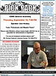
| state. At right, Mr. Hickey displays a sample of schist during a presentation named Touching a Piece of...Arnson, 719 337-8070 Sharon Holte, 719 217-5683 CO Springs 80909 For more information on any of the...AND manning hands-on activities such as gold ver, CO. See https:// panning, metal detecting, track painting...-Sun., Oct. 5-6, Colorado Scientific Society will (south side of I-70) and the National Western complex host...Garden Park; and the Cripple Creek and Victor Gold Mine. You must be a CSS member to take part, but anyMinerals |
 | | Report (volume) |
| correlation........................................ Schist band..................................................................................... Sumdum mine............................................. Portland............. Friday mine.............................................. Crystal mine......................of quartz veins.......................... Ebner mine........................................... Position...ore.............................. Alaska Juneau mine .................................. Position and |
 | | Report (volume) |
| ____________ Suggestions for further exploration_____ __ Last Shot group_______________________________ Mountain... Creek property..__________________________ Last Chance group. __ __________________________ Monarch...Lindeborg shear zone, Riverside mine. Geologic maps of levels, Riverside mine. Longitudinal projection of...Riverside mine (1942). 17. Map and longitudinal projection of upper levels, Riverside mine. 18. Geologic...gold and silver from Riverside, the only productive mine in the district, continued intermittently from 1925 |
 | | Report (volume) |
| (B) Clays Ferry Formation (Ordovician) a new map unit in south-central Kentucky, by Gordon W. Weir and...Ashlock and Drakes Formations (Upper Ordovician) in south-central Kentucky, by Gordon W. Weir, Robert C. Greene...Gualtieri. (F) Borden Formation (Mississippian) in south- and southeast-central Kentucky, by G. W. Weir,...(G) The Yakima Basalt and Ellensburg Formation of south-central Washington, by J. W. Bingham and M. J. Grolier...Lopez Member, Mancos Shale, in the San Juan Basin, New Mexico, by Carle H. Dane, William A. Cobban, and |
 | | Journal (issue) |
| ....................... by W. E. W ilson 2 Australia G old in A u s tr a lia ........................arrison & J. Fuller Recent Discoveries W hat's new in gold? Venezuelan gold (by W. E. W ilson) .......the "Fricot Nugget," collected in 1865 at the Grit mine, El Dorado County, California, by Jules Fricot and...many different species these days, so what else is new? One must faking, so gold collectors must be appropriately...gold localities not mentioned in G old-I. . . Australia, Colorado and Appalachia, for example. It seems |
 | | Journal (issue) |
| issue, on page 55, the last page of Bruce McKay’s feature about the Polka Dot Mine in Central Oregon, information...information about connecting with the mine via Facebook was incorrect. On Facebook, search for the Polka...Leatherman. In my opinion he saved the best for last. Why? Because I’ve been to both the Crabtree and...shipment of High Grade Welo opal from Ethiopia-posting new opal parcels daily. Please call or order directly...villagesmithyopals.com 8 ROCKNGEM.COM ! d e v o M e v ’ We NEW LOCATION Y Covington Same Great Product 520 E. |
 | | Report (issue) |
| 12 figs. Price 35tf. 28. Geology of the Mammoth mine, Shasta County, California, b; A. R. Kinkel, Jr...75*. Geology and ore deposits of the Afterthought mine, Shasta County, California, by John P. Albers. 1953...filling in figs. 16. Geology of the Shasta King mine, Shasta County, California, by A. R. Kinkel, Jr...50*. Suggestions for exploration at New Almaden quicksilver mine, California, by Edgar H. Bailey. 1952...figs. 19. 24. Geology of the Santa Rosa lead mine, Inyo County, California, by Edward M. Mackevett |
 | | Report (issue) |
| Geology Introduction Bed-rock geology Sedimentaries Wales series Vallenar series Ketchikan series 4 Gravina...States claims Mary T. claim 4 57 4 57 4 57 4 57 Last Chance claim Glory claim Keystone claim 4 57 58 4 58...claim _, Thorne Arm General description Sea Level mine Sea Breeze claim Golden Dream claim Mother Lode...Fortune claim Jumbo claim Matilda claim Golden Fleece mine Copper Lake group Beulah claim Welfleet claim Home...localities—Continued. Dolomi—Continued. Pauline claim Valparaiso mine Wednesday claim Jessie claim Paul claim Kitkun Bay |
 | | Report (issue) |
| OOVERNMENT OF WESTERN AUSTRALIA 1 TALC, PYROPHYLLITE AND MAGNESITE IN WESTERN AUSTRALIA FRONTISPIECE: COVER:...(left) and Three Springs talc (right) The talc mine at Three Springs sits comfortably amongst recently...Talc Asia Pacific GEOLOGICAL SURVEY OF WESTERN AUSTRALIA MINERAL RESOURCES BULLETIN 16 by P. B. Abeysinghe...Perry DIRECTOR, GEOLOGICAL SURVEY OF WESTERN AUSTRALIA Pietro Guj Copy editor: J. F. Johnston The recommended...pyrophyllite and magnesite in Western Australia: Western Australia Geological Survey, Mineral Resources |
 | | Report (issue) |
| incorporated in this paper. Data on the Arlington mine were kindly supplied by Mr. H. S. Stoolfire, of...Arlington, First Thought, Fourth of July, and Last Chance mines in the Ruby district are estimated from...favorable for mining in these districts. Wood for mine timbers and fuel is abundant, and electric power...Okanogan Valley. .The old town site of Ruby, 5 miles south of Conconully, is near the center of the Ruby district...lavas in the Cascade Mountains to the west and south, respectively, of the area. The postMiocene plantation |
 | | Report (issue) |
| August 1, 1981 have been incorporated in rewritten or new summaries where appropriate. For each occurrence...trenches. Bedrock lower Paleozoic or Precambrian schist. Includes references to: Fursteneau, Genki, Gladstone...30-ft shaft sunk on an auriferous quartz vein in schist near contact with Cretaceous-Tertiary granodiorite...Lode 4-8 ft wide consists of 1-6 ft of crushed schist and 1-2 ft of clay gouge; lenticular masses of...about 1915 and 1929. Quartz vein in quartz-mica schist contains arsenopyrite, jamesonite, and galena; |
 | | Report (volume) |
| mine_____________________________________ Galena mine ____________________ -----_____________ 11 11 11...________ ------ __ ------_____________________ Last Chance propertY---------------------------------VVo...ILLUSTRATIONS Par PLATE 2. Meta-autunite from the Daybreak mine, Spokane County, VV ash _______________________...prospect Page mine Bunker Hill mine Crescent mine Sunshine mine Coeur d'Alene mine Galena mine Surprise claims...Garm-Lamoreaux mine Williams Creek prospect Pahsimeroi Valley Rustler claims Camas mine Waterhole claim |
 | | Report (issue) |
| the Buclimo mine. The district lies on the west side of the rugged Coast Range, near the south line of Monterey...Coast Line of the Southern Pacific Railroad at the south end of Salinas Valley, by 45 miles of road and 14...the headwaters of Alder Creek, a smaller stream south of Willow Creek. TOPOGRAPHY. The Coast Range in...located, are about 100 to 200 feet above sea level. South of Cape San Martin, however, there are well-developed...west-northwest direction, which run through the south-central part of the district. The most conspicuous |
 | | Report (issue) |
| -_-__-_____-_-_--___-__.--___ Pre-Cambrian rocks (Birch Creek schist)..___-_-----__--_.-__ Character- ___-_---_-___..._______________________ In pocket 4. Claim map of Cleary Hill mine.._____.-..__-_.______._..__ 98 5. Plan and cross...cross section of main workings, Cleary Hill mine-... 98 6. Claim map of properties on Fairbanks-Wolf Creek...section, Hi-Yu mine-___----__---_-_____-__106 8. Plan and cross section, Ready Bullion mine.________________...___..___ 130 10. Plan and cross section, Mohawk mine-__-----__-___--__--__146 FIGURE 1. Index map showing |


