 | | Report (issue) |
| placers of the ancient beach about 3 miles north of Nome. Although extensions of this beach have been uncovered...field season of 1907. 6 Brooks, A. H., Placer mining in Alaska: Bull. U. S. Geol. Survey No. 259, 1905, pp...Mofflt, F. H., Gold mining in Seward Peninsula: Bull. No. 284, 1906, pp. 132141; The Nome region : Bull. No...first discovered, between Snake and Nome rivers.- But, as the mining of placers goes on with much rapidity...had some effect in reducing the output of the district. One of these minor causes was the labor trouble |
 | | Report (issue) |
| LODE MINING AND PROSPECTING ON SEWARD PENINSULA. By J. B. MERTIE, Jr. INTRODUCTION. The lodes of Seward...undeveloped. The Big Hurrah mine, in the Solomon district, produced gold from 1903 to 1907 but has not been...the Sliscovich mine, on Manila Creek, in the Nome district, but these were more in the nature of samples...development is still in the stage of prospecting. Lode mining of some of the semiprecious and base metals, however...fall of 1915, 1 Chapin, Theodore, Mining on Seward Peninsula, Alaska: TJ. S. Geol. Survey Bull. 592, pp |
 | | Report (volume) |
| GEOLOGY OF THE SEWARD PENINSULA TIN DEPOSITS ALASKA BY ADOLPH KNOPF WASHINGTON GOVERNMENT POINTING...Other mineral deposits______1..______________ 58 Alaska Chief property__________________ 58 Idaho clai...___ III. A, Thin section of uctiuolite-cassiterite rock; B, Thin section of stanniferous metamorphosed limestone...exposure showing occurrence of fluorite silicate rock adjoining veinlets in limestone_l_i____________...surface of wall rock adjoining wolframite-quartz vein; B, Thin section of wall rock adjoining wolframite-quarts |
 | | Report (issue) |
| MINERAL RESOURCES OF ALASKA, 1920. By ALFRED H. BROOKS and others. PREFACE. By ALFRED H. BROOKS. I )...investigation of the mineral resources of Alaska and treating of the mining industry of the Territory, especially...particular district should therefore procure a copy of the complete report on that district as soon as...692, 712, and 714. 5 6 MINERAL RESOURCES OF ALASKA, 1920. Director and other officers of the United...Mines; B. D. Stewart, Territorial mining inspector; the officers of the Alaska customs service; the officers |
 | | Report (issue) |
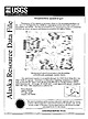
| mines, prospects and mineral occurrences throughout Alaska. 1K'«r RM111 /BN140 / WtKS\ / /BN057 / BBN^///BNl4...Bendeleben 1:250,000-scale quadrangle, western Alaska This and related reports are accessible through...the U.S. Government. OPEN-FILE REPORT 99-332 Alaska Resource Data File BN001 Site name(s): Idaho...the Kuzitrin River, and 10,500 feet east of the Nome-Taylor road. It is locality 46 of Cobb (1972; MF...its digging was hampered by the-presence of large rock fragments (Brooks and others, 1901). Sainsbury and |
 | | Report (volume) |
| Metalliferous Lode Deposits of Alaska By HENRY C. BERG and EDWARD H. COBB . G E O L O G I C A L S...A n inventory of the mines and )- grosfiects of Alaska and their ' f geologic settings UNITED STATES...acknowledgments--- - - - - - ----- - - - -- - -- 4 Alaska Peninsula region- - - - - - - - -- - - - - - -...- - - _ - - - _ - - - - - - - - - - 16 Redoubt district--- - - - - - - - - - - - - - - - - - - - - - -...- - - - - - - - - - - - - - - - 23 Valdez Creek area . . . . . . . . . . . . . . . . . . . . . . . . |
 | | Report (issue) |
| forth is unnecessary. In trying to cover so large an area as the southern part of Seward Peninsula, the writer...geology and ore deposits. On the other hand, some prospect hole without enough mineral exposed to warrant...open season of 1908. a Brooks, A. H., Placer mining in Alaska: Bull. U. S. Geol. Survey No. 259,1905, pp...Bull. No. 284,190G, pp. 132-141. Moflit, F. H., The Nome region: Bull. No. 314,1907, pp. 126-144. Smith,...No. 358,1908. 267 268 MINEBAL EESOUEGES OF ALASKA, 1908. These estimates are based on statements |
 | | Report (volume) |
| Brooks.................................... 5 The mining industry in 1908, by Alfred H. Brooks............peat fuel in Alaska, by C. A. Davis . . . . . . . . . . . . . . . . . . . . . . 63 Mining in southeastern...southeastern Alaska, by C. ,V. Wright............................. 67 Copper mining and prospecting on Prince...resources of southwestern Alaska, by W. W. Atwood.................. 108 Mining in the· Kotsina, Chitina...153 Mineral resources of the Nabesna-White River district, by F. H. Moffit and Adolph Knopf. .......... |
 | | Report (volume) |
| Bulletin 733 GEOLOGY OF THE YORK TIN DEPOSITS ALASKA BY EDWARD STEIDTMANN AND S. H. CATHCART WASHINGTON...Location and area _ Topography _____ ___ . Drainage________-___ a. ____ _ Climate _-_____ _ _ _ Rock weathering________...weathering________ ________________ Rock transportation_______________ ________ __ Vegetation and animals____...Mineralogy ________________.__________________ Lost River area ____________ __________________ Geographic feat...Lost River area Continued. Prospects ____ __ _____________________ Cassiterite Creek tin prospect ____________________ |
 | | Report (volume) |
| Mineral Resources of Alaska 1945-46 GEOLOGICAL SURVEY BULLETIN 963 This bulletin was printed as separate...(A) Some mineral investigations in southeastern Alaska, by W. S. Twen-. hofel, J. C. Reed, and G. 0. Gates____-_____...Copper deposits of the Prince William Sound district, Alaska, by F. H. Moffitand R. E. Fellows__-____-...(C) Garnet deposits near Wrangell, southeastern ^Alaska, by C. T. Bressler______________^___________.________-____..._ 95 '(E) Coal investigations in south-central Alaska, 1944-46, by F. F. Barnes, Clyde Wahrhaftig, C |
 | | Report (volume) |
| RESOURCES OF THE GRANITE FIORDS WILDERNESS STUDY AREA, ALASKA Rugged, glacier-dominated alpine terrain,...elevation, the second highest peak in the study area. Through Glacier in foreground; Chickainin Glacier...Resources of the Granite Fiords Wilderness Study Area, Alaska By HENRY C. BERG, RAYMOND L. ELLIOTT, and JAMES...1403 An evaluation of the mineral potential of the area UNITED STATES GOVERNMENT PRINTING OFFICE, WASHINGTON...resources of the Granite Fiords Wilderness Study Area, Alaska. (Studies related to wilderness-wilderness areas) |
 | | Report (issue) |
| RUBY-POORMAN AND NIXON FORK DISTRICTS, WEST-CENTRAL ALASKA, 1949 UNITED STATES DEPARTMENT OF THE INTERIOR...RUBY-POORMAN AND NIXON FORK DISTRICTS, WEST-CENTRAL ALASKA, 1949 By Max G. White and John M. Stevens This...Calif. CONTENTS Page Chapter A. Ruby-Poorman district Abstract ............................. Introduction...investigations ........... Ruby, area ....................... Long area ....................... Granite...Granite on upper Flint Creek ............... Poorman area .................. . Summary and conclusions .. |
 | | Conference Proceedings (Volume) |
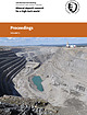
| very north of Sweden. Mining operations started in 1968 and the current mining depth is 430 m. The open...integration for interpretive bedrock mapping in the Giyani area (South Africa) .. ...............................Ronde Alteration in the area of the Kristineberg VHMS deposit, Skellefte district, Sweden ...............A. Massive Zn-Cu-Pb deposits in the Røros ore district, Norway: setting and formation ................Matos The Jörn granitoid complex, Skellefte mining district, Sweden: petrography, lithogeochemistry and |
 | | Report (volume) |
| Director Bulletin 687 THE KANTISHNA REGION ALASKA BY STEPHEN R. CAPPS )L.TL:iCA L 120926 WASHINGTON...-1PIRAfe( • CONTENTS. Page. Introduction Location and area Previous surveys. Present investigation Geography...Kantishna basin Relief Tanana lowland Foothills Alaska Range. Climate " Vegetation Game. Population Routes...Economic geology 75 History of mining 76 Gold placers • 76 General features 77 Mining condition• Origin of gold...Total production of placer gold 94 Future of placer mining 95 Lode deposits 95 General features 95 Gold lode |
 | | Report (issue) |
| Survey in Alaska: Accomplishments During 1975 The United States Geological Survey in Alaska: Accomplishments...Edward H. The United States Geological Survey in Alaska. (Geological Survey Circular 733) Supt.ofDocs.no...States Geological Survey 2. Geological research-Alaska. 3. Geology-AlaskaBibliography. I. Cobb, Edward...resources of Alaska, by Edward H. Cobb ___________________________ New gravity map of Alaska, by David F...______________________ Exploration geochemistry in Alaska, by G. C. Curtin, G. W. Day, C. L. Forn, T. D. |
 | | Report (issue) |
| THE PO&T WELLS GOLD~LODE DISTRICT. By B. L. JoKNsoN. INTRODUCTION. SCOPE OJI' REPORT. The object of...of the Port Wells district. Before the geology and mineral resources of the district are considered a...economic development of the mineral deposits of the district will be given. This will be followed by a description...WORX IN '1'lllll DISTRICT. The earliest rocordect exploration o{ the Port Wells district was made in June...geographic inforination concerning this part of Alaska; that of W. C. Mendenhall,' who was attached to |
 | MacKevett, E.M., Brew, D.A., Hawley, C.C., Huff, L.C., Smith, James G. (1971) Mineral resources of Glacier Bay National Monument, Alaska. Professional Paper 632. US Geological Survey doi:10.3133/pp632 | Report (issue) |
| Mineral Resources of Glacier Bay National Monument, Alaska GEOLOGICAL SURVEY PROFESSIONAL PAPER 632 Mineral... Mineral Resources of Glacier Bay National Monument, Alaska By E. M. MAcKEVETT, JR., DAVID A. BREW, C. C. HAWLEY...molybdenum prospect ......... Brady Glacier prospect ._____.. Fairweather Range _ . _ _ Alaska Chief prospect...Margerie prospect ................. - ...........-. Reid Inlet gold area and Sandy Cove prospect . __ ........ Western Dundas Bay area . ..................... Eastern Dundas Bay area ....................... |
 | | Report (volume) |
| Economic Geology of Alaska BULLETIN 1155 . Contributions to Economic Geology of Alaska GEOLOGICAL SURVEY...Geological Survey. Contributions to economic geology of Alaska. Washington, U.S. Govt. Print. Off., 1963. viii...1155) Bibliography: p. 87-89. 1. Geology, Economic-Alaska. 2. Mines and mineral resourcesAlaska. I. Title...Funter Bay nickel-copper deposit, Admiralty Island, Alaska, by Fred Barker-------------------------------...pipe__________________________________ Distribution of rock types and sulfides within the pipe_________ Sulfide-rich |
 | | Journal (article/letter/editorial) |
| omitted from locality information. Where lot and district numbers are given, it is necessary to use topographic...the photographs. Baldwin County Milledgeville district—between the State Sanitarium and the Oconee River:...property—near Commerce: ferrocolumbite (Cook, 1978). Lula district—Standridge property, about 7.0 km east of Lula:...sericite, vermiculite (Furcron, 1960c). Maysville area—T. J . Carr farm (1899), 1.6 km from Maysville:...(chryso lite, olivine) (Teague, 1956). Jefferson district—9.7 km southwest of Jefferson on S.R. 11, northwest |
 | Brew, David A., Johnson, B.R., Grybeck, Donald, Griscom, Andrew, Barnes, D.F., Kimball, A.L., Still, J.C., Rataj, J.I. (1978) Mineral resources of the Glacier Bay National Monument Wilderness Study Area, Alaska. Open-File Report Vol. 1978 (78-494) US Geological Survey doi:10.3133/ofr78494 | Report (issue) |
| Glacier Bay National Monument Wilderness Study Area, Alaska by David A. Brew, Bruce R. Johnson, Donald Grybeck...lands in the Glacier Bay National Monument study area, jAlaska, that are being considered for wilderness...wilderness designation. T7 ; '3 ' 20 jThe area studied is between tidewater and the International Boundary...about 160 km ji west of Juneau in southeastern Alaska. : 11 (100 mi) 9-1267 1 i Contents ! j...map of Glacier i :- r, Bay National Monument, Alaska by Andrew Griscom B-22 Aeromagnetic data and |
 | | Report (volume) |
| TRACY ARM-FORDS TERROR WILDERNESS STUDY AREA AND VICINITY, ALASKA FRONTISPIECE.-Oblique aerial photograph...Tracy Arm-Fords Terror Wilderness Study Area and Vicinity, Alaska By A. B. C. D. E. F. U.S. GEOLOGICAL...Tracy Arm-Fords Terror wilderness study area and vicinity, Alaska Interpretation of the aeromagnetic data...Tracy Arm-Fords Terror wilderness study area an~ vicinity, Alaska Mineral deposits and occurrences in the...Tracy Arm-Fords Terror wilderness study area and vicinity, Alaska Evaluation of mineral resources STUDIES |
 | | Report (issue) |
| Monitor-Mogul district 13 ; 13 14 15 Silver King district Silver Mountain district Other gold- and...Mineral specimens Molybdenum Radioactive minerals Rock products Sand and gravel Stone Selenium Sulfur...of 5 6 3 4 5 6 7 8 map Sketch claims by district in 1864 the Zaca gold-silver mine the Lost Cabin...East Carson River Crest of Colorado Hill, Monitor district Dixon gold mine Georgiana gold mine 2 8 9 10...Alpine County in 1864 showing mining districts Map of the Monitor-Mogul district Composite level map of the |
 | | Report (issue) |
| CRIB, compiled mineral occurrence records for the area of study from approximately the Fall of 1979 through...the mineral occurrence map for the Wallace 1° X 2° area during the summer of 1981. The user should be aware...A listing of the numeric codes used for drainage area, physiographic province, land classification, and...Placer Meadow Creek Placer Mine Floodwood Creek Prospect Amended Sweeney, Amended Sunflower Sunrise Creek...Blue Jay Placer Yellow Bucket Placer Ace Placer Big Rock Placer Claim Van Ness Mine Hungry Placer B. S. |
 | | Report (volume) |
| BUDDINGTON Prepared in cooperation with the STATE MINING BOARD OF OREGON UNITED STATES GOVERNMENT PRINTING...veins__-_---___-_---i___---.i-____________-__--_ 29 Rock alteration____ ...........L. ........^...^^.......Mineralized areas and mining districts.____-_--_-----_____-______---_ Bohemia district.._i_-_-__--_---_-...CONTENTS Mineralized areas and mining districts Continued. Bohemia district Continued. Mineral deposits...48 Hydrothermal and supergene alteration of wall rock. ______ 49 Future of the district_____----_---_----_--___- |
 | | Journal (article/letter/editorial) |
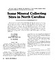
| Alexander County is a renowned mineral collecting area in North Carolina. Hiddenite, a rare and highly...farm. Mountain. A kyanite and sapphire corundum area lies northeast of Black Mountain and is located...its junction with SR 1236. The itacolumite in this area is generally inferior to the Stokes County flexible...the road and can be seen from the road. An other area where tourmaline, as well as quartz crystals, can...can be found is almost due north of this area, approximately 0.3 mile north of the road. Quartz and tourmaline |


