 | | Journal (article/letter/editorial) | | Diego State University, San Diego, CA 92182-0337, USA b 5-24-6 Hirashiba, Toyota City 471, Japan " Departments...;---~<.j~];1 'l ~$) A ,, / or-~\~(~ ~ 3~ SHAVER LAKE QUADRANGLE S,ERRA NEVAOA S,ERRA .EVAOA O SA...SA TUOLUMNE INTRUSIVE SERIES SIERRA USA ~, ~, onorthitein o t ..... YI 1 Fig. 2. Examples of...complexes [14] axe a nested chain. Adamello [13]; Shaver Lake [12]; Tonahata [18]; and Stong [19] are stuff-bag...bull's eye shaped E1 Topo body of northern Baja California [9]. In the case of the El Topo pluton, and the |  | | Report (issue) | | Shaver Lake Quadrangle, Central Sierra Nevada, California Analytic Data GEOLOGICAL SURVEY PROFESSIONAL...PROFESSIONAL PAPER 774-D Shaver Lake Quadrangle, Central Sierra Nevada, California Analytic Data By PAUL...Paul Charles, 1910Shaver Lake quadrangle, central Sierra Nevada, California-analytic data. (Shorter contributions...16:774-D. 1. Granite-California-Shaver Lake region-Analysis. 2. Volcanic ash, tuff, etc.-California-Shaver...FIGURES 1-7. Simplified geologic map of the Shaver Lake quadrangle showing 1. Locations of chemically |  | | Journal (article/letter/editorial) | | of California, Berkley, California Stepped Topography of the Southern Sierra Nevada, California Abstract:...Joaquin Valley is a smooth plain bevelled across granite, and has an origin similar to the steps. Outcrops...central California 1166 2. Profiles across the foothill part of the Sierra Nevada, California, projected...WAHRHAFTIG—STEPPED TOPOGRAPHY, CALIFORNIA tween step fronts and master joints east of Raymond, California 1185 19. Effect...underlain by a thick mantle ot gruss (disintegrated granite in place). Commonly, each tread declines eastward |  | | Report (issue) | | FOR A TRANSECT OF THE CENTRAL SIERRA NEVADA, CALIFORNIA: GEOCHRONOLOG Y AND ISOTOPE GEOLOGY by R. W........................................10 DAY 1. Fresno to Courtright Reservoir and Return ...................................................14 DAY 2. Fresno to Yosemite Valley ...............................25 DAY 3. Yosemite Valley to Mammoth Lakes, California .......................27 Figure 13............DAY 4. Mammoth Lakes, Mono Craters, and Saddlebag Lake ................ 3 6 Figure 17................. |  | | Report (issue) | | SURFACE-WATER RECORDS PART 11.P PACIFIC SLOPE BASINS IN CALIFORNIA TO SEPTEMBER 30, 1948 Prepared by San Francisco...SURFACE-WATER RECORDS PART 11.P PACIFIC SLOPE BASINS IN CALIFORNIA TO SEPTEMBER 30, 1948 EXPLANATION The index...reservoir stations in the Pacific Slope Basins in California for which records have been or are to be pub... 2 INDEX, PART 11, PACIFIC SLOPE BASINS IN CALIFORNIA Drainage Basins South of San Franisco Bay Cottonwood...Dieguito River at Bernardo, Calif San Dieguito River at Lake Hodges and near Escondido (Bernardo), Calif San |  | | Report (issue) | | SEPTEMBER 30, 1955 PART 11.-PACIFIC SLOPE BASINS IN CALIFORNIA UNITED STATES DEPARTMENT OF THE INTERIOR Fred...SEPrEMBER 30,1955 PART 11.-PACIFIC SLOPE BASINS IN CALIFORNIA By J. S. Gatewood Waabington, D. C., 1956 Free...SEPTEMBER 30,1955 PART 11.-PACIFIC SLOPE BASINS IN CALIFORNIA By J. 8. Gatewood EXPLANATION This index lists...reservoir stations in the Pacific slope basins in California for which records have been or are to be published...Calif •••••••••••••••••••.... San Dieguito River at Lake Hodges (near Bernardo) (near Escondido), Calif | 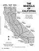 | | Journal (article/letter/editorial) | | Library] at 07:06 06 January 2015 Even though California is known as the “Golden State, ” it could also...the Tourmaline State, or the Colemanite State. California is, in fact, one of the world’s greatest sources...localities, the reader is encouraged to consult the “California Locality Index” (Kampf et al. 1989). The bibliography...great deal from the many publications of the California Division of Mines and Geology. The most valuable...tool for finding information on older mines in California is the Consolidated Index of Publications, Division |  | | Report (issue) | | National Parks, California James G. Moore and Thomas W. Sisson Menlo Park, California Open-File Report...single map unit, which includes not only stream and lake deposits, landslides and talus, but also glacial...for 11 of the remaining 18 quadrangles: Huntington Lake (Batertian and Wones, 1972b), Blackcap Mountain...yielded an age of 3.4 ±0.1 m. y. and one near Hume Lake, an age of 3.3 ±0.1 m. y.(Larsen, 1979). The Tertiary...analyses are available for 6 quadrangles: Huntington Lake (Bateman and Wones, 1972a), Blackcap Mountain (Bateman |  | | Journal (article/letter/editorial) | | the foothill suture zone, Sierra Nevada Range, California SEYMOUR MACK L O R R A I N E M . FERRELL j ...Department of Geology, California State University, Fresno, California ABSTRACT GEOLOGIC Thirty-one...Sierra N e v a d a foothills of Fresno and M a d e r a Counties, California. Their chemistry contrasts sharply...km wide, and it runs northwest through eastern California for more t h a n 6 4 0 km, f r o m the M o j...drilled in the western Sierra Nevada foothills of Fresno and M a d e r a Counties (Fig. 1) have been reported |  | | Report (issue) | | Geology of the San Joaquin Basin, Sierra Nevada California GEOLOGICAL SURVEY PROFESSIONAL PAPER 329 Reconnaissance...Geology of the San Joaquin Basin, Sierra Nevada California By FRANCOIS E. MATTHES GEOLOGICAL SURVEY PROFESSIONAL... Glaciers on Kaiser Ridge____________________ Granite Creek glacier,_______-_--_--_-_-___ Glaciers in...ice-scoured rock floor of Evolution Basin, near Sapphire Lake,__________________________________ Crescentric gouges...Remarkable imitation of a perched erratic boulder of granite, produced wholly by weathering in place. _______ |  | Stern, T.W., Bateman, P.C., Morgan, B.A., Newell, M.F., Peck, D.L. (1981) Isotopic U-Pb ages of zircon from the granitoids of the central Sierra Nevada, California. Professional Paper 1185. US Geological Survey doi:10.3133/pp1185 | Report (issue) | | the Granitoids of the Central Sierra Nevada, California Isotopic U-Pb Ages of Zircon from the Granitoids...Granitoids of the Central Sierra Nevada, California By T. W. STERN, P. C. BATEMAN, B. A. MORGAN, M. F. NEWELL...granitoids, Sierra Nevada and adjacent areas, eastern California ----------------- 2 2. Schematic chart showing...THE GRANITOIDS OF THE CENTRAL SIERRA NEVADA, CALIFORNIA By T. W. STERN, P. C. BATEMAN, B. A. MORGAN...existence of five cyclic intrusive epochs for California and western Nevada. Comparison of the U-Pb ages |  | | Report (issue) | | Millerton Lake Quadrangle, "^W GEOLOGICAL SURVEY PROFESSIONAL Lake Quadrangle...Quadrangle, West-Central Sierra Nevada, California Analytic Data By PAUL C. BATEMAN and ALAN J. BUSACCA...isotopic ages of the plutonic rocks of the Millerton Lake quadrangle UNITED STATES GOVERNMENT PRINTING OFFICE...Charles, 1910Millerton Lake quadrangle, west-central Sierra Nevada, California analytic data. (Geological...igneous. 2. Geological time. 3. Geology California Madera County. III. Series: United States. Geological |  | | Report (issue) | | December 31, 1963 Part 11.-Pacific Slope Basins in California Index of Surface-Water Records to December...December 31, 1963 Part 11.-Pacific Slope Basins in California By H. P. Eisenhuth Geological Survey Circular...December 31 , 1963 Part 11 .-Pacific Slope Basins in California By H. P. Eisenhuth INTRODUCTION This report...reservoir stations in the Pacific slope basins in California for which records have been or are to be published.... Rodriguez Reservoir at Rodriguez Dam, Baja California, Mexico. Tia Juana River near Nestor, Calif |  | | Report (issue) | | September 30, 1 970 Part 11 .-Pacific Slope Basins in California GEOLOGICAL SURVEY CIRCULAR 661 Index of Surface-Water...September 30, 1 970 Part 11 .-Pacific Slope Basins in California GEOLOGICAL SURVEY Washington 1971 CIRCULAR...September 30, 1970 Part 11.-Pacific Slope Basins in California INTRODUCTION This report lists the streamflow...reservoir stations in the Pacific slope basins in California for which records have been or are to be published...prior to 1951 for the Pacific slope basins in California are summarized in Water-Supply Papers 1315-A |  | | Report (issue) | | September 30, 1967 Part 11-Pacific Slope Basins in California GEOLOGICAL SURVEY CIRCULAR 581 Index of Surface-Water...September 30, 1967 Part 1·1-Pacific Slope Basins in California By H. P. Eisenhuth G E0 L0 G I C A L S U RV...September 30, 1967 Part 11-Pacific Slope Bas1ns in California By H. P. Eisenhuth INTRODUCTION This report...reservoir stations in the Pacific slope basins in California for which records have been or are to be published...••••••••••••••••••• Rodriguez Reservoir at Rodriguez Dam, Baja California, Mexico. Tia Juana River near Nestor, Calif |  | | Report (volume) | | Granitoid Rocks, Central Sierra Nevada Batholith, California-Analytic Data U.S. GEOLOGICAL SURVEY BULLETIN...ANGELES, California--Federal Bldg .• Rm. 7638, 300 N. Los Angeles St. • MENLO PARK, California--Bldg. 3...SALT LAKE CITY, Utah--Federal Bldg., Rm. 8105, 125 South State St. • SAN FRANCISCO, California--Customhouse...Granitoid Rocks, Central Sierra Nevada Batholith, California-Analytic Data By BERNARD BARBARIN, F.C.W. DODGE...granitoid rocks, Central Sierra Nevada batholith, California-analytic data I by Bernard Barbarin ... [et al |  | | Journal (article/letter/editorial) | | granitoids of the central Sierra Nevada batholith, California: nature, origin, and relations with the hosts...Calc-alkaline granitoids; Sierra Nevada batholith; California 1. Introduction Mafic magmatic enclaves (MME)...batholith range in composition from gabbro to granite. Tonalite, quartz diorite, granodiorite, and quartz...Intrusive Suite: Bateman and Chappell, 1979; Red Lake and Eagle Peak plutons: Noyes et al., 1983a,b; Palisade...(Barbarin, 1988) SQ SC NF HH Tenaya lake Olmstead Point May Lake Lat. (8N) Long. (8W) Rock unit 37849 |  | | Report (issue) | | Central Part of the Sierra Nevada Batholith, California by Paul C. Batemanl/ This report supplements...87-670, Pre-Tertiary bedrock geologic quadrangle, California. It provides expanded shown on the map and interpretations...does not imply endorsement by the USGS. Park, California Note for New Publications of the U.S. Geological...central part of the Sierra Nevada batholith, California, by Paul C. Bateman. This publication supplements...geologic map of the Mariposa 1° by 2° quadrangle, California by providing descriptions and interpretations |  | | Journal (article/letter/editorial) | | swarms in granitic plutons, central Sierra Nevada, California O.T. Tobisch aY*, B.A. McNulty a, R.H. Vernon...Science Building, University of California, Santa Cruz , CA 95064, USA b School of Earth Sciences, Macquarie...Jackass Lakes, and Mount Givens plutons. F = Florence Lake, C = Courtright Reservoir, S.F. = San Francisco...in Stevenson Creek (north fork) 600 m east of Shaver Lake. 0. T. Tobisch et al. / Lithos 40 (1997) 321-339...Creek (north fork), near entrance to Southern California Edison Power tunnel. 328 0. T. Tobisch et |  | | Journal (article/letter/editorial) | | Creek Pluton, Central Sierra Nevada Batholith, California Department of Geology, University of Georgia...http://petrology.oxfordjournals.org/ at University of California, San Francisco on December 15, 2014 by MICHAEL...FIELD RELATIONS The Sierra Nevada batholith of California comprises many distinct plutons that are grouped...of quartz diorite, tonalite, granodiorite, and granite occur along the margins of the batholith and locally...and is the oldest and most mafic member of the Shaver Lake Intrusive Series (P. C. Bateman, pers. comm.; |  | | Journal (article/letter/editorial) | | Creek, California F.C.W. DODGE U.S. Geological Survey, 345 Middlefleld Road, Menlo Park, California 94025...Geological Survey, 345 Middlefleld Road, Menlo Park, California 94025 ABSTRACT INTRODUCTION A Miocene volcanic...central Sierra Nevada near the town of Big Creek, California. The volcanic magma began its ascent from a mantle...Sierra Nevada during geologic mapping of the Shaver Lake 15' quadrangle (Lockwood and Bateman, 1976);...northern boundary and northeast corner of the Shaver Lake quadrangle (Fig. 1). Xenoliths are most abundant |  | | Report (issue) | | Creek Roof Pendant in the Central Sierra Nevada, California GEOLOGICAL SURVEY PROFESSIONAL PAPER 524-B ...Creek Roof Pendant in the Central Sierra Nevada, California By R. W. KISTLER and P. C. BATEMAN SHORTER CONTRIBUTIONS...CREEK ROOF PENDANT IN THE CENTRAL SIERRA NEVADA, CALIFORNIA By R. W. KrsTLER and P. C. BATEMAN ABSTRACT...Creek roof pendant, about 50 miles northeast of Fresno in the central Sierra Nevada, Calif., is composed...the central Sierra Nevada. between Shaver Lake and Huntington Lake. The east end of the pendant can be |  | | Journal (article/letter/editorial) | | ................................ Pilot Peak-Shaver Lake z o n e .......................................trending moun tain range which lies in eastern California. I t is about 450 miles long and has a width...evenly into the rounded forms developed on the granite. Where the more resistant of the metamorphic rocks...partly north and partly northwest. Pilot Peak-Shaver Lake zone.— The most extensive of these zones is the...21 east), southeastward for about 40 miles to Shaver Lake (Kaiser Quadrangle, township 9 south, range 25 |  | | Journal (article/letter/editorial) | | • O. VV . 3. Geological Survey, Metilo Par%, California 94025 Variations of Major Chemical Constituents...synthesized the available data Figure 1. Index map of California, showing the location of the area studied. Geological...According to the most recent analysis of age data in California by Evernden and Kistler (1970), granitic rocks...sequence crop out. The Shaver sequence is named after Shaver Lake northeast of Fresno, the Palisade Crest...sequence John Muir sequence Tuolumne Intrusive Series Shaver sequence Western foothills rocks Yosemite rocks |  | | Journal (article/letter/editorial) | | a Transect of the Sierra Nevada Mountains of California Author(s): F. D. Klyver Reviewed work(s): Source:...NEVADA MOUNTAINS OF CALIFORNIA F. D. KLYVER San Mateo Junior College, San Moateo,California Amongtheecologicalproblemsin...the Inyo National Forest. Most of it is in Fresno County,althougha part of Madera, Mono, and Inyo countiesis...presence of a number of artificiallakes, such as Shaver and Huntington lakes. The Sierran crest line attains...height. Farther north, in the region south of Mono Lake, the height of the east front is considerably less |
|


