 | | Report (issue) |
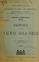
| ^^ ^^ NEW^ SOUTH WALES. DEPARTMENT OF MINES AND AGRICULTURE. : {/j^Z^ /; PIWMAN, E. F. ^ GEOLOGICAL... '*H-. View of Yalwal from the South. NEW SOUTH WALES. DEPARTMENT OF MINES AND AGRICULTURE...patches of extracted from such mines as and The Homeward Bound, it stone have been The Pinnacle, The Caledonia...attempt to pick out the richer portions. The Homeward Bound and Pioneer Mines have been able some years...1871. Discovery of Pioneer Claim, 1872. Homward Bound Mine, 1874. Erection of batteries. Find of alluvial |
 | | Report (issue) |
| ^ 1& (NKW SOUTH /^^ ^'? DEPARTMENT OF MINES \VALES. AND AGRICULTURE. GEOLOGICAL SURVEY. nsineering...GOVERNMENT PRINTER. New Chum Hill, shewing Open Cuts. From the South , NEAV SOUTH V/ALES. DEPARTMENT...GOVERNMENT PRINTER. Geological Survey of New South Wales, Departmeut of Mines and Agriculture. Sydney... Township (h) 23 South Tlie Basalt Claim and Hill. (/) Home- ward Bound, Cornishmen's, Pattinson...(a) The Fifteen-mile, (b) Eight-mile, (c) New Meragle. 8. The Kiandra Reefs 2{i 9. Methods |
 | | Report (issue) |
| VIEW ^'V'iccjring MINING OPERATIONS STATE OF SOUTH AUSTRALIA nUKINO THE HALF-YEAR ENDED DECEMBER Compiled...Jluetralia. REVIEAV A MINING OPERATIONS STATE OF SOUTH AUSTRALIA DUKING THE HALF-YEAR ENDED DECEMBER 31st...Hill Proprietary Company near Newcastle, Xew South Wales, the high average price of copper, and the appreciation...Dorris Fabian Dustholes, G. Earea Morning Myrtle New —Ochre . 7, G.M Milo G. II 14 . M 1) Boring... Queen Bee 11 Radium Hill 11 Radium Extraction Co Reports by Government Geologist 34-37 Reports by |
 | | Journal (article/letter/editorial) |
| GOLDF~ELDSof LY~)ENBURGand DE KAAP, in the TRANSVAAL, SOUTH AFRICA. By W. ttEERZ P~.NNIN% Esq., F.G.S., &c....F.R.G.S., in his work on ' The Gold Regions of South-eastern Africa' *, and prove the extension of auriferous...generally See "A Sketch of the High-level Goalfields of South Africa," read before the Society on 5th March, 1884...Goldfield, Pretoria, 1883. ' Guide to the Goldfields of South Africa,' Pretoria, 1883, pp. 44-46. Downloaded...This creek is really a very deep gorge; on the south side the mountain rises to perhaps 1500 feet in |
 | | Report (issue) |
| Torrens Government Plant 50 21 New 22 Notes on Sampling . Glenloth Co Notes for Opal Miners MoontaCo...Gypsum Hidden Secret G.M Hicks and Hooper CM Homeward Bound G.M Hill, Welfare 14, Work at.. . Bonus...Sampline, Notes on Salt ...^ Sliding Scale of Moonta Co Slate, 31 14 Wages, Wallaroo and 12 —^Report on...by Coal Committee 96 25 — Wallaroo and Moonta Co. Future 12, 13 Policy with Employees 97 Wallis and...AND VALUE OF THE VARIOUS METALS AND MINERALS SOUTH AUSTRALIA. Quan- Quan- Value. Value. £ ozs. ozs |
 | | Journal (issue) |
| Award Report | Redrawing the geological map of South Wales | Hyoliths - where they fit in | Coastal Exposures...Rehemat Bhatia 13 GASS2018 Contribution: Homeward Bound; By: Madeleine Hann 15 Evening Lecture October...October 2018: Redrawing the map of South Wales; By: Prof. John Cope Evening Lecture December 2018; Hyoliths...University in the west; Plymouth University in the south to Aberdeen University in the north. In all there...3 REPORT FROM COUNCIL By: Diana Clements The new Data Protection Regulations still continue to occupy |
 | | Report (issue) |
| ILLINOIS LIBRARY i ^ 6^2.09 S ^^ 2 . ) I NEW SOUTH WALES. DEPARTMENT OF MINES. GEOLOGICAL SURVEY...p. 5. List of Papers, p. 7. Australia generally New South Wales Victoria : Queensland Subject...Western Australia Locality Index, p. 75. Locality Index, p. 95. ; Subject Index, p. 102; South Australia:...name. Agam, in a new country like Australia, it is often necessary to christen a new mining field, and...occurrences. A case in point may be cited from South Australia. Wulfenite is recorded from “ Mount Lyndhurst |
 | | Journal (article/letter/editorial) |
| the Great War can be realised, and the fact that a new method of naval warfare, 1913 1914 1915 1916... especially vol. v. London : Longmans, Green and Co. 3. Gibson and Prendergast, The German Submarine...the evening at Professor Eskola's country home south-west of the little island of Sappi. It was at Professor...exposures of Jotnian Sandstone, the Finnish equivalent of the Torridon Sandstone of Scotland. VOL. XLVIII...Tammerfors, and the British members caught the homeward-bound steamer on the afternoon of their arrival back |
 | | Report (Issue volume) |
| GEOLOGICAL SURVEY OF NEW SOUTH WALES EXPLORATION DATA PACKAGE Quartz-jasper and quartz-sulphide veinlets...WARWICK-TWEED HEADS 1:250 000 SHEET AREA (New South Wales Portion) VOLUME 2 MINERAL OCCURRENCE DATA...error or omission. Therefore, the State of New South Wales and its employees disclaim liability for any...-1- VOLUME 2 CONTENTS GEOLOGICAL SURVEY OF NEW SOUTH WALES .............................................(see list below) The letter symbol is unique for New England Fold Belt metallogenic sheets. The general |
 | | Report (Issue volume) |
| OF NEW SOUTH WALES EXPLORATION DATA PACKAGE WARWICK-TWEED HEADS 1:250 000 SHEET AREA (New South Wales...error or omission. Therefore, the State of New South Wales and its employees disclaim liability for any...Sydney. GS2001/087 1 VOLUME 1 SUMMARY The New South Wales portion of the WarwickTweed Heads 1:250 000...northeastern New South Wales and extends over a significantly mineralised portion of the southern New England............................................... 12 NEW ENGLAND FOLD BELT .............................. |
 | | Report (issue) |
| N. CRAMSIE, DIRECTOR GEOLOGICAL SURVEY OF NEW SOUTH WALES Cover photo: Photomicrograph of quartz-fibre...Survey of New South Wales, Sydney. Edited by: J.R. Stewart ISSN 0727 9418 © New South Wales Department...14 Regional relations in central western New South Wales showing Middle Silurian to Early Devonian elements...Ridge prospect geology (from Amoco Minerals Australia Co 1983a) 37 Figure 12. Longitudinal section...mineral deposits (from Suppe11984) 41 Figure 13. New Occidental deposit. A. Plan based on Mulholland and |
 | | Report (chapter) |
| of the Pleistocene Tamala Limestone, Western Australia WOLF MAYER Research School of Earth Sciences,...Australian National University, Canberra, ACT 0200, Australia (e-mail: wolf.mayer@ems.anu.edu.au) Abstract:...crop out extensively along the coast of Western Australia, were carried out by members of English and French...southern continent that would soon become known as New Holland. Their commander, Dirk Hartog, piloted his...coast of Tasmania and the new English settlement at Sydney, brought to Australia a number of wellqualified |
 | | Journal (issue) |
| (Lapidary) Circulation of Journals Equipment Loans Co-ordinator Web Master John Burgess John Pearce Mark...evening meetings a year in March and October, which are co-ordinated by John. This subject was looked at through...coastal exposures. Several species new to the UK and even some new to science have been discovered in...Torbernite (5mm FOV) Blackpool China Clay Pit, Trewoon, St. Austell, Cornwall -5- SMLS Journal 242 March/April...These microscopes are not necessarily expensive, new, reasonably good models, with built in lights, are |
 | | Book |
| N. CRAMSIE, DIRECTOR GEOLOGICAL SURVEY OF NEW SOUTH WALES Cover photo: Quartz - mudstone - stibnite...Sheets. 509 pp. New South Wales Geological Survey. Sydney. ISSNQ7279418 © New South Wales Department of...DATA SHEETS Unpublished reports held by the New South Wales Depanment of Mineral Resources INDEX TO WNERAL...FIGURES Figure 1. Geological subdivision of the New England Fold Belt 7 Figure 2. Granitoid belts...the mineral resources of the New England Fold Belt· in New South Wales. This program is a continuation |
 | | Book |
| GEOLOGICAL SURVEY OF NLW SOUTH WALES. i ii MINERAL RESOURCES \t;\v south walks. » EDWARD Oo\ F...lis ; NEW SOUTH WALES. GEOLOGICAL SURVEY OF THE MINERAL RESOURCES OF NEW SOUTH WALES. BY EDWARD...and Metallurgy ; Government Geologist of New South Wales Lecturer in Mining at the Sydney University...official my notes South Wales. that was possible, within the limits of such a all ; New number of separate...GEOLOGICAL SURVEYOR IN CHARGE. INTRODUCTORY. When Australia was being colonised the pastoral industry "was |
 | Henley, H. F., Brown, R. E., Brownlow, J. W., Barnes, R. G., Stroud, W. J. (2001) Grafton-Maclean Metallogenic Map (SH/56-6, SH/56-7) Metallogenic Study and Mineral Deposit Data Sheets. Geological Survey of New South Wales | Report (issue) |
| N. CRAMSIE, DIRECTOR GEOLOGICAL SURVEY OF NEW SOUTH WALES i Original typing: Review: Cartography: Cover...from the coast south of Evans Head (see Photograph 12). Insets are: cut blue and gold New England sapphires...Survey of New South Wales, Sydney, xii + 292 pp, with CD-ROM. Edited by: R.A. Facer © New South Wales Department...northeastern New South Wales and extends over a significantly mineralised portion of the southern New England...large part of the Clarence-Moreton Basin in New South Wales, and includes parts of large Tertiary volcanic |
 | | Journal (article/letter/editorial) |
| Graham Land, preparatory to seeking a base farther south, probably in Marguerite Bay, when the pack-ice allowed...venture under Mr. L. Ellsworth at Deception Island, South Shetlands, awaited in vain a favourable opportunity...Antarctica to the Ross Sea. A Press message from New Zealand at the end of December, announcing that the...Four flights in November 1934, to the east and south-east, would seem to prove the extension of the high...plateau of Marie Byrd Land to the south and to establish the south-eastern boundary of the Ross Sea. |
 | | Journal (article/letter/editorial) |
| name being a modern invention, like Invercargill in New Zealand, for the sake of a pleasing sound. Beauty...Gaelicspeaking Mackays, and in the hills on the south Gunns and Keiths. In Ross and Cromarty there were...of the Firth of Forth and the east coast as far south as Holy Island in Northumberland. We can trace the...the course of Tweed and Teviot ; and not in the south alone, but northward through the Central Lowland...the Free Church of the Scottish colony in Otago, New Zealand, where Dunedin stands to-day with all its |
 | | Report (Issue volume) |
| Roadside section in Gravel and Limestone Series south of Anse Bouleau and north of Coulibistri. 2. Pumiceous...Pumiceous agglomerates in road section, Ma Robert area, south of Rosalie. Plate III • • Scenes in North-East...laboratories. '' 88 Plate VI Geological Features in the New Hebrides • • 1. Agglomerates with interbedded layers...Council held on 22nd March, I 966, a title for the new organisation was agreed, namely, the Institute of...Guiana 2, Bechuanaland 1, British Solomon Islands 1, New Hebrides 1, Northern Rhodesia 1, Swaziland I. 1964 |
 | | Journal (article/letter/editorial) |
| be used in connection with any ordinary case, is Wales,' Erie County, N. Y. To the main frame there ing...An exteriorly threaded sleeve is de one of the new building materials tachably secured in the under...before in a vacant lot at A�bury Park, N. J. The co-opera- least attempt at concealment. The whole formicary...cunningly con- tific circles. It has furmshed a new key to the geologi mestic labor as well as war,...were added. Next the worker up by strata of sandstone. tude of fevered eagerness, applying their mandibles |
 | | Book |
| VES ; an ‘ Cor pbnenbs HERTZBERG CLOTH — NEW METHOD, TITLE NO. INC. EAST VANDALIA ACCOUNT... THE GEOLOGY AND PALAONTOLOGY OF QUEENSLAND AND NEW GUINEA, WITH SIXTY-KIGHT PLATES AND A GEOLOGICAL...ROBERT GOVERNMENT PALHONTOLOGIST (NEW SOUTH ETHERIDGE, WALES); VICTORIA ; ACTING-PALHZONTOLOGIST...GOVERNMENT PRINTER, WILLIAM LONDON: DULAU AND CO., 37, SOHO 1892. SQUARE, STREET. DMevicated...Queensland. In every country, and especially in every new country, it becomes necessary in the first place |
 | | Report (issue) |
| taken from the Library NN GU 1900 TP CATALOGUE SOUTH OF AUSTRALIAN MINERALS: 1983 by R.J. Noble...Government Printer, South Australia, 1983 REF 349.994, N668c Noble, R. A. Catalogue of South Australian minerals...Catalogue of South Australian minerals: 1983. Bibliography. ISBN 0 7243 6247 9. ome Co \"] 1. Mineralogy—South...Mineralogy—South Australia. |. Just, J. (Juri). Il. Johnson, J. E. (James Eric). Ill. South Australia. Dept...and Energy. IV. Title. (Series: Handbook (South Australia. Dept. of Mines and Energy); 7) 549.99423 |
 | | Book |
| https://books.google.com UN O SH MW I A Visit to Australia and its gold regions Society for Promoting Christian...and ... . Pit' ,4 I i I VISIT TO AUSTRALIA — |ts iolfr Regions. PUBLISHED UNDER THE DIRECTION...ISLAND OF ST. PAUL — LAND HO ! ARRIVAL AT ADELAIDE 1 CHAPTER II. ^ THE COLONY OF SOUTH AUSTRALIA — ITS...CONTENTS. CHAPTER IV. PAGE THE COLONY OF NEW SOUTH WALES—THE HARBOUR OF PORT JACKSON—THE CITY OF SYDNEY—THE...AND SOCIAL EFFECTS OF THE DISCOVERY 164 / AUSTRALIA AND ITS GOLD REGIONS. CHAPTER I. FAREWELL TO |
 | | Report (volume) |
| _______________________________________ 270 Homeward Bound and other lodes-____-_-__---__-_---.-.. 272...Canyon of.South Fork of Payette River; B, view of south wall of canyon of Payette River showing Grimes Creek.... Geologic map of the west workings in the Homeward Bound lode, Mayflower mine__________________________________...lodes at present levels and to the discovery of new lodes. Secondary enrichment has played a negligible...interest in the deposits in Boise Basin reached new heights, and the demand for a comprehensive geologic |
 | | Report (issue) |
| MINES BLOCK Xlll.WAITAHU S.D. Scale Blackwater South ^e^ DEPARTMENT OF GEOLOGY ToajccoTnpmyySuUeU>v]f^l8...[Marine sandstone {Uawheranu/ and claystone, often coicareoui Series, Conglomerate, gnt, sandstone, and...glacial v~^-. gravels Dellelo conglomerate, sandstone, MIOCENE \ at J> \ /' UPPER i,. XamT ...and lifinillc s,..i. X.-%v^ banda. Marine sandstone and claystone, often calcareous... /An v/ l/~\%...and llgnltio bands. Dellalc MIOCENE [ Marine sandstone and olajstone, often calcareous.. f Mawheranai |


