 | | Report (issue) |
| evidence analysis in northeast Washington—4. Mineral industry activity in Washington, 1985-1997. by D.E. Boleneus1...Report 00-014 A Prepared in cooperation with Washington Department of Natural Resources, Division of...1 2 Spokane, Washington Washington Department of Natural Resources, Spokane, Washington Contents Abstract...Appendix II--Table of mineral industry activity in Washington, 1985 to 1997..................................showing location of 339 exploration or mining sites in Washington. ................................... |
| | Report (issue) |
| evidence analysis in northeast Washington—4. Mineral industry activity in Washington, 1985-1997. by D.E. Boleneus1...Report 00-014 A Prepared in cooperation with Washington Department of Natural Resources, Division of...1 2 Spokane, Washington Washington Department of Natural Resources, Spokane, Washington Contents Abstract...Appendix II--Table of mineral industry activity in Washington, 1985 to 1997..................................showing location of 339 exploration or mining sites in Washington. ................................... |
 | | Journal (article/letter/editorial) |
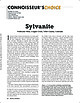
| 23:14 19 October 2014 Vindicator Mine, Cripple Creek, Teller County, Colorado I n terms of sheer volume...years: Kalgoorlie, Western Australia, and Cripple Creek, Colorado. Although on opposite sides of the globe...globe, they have striking similarities in their mining history and mineralogy, but their geology is seemingly...essentially massive gold tellurides associated with coarse native gold. Cripple Creek, on the other hand...is sylvanite. A historically significant Cripple Creek sylvanite specimen has been nominated for this issue’s |
 | | Report (issue) |
| WASHINGTON . GEOLOGICAL SURVEY. HENRY LANDES, STA TE GEOLOGIST. VOLUME I. ANNUAL REPORT FOR 1901... . . . . . . . . . . . . . . . . . . . Stevens County..................... ... . . . . . . . . . . ....Northport District. .... . ........ . .. ... . . . .. . . . ............ . Myers Fa.Us District . . . .... . . . . . . . . . . . . . . . . Fla.t C1·eek District . . . . . . . . . . . . . . . . . . . . . . .... . . . . . . . . . . . . . . . . . Colville District . . . . . . . . . . . . . . . . . . . . . . . . |
 | | Report (issue) |
| WASHINGTON . GEOLOGICAL SURVEY. HENRY LANDES, STA TE GEOLOGIST. VOLUME I. ANNUAL REPORT FOR 1901...Skagit County ... . ...... .. ....... . ............ . ... . ..... .. ... . .. 265 Cokedale District . ..... 266 Hamilton District ............................................ 266 King County. . . . . . . . ...Newcastle-Issaquah District ................................ . 261 Renton-Cedar River District .... .. .......269 Green River District ...... . ................... . .......... . ... 270 Pierce County ............ |
 | | Journal (article/letter/editorial) |
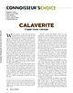
| CALAVERITE Cripple Creek, Colorado W ith the exception of native gold and electrum, the gold telluride calaverite...calaverite may well be the most important gold ore mineral. Its weathering characteristics make identification...Cripple Creek district, essentially subsequent to the development of all other Colorado gold districts...districts. Unlike most gold deposits, weathering of those characterized by relatively abundant telluride minerals...fine-grained and dull, mustard-colored secondary gold that is disbursed as tiny particles as the individual |
 | | Report (issue) |
| WASHINGTON GEOLOGICAL SURVEY HENRY LAND.ES, State Geologist BULLETIN No. 11 The Mineral Resources of...of Washington WITH ST A TISTICS FOR 1912 By HENRY LANDES • OLYltPl'.A, WASB. , P'UN lt M. LAMBORN...herewith a report entitled "The Mineral Resources of Washington, with Statistics for 19U," with the recommendation...especially as to geological occurrence, methods of mining or of utilization, and value. In this report the... . . . • . . . . . . . . . . . . . . . 20 COAL MINING . • . . . • . . • • . • . . . . . . . . . . . |
 | | Report (volume) |
| COMPILED BY SAMUEL SANFORD AND RALPH W. STONE WASHINGTON GOVERNMENT PRINTING OFFICE 1914 USEFUL MINERALS...it helpful to refer to Survey Bulletin 507, "The mining districts of the western United States," and to...abundant, it may have been completely exhausted by mining or quarrying. Deposits of minerals of wide distribution...because they occur in sufficient quantity to warrant mining for their usual products but because they furnish...North Carolina.. .Dr. Joseph Hyde Pratt, Chapel Hill. North Dakota... .Dr. A. G. Leonard, Grand Forks |
 | | Report (volume) |
| AND SAMUEL SANFORD A revision of Bulletin 585 WASHINGTON GOVERNMENT FEINTING OFFICE 1917 CONTENTS........................................... 102 District of Columbia ................................................................................ Washington................................................to refer to Geological Survey Bulletin 507, "The mining districts of the western United States," and to...abundant it may have been completely exhausted by mining or quarrying. Deposits of minerals that are widely |
 | | Book (edition) |
| MINES AND MINERALS OF WASHINGTON. SECOND ANNUAL REPORT GEORGE A. BETHUNE, STATE GEOLOGIST. OLYMPIA...Report of the State G<3ologist for the State of Washington, George A. Bethune, First State Geologist, 1891...Pacific Northwest Collection of the University of Washington Library and we are most grateful to the library...Geology and F.arth Resources Division of the Washington State Department of Natural Resources for their...American Trading Company, P.O. Box 1312, Bellevue, 'Washington, 98009 · To H<>n. ELISHA P. FERRY, Govern(lr |
 | | Report (issue) |
| Principal Gold-Producing Districts of the United States By A. H. KOSCHMANN and M. H. BERGENDAHL GEOLOGICAL...description of the geology, mining history, and production of the major gold-mining districts in 21 States...States UNITED STATES GOVERNMENT PRINTING OFFICE, WASHINGTON 1968 UNITED STATES DEPARTMENT OF THE INTERIOR...relations ---------------------------History of gold mining and trends in production_ J\labama ---------...--------------Cleburne County ----------~----------------- Tallapoosa County --------------------------Alaska |
 | | Report (Issue volume) |
| State of Washington ARTHUR B. LANGLIE, Governor Department of Conservation and Development W. A. GALBRAITH...GLOVER, Supervisor Bulletin No. 37 INVENTORY OF WASHINGTON MINERALS PART II METALLIC MINERALS By MARSHALL...Volume 2 - MAPS STATE PRINTING PLANT. OLYMPIA, WASHINGTON lll!UI For sale by Department of Conservation...volumes-text and maps) $4.50. INVENTORY OF WASHINGTON MINERALS PART II METALLIC MINERALS Volume 1...Bulletin 33, "Nonmetallic Mineral Resources of Washington," published in 1936. Since then the catalogue |
 | | Report (issue) |
| (919) 733-2423. Jeffrey C. Reid Chief Geologist GOLD NORTH CAROLINA IN . by P. Albert Carpenter III...Arrington Mine Carolina Slate 'Belt 25 27 2 Gold Hill Mine 28 Placer ~lXlsits 2 Howie Mine 29 !me...me Del"'sits 2 Reed Mine 31 S<>urces and Prtxluction 5 Silver Hill Mine 31 World Sources and...Production 5 Phoenix Mine 33 United States Sources and Production 5 Hoover Hill Mine 33 Mineralogy and...Gardner Hill Mine 33 Uses 7 Fentress Mine 34 Prices 8 Mining Methc:xis 9 Rudisil Mine 34 OJ:>en-Pit |
 | | Book |
| Bart Cannon 1975 CORD ILLERAN Mercer Island, Washington Lilli liliiiLt' 111? KLi-KlLLLIlrVlIlI Copyright...in 1975 by Cordilleran 18 Holly Hill Drive Mercer Island, Washington 98040 COVER ILLUSTRATION: Amethyst...milky quartz stems. Denny Mountain area of King County. Specimen from the collection of Cary A. Maykut...publications dealing with the various aspects of Washington State's diverse mineral wealth exist, but none..."Minerals of Washington" represents an attempt to begin such a cata logue. "Minerals of Washington" shall |
| Long, Keith R., DeYoung,, John H., Ludington, Stephen (1998) Database of significant deposits of gold, silver, copper, lead, and zinc in the United States. Open-File Report Vol. 1998 (98-206) US Geological Survey doi:10.3133/ofr98206ab | Report (issue) |
| deposits of the East Shasta copper-zinc district, Shasta County, California: U.S. Geological Survey Professional...1972, Geology and mineral deposits of Esmeralda County, Nevada: Nevada Bureau of Mines and Geology Bulletin...80 p. Allsman, P.T., 1940, Reconnaissance of gold mining districts in the Black Hills, South Dakota: U...Nutt Wilderness Study Area (AZ-020-024), Mohave County, Arizona: U.S. Bureau of Mines Mineral Land Assessment...Summary report (preliminary), Lights Creek Copper Project, Plumas County, California; Venture 63: San Francisco |
 | | Report (edition) |
| Information Circular GOLD RESOURCES OF NORTH CAROLINA by P. A. Carpenter, D oc ms C% M:*L Raleigh...2 Uses 3 Mining Methods and Recovery 3 Gold in North Carolina 5 History of Mining 5 Production...Prospecting 7 10 Gold Deposits of North Carolina 12 Eastern Carolina Belt 12 Portis Mine 14 Other Mines...Mines 14 Carolina Slate Belt 15 Gold Hill Mine 20 Howie Mine 21 Reed Mine 21 Other Mines Charlotte...Charlotte Belt 22 23 Rudisil Mine 23 Gardner Hill Mine 24 Fentress Mine 24 Other Mines 24 Kings |
 | | Report (issue) |
| Stony Mountain Gabbro on Ridges Mountain, Randolph County, North Carolina (see DeDecker et al., this volume).............. 4 Stop 1.3 Structure in Vulcan Gold Hill quarry ........................................................................ 5 Stop 1.4 Gold Hill Mines Historic Park (Lunch) ……………………………………………...Stop 2A.1 Jacob’s Creek quarry main pit …………………………………………………… 14 Stop 2A.2 Jacob’s Creek quarry Cid mudstone............................... 17 Stop 2B Reed Gold Mine ............................................. |
 | | Report (issue) |
| METALLIC MINERAL DEPOSITS OF THE CAROLINA SLATE BELT, NORTH CAROLINA by P. Albert Carpenter, m Reprinted...Intrusive rocks Metallic minerals Chromium Copper Gold , 1 2 2 2 3 3 3 4 4 4 4 . Iron Lead, zinc and...deposits of the slate belt Distribution of mines and prospects Previous investigations Mine descriptions...descriptions Alamance County Copper prospect Foust copper mine Robeson gold prospect Cabarrus County Allman prospect...Buffalo mine Cabarrus? mine Clinemine Crayton mine Furniss mine Eva Furr mine Isenhour mine ..; : Newellmine |
 | | Report (issue) |
| CHARGE UNITED STATES (JOVERNMENT PRINTING OFFICE WASHINGTON : 1934 . . * " «* ;;~ ... "v.:.:.. CONTENTS...designate the papers for advance publication] (A) Some mining districts of eastern Oregon, by James Gilluly,...deposits of the Takilma-Waldo district, Oreg., including the Blue Creek district, by Philip J. Shenon________...ILLUSTRATIONS PLATE 1. Index map showing location of mining districts in eastern Oregon. 8 2. Topographic and...and geologic map of the Mormon Basin mining district, Baker and Malheur Counties, Oreg _ 32 3. Geologic |
 | | Journal (article/letter/editorial) |
| specimens, are either inaccessible or are in closed mining districts, or are closed for political reasons...City-D~Lamar Mining Dlstricts / J\. I,' -r-, - L..... ~ rl.. kl \ , 50 I 100 I Miles old mining and...scientific significance. In this index, the better known mining districts that have produced many high-quality...across, on blue thomsonite. Lucky Peak Dam, Ada County; Lanny Ream specimen and photo. Figure 3 (below)...cut near Pinehurst, Adams County; Lanny Ream specimen and photo. Ada County Lucky Peak Dam, on east side |
 | | Book (edition) |
| .- ,: --- . :i! __;,;,,~ • ·. I ..' - ros I Gold Prospectors Ass ociation of America P. 0. Box 891509...- Temecula, CA 92589 (909) 699-4749 - 1994 Mining Guide TABLE OF CONTENTS INrRoDUCI'ION ••••••••..................... ................ VA 1 - 4 Washington .................................................... . 1994 Mining Guide INTRODUCTION IMPORTANT - PLEAsE READ! The 1994 GPM Mining Guide is designed...listed from north to south), directions and mining commen ts; gold-producing areas, general prospecting regulations |
 | | Report (issue) |
| & Engr TN 2^ C3 A3 NO. 193 C.2 GOLD DISTRICTS OF CALIFORNIA BULLETIN 193 California Division...Mines and Geology Sacramento, California, 1970 GOLD By William B. DISTRICTS OF CALIFORNIA Clark...though Nugget. This 201 -ounce (troy) cluster of gold on display in the Division of Mines and Geology...Geology San Francisco's Ferry Building. Melted down as gold, it would be worth tome seven or eight The Fricof...Mary Hill. FOREWORD This bulletin number is is an overall guide been written on gold and gold mining |
 | | Book |
| MRECTQRY OF NEVADA COUNTY, CALIFORNIA. CONTAINING A COMPLETE HISTOEY OF THE COUNTY, WITH SKETCHES OF...TOWNS AND MINING CAMPS, THE NAMES AND OCCUPATION OF RESIDENTS; ALSO, FULL STATISTICS OF MINING AND ALL...made on Treasonable Terms, Gold and Silver Bullion Bought and Sold, Gold Dust received for Assay or...Officers, etc. State Officers 4 Judicial Districts 4 County Officers 5 Courts 6 Revenue U. S. Officers 6 Post...Military Organizations 7 Quartz Mining Laws 8 Historical Sketch of County. ... 9 Declaratory 9 Description |
| | Report (issue) |
| for weights of evidence analysis in Northeast Washington— 3. Minerals-related permits on national forests...GEOLOGICAL SURVEY 1 U.S. Geological Survey, Spokane, Washington 99201 Contents Abstract .....................Kaniksu, Okanogan, and Wenatchee National Forests, Washington State..........................................Kaniksu, Okanogan and Wenatchee National Forests in Washington. ..............................................exploration and mining activity for minerals on national forest lands in northeast Washington. Plans and Notices |
 | | Book (edition) |
| DAY, CHIEF OF THE DIVISION OF MINING STATISTICS AND TECHNOLOGY WASHINGTON GOVERNMENT PRINTING OFFICE 18...exten sive deposits, such as coal and iron fields, gold belts, etc., are mentioned in general terms. 688...and consump tion, or better and cheaper means of mining, extraction, and convey ance to market, may in...correspondence has been carried on with geologists, mining engineers, and other local authorities, and various...ALABAMA—Mined. Mineralogical name. Coal, var. bitu minous. Gold. Common name. Remarks. Coal, bituminous coal |


