 | | Journal (article/letter/editorial) | | OF SEPIOLITE A. J. EHLMANN, IN UTAH AND NEVADA L. B. SAND, AND A. J. REGIS CONTENTS PAGE Abstract............................... 1085 1086 1086 Maxfield sepiolite ......................................Sepiolite (2MgO.3SiO2-4H•O) occurrencesin four mining districts were investigatedby field and laboratory...geologicalenvironment. In the Maxfield Mine, Big CottonwoodCanyon, Salt Lake County, Utah, sepioliteoccursin...containingpyrite, galena,sphalerite,calcite,and quartz. White to tan sepiolite,calcite,and chalcedony,in veins | 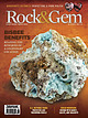 | | Journal (issue) | | PROTECTING AND PRESERVING FOSSILS TEEMING WITH GARNET, CALCITE, AND MALACHITE Best of Both Worlds! Free edEx...Galaxy & Nova Wheels This machine is made in the USA by Kingsley North. Features: • Stainless Steel construction...TAKING A CLOSER LOOK AT COPPER Revealing Garnet, Calcite, and Malachite Mineralization Exploring Clarkdale’s...Floor Bob Jones 56 MAXFIELD MINE 38 Exploring Utah’s Big Cottonwood Mining District 26 PALEONTOLOGY...BD10 Power Feed Trim Saw Scan for Video MADE IN USA Features include: • All cast aluminum tank, table |  | | Report (issue) | | member- __1__^______ Age_ __-_-_-----_--_--_----_--Maxfield limestone. _________________ N ame _-----_---...69 69 69 69 69 70 70 70 70 70 70 71 History of mining, by V. C. Heikes.__________________ The first prospectors...Cotton wood area. _________ Regulations governing mining locations____________ Early shipments and experiments...Electric power________________________________ Mining-_______________________________________ Milling...____ Big Cottonwood district.________________________ Little Cottonwood district.______________________ |  | | Report (issue) | | ___________ ____ __ ________ ____ Silver Islet district ___________________ ~_____________________ Cache..._______________________________ American Fork district (Alta area)___________________________ Alpine...______ Redmond district __________________________________ _:________ Millard County _______________..._______________ .:._______________________________ Black Rock area___________________________________________ Gordon...Map showing oxidized ziuc deposits of the Tintic district, Juab and Utah Counties. 3. Map showing oxidized |  | | Journal (article/letter/editorial) | | LARAMIDE NEAR ALTA, SALT LAKE COUNTY, UTAH LAURENCEP. JAMES Mining Geologist,Box 226, Golden,Colorado80402...California 94025 Introduction Mining Districts The two largest metal mining districts in Utah, BinghamandPark...minerals from the the Little Cottonwood(Alta) district, which centers Binghamporphyrycopperand the Park...the latter body containsa center of molybdenum mining districtand the Argentaarea lie north and northwestof...CITY, BIG Ontario COTTONWOOD ::....•• ,:....: DISTRICT ..':"t_ -•;! • ' stock ..•,,"• Ferguson Canyon |  | | Journal (article/letter/editorial) | | constraintsand evidenceof advectiveheat transport from calcite * dolomite geothermometry SrnpnrN J. Cooxr* JorrN...tremolite-bearingthrough periclase-bearing zones.The calcite + dolomite temperaturesfollow a consistenttrend...peak temperature-distanceprofile defined by the calcite * dolomite data and temperature-distanceprofiles...1976; Bowman and Essene,1982; liceous dolomites is calcite + dolomite solvus geotherFerry, 1983,1989;Nabeleket...intrusion,of the thermal properties the applicationof calcite + dolomite geothermometryto documentthe thermal |  | | Report (issue) | | . . . . . . . . . . . . . . . . . 1 Chapter I. Mining Districts of Counties and the State of Utah. .... . . . . . . . . . . . . . . . . . . . . . . 1 County Listings. . . . . . . . . . . . . . . . . . . ... . . . . . . . . . . . . . . . . 1 Chapter II. Mining Districts of Utah . . . . . . . . . . . . . . .... . . . . . . . 4 Mineral Localities Listed by County . . . . . . . . . . . . . . . . . . . . . . . .... . . . . . . . . . . . . . . . . . . 7 Beaver County . . . . . . . . . . . . . . . . . . . . . . . |  | | Report (issue) | | Selected Mining Districts of Utah by Carl L. Ege Headframe of Centennial Eureka mine, Tintic mining district... . . . . . . . . . . . . . . .1 What is a mining district? . . . . . . . . . . . . . . . . . . . . .... . . . . . . . . . . . . . . . . . .1 How many mining districts are there in Utah and are they still...mineral resources are mined in Utah’s most productive mining districts . . . . . . . . . . . . . . . . . . ...most common types of ore deposits found in Utah’s mining districts? . . . . . . . . . . . . . . . . . . |  | | Report (issue) | | RECONNAISSANCE OF THE COTTONWOOD-AMERICAN FORK MINING REGION, UTAH. By B. S. BUTLER and G. F. LOUGHLIN...the summer of 1912 during a reconnaissance of the mining districts of Utah made in a general study of the...presented Avill be of assistance to those engaged in mining. It should be borne in mind that both the descriptions...general features of the district, lack the detail desirable for the laying out of mining development. Such...very careful mapping. A portion of the Park City district, mapped by Boutwell, Irving, and Woolsey, is shown |  | | Report (issue) | | sections in central and western Utah and east-central Nevada. Correlation of some Paleozoic sections in central...---___________________-_-____-___--------_---_--83 36. Black cherty dolomite in Fitchville formation. ______...shale member of Deseret limestone, Tintic mining district, Juab County______________________________...Cambrian fossils. In the Tintic and East Tintic mining districts, where the Ophir formation is 400-425...Utah and in the lower part of the Pogonip group of Nevada. The Opohonga and Fish Haven are separated by a |  | | Journal (issue) | | Annual Wildflower Show, Julian, California. May 13—Horse Show, Sonoita, Ariz. May 13—Pictograph Tour of White...Circus, Evergreen Park, Mesa, Arizona. May 18-19—Black and White Days, Richmond, Utah. May 26—Fiesta of...desert knowledge MINING Current news of desert mines URANIUM Progress of the mining boom HOBBY Gems and...Tung- where scatterings of chalcedony or agsten Mine sign, at 1.7 miles from the ate or chalcedony roses...foot of the last steep the Chuckawallas to active mining upward pitch. Eastward from here colclaims near |  | | Report (volume) | | __ _____....._........-.._._._...__.....-_..... Mining and beneficiation_____________._____________________..._ New Mexico____ ___ __ _ _ ___ ______________ Nevada....._.__.._.__.___._...._...._.________.-.___ Gabbs________... _____ _______.._-_____.___-__...______ ..._.. Mining and beneficiation_______.___________________________________...Washington, Nevada, and Texas; at present the only commercial domestic production is from Nye County, Nev...., and Stevens County, Wash. Magnesite occurs also in New Mexico, Idaho, Oregon, Utah, Pennsylvania, and |  | | Journal (volume) | | THESALT LAKE 689388 W G E N I I V N E I R M ... MINING REVIEW Table of Contents , Page 24 Index To Advertisers...SALT LAKE CITY , UTAH Il f 2 THE SALT LAKE MINING REVIEW , APRIL 15, 1915. Products of the Experience...attention than to OTHERBRANCH the Engineering and Mining Trade.BUSINESS Carrying a dowe full line give in...engineering practice . Write forour new Catalog L. MINE & SMELTER SUPPLY CO., Agents REVERE RUBBER CO....KANSAS CITY. MO . Glant Belting THE SALT LAKE MINING REVIEW , APRIL 15, 1915. 3 Built for underground |  | | Report (issue) | | description of the geology, mining history, and production of the major gold-mining districts in 21 States...relations ---------------------------History of gold mining and trends in production_ J\labama -----------...--------------Cleburne County ----------~----------------- Tallapoosa County --------------------------Alaska...------------------Cochise County -----------------------------Gila County --------------------------------Greenlee...ee County ----------------------------R[aricopa County ----------------------------R[ohave County -- |  | | Report (issue) | | BATESVILLE DISTRICT, ARKANSAS. By HUGH D. MISER. LOCATION. The Batesville manganese district is .in the...Batesville manganese-ore district. the Gulf Coastal Plain, mostly in Independence County but partly in Sharp...CONTRIBUTIONS TO ECONOMIC GEOLOGY, 1920, PART I. the Ball mine, 2 miles east of Hickory Valley, westward to Guion...paper on the manganese deposits of the Batesville district that was presented April 23, 1919, before the...1919.1 A paper on hausmannite in the Batesville district, by J. G. Fairchild and the writer, was published |  | | Report (volume) | | mineralization.......................... Alpine mining district .......................................................................... Silver Lake mining district..............................................34 46 46 43 52 54 58 59 61 62 63 CONTENTS VI Mining claims, prospects, and mineral deposits, by Lowell..................................... Alpine mining district (locality C).................................Map of sample localities, mines or prospects, and mining claims, and aeromagnetic map, Lone Peak wilderness |  | | Journal (article/letter/editorial) | | malachite contain between 50 and 1200 ppm B. Diopside, calcite, clintonite, phlogopite, brucite, hedenbergite...Metamorphism of siliceous dolostones from the Cambrian Maxfield, and Mississippian Deseret, Gardison, and Fitchville...Undifferentiated rocks Deseret & Gardison formations Ophir & Maxfield formations 0 1 2 km Forsterite Talc Periclase...clinopyroxene, and magnetite together with minor calcite and quartz. Ludwigite [(Mg, Fe2+)2Fe3+BO5] usually...assemblages (epidote, actinolite, pyroxene, quartz, calcite, chlorite, scheelite, magnetite, pyrite, and ore |  | | Book (volume) | | the land rises abruptly into the 6,000 sq. mi. Black Hills region enclosed by the Belle Fourche and Cheyenne...instance, a single Spodumene crystal from the Etta Mine near Keystone on the east side of the Mount Rushmore...huge crystals of sparkling blue Beryl from the Black Hills pegmatites have measured from 18’ to 27’ long...and Uranium has come only from the core of the Black Hills region. Two divisions are recognized: the...beds, excavations, etc.Selenite roses. BRULE COUNTY AREA: in the Oacoma zone of the Pierre Fm. On Elm |  | | Report (issue) | | BRITISH MINING THE OFFICIAL PUBLICATION OF THE NORTHERN MINE RESEARCH SOCIETY ISSN 0308 - 2199. British...British Mining Memoirs and Monographs are vehicles for the publication of members' researches into Britain's...Robert Hunt's great dissertation on metalliferous mining in the United Kingdom, first published in 1884... Hunt (1807 - 1887) held the post of Keeper of Mining Records for 37 years from 1845; he was a lecturer...contain short papers on a wide range of historic mining topics and are usually published annually. On the |  | | Report (volume) | | sections of Au-skarn deposits in north-central Nevada 8 Map showing distribution of Au-skarn districts...zoned garnets from oxidized skarn, Surprise Mine, Nevada 16 Ternary diagrams showing ranges of garnet...five Au-bearing skarn systems in north-central Nevada 16 Ternary diagrams showing ranges of pyroxene...three Au-bearing skarn systems in north-central Nevada 17 Photomicrograph showing massive garnet partly...north-central Nevada 59 · Representative data for minerals in gold skarns from north-central Nevada 60 Chemical |  | | Book | | boreholes and underground workings within the district are tabulated below: DRIFT Blown Sand Peat Alluvium...geology of parts of East Sussex and Kent; the district includes the resorts of Bexhill, Hastings and...pleasantly varied relief in the western part of the district. East of Hastings these beds form rugged sea cliffs...deposits of gypsum in their lowest part. The eastern district comprises the low-lying reclaimed coastal deposits...into the Mesozoic and Quaternary history of the district, are summarised herein. The geology of the coast |  | | Journal (article/letter/editorial) | | Pre-intrusive thrusting in these units placed the Cambrian Maxfield Formation above Upper Mississippian Deseret-Guardison...but was not included in this study. Dolomite and calcite are present in all zones. Samples from each zone...low-grade metamorphism. Talc, Mg3(Si4O10)(OH)2, and calcite formed by the reaction of dolomite and quartz (chert...(chert nodules less than 1 cm). Massive calcite and talc, both as crystals and microscopic masses, occur...been replaced by intergrowths of tremolite and calcite. Tremolite occurs as acicular crystals that are |  | | Report (volume) | | I.M.E., Mining Geology Geophysics Div. Ann. Mtg., Min. Br. Abs.-American Institute of Mining and Metallurgical...Metallurgical Engineers, Mining, Geology,. and Geophysics Division Annual Meeting, Mining Branch Abstracts....New York. A.I.M.E. Trans.-American Institute of Mining, Metallurgical, and Petroleum Engineers Transactions...Alberta. Canadian Inst. Mining and Metallurgy Trans.-Canadian Institute of Mining and Metallurgy Transactions...-Canadian Mining Journal. Gardenvale, Quebec. Canadian Min. Metall. Bull.-Canadian Mining and Metallurgical |  | | Journal (issue) | | placer gold- Happy Day Placer, Divide, Melrose Mining District, Montana. (See Ro»ANCE OF Roci,;s A:SD l\irNEllALS...MINERALS did a great deal in convincing me that mining is a fine profession and that the study of minerals...and crystalljzed Nevada and California minerals. H . G. CLINTON Manhattan, Nevada U. S. A. llineralll...of the Tri-State Dlnrtct S phalertte, Galena. Calcite, Barile, Marcasite, Dolomite, T rlpoll. Chert,...in which the whjte limestone or marble is pure calcite and the rock known as serpentine is composed, in |  | | Report (issue) | | Belt (Armstrong and Oriel, 1965), Kaiparowits and Black Mesa Basins (Lessintine, 1965), Paradox Basin (Ohlen...overlain by as much as 5,000 ft of olive-green and black siltstone and claystone with quartzite and arkosic...in this report to be the Tintic Quartzite and Maxfield Limestone), probably is the Ophir Shale. In the...contact between the Ophir Shale (Formation) and Maxfield Limestone is gradational where it can be observed...in the Wasatch Range and Uinta Mountains, the Maxfield Limestone has been removed by erosion, and the |
|


