 | | Journal (article/letter/editorial) |
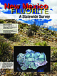
| cm, Doublestrike prospects, Bound Ranch district, Grant County. Collected by Brian Huntsman, Ray DeMark...Fluorite, 14.1 × 10.6 cm, Foster mine, Gila fluorspar district, Grant County. Collected by Jay Rosenbauer... This photo was taken at the Blanchard mine in Socorro County during early May and shows blossoming red...red ocotillo on top of a limestone ledge. Days like this are not uncommon during the spring, fall, and...Grande Rift region and the southwestern Basin and Range Province. Map prepared by William Besse. Reproduced |
 | | Report (volume) |
| Cambrian and Precambrian Rocks of the Groom District Nevada, Southern Great Basin GEOLOGICAL SURVEY BULLETIN... Cambrian and Precambrian Rocks of the Groom District Nevada, Southern Great Basin By HARLEY BARNES and...Reconnaissance geologic map of Groom district, south end of Groom Range.______________________________________...units used by various authors in Groom district and at Nevada Test Site________________ G16 2. Comparison...CAMBRIAN AND PRECAMBRIAN ROCKS OF THE GROOM DISTRICT, NEVADA, SOUTHERN GREAT BASIN By HARLEY BARNES and |
 | | Report (issue) |
| migrational events as presented hi papers on eastern Nevada, Utah, and Idaho (9,10,12). Figure 1. Map showing...GP-10 1817.2 GP-10 2654.4 GP-1O 2671.1 silty limestone/ litharenite Normal to bedding; litharenite ...sample and depth (ft) Table 1 (Continued) silty limestone Normal to bedding; quartz arenite quartz arenite...origins in the audio-magnetotelluric (AMT) frequency range of 4.5-27,000 hertz (HZ) were analyzed to depict...MINERALIZED VEINS IN CHAMPAGNE CREEK AREA, BUTTE COUNTY, IDAHO BETTY A. SKIPP, Branch of Central Regional |
 | | Report (volume) |
| Director ' Bulletin 648 NOTES ON SOME MINING DISTRICTS IN EASTERN NEVADA BY JAMES M. HILL WASHINGTON GOVERNMENT...Clark County.......................................................'.. Gold Butte mining district........the ores........................ Deposits in limestone..................................... Tramp Miner................... Lincoln mine........................................ Bennett mine.....................gneiss............................. Gold Butte Mining Co................................. New Era group |
 | | Report (issue) |
| mines, which comprise the greater Bingham mining district. Mining activity in this area began in the early...continued until 1985, when the last mine in Bingham Canyon, Kenncott's Utah Copper mine, was closed temporarily...temporarily. Plans to reopen and modernize mining and milling methods were announced (Skilling, 1985) and new...Canyon area, about 6 km north of the Utah Copper Mine (Standard Oil Co., 1986). The discovery has been...enlarged by Barrick Resources (U.S.A.) (Skillings Mining Record, 1987). BP Minerals America, who has since |
 | | Journal (article/letter/editorial) |
| specimens, are either inaccessible or are in closed mining districts, or are closed for political reasons...many occurrences reported in 'C) -- , ", . Lincoln ~ 1.J \ ~-'-T-.P' -, ,,---.Jerome I i,J--..s....City-D~Lamar Mining Dlstricts / J\. I,' -r-, - L..... ~ rl.. kl \ , 50 I 100 I Miles old mining and...scientific significance. In this index, the better known mining districts that have produced many high-quality...across, on blue thomsonite. Lucky Peak Dam, Ada County; Lanny Ream specimen and photo. Figure 3 (below) |
 | | Report (issue) |
| decide whether a certain metalliferous deposit or district should be included or not. The problem was also...other forms) since 1935 is reviewed. New sulfur mining and recovery projects in the United States and...chemical properties of sulfur, the geology and mining operations of the salt-dome sulfur deposits, the...sulfur by superheated water through wells at Sulphur mine, Louisiana, are fully detailed. Exploration and...Swager, W. L. , and Sullivan, J. D. , 1951, Sulphur: Mining Engineering, vol. 3. , pp. 403409. The history |
 | | Report (issue) |
| . . . . . . . . . . . . . . . . . 1 Chapter I. Mining Districts of Counties and the State of Utah. .... . . . . . . . . . . . . . . . . . . . . . . 1 County Listings. . . . . . . . . . . . . . . . . . . ... . . . . . . . . . . . . . . . . 1 Chapter II. Mining Districts of Utah . . . . . . . . . . . . . . .... . . . . . . . 4 Mineral Localities Listed by County . . . . . . . . . . . . . . . . . . . . . . . .... . . . . . . . . . . . . . . . . . . 7 Beaver County . . . . . . . . . . . . . . . . . . . . . . . |
 | | Report (issue) |
| Control the Location of Base- and Precious-Metal Mining Districts in the Oquirrh Mountains, Utah by Edwin...Structural and Stratigraphic Characteristics of Mining Districts in the Oquirrh Mountains ..............(West Mountain) mining district ................ .14 Mercur (Camp Floyd) Mining District ................Ophir Mining District.................................. .27 Stockton (Rush Valley) Mining District ...................... 32 Barneys Canyon-Melco Mining Area ..................... 35 Conclusions .......... |
 | | Journal (article/letter/editorial) |
| Index Downloaded by [University of Nebraska, Lincoln] at 20:00 09 April 2015 K NOWN AS THE TREASURE...with its representation of mining tools clearly proclaim Montana’s mining origins. Montana’s production...published describing the occurrence, collecting, mining, and cutting of the two state gemstones. Figure...2. Granville Stuart established Montana’s first mining camp at Gold Creek in 1860. Geologic Provinces...view showing the Indian Queen mine ca. 1905 at Farlin, Beaverhead County. 208 ROCKS & MINERALS Downloaded |
 | | Report (issue) |
| DIRECTOR ECONOMIC GEOLOGY OF THE BINGHAM MINING DISTRICT, UTAH By JOHN MASON BODTWELL WITH A SECTION...DIRECTOR ECONOMIC GEOLOGY OF THE BINGHAM MINING ^DISTRICT, UTAH By JOHN MASON BOUTWELL WITH A SECTION...... 25 PART I. AREAL GEOLOGY OF THE BINGHAM DISTRICT, BY ARTHUR KEITH. Geography...............--....Butterfield limestone member.................................................... Lenox limestone member....Jordan limestone member........................................................ Commercial limestone member |
 | | Report (issue) |
| description of the geology, mining history, and production of the major gold-mining districts in 21 States...relations ---------------------------History of gold mining and trends in production_ J\labama -----------...--------------Cleburne County ----------~----------------- Tallapoosa County --------------------------Alaska...------------------Cochise County -----------------------------Gila County --------------------------------Greenlee...ee County ----------------------------R[aricopa County ----------------------------R[ohave County -- |
 | | Report (issue) |
| ___________ ____ __ ________ ____ Silver Islet district ___________________ ~_____________________ Cache..._______________________________ American Fork district (Alta area)___________________________ Alpine...______ Redmond district __________________________________ _:________ Millard County _______________...Bradshawd~trict__________________________________________ Lincoln district____ _ __ __ __ ___ __ __ _________ ____________...Map showing oxidized ziuc deposits of the Tintic district, Juab and Utah Counties. 3. Map showing oxidized |
 | | Report (volume) |
| similar lists have been published by the Survey in the last quarter of a century. During that period, however...increase in production have taken place during the last quarter of a century. Aluminum was not made in the...it helpful to refer to Survey Bulletin 507, "The mining districts of the western United States," and to...abundant, it may have been completely exhausted by mining or quarrying. Deposits of minerals of wide distribution...because they occur in sufficient quantity to warrant mining for their usual products but because they furnish |
 | | Report (volume) |
| ....................................... 102 District of Columbia ............................................................................ 187 Nevada..................................................which includes much more information than the one last published. This bulletin may be regarded as a thoroughly...to refer to Geological Survey Bulletin 507, "The mining districts of the western United States," and to...abundant it may have been completely exhausted by mining or quarrying. Deposits of minerals that are widely |
 | | Report (volume) |
| Weir and Robert C. Greene. (C) The Lexington Limestone (Middle Ordovician) of central Kentucky, by Douglas...and William C. MacQuown, Jr. (D) Galloway Creek Limestone and Ashlock and Drakes Formations (Upper Ordovician)...Cobban, and Erie G. Kauffman. (I) Harrodsburg Limestone in Kentucky, by E. G. Sable, R. C. Kepferle, and...Crawford E. Fritts. _______ Belted Range Tuff of Nye and Lincoln Counties, Nevada, by K. A. Sar>gent, D. C: Noble...E. B. Ekren __ .-__._ - _ ______ _______ Belted Range Tuff. _____ _______ _________ ___ ________ ___:__ |
 | | Journal (article/letter/editorial) |
| east-westtrending folds and beddingplanefaults acrossthe district; differentialyielding resultedin overturningof...produced:diopsidein quartziteand in interbedded, thin silty limestone beds;wollastonite, with minoridocraseand garnet...eraplacement of the quartz monzoniteof the Binghamand Last Chancestocksand continuedduring the initial eraplacementof...from the stock. TheMainStageoforedeposition in limestone skarns culminated in thepartialdestruc- tion...ssureore (Pb/Cu -' 5 to 0.2) in nonsilicated limestone,up to 900 m; (3) copperore (Pb/Cu • 0.02) in garnet |
 | | Report (issue) |
| an overall guide been written on gold and gold mining of publications have no single report or to...deposits within the state, mostly in the Sierra Nevada. Some of these reports are classics now. Among...Sierra Nevada, Lindgren's 1911 professional paper on the number of very excellent reports Nevada and...longer district Hulin, respectively. the principal features of each gold-bearing district are described...publications were written on various phases of gold mining. The reports of John Trosk, the first State Geologist |
 | | Report (issue) |
| from large-scale geologic maps, such as State or County geologic maps. The outcrop patterns are necessarily...of isopachs. In much of the Basin and Range province of Nevada, southern California, southern Arizona...broad valleys in a large part of the Basin and Range province. This implies that rocks of the mapped...represent a single homogeneous unit of sandy limestone or interbedded layers of sandstone and carbonate...systemic boundary. Locally, in the Anthracite district of Pennsylvania, an episode of uplift and gentle |
 | | Report (issue) |
| by Betty Skipp, W. J. Sando, and W. E. Hall BB. Nevada, by E. R. Larson and Ralph L. Langenheim, Jr.,...and W. E. HalL-----------------------------BB. Nevada, by E. R. Larson and Ralph L. Langenheim, Jr.,...from Lee County in the southeast corner of the State northwestward to southeastern Kossuth County in north-central... 1956) includes in ascending order: McCraney Limestone, Prospect Hill Siltstone, and Starrs Cave Formation...Formation. An interval of dominantly oolitic limestone, the Chapin For·mation of north-central Iowa, is |
 | | Report (issue) |
| MINERALS OF NEVADA MINERALS OF NEVADA Peer Hen By CASTOR oan eGORY.C.oFER DOCK NEVADA AND BUREAU... UNIVERSITY Reno & Las Vegas OF NEVADA PRESS GEOLOGY Nevada Bureau of Mines and Geology Special...University of Nevada Press, Reno, Nevada 89557 USA Copyright © 2004 by University of Nevada Press Photographs...otherwise noted Map of Mining Districts and significant mineral occurrences of Nevada by Nevada Bureau of Mines...Cataloging-in-Publication Data Castor, Stephen B, Minerals of Nevada / Stephen B. Castor and Gregory C. Ferdock.— Ist |
 | | Report (volume) |
| Bulletin 732 GEOLOGY AND ORE DEPOSITS OF SHOSHONE COUNTY, IDAHO BY JOSEPH B. UMPLEBY AND E. L. JONES...Interstate-Callahan mine_________________ Success mine __________________________ Rex mine____________________________...deposits to other deposits in the Coeur d'Alene district ___________________ 120 Antimony deposits_____...topography of Shoshone County, Idaho____ V. A, Valley of Milo Creek, Shoshone County, Idaho; B, Summit topography...the 900-foot level of the Bunker Hill and Sullivan mine _____________________________ I.. Geologic sections |
 | | Report (issue) |
| U.S. Geological Survey, along with prices of the last offerings, are given in the current-year issues...Gold in the Bingham District, Utah By EDWIN W. TOOKER Gold in the Butte District, Montana By EDWIN W...Gold in the Ely (Robinson) Copper District, White Pine County, Nevada By LAURENCE P.JAMES The Tomboy-Minnie...Tomboy-Minnie Gold Deposits at Copper Canyon, Lander County, Nevada By TED G. THEODORE, STEPHEN S. HOWE, and DAVID...Gold in the Bingham District, Utah / by Edwin W. looker Gold in the Butte District, Montana / by Edwin |
 | | Report (issue) |
| RECONNAISSANCE OF THE CONCONULLY AND RUBY MINING DISTRICTS, WASHINGTON. By EDWARD L. JONES, Jr. INTRODUCTION...examination of the Conconully and Ruby mining districts, in Okanogan County, Wash., made during two weeks in...incorporated in this paper. Data on the Arlington mine were kindly supplied by Mr. H. S. Stoolfire, of...1890 first describes the Ruby and Salmon River mining districts. Henry Landes, in volume 1 of the State...gives a brief economic account of the Conconully district. J. B. Umpleby, in Bulletin 5 of the State Geological |
 | | Report (issue) |
| characteristics ....................... Thimble Limestone Member .................... Faunal characteristics...characteristics ....................... Gold Ace Limestone Member ................... Faunal characteristics...characteristics ....................... Red Pass Limestone Member .................... Faunal characteristics...characteristics ....................... Jangle Limestone Member ...................... Faunal characteristics...characteristics ....................... Desert Range Limestone Member ............... Faunal characteristics |


