 | | Journal (article/letter/editorial) |
| IZATION, AND CHARACTER BURRO MOUNTAINS, ELLIOT OF MINERAL- NEW MEXICO GILLERMAN ABSTRACT Faultsdividethe...Faultsdividethe Big Burro Mountainsinto threeseparateand distinct blocks. The Tyrone stock occupiesthe northeasternpart...northeasternpart of the central Tyrone-Burro Peak block. This block is a horst, uplifted along the Austin-Amazonand...roof pendantsof metamorphicrocksinto which the Burro Mountain batholith was intruded, and the deep erosion...TyroneBurro Peak block of all minerals except chalcopyrite, and the ubiquitous pyrite. In the adjacentblocks |
 | | Report (issue) |
| mines, and prospects of the Tyrone stock and vicinity, Grant County, New Mexico By D. C. Hedlund 1 Open-File................. Porphyry copper deposits of the Tyrone stock....................... Precious- and base-metal...of the quartz-pyrite veins of the White Signal district............................... Quartz-molybdenite.... Quartz-pyrite veins, including White Signal district............... Silver-lead-manganese oxide veins...mines, and prospects of the Tyrone stock and vicinity, Grant County, New Mexico......................... |
 | | Report (issue) |
| 83 New Mexico Bureau of Mines & Mineral Resources A DIVISION OF NEW MEXICO INSTITUTE OF MINING & TECHNOLOGY...of Western Grant County, New Mexico by Elliot Gillerman NEW MEXICO INSTITUTE OF MINING & TECHNOLOGY...TECHNOLOGY KENNETH W. FoRD, President NEW MEXICO BUREAU OF MINES FRANK E. & KoTTLOWSKI, MINERAL RESOURCES...REGENTS Ex Officio Jerry Apodaca, Governor of New Mexico Leonard DeLayo, Superintendent of Public Instruction...PATRICIA E. CANDELARIA, Secretary JAMES M. ROBERTSON, Mining Geologist RoNALD J. RoMAN, Chief Research Metallurgist |
 | | Journal (article/letter/editorial) |
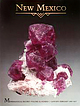
| leaf gold, smoky quark, and turquoise specimens, New Mexico boasts an array of mineral species. RAMON S....Albuquerque, New Mexico 87110 THE PURPOSE OF THIS INDEX is to provide a comprehensive listing of New Mexico...Particular attention was directed toward incorporating new information on discoveries and occurrences, although...to compile all of the mineral occurrences in New Mexico-a venture of that magnitude is beyond the scope...Minerals of New Mexico is the basic reference for locations. Abstracts from the New Mexico mineral symposia |
 | | Report (issue) |
| NEAR THE BURRO MOUNTAINS, GRANT COUNTY, NEW MEXICO. By SIDNEY PAIGE. LOCATION. The Burro Mountains lie near...near and southwest of Silver City, Grant County, N. Mex. Silver City is reached by a spur of the Atchison...likewise passes through Deming. TOPOGRAPHY. The Burro Mountains consist of two distinct mountain masses, the...carved, sloping, gravel plain. The Little Burro Mountains rise out of this dissected expanse of semiconsolidated...conical mass of the Big. Burros. The Little Burro Mountains trend northwest and southeast, are about 8 |
 | | Report (volume) |
| Fluorspar Deposits of Burro Mountains and Vicinity New Mexico By ELLIOT GILLERMAN CONTRIBUTIONS TO GENERAL..._________----___---___----___--__________ ' History of mining.____________________________________________ Production...deposits._--_____------_--------_--._--_-_..__-__. "Burro Chief-..l.__....._........._"___........ .........------.--. Grandview, Bounds, Fence Line, and Grant County. __________ Langford and Hines_-------____-...Geologic map of the Burro Chief fluorspar deposit and vicinity, Burro Mountains, Grant County, N. Mex._______________________ |
 | | Report (issue) |
| of New Mexico by JOHN H. SCHILLING 1965 STATE BUREAU OF MINES AND MINERAL RESOURCES NEW MEXICO INSTITUTE...INSTITUTE OF MINING & TECHNOLOGY CAMPUS STATION SOCORRO, NEW MEXICO NEW MEXICO INSTITUTE OF MINING Sc TECHNOLOGY................................... Governor of New Mexico Leonard DeLayo ................................................... Socorro For sale by the New Mexico Bureau of Mines and Mineral Resources Campus............................................... 7 Mining .............................................. |
 | | Report (issue) |
| PROFESSIONAL PAPER 122 COPPER DEPOSITS OF THE TYRONE DISTRICT, NEW MEXICO BY SIDNEY PAIGE • I . ' : i~ ~ t...Professional Paper 122 COPPER DEPOSITS OF THE TYRONE DISTRICT, NE'W MEXICO BY • .SIDNEY PATGE .· WASHINGTON................................ . Position of the area ............................. ·........................................... . Geology of the Tyrone district ..................................................................... . Faultingin the Tyrone district .................................. ·...... |
 | Richter, D.H., Sharp, W.N., Watts, K.C., Raines, G.L., Houser, B.B., Klein, D.P. (1983) Mineral resource assessment of the Silver City 1 degree x 2 degrees Quadrangle, New Mexico-Arizona. Open-File Report Vol. 1983 (83-924) US Geological Survey doi:10.3133/ofr83924 | Report (issue) |
| assessment of the Silver City I°x2° quadrangle, New Mexico-Arizona by D. H. Richter, W. N. Sharp, K. C... INTRODUCTION The Silver City l°x 2° quadrangle, New Mexico-Arizona, has a wide variety of metallic and nonmetallic...southern Basin and Range province of southwestern New Mexico and southeastern Arizona. Bedrock of the ranges...constitute about 65 percent of the quadrangle's surface area, are filled with Late Cenozoic (Pliocene-Pleistocene)...deposit types in the Silver City l°x 2° quadrangle, New Mexico-Arizona, showing some geologic characteristics |
 | | Report (issue) |
| THE WILD HORSE MESA AREA, NORTHEASTERN BURRO MOUNTAINS, GRANT COUNTY, NEW MEXICO Virginia T. McLemore...August 2005 New Mexico Bureau of Geology and Mineral Resources New Mexico Institute of Mining and Technology...Mesa in the eastern Telegraph district of the northern Burro Mountains are volcanic-epithermal veins...epithermal fluorite vein deposits in the Wild Horse Mesa area is moderate with a moderate certainty of assurance...assurance. However, due to the remoteness of the area and low grades, it is unlikely that these deposits |
 | | Map |
| New Mexico Bureau of Mines & Mineral Resources Resource Map 15 March 1986 Silver and gold occurrences...occurrences in New Mexico by Robert M. North and Virginia T. Mclemore New Mexico Bureau of Mines and Mineral Resources...Resources, Socorro, New Mexico 87801 Abstract Anomalous amounts of silver and/or gold have been identified...identified in 153 mining districts or prospect areas of New Mexico. Production from most of these occurrences...200,000 ounces of silver. Silver and gold in New Mexico occur in 14 distinct types of deposits ranging |
 | | Report (issue) |
| BULLETIN 39 The Metal Resources of New Mexico and Their Economic Features Through 1954 A revision of...RESOURCES NEW MEXICO INSTITUTE OF MINING & TECHNOLOGY CAMPUS STATION SOCORRO, NEW MEXICO NEW MEXICO INSTITUTE...INSTITUTE OF MINING & TECHNOLOGY E. J. Workman, President STATE BUREAU OF MINES AND MINERAL RESOURCES Alvin...THE HONORABLE EDWIN L. MECHEM………...Governor of New Mexico MRS. GEORGIA L. LUSK ......................Superintendent...Dealing With the Geology and Mineral Resources of New Mexico ............................................ |
 | | Book |
| MINERALS OF THE GREAT AMERICAN RIFT (COLORADO-NEW MEXICO) Sine —_—< ¢ te om At _SHT 40 MADIASIMA...MINERALS OF THE GREAT AMERICAN RIFT (COLORADO-NEW MEXICO) Richard Walker Holmes and Marrianna B. Kennedy...Kennedy [aN VAN NOSTRAND REINHOLD COMPANY NEW YORK CINCINNATl TORONTO LONDON MELBOURNE Copyright © 1983...Nostrand Reinhold Company Inc. 135 West 50th Street, New York, N.Y. 10020 Van Nostrand Reinhold Publishing...minerals of the Great American Rift (Colorado-New Mexico). Bibliography: p. Includes index. 1. Mines |
 | | Book (edition) |
| HURLEY NEW MEXICO Scenic Trips to the Geologic Past Series: No. I - Santa Fe, New Mexico No. 2 - Taos-Red...Nest, New Mexico, Circle Drive No. 3 - Roswell- Capitan - Ruidoso and Bottomless Lakes Park, New Mexico...Southern Zuni Mountains, New Mexico No. 5 - Silver City-Santa Rita-Hurley, New Mexico Additional copies...from the New Mexico Bureau of Mines and Mineral Resources, Campus Station, Socorro, New Mexico. HO: FOR...FOR THE GOLD AND SILVER MINES OF NEW MEXICO Fortune hunters, capitalists, poor men, Sickly folks, all |
 | | Report (issue) |
| Resource Maps of the Silver City 1° X 2° Quadrangle, New Mexico and Arizona The Conterminous United States...Resource Maps of the 0 Silver City l X2° Quadrangle, New Mexico and Arizona By D. H. Richter, B. B. Houser, K...---------------------------------------------History of mining activity -------------------------------------...ILLUSTRATIONS Page FIGURE 1. Index map of Arizona and New Mexico showing location of the Silver City 1 °X2° quadrangle------2...City 1 oX 2 o quadrangle, New Mexico and Arizona, showing principal mining areas a..,.d 3 year of |
 | | Journal (article/letter/editorial) |
| RALPH WAYMAN 930 Warren Ave., Longmont, Colo. New Mexico is truly a paradise for the gem, crystal, and...early one Monday morning, we were well into the mountains southwest of Denver before most tourists were...the road. Our first stop was at the King Turquoise Mine in Colorado's famous San Luis Valley. The mines...about twelve (12) miles east of Manassa (Conejos County), Colo. The Indians originally discovered the turquoise...* - ^ / stay near one shade. The mine owner's son told us the mine has produced about $27,000 worth of |
 | | Journal (issue) |
| ................ 2 A short history of mining in New Mexico ...................................... 5...5 by W. E. Wilson Minerals first described from New M ex ico ...................................... 9...Famous mineral localities: The Magdalena district, Kelly, New Mexico ............................................ 13 by R. B. Gibbs The Stephenson-Bennett mine ..................................................mineral localities: The Hansonberg district, Bingham, New Mexico ................................... |
 | | Report (issue) |
| SOCIETY and · SOUTHWESTERN NEW MEXICO SECTION American Institute of Mining and Metallurgical Engineers...Gladstone Arrangements with John Byron Georges Mining Companies Faick Hardie Ordonez Road log - Silver...Norman, · Jr., Treasurer OFFICERS OF SOUTHWESTERN NEW MEXICO SECTION, AIM&ME Joseph H. Taylor, Chairman Ira...Society and the Southwestern New Mexico Section, American Institute of Mining and Metallurgical Engineers...Geologic Features of Region Central Mining D.istrict, New Mexico .. (By.. ..S... G... .. . . ..and. |
 | | Report (issue) |
| ASHLEY SCHMITT "As !look back on four decades in mining geology I am impressed by the magnitude of the...geologists who developed the art and science of mining geology into a leading factor in the unprecedented...detailed ore deposit studies to the exploration for new mines. Our generation, in 1. Presented to the Arizona...their concepts of applied ore deposition with the new techniques of geochemistry and geophysics. vi ...1926. His thesis work in the Parral District of Chihauhua, Mexico, (1931) and other investigations in |
 | | Report (volume) |
| Deposits rOf the Steeple Rock Mining District, Grant County "New Mexico M ^: By ROY L. GRIGGS and HOLLY...fore deposits of Tertiary age in southwestern New Mexico UNITED STATES GOVERNMENT PRINTING OFFICE, WASHINGTON... Center-Pennsylvania mine. _____________________________________ East Camp mine ____________________...__________________________ Mohawk mine._______________________________________________ Other mines.-__-_-------...the Carlisle mine area. Geologic map of the Carlisle mine. Sections through the Carlisle mine. FIGURE 1 |
 | | Journal (article/letter/editorial) |
| BLACK HAWKNewDISTRICT Mexico Minerals of the Downloaded by [McGill University Library] at 10:10 18 December... Because most of its mine development occurred in the late 1800s, this district, with its approximately...HAWK (also known as Bullard Peak) district is the largest district of the silver-nickel-cobaltbismuth-uranium-arsenic...Radium, Northwest Territories, Canada; Batopilas, Mexico; Chafiarcillo, Chile; Joachimstal, Czechoslovakia;...Norway; Bou Azzer, Morocco; and the Consols mine at Broken Hill, New South Wales, Australia. These deposits |
 | | Journal (article/letter/editorial) |
| removedfrom mineral combination,it is readilyfixedin new environments beforebeingdispersed.Thus, a regionof...CA•YON GAP'---"'-- WAGON EAGLE MTNS. ß FLUORSPAR MINE OR GROUP OF MINES FLUORITE OCCURRENCE ß FLUORITE... include:Deming-Silver Cityarea,New Mexico;ZuniMountains, New Mexico; Jamestown, Colorado;Northgate,...Alstine (47), Colorado;Rothrockand others(35), New Mexico; Ross (34), Montana; CrosbyandHoffman (11), ...Colorado;Gillerman (14, 15) on the Eagle Mountains,Texas,and the Burro Mountains,New Mexico; Steven(42, 43) on Northgate |
 | | Journal (article/letter/editorial) |
| and the presence of data from a wide geographical area, there are some important consistencies throughout...limestone. ß 2009 Institute of Materials, Minerals and Mining and The AusIMM Published by Maney on behalf of...rocks), direct atmospheric leaching of the run of the mine (5ROM) ore with sulphuric acid will not be economically...generally low, and thought to represent a subeconomic mining source. Unlike continental stratiform chromitite...118 of PGE grade and PPGE/ IPGE ratios. As such, mining of podiform chromitite ores is often an informal |
 | | Journal (article/letter/editorial) |
| 16 April 2015 Minerals of the Ground Hog Mine GRANT COUNTY Even though some of its dumps can still provide...this mine became famous can now only be found in collections. RON GIBBS P.O. Box 448 Tyrone, New Mexico...HOG MINE IS LOCATED in the Central mining district near the town of Bayard in Grant County, New Mexico...Mexico. Even though the mine has been a steady producer of lead and zinc ores from the early 1900s until...crystallized chalcopyrite. History The first mining activity at what would become the Ground Hog mine began |
 | Hollis, Steven P., Roberts, Stephen, Earls, Garth, Herrington, Richard, Cooper, Mark R., Piercey, Stephen J., Archibald, Sandy M., Moloney, Martin (2014) Petrochemistry and hydrothermal alteration within the Tyrone Igneous Complex, Northern Ireland: implications for VMS mineralization in the British and Irish Caledonides. Mineralium Deposita, 49 (5) 575-593 doi:10.1007/s00126-013-0508-x | Journal (article/letter/editorial) |
| Petrochemistry and hydrothermal alteration within the Tyrone Igneous Complex, Northern Ireland: implications...deposits are limited to Avoca and Parys Mountain. The Tyrone Igneous Complex of Northern Ireland represents...horizons prospective for VMS mineralization in the Tyrone Igneous Complex are associated with rift-related...ca. 475 Ma precollisional, calc-alkaline lower Tyrone Volcanic Group riftrelated magmatism is characterized...Killybrack Road, Omagh BT79 7DG, UK Miner Deposita Tyrone Volcanic Group is dominated by OIB-like, subalkaline |


