 | | Report (issue) |
| RESOURCES OF ELKO COUNTY, NEVADA By Roscoe M. Smith Prepared in cooperation with Nevada Bureau of Mines...Acknowledgment -Mining districts Commodities Production Descriptions of mining districts . Alder district-Aura district...-Beaver district Black Mountain district Bootstrap district Burner district Burns Basin district-- -Carlin...-Carlin district Cave Creek district ----Charleston district_--Coal Mine district~ Contact district Cornucopia...Cornucopia district - -Corral Creek district - Decoy district Delano district Delker districtDivide district |
 | | Journal (issue) |
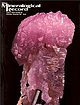
| Rosenzweig Tampa, Florida Richard W. Thomssen Reno, Nevada photography Nelly Bariand Paris, France Werner...Record Inc. Articles The Bunker Hill mine, Kellogg, Shoshone County, Id a h o 339 by N. Radford and J...by R. S. W. Braithwaite Barite from the Niobec mine, Chicoutimi, Quebec .....................355 by...G. Gagnon Minerals of the Yates uranium mine, Pontiac County, Quebec . 359 by D. L. Leavitt Shavano...— December, 1981 Bunker Hill the mine kellogg, shoshone county, idaho by Norman Radford P. O. Box N |
 | | Report (volume) |
| location and means of access to all the metallic mining districts in the State, as well as a large number...documented summary of the beginning of Colorado mining history. Part of his summary is given here in the...had been recently found in the Tenmile district, Summit County. In his booklet, which today would be classed...silver," "ruby silver," "sulphates of copper," "limonite" and others. Few of these notes can be translated...however, because it contains lists of the mines and mining districts that were active at the time in Clear |
 | | Report (issue) |
| GEOLOGY AND ORE DEPOSITS OF THE OCEUR D'ALENE DISTRICT, IDAHO BY RANSO~IE FREDERICK LESLIE AND FRANK.... ..... . . 65 Structural subdivisions of the district. . ................................•.. .. ......-Structure-Continued. Structural subdivisions of the district-Continued. Page. Southeastern area ... _. ___..._________ . _..... __ ._ .... _.... __ 78 History of mining development .. ______ .. ___ . __________ . _______... _________ ._ .. ____ .. __ .____ 84 Mines and mining ___ .. _... _______ . ________ . _. ____ . ___ |
 | | Report (volume) |
| SMITH, Director Bulletin 626 THE ATLANTIC GOLI) DISTRICT AND THE NORTH LARAMIE MOUNTAINS PAPERS BY ARTHUR...................... The Atlantic gold district, Fremont County, Wyo........................... Introduction........................ Geology of the Atlantic district......................................... Rocks...Magnetite schists in the northern part of the district.............. 16 Distribution and general character........................ General outlook for lode mining.................................... Planning of |
 | | Report (volume) |
| periods of exploratIon that ultimately led to a mining "boom ll in the 1950 IS. Since I ts meager start...Tallahassee Creek distrIct in Fremont County. Uranium, recoverable by solution mining of Upper Cretaceous...evaluated In Weld County. VBlntype uran I urn occurrence 5 are typ I fled in Je f farson County by the Schwartzwal...Schwartzwal der Mi ne, the largest uranium mine In Colorado. Part 2 contains in the bibliography of approximately...occurrences In the state, with cross-Indexes by county, host rock, and the special categoriesof "Front |
 | Doebrich, Jeff L., Albino, G.V., Barker, C.E., Duffield, W.A., Dunn, V.C., Hanna, W.F., McFarlan, J.P., McGuire, D.J., Miller, M.S., Peters, S.G., Plouff, Donald, Raines, G.L., Sawatasky, D.L., Spanski, G.T. (1994) Resource assessment of the Bureau of Land Management's Winnemucca District and Surprise Resource Area, Northwest Nevada and Northeast California. Open-File Report Vol. 1994 (94-712) US Geological Survey doi:10.3133/ofr94712 | Report (issue) |
| MANAGEMENT'S WINNEMUCCA DISTRICT AND SURPRISE RESOURCE AREA, NORTHWEST NEVADA AND NORTHEAST CALIFORNIA...Field Office, Mackay School of Mines, University of Nevada, Reno, NV 89557-0047 2U.S. Geological Survey, Unit...Winnemucca District and Surprise Resource Area, an area covering 13.5 million acres in northwest Nevada and...Rock National Conservation Area), and the impact of mine dewatering on drainage basin groundwater resources...part of their Resource Management Plan for the District/Resource Area or for other planning units such |
 | | Report (volume) |
| ...................... 1. Rocks from Aroostook County..... ^..................'........... 2. Miscellaneous............................... Maryland and the District of Columbia.....................................1. Elliott County dike............................................... 2. Crittenden County dike..................................... 2. Crystal Falls district, Michigan.................................. ....................... Schist from the Aragon iron mine............................... ill 17 .18 18 19 |
 | | Report (volume) |
| Geophysical Union.. Transactions, American Institute of Mining and Metallurgical Engineers _..._ American Journal...Colorado Mining Association publications . Economic Geology. _ . _ ___... Engineering and Mining Journal...of Sedimentary Petrology_...__._ Mines Magazine Mining Engineering ........___..._...._____ Advances in...Tallahassee, Fla. GA Georgia Department of Mines, Mining and Geology, 425 State Capitol, Atlanta, Ga. IM...and Geology, Butte, Mont. NEV Office of Director, Nevada Bureau of Mines, Reno, Nev. NJ Geology Library |
 | | Report (volume) |
| Director Bulletin 842 OF THE GREATER HELENA MINING REGION MONTANA BY J. T. PARDEE and F. C. SCHRADER...______________________-__-_________--_------___-_ Ophir district.________________________________________________...__________---__--_-___ Austin district._.____..._..._._.____._____.____.___-.___._____ Marysville district.___________...___________________________________________ Gould district._______________________________________________ Stemple...._ Heddleston district.___________________________________________ Wolf Creek district.._..........__ |
 | | Report (issue) |
| of land forms Metallic mineral deposits Elkhorn district Geology Types of deposits Replacement deposits...Elkhorn district Elkhorn mine Keene mine Dolcoath mine and Klondyke mine Golden Moss mine Union mine C and...and D mine Swissmont and Pittsmont claims Carmody-Papesh mine Bulwer and adjacent claims Tourmaline Queen...Queen property Skyline mine Elkhorn Queen mine Tacoma mine Golden Curry mine 65 65 65 66 66 66 67 67...Descriptions of mines and prospects—Continued Elkhorn district—Continued Elkhorn Peak iron deposits Elkhorn Creek |
 | | Report (volume) |
| ......................... 82 Maryland and the District of Columbia.............................. 83 1...TheElliott County dike ...................................... 92 2. The Crittenden County dike............................... 4. The Castle Mountain district...........................'...-.. 5. The Highwood.............................. 2. The Pikes Peak district ...... ....:..........-.....--.-----.-3. Silver................................ 6. The Ten Mile district......................................... 7. The |
 | | Report (issue) |
| Deposits of the Chicago Creek Area Clear Creek County Colorado GEOLOGICAL SURVEY PROFESSIONAL PAPER 319...Deposits of the Chicago Creek Area Clear Creek County Colorado By J. E. HARRISON and J. D. WELLS GEOLOGICAL...deposits of the Chicago Creek area, Clear Creek County, Colorado, by J. E. Harrison and J. D. Wells. Washington..._---_-__-_--__________-____________--. History of the district-______________________________ General geology...nswick (45)__---------------_----------Chemung County (71)____________________ Chicago (161)_---___- |
 | | Report (issue) |
| ..... . . ............ 10 Pike National Forest County of El Paso (Black Forest) Land Exchange Offer ...................... 48 Fig. 14. Map 12-Offered mining claims-Quartz Creek & Cumberland Pass areas (provided...................... 49 Fig. 15. Map 13-Offered mining claims-Taylor Pass area (provided by USFS) ......................... 50 Fig. 16. Map 14-Offered mining claims-Whitepine area (provided by USFS) ........................... 51 Fig. 17. Map 15-Offered mining claims-Granite Mountain area (provided by USFS) |
 | | Journal (volume) |
| The Champion nine at Nevada w^.- *HKI£K UOLXuVKH fKK ANNUM. 2, 1897. Mining Legislation. 'City....Champion Mining Company's properties near The Committee on Legislation of the California Nevada City are...The reopening of the old G win mine in Calaveras proposed by the Mining and Scientii-io Pkess and A 10-stamp...Spanish mine is also included putilisiied in the issues of October 31st and November county is an event...1500-foot shaft, and putting ing properties in Nevada county. There was, when they took charge, up a 40-stamp |
 | | Report (volume) |
| THEIR GEOLOGIC ENVIRONMENT IN NORTHWESTERN PARK COUNTY, COLORADO BY QUENTIN D. SINGEWALD Prepared in...STATE OF COLORADO, THE COLORADO METAL MINING FUND THE COLORADO MINING ASSOCIATION AND THE COLORADO GEOLOGICAL...Gulch__-------_-_-_____-__------_---_________-_Sacramento Gulch.________________________________________ Beaver...Gulch________________________________-___ Deadwood Gulch..._..___'.__________________ Middle Tarryall Creek________...placer_______________________________________ Placers in Park Gulch.____________________________________ Wilson pla |
 | | Report (issue) |
| assessments _____________________ Geologic studies of mining districts and mineralbearing regions _________________...Phosphate investigation ____________ Novaculite in Nevada ________________ Mineral-fuel investigations _______________...___-_——-————————— Idaho ______________________ Nevada _____________________ Oregon ________________———___...Service ____________ Cooperative projects with the Mine Safety and Health Administration _____ Cooperative...Reclamation ____________________ Impact of surface mining _____________ Cooperative projects with States |
 | Stark, J. T., Johnson, J. H., Behre, C. H. Jr., Powers, W. E., Howland, A. L., Gould, Don B. (1949, January) Geology and Origin of South Park, Colorado. GSA Memoir 33. Geological Society of America doi:10.1130/mem33 | Report (issue) |
| formations. Tertiary vertebrate fossils. Tertiary fossil wood and Alga. Exposures of Trump and Wagontongue formations...Nfosq1tito Range Topography taken from Mosquito Range Mining RegioJJ special topograpl1ic map between Horseshoe...Red Hill station and the valley system of Park Gulch south of Como in the same township are good examples...those of ,.r v,elvemile Creek, Sacramento Gulch, Pennsylvania Gulch, and Jefferson Creek; and stony, rough...in the Valley of Fourmile Creek below Horseshoe Gulch. Most of them are heavily wooded. Their rough and |
 | | Journal (volume) |
| list feb : s -921 \ \ 7 ' y' Magame Mining PUBLISHED AT SALISBURY HOUSE, LONDON. (INDEX...Nigerian Tin Mines Plant Aurora West and Selective Mining Aurora West United Australian Institute of Science...) 8, (m.d.) Report Australian Mining in 1919. Australian Mining, What is the matter with R. T. Hancock...refer to notices of articles under the heading" Mining Digest." Cyaniding (m.d.) Baku Oil Wells, Bolshevists...Dredging Co Bantjes Agitation Report Barramia Mining and Exploration Basic Slag as Phosphate Fertilizer |
 | | Report (issue) |
| topographic maps covering much of the area. Many of the mining men and other residents of the San Juan region..._______^________-_-____ Granite porphyry of Alpine Gulch. _______ Granite porphyry of Needle Creek __ ______...norms of augite syenite and shonkinite from Wildcat Gulch._________-___-__----_-_--__________ 38 Section of... found rich float near Lake City and started a mining boom in that locality. Ore was not found at Creede...valleys near the borders of the mountains and in the mining towns. In the mountain valleys are scattered ranches |
 | | Book |
| 643 The Littoral District; 2. The Bathyal District; 3. The Deep Sea or Abyssal District Murray and Renard's...(Inter Co-tidal Zone; Littoral Zone in a Littoral District ' 646 646 647 Restricted Sense) i. Rocky Cliff...the Neritic Zone 661-667 Deposits of the Bathyal District 668 Table Showing Kinds and Distribution of Bathyal...Characters of the Environment I. The Littoral District Bionomic ^ 982 983 A. Marine (983); B. Fresh...(987); C. Terrestrial (988) 983-988 II. The Pelagic District 988 A. Marine (988); B. Fresh Water (988); C. |
 | Adam, Oszkar, Hivatal, Kozponti Foldtani, Kilenyi, Eva (1985) Cooperative research in the geosciences between the U.S. Geological Survey and the Central Office of Geology, Hungary during 1978-84; proceedings of a joint conference, October 1-3, 1984, Budapest, Hungary. Open-File Report Vol. 1985 (85-291) US Geological Survey doi:10.3133/ofr85291 | Report (issue) |
| Hutchinson Ross Publish ing Co. , Stroudsburg, Pa. USA JAMBOR A. , KORPAS-H6DI M., SzELES M ., SOT6-SZENTAI...Geological conditions of the Salgotarjan coal district (in Hungarian) . A Koch A . memorial edition pp...conglomerate (and scattered large clasts of silicified wood) terminates the lower succession. The vertical sequence...Hungarian). 257 p. MAFI, Budapest ScHRETER Z. 1929: Mining-geological description of the lignite deposits...Basin [PANTO 1935]. The "golden age" of placer mining in the region is considered to have occurred in |


