 | | Journal (article/letter/editorial) | | SHERWOOD 106A East 25th, P. 0. Box 436 Oak Grove, Missouri 64075-0436 Downloaded by [Brown University Library]...Louis, Missouri 63129-2704 Figure 1. Counties in Missouri. N o comprehensive list of Missouri mineral...found in Missouri; two of these, fletcherite and starkeyite, were first described from Missouri mines....location a~ included at the end of each entry. Adair County Chariton River (40-04-05N 92-4 I -23W). septarian...septarian concretions about 2 miles north of the Macon county line. CALCITE crystals enclosing bundles of acicular |  | | Journal (article/letter/editorial) | | Postcard view of the Waukon iron mine, Allamakee County, cia. 1912. John Taylor collection. ARTHUR E ...Iowa Geological Survey. Localities by County Allamakee County Lansing, Lansing lead mines = Captain...(crystals), dolomite, galena, goethite, hemimorphite, marcasite, pyrite, quartz (drusy), smithsonite (Garvin,...yellow to purple color-zoned, cubic), gypsum, marcasite, pyrite, siderite, sphalerite (Prior 1994). Waukon...limonitic iron deposit in Cretaceous-age Windrow Formation, mined intermittently 1899-191 8: goethite, hematite | 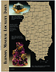 | | Journal (article/letter/editorial) | | Sphalerite and calcite, 5 cm across, Denton mine, Hardin County. Ross Lillie specimen. +!.+!+%% 34!2+ +./8 ...chalcopyrite, and sphalerite, 12.7 cm high, Hardin County. Marv Rausch specimen. 3(%,"9 -!#/50). /5 ....Here, quartz-lined geodes occur in the Warsaw Formation with a unique suite of minerals. Quarries and...collectible septaria with calcite, pyrite, and marcasite. The coal mines in the Sparta area are well known...and barite, 6 cm high, Minerva No. 1 mine, Hardin County. Ross Lillie specimen. Figure 5 (above right). |  | | Report (issue) | | II Appendix III Appendix IV Index Pyrite and marcasite .................................. Pyrolusite...claystone concretion with celestite, calcite and marcasite. 20 23 . 24 Plates Page I i 7) A. Brown...calcite and limestone. 11) A. B. C. D. Cluster of marcasite crystals................ Close-up of plant material...... B. Nodule of "coldwater agate" from Benton County showing gray and white chalcedony and crystalline...cabachon made from "coldwater agate" material of Keokuk County............................................ |  | | Journal (issue) | | Cooper Nottingham, England Anthony R. Kampf L.A. County Mus. of Nat. Hist. Los Angeles, CA Joseph A. Mandarino...amount of aluminum oxide is insufficient for the formation of aluminum silicates. Hyperagpaite is an extreme...and villiaumite. The temperatures of mineral formation (except for revdite in cavities) can be determined...that must have existed during late stages of the formation of the Palitra pegmatite. Another interesting...derivatives of the Lovozero massif. The sequence of formation of the mineral assemblages in the Palitra pegmatite |  | | Report (issue) | | Osage and Meramec Series.__________________ Boone Formation.______________________ St. Joe Limestone Member_________...Morrow Series____________________________ Hale Formation._______________________ Des Moines Series.___...____________________ Bluejacket Sandstone Member of Boggy Formation. ______________________ Page 1 5 5 5 10 11 12...correlation of the Moccasin Bend Member of Boone Formation in the Roanoke, Wilson, Crystal, and Discard mines...in basal part of Reeds Spring Member of Boone Formation.-_________________________ 6. Diagram showing |  | | Journal (article/letter/editorial) | | cement zonation related to uplift of the Raisby Formation (Zechstein carbonate), northeast England MARTIN...cement zonation related to uplift of the Raisby Formation (Zechstein carbonate), northeast England. In:...Implications. Sediment. Geol., 65: 285-305. The Raisby Formation is the basal Zechstein carbonate of northeast...In this paper, the diagenesis of the Raisby Formation, the basal Zechstein c a r b o n a t e of northeast...although the diagenesis of the overlying F o r d Formation reef (Fig. 2), h a s been studied b y Aplin (1985) |  | | Journal (article/letter/editorial) | | Multiple Fluids and Fluid Sources in the Southeast Missouri Mississippi Valley-Type District: Halogen-87Sr/86Sr-δ18O-δ34S...of Geological Sciences, University of Missouri, Columbia, Missouri 65211 Pickens School of Geology, Oklahoma...Geology and Geography, Northwest Missouri State University, Maryville, Missouri 64468 Abstract Replacement...approach to the Bonneterre Dolomite of southeast Missouri, which hosts the world-class Viburnum Trend Mississippi...Introduction CAMBRO-ORDOVICIAN rocks of southern Missouri host worldclass Mississippi Valley-type (MVT) |  | McClung, Craig, Bair, Dorinda, Leach, David L. (1998) Bibliography pertaining to the Ozark Mississipi Valley-type metallogenic province, Missouri, Arkansas, Kansas, and Oklahoma, USA covering 1785 to February 1998; paper edition. Open-File Report Vol. 1998 (98-238) US Geological Survey doi:10.3133/ofr98238 | Report (issue) | | VALLEY-TYPE METALLOGENIC PROVINCE, MISSOURI, ARKANSAS, KANSAS, AND OKLAHOMA, USA COVERING 1785 TO FEBRUARY 1998;...smaller Northern Arkansas, Central Missouri, and Southeast Missouri barite districts. This report provides...list of the Mississippi Valley-type districts of Missouri and key words relating to mining, MVT's, base...the same operation on the water resources of the Missouri by using the Water Resources Abstracts, a CD ROM...relating to the carbonate-hosted leadzinc deposits of Missouri. Acknowledgments We would like to thank John |  | | Report (volume) | | MISSOURI BUREAU OF GEOLOGY AND MINES E. R. BUCKLEY, Pb. D., Director and State Geologist. Vol. IV, 2nd... His Excellency, Joseph Vv. Folk, Governor of Missouri, ex-officio President of the Board ...................................... 29 VI. Fossiliferous Keokuk llmesto ne showing characteristic w eath ering..... 31 (From Vol. 2, 2nd Series reports of the Missouri Bureau of Geology ancl Mines). VIII. Flint breccla...XXXVI. Oross sectlons of a coal pocket in Moniteau county, showing the occurrence of zinc blende in the coal |  | Moritz, R., Fontboté, L., Spangenberg, J., Rosas, S., Sharp, Z., Fontignie, D. (1996) Sr, C and O isotope systematics in the Pucará basin, central Peru. Mineralium Deposita, 31 (3) 147-162 doi:10.1007/bf00204023 | Journal (article/letter/editorial) | | diagenetic events in sedimentary basins, including ore-formation (e.g., Kessen et al. 1981; Machel 1987; Gorzawski...and 3): (1) the Norian to Rhaethian Chambar'~ Formation, consisting of up to 1200 m of thick dolomite...100m thick Hettangian to Sinemurian Aramachay Formation, composed of bituminous shale and sandstone, chert...(3) the Pliensbachian to Toarcian Condorsinga Formation consisting mainly of about 350 m thick limestone...across the entire basin, except in the Aramachay Formation, which is characterized mainly by deeper anoxic |  | | Journal (article/letter/editorial) | | FILLED SINK-STRUCTURES AND CIRCLE DEPOSITS OF MISSOURI BY J HAELEN BRETZ CONTENTS Page Abstract 790 Introduction...literature 823 Circles and filled sinks of Morgan County. . 824 Oronogo lead and zinc mine 825 Conclusions...Jefferson County subdistrict 827 "Filled Caves" in Cooper County 827 Filled cave in Cole County 829 Filled...Filled cave in Montgomery County 829 Summary 830 Filled sink problems not treated in this paper. 831 References...Jefferson County... 827 9. Deformed coal and shale beneath tilted 21. "Filled Cave", Cooper County 827 Burlington |  | | Journal (article/letter/editorial) | | Sr) geochemistryof the SanVicentedeposit.The formation of the ore depositis studiedin the frame of in...peritidal carbonatesequenceof the Tambo Maria Formation (Upper Triassic-Hettangian, 600 m thick) correlates...and Maim elasticrocks (the Upper Sarayaquillo Formation, about 1,000 m), as well as continental Cretaceoussediments(the...are in dolomiticrocks,mainly in the Tambo Maria Formation. The EasternCordilleraandthe sub-Andeanregion...anularly andin the eluded in the Tambo Mar•a Formation,comprises frequentstyloliteseams. The tidalfiatandlagoonfa- |  | | Report (issue) | | information iuly 18 circular 1967 STATE OF MISSOURI DIVISION OF WC HAYES DEPARTMENT GEOLOGICAL... AND AND WATER DIRECTOR RESOURCES ROLLA MISSOURI Digitized by the Internet Archive in 2023 with...fgeO OOOj err , BIBLIOGRAPHY OF THE GEOLOGY OF MISSOURI 1966 by Jerry D. Vineyard / INFORMATION CIRCULAR...CIRCULAR NO. 18 July, 1967 STATE OF MISSOURI Department of Business and Administration Division of GEOLOGICAL...Director and State Geologist Rolla, Missouri STATE OF MISSOURI Warren E. Hearnes, Governor DEPARTMENT |  | | Report (issue) | | and Head L. D. McVICKER, B.S., Chemist HowARD S. CLARK, A.B., Chemist EMILE D. PIERRON, M.S., Associate...Ordovician system . Plattin formation Decorah formation Galena (Kimmswick) formation . Cincinnatian series...Maquoketa formation. Silurian system . Alexandrian series Edgewood formation Sexton Creek formation Tiagaran...series . Devonian system Wapsipinicon formation Cedar Valley formation Mississippian system Iowa series Kinderhook...Kinderhook group Grassy Creek formation Louisiana formation Hannibal formation. Hamburg member Maple Mill |  | | Journal (article/letter/editorial) | | and Barnes,1994). The organicmatter occursas marcasite, Pyriteisotherwise onlypresent in traces. (hydro)thermally...organicmatter carbonates were used to constrain ore formation models between thegrainboundaries of sulfides...duringmigration (see below).The occurrence of massive marcasite, nowpseudomorphed bypyrite,at theborderof theuppermarginof...theverticalfield. incorporated duringdolomite formation. Thisimpliesa relaMeyers(1989)interpreted a similarL-shaped...traceelementsignature of the SanVicentecarbon- southeast Missouri: a reconnaissance study, in Shukla, V.,andBaker |  | | Report (volume) | | Bulletin, nos. 19, 21. Hartford, Conn. Delaware County Institute of Science: Proceedings, vol. 6, nos...Marshall and Ben ton. counties. Jackson, Miss. Missouri Bureau of Geology and Mines, 2d ser., vols. 10...Olympia, Wash. West Virginia Geological Survey: County reports Doddridge-and Harrison counties. Morgantown...Sketch of the geological history of Green Lake County, Wisconsin : School x Quart., Berlin, Wis., vol...471, pp. 106-136, 1 pi. (map), 1912. . 16. [The formation of a new island near Trinidad]: Abstract, Washington |  | | Report (issue) | | limestone resources of Illinois — the Boone County 73 73 northern district 92 92 92 Shipping...Shipping quarries Local quarry sites 93 Carroll County 93 Topographic relations The rock formations Shipping...local quarries 97 Cook County Topographic relations The exposed rock formation Shipping quarries 97 ... 97 97 98 Quarry sites De Kalb County Du Page County Ill 113 113 Shipping quarry Outcrops mainly...Grundy County 113 114 115 Shipping quarries 115 Possible shipping quarry sites Jo Daviess County 115 |  | | Report (issue) | | COVER Swamp-forest landscape at time of coal formation : lepidodendrons (left) , sigillarias (in the... Iowa, by Matthew J. Avcin and Donald L. Koch Missouri, by Thomas L. Thompson Arkansas, by Boyd R. Haley...Donald L. Koch__________________________________ Missouri, by Thomas L. Thompson_______________________...-----------------------------------------------Missouri Series _ _ _ _ _ __ _ _ _ _ _ __ _ _ __ _ _ __...environments of deposition a.s they relate to· the formation and occurrence ·of coal beds, particularly with |  | | Report (issue) | | capitalization of the full name, as Hardinsburg Formation, Wyandotte Cave, or Teays Valley, indicates that...doubt remains concerning the geologic age of a formation, it is indexed under one age, with a "see" reference...under the mineral resource or resources and the county or locality discussed. If the mineral or rock has...papers concerning gold in Brown County, look under: Gold Brown County 10 ANNOTATED BIBLIOGRAPHY OF...OF INDIAN A GEOLOG Y or under: Brown County gold Under these headings will be found authors and dates; |  | | Report (volume) | | Bulletin, nos. 16, 18. Hartford, Conn. Delaware County Institute of Science: Proceedings, vol. 5, no....Survey: vol. 9; Lower Cretaceous; Prince Georges County. Baltimore, Md. Meddelelser om Greenland, Bd. 43...and Engineering World, vol. 35. Chicago, 111. Missouri Bureau of Geology and Mines: Biennial Report [for...Vol. 5; Geological map (coal, etc.), 2d edition; County reports Wirt, Roan, and Calhoun counties; Jackson... p. 224, 1911. Adams, Francis S. 3. The iron formation of the Cuyuna Eange. Parts II and III. Econ. Geology |  | | Report (issue) | | Sciences Washington University St. Louis, Missouri 63130 USA Katrina J. Edwards Geomicrobiology Group...Massachusetts 02536 USA Timothy W. Lyons Department of Geological Sciences University of Missouri Columbia, Missouri...65211 USA Special Paper 379 3300 Penrose Place, P.O. Box 9140 Boulder, Colorado 80301-9140 USA 2004...Place, P.O. Box 9140, Boulder, Colorado 80301-9140, USA. Copyright is not claimed on any material prepared...Place, P.O. Box 9140, Boulder, Colorado 80301-9140, USA www.geosociety.org Printed in U.S.A. GSA Books Science |  | | Report (issue) | | no OIL ORO OIG ZoZ 292 Boulder County Tellurides .... 294 Boulder County Tungsten ...... eeoeeesee 296...wsseeveesvsssceevevecees MISSISSIPPI VALLEY TYPE (GENERAL) STF, MISSOURI ....+- . eee ecesre ore esr seers eeresreeeee...stexeleiniakeletetsiatele 380 Leadbelt (Southeast Missouri) ...ccccsesvescevecseces - 384 sees MONTANA, -ssie...creterers eee eee eres eres eeeree 472 OKLAHOMA-KANSAS-MISSOURI .......00. Cece reece rere seseesene 474 TOWING...sphalerite, Darwin Lead-Silver-Zinc mine, Inyo County, California, Econ. Geol., v. 66, p. 602-606 significance |  | | Report (volume) | | no. 17; Eighth Biennial Report. Jackson, Miss. Missouri Bureau of Geology and Mines: Biennial Report [1919-20]...Virginia Geological Survey: County Reports, Nicholas County, Tucker County. Morgantown, W. Va. Wisconsin...30, 1921. 12. Geology of Lemieux township, Gaspe County, Quebec: Canada, Geol. Survey, Summ. Rept., 1921...Glacial geology [of the Mount Marcy quadrangle, Essex County, New York]: New York State Mus. Bull. nos. 229...5-9, 1 fig., April, 1920. Aurin, F. L. 55. (and Clark, G. C., and Trager, E. A.). Notes on the subsurface |  | | Report (volume) | | vol. 12, pp. 95-222. Davenport, Iowa. . Delaware County Institute of Science: Proceedings, vol. 4, nos...Geological Survey: Bulletin, nos. 5, 6. Jackson, Miss. Missouri Bureau of Geology and Mines: Biennial Report State...D. C. West Virginia Geological Survey, vol. 4; County Reports, Marshall, Wetzel, and Tyler Counties....,pp. 95-103, 2 pis., 4 figs., 1909. 17. Iron formation of Woman River area [Ontario]. Ontario, Bur. Mines...for oil. 26. Two areas of oil prospecting in Lyon County., western Nevada. U. S. Geol. Survey, Bull. 381-D |
|


