 | | Report (issue) |
| STATE OF SOUTH DAKOTA Nils Boe, Governor MINERALOGY OF THE BLACK HILLS by WILLARD LINCOLN ROBERTS...Associate in Mineralogy Museum of Geology, South Dakota School of Mines and Technology and GEORGE RAPP...Department of Geology and Geological Engineering, South Dakota School of Mines and Technology With the Editorial...Mineralogy South Dakota School of Mines and Technology BULLETIN NUMBER 18 of the South Dakota School of...of Mines and Technology Rapid City, South Dakota PUBLICATIONS STAFF F. L. Partlo J. T. Thomas President |
 | | Journal (article/letter/editorial) |
| Caldwell Stone Company quarry, Danville, Boyle County. Terry Huizing specimen and photo. K entucky...Commonwealth is Black Mountain in the Appalachians (Harlan County) at 4,139 feet. The lowest point is the floor of...of the Reed quarry near Grand Rivers (Livingston County) in western Kentucky, at 100 feet below sea level...small, nondiamondiferous kimberlite in Elliott County in eastern Kentucky and alnöite intrusions in Crittenden...described in Anderson (1994). The most widespread mining in Kentucky is coal. More than 7.4 billion tons |
 | | Report (issue) |
| ___________________________________ _ History of mining in the region __________________ _ Production-...______________________ _ ·Mining districts and mines ______________________ _ Rimini district ____________________________...Mineral deposits-Continued Mining districts and mines-Continued Rimini district-Continued Mines in the southern..._ Other mines _______________________ _ Clancy district ____________________________ _ King Solomon mine...<- __________________ _ Wickes (or Colorado) district ___ ~------------Al ta mine _____________________________ |
 | | Journal (article/letter/editorial) |
| THE BREWSTER IRON-BEARING YORK. • DISTRICT OF NEW F. R. KOEBERLIN. CONTENTS. General Geology...eighties,as it was then the seat of an active iron-mining industry. At the presenttime, however, none of...are working and but little has beenheard of the district during the last decade. • Submitted in partial...BrewsterIron-bearingDistrict. THE BREWSTER DISTRICT OF NEW YORK. 7I 5 The geologyof the regionhas...work was confinedis a rectanglesix miles north and south by three miles east and west. It includes the Tilly |
 | | Report (issue) |
| identification of certain formations, particularly the St. Lawrence and Jordan, which plagued the preliminary work...Franconia Formation .............................. St. Lawrence Formation ........................... .J ordan...Platteville Formation .............................. Galena Formation ................................. Cincinnatian.... . . . . . . . . . . . . . . . . . . . . . . Dakota Series ..........................................PALEOZOIC AND RELATED ROCKS OF SOUTHEASTERN MINNESOTA Dakota Formation ................................ 99 Colorado |
 | | Report (issue) |
| landfill at the headwaters of Lake Marion, Sumter County, South Carolina by David C. Prowell1 Open File Report...landfill near the headwaters of Lake Marion in Sumter County, S.C. is the site of a geohydrologic study by the...LANDFILL AT THE HEADWATERS OF LAKE MARION, SUMTER COUNTY, SOUTH CAROLINA INTRODUCTION BACKGROUND A hazardous-waste...1,200 ft of South Carolina's largest reservoir, Lake Marion, which is managed by the South Carolina Public...U.S. Geological Survey in cooperation with the South Carolina Public Service Authority is conducting |
 | | Report (issue) |
| carbonate-facies iron-formation of the Lake Superior district. This rock was the host rock for gold-sulfide...and in several abandoned mines, 3 to 8 kilometers south of Nova Lima, where it was the host rock for gold-sulfide...correlated with the Cane itabirite of the Itabira district to the northeast. The outcrop belt of the the...schist occurs mainly along a nar row belt that cuts across the serpentinite and partly across a body...Lima and the Raposos group near Raposos in the south-central part of the Nova Lima quadrangle. Some silver |
 | | Report (issue) |
| and Reed in the Grandfather Mountain area to the south (Bryant and Reed, 1962). INTRODUCTION The field...walking, and will end near West Jefferson, Ashe County, North Carolina. The Mt. Rogers area includes the...rather than along discrete macroscopic planes. South of Roanoke, Virginia, the Valley and Ridge belt...(Brown, 1958; Hopson, 1964; and Rankin, this study). South of New York, the age of the basement granitic gneisses...Crossnore, Avery County, North Carolina (Bryant 1962) and the Striped Rock Granite, Grayson County, Virginia |
 | | Report (volume) |
| Geologic Setting of the Hamme Tungsten District North Carolina and Virginia GEOLOGICAL SURVEY BULLETIN...1122-G Geologic Setting of the Hamme Tungsten District North Carolina and Virginia By JOHN M. PARKER...pocket] PLATE 1. Geologic map of Hamme tungsten district, North Carolina and Virginia. 2. Generalized geologic...section of the Hamme tungsten district and part of the Virgilina district, North Carolina and Virginia...showing location of Hamme tungsten district and Virgilina copper district, North Carolina and Virginia _____ |
 | | Journal (article/letter/editorial) |
| IC A GEOLOGY OF THE DIAMOND IIILL-CUMBERLAND DISTRICT IN RHODE ISLAND-M ASSACHUSETTS 1 BY CHARLES H...WARREN AND POWERS----DIAMOND H ILL—CUMBERLAND DISTRICT Page Riebeckite-iegirite granite.............. WARREN AND POWERS----DIAMOND HILL—CUMBERLAND DISTRICT lish ed by E m e rso n a n d P e rry ,2 w here...n schists a n d associated rocks in th e region south of Iro n M ine H ill. B. L. Jo h n s o n 4 has de...to th e n o rth . O n th e n o rth w est a n d south east are ra th e r flat, low regions u n d e rla |
 | | Report (issue) |
| of SenegaL ___________________ ----Republic of South Mrica ___________________ _ Cape of Good Hope Province...omali Republic ________ - ____ -_---------- -- South-VVestAfrica _________________________ _ Swaziland...-----------------Queensland and New South Wales _______ _ South Australia ____ -------------------Tasmania...------------------New Zealand ______ -----------------------South Island_----------------- ________ _ North Island_____...________ _ Southeastern Alaska ___ ------------South-central Alaska _______________ _ East-central Alaska |
 | | Journal (issue) |
| Although Deicke samples from cores and from deep cuts that are excavated well below grade such as the...sections-typically shallow and weathered roadcuts or railroad cuts at or near grade -is a grayish orange (IOYR...variously as ilmenite, anatase, rutile, TiO,, and leucoxene (Samson and others, 1988; Haynes, 1992, 1994)...samples from the Rockdell * ,s e d o n h Russell County are presented in Figure 4. Three bjvariate scatter...school. ~lddlesborosouth 7.5, quadrangle,Clattmrne County, Tennessee Units: Dpcke K-bentonite m the Eggleston |
 | | Report (volume) |
| _____-____-_--.-_-.-.___ 11 j Geology of Catoctin-South Mountain___________________ 13 * , * m ,t L..._-_---___ Geology of the McCalls Ferry-Quarry ville district. ________________ Pre-Cambrian rocks of sedimentary...Cambrian rocks of the McCalls Ferry-Quarry ville district..-----._---_-_-..---------_----_---_-______._...Continued. Geology of the McCalls Ferry-Quarryville district Continued. Paleozoic sedimentary rocks Continued...Cambrian rocks of the McCalls Ferry-Quarryville district Continued. Vintage dolomite.-________________-____-_-____Kinzers |
 | | Journal (issue) |
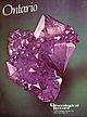
| 36 Deepwood Crescent Don Mills, Ontario M3C 1N8 South Africa: Horst Windisch 30 Van Wouw Street Groenkloof...Raven Hills Court, Colorado Springs, Colorado 80919 USA; tel: (303) 598-1233 66 The Mineralogical Record...and Japan. ACCESS The majority of the amethyst mining activity is confined to a 40 x 1% km area, approximately...Thunder Bay. From Highway 11-17, logging roads and mining roads provide access to the heavily forested areas...from east-west at the Thunder Bay mine, to north-south at the Diamond Willow mine. Lead and zincbearing |
 | | Report (issue) |
| Numerous samples were contributed by geologists of mining companies, and these are acknowledged in the text...the field and in the laboratory. Gilbert Hanson, Lawrence Mangen, and Marshall Swain assisted with the sample... . . . . . . . . . . . . . . . . . . . . . J. Lawrence Smith Method . . . . . . . . . . . . . . . . ...Introductory Statement ............ . 86 Vermilion District .................. . General Statement .........Structure and Thickness .... . Ages for the Vermilion District Soudan Area ................ . Knife Lake Area |
 | | Report (issue) |
| quadrangle and part of the Almanor quadrangle, Plumas County, California. 3. Map showing pre-Tertiary geology...serpentine at the east border of the ultramafic mass south of Bucks Lake ....................................correlated with Paleozoic pyroclastic formations in the south and with those dated on the basis of fossil evidence...were found in the Diadem lode at Edmanton on the south side of Eagle Gulch (sec. 28, T. 24 N., R. 8 E.)...the Shoo Fly Formation with angular unconformity south of Taylorsville. Revision of stratigraphy in the |
 | | Report (volume) |
| Geology of the Attean Quadrangle, Somerset County, Maine By ARDEN L. ALBEE and EUGENE L. BOUDETTE ...Monzonite __________________________________ _ South of Little Big Wood Pond ________________________...magnetic profiles of the Attean quadrangle, Somerset County, Maine. 2. Bedrock geologic maps and section of...98 GEOLOGY OF THE ATTEAN QUADRANGLE, SOMERSET COUNTY, MAINE By ARDEN L. ALBEE and EuGENE L. BoUDETTE...Somerset County, west-central Maine, and 1about 12 square miles of the eleotor.al district of Frontenac |
 | | Book |
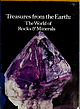
| Shaub -y Treasures from the earth PUBLIC LIBRARY COUNTY, FORT WAYNE AND ALLEN IND. Treasures from...New fork, N.Y. 10036. Published in 1975 by Crow*T South, 419 Inc., lishers, New Park Avon York, N...mJneraL Opf <>f formation of I ' -! in ran South tn in Afrfc An imr*ru from Muzo Colombii Un1u...sulfur, the next, quartz, followed by diamond, galena actly usefulness of minerals In art certain... these are the well-known from Cape Province, South Africa, (commonly called tiger's-eye), and the cymophane |
 | | Report (volume) |
| MINERAL RESOURCES OF THE QUAKERTOWN-DOYLESTOWN DISTRICT PENNSYLVANIA AND NEW JERSEY BY F. BASCOM, E....section of the rocks of the Quakertown-Doylestown district._ ___-___-_____-_-----_______-_---__-___________...MINERAL RESOURCES OF THE QUAKERTOWN-DOYLESTOWN DISTRICT, PENNSYLVANIA AND NEW JERSEY 1 By F. BASCOM, E...this bulletin called the Quakertown-Doylestown district, lie mainly between the Delaware and Schuylkill...Trenton. (See fig. 1.) The area lies chiefly in Bucks County but includes portions of Montgomery and Lehigh |
 | | Report (volume) |
| WALCOTT, BIKECTOK THE ANCIENT VOLCANIC ROCKS SOUTH MOUNTAIN, PENNSYLVANIA FLORENCE BASCOM WASHINGTON...CHAPTER I. An account of geological surveys in the South Mountain below the Susquehanna....................Geological relationship of the rocks of the Monteroy district.... General description of the area studied..................... Ore deposits of the Monterey district .................................... Comparative...Monterey district......................... Panoramic view of mountains of the Monterey district....... |
 | | Report (issue) |
| GENERAL HEDUCTION COM PANY. PIKES PEAK, TWIGGS COUNTY. Plloto by S. I.V. JllcCalb'e GEOLOGICAL SURVEY...deposits ........................... . 32-60 Wilkinson County ...................................... ." .. ..................................... . 59 Baldwin County ......................................... . 59~60... 59-60 Twiggs County ......•..................................... 60 Washington County ................deposits ...............•............ 66-91 Sumter County ........................................... . 66-78 |
 | | Journal (article/letter/editorial) |
| Morton Island, Rainy Knife Lake sediments 1043 Lake, south of Bears Passage, where Cout8 Animikie sediments... INTRODUCTION AND RELATIONS TO ADJOINING AREAS south shore of Lake Superior and in Canada. We agree that...SUPERIOR AS INDICATED BY STUDY OF ZIRCONS North Shore South Shore Granite (Keweenawan) Granite (Keweenawan)...across Neil Point the tops of the beds are to the south. South of the Point is a narrow belt of green sediment...conglomerates; farther south is a mica schist. Clearly these structures, one north and one south of the greenstone |
 | | Report (volume) |
| Coatesville; £, Chickies quaitzite exposed in railroad cut, 1 mile west of Atglen.__________ 42 8....Pennsylvania showing relation of Honeybrook uplift to South Mountain uplift and Appalachian Valley.._-.__-_...fault in Triassic rocks in Philadelphia & Reading Railroad cut, Phoenixville______.-__-_-_-____ 18. Plans...apparently also upthrust on a high-angle fault on its south side. The middle fold the Barren Hills anticline...high-angle faults on each flank. Chester Valley, south of these uplifts, encloses Paleozoic limestone in |
 | | Report (issue) |
| studies are brought together in this paper. The district is one of peculiar interest,, having a complicated...prepared with especial reference to the needs of the mining industry, and in such form that its conclusions...practical benefit in developing the industry in this district. Very respectfully, C. W. HATES, Geologist in........... Location and general features of the district............................................................................................... Mining............................................... |
 | | Journal (article/letter/editorial) |
| on August 5, 2015 132 TULLIS— GEOLOGY OF LATAH COUNTY, IDAHO Tertiary extrusive rocks.................Page 1. Map of the southwestern cornerof Latah County....................................................................... 6. Geologic map of Latah County, Idaho................................................ 131 140 141 162 163 164 ABSTRACT Latah County lies within the Coeur d ’Alene Mountains and the...more like the igneous rocks in the Coeur d’Alene district. The principal type is syenite with considerable |


