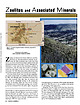
 | | Journal (article/letter/editorial) | | Associated Minerals Figure 1. Location map for Golden, Colorado, prepared by William Besse. All photos by...are well represented in Colorado. In particular, the Table Mountains near Golden have been known as a source...the size, variety, and quality of thomsonite. The Table Mountains additionally feature other rare zeolites...geochemist with the US.Geological Survey in Boulder, Colorado. His most recentfeature articlefor Rocks & Minerals...Moss Agatefiom the Del Norte Area, Saguache County, Colorado” and appeared in the July/August 2003 issue | 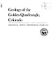 | | Report (issue) | | r~~~J Geology of the Golden Quadrangle, Colorado GEOLOGICAL SURVEY PROFESSIONAL ~i''(': u (,, PAPER... GEOLOGY OF THE GOLDEN QUADRANGLE, COLORADO FRONTISPIECE.-Physiographic setting of the Golden quadrangle...viewed northward from Lookout Mountain. The hummocky surface of Table Mountains. The escarpment between...an old landslide (Is) lies between Golden and North Table Mountain. Other landslides are present on the...the steep flanks of North and South east (right) fa ce of Mount Zion. The si nuo us ridge in the left |  | | Book | | .3 COLORADO. of COLORADO. J. S. l GEORGETOWN, COLO. GEORGETOWN COURIER PRINT. 1887. 3 Bancroft...From a mineralogical point of view the wealth of Colorado exceeds that of In the metallic minerals almost...to in the following pages Proceedings of the Colorado Scientific Society. Proceedings of the Academy...the U. S. Geological Survey. J. GEORGETOWN, COLORADO, January, 1887. S. RANDALL. : MINERALS...gravel of streams and in veins. The veins of Gilpin County are especially noteworthy for the amount of gold |  | | Report (volume) | | Minerals of Colorado: A 100- Year Record By EDWIN B. ECKEL GEOLOGICAL SURVEY BULLETIN 1 1 14 A...Branch of Distribution, U.S. Geological Survey, 1200 South Eads Street, Arlington, VA 22202 CONTENTS Page...knowledge____________________________________ Future of Colorado mineralogy______________________________________...mineral localities and metallic mineral deposits of Colorado ________________________________ In pocket III...mineral localities and metallic mineral deposits of Colorado, has not been included in this reprint. Many of |  | | Report (volume) | | ARSENIDES. BISMUTHINITB. From the Rosario Mining District, Sinaloa, Mexico. W. I-I. Melville. Described...mine of the Canadian Copper Company, Sudbury, district of Algoma, Ontario. Specific gravity, 4.541 ~...From the Silver King mine, Calico, San Bernardino County, Cal. Specific gravity, 6:28. Analysis by W. H...19 LOLLINGITE. From .Teocalli Mountain, Brush Creek, Gunnison County, Colo. Specific gravity, 7.400...described in Proc. Colorado Sci. Soc., vol. 3, pt. 1, p. 46. From the Rose mine, Grant County, N". Mex. Specific |  | | Journal (issue) | | Three Articles The Tonopah-Belmont mine, Maricopa County, A rizona by G. B. Allen & W. Hunt 139 James...related minerals from the Table Mountain lava flows near Golden, Colorado .............................thorough review of the history, including many antique mining photos and engravings, and many detailed maps showing...r iz o n a George B. Allen Route 6, Box 32 Golden, Colorado 80403 W illiam Hunt 10350 Andover Avenue Sun...Ag-Au district of Maricopa County in west-central Arizona. The primary property in the district is the |  | | Journal (article/letter/editorial) | | Plant Fossils In the Denver Formation, Lakewood, Colorado AN UNUSUAL OCCURRENCE OF WELLD E V E L O P E...for a housing development in Lakewood, Jefferson Coun ty, Colorado. Heulandite replacements of fossil seeds...Heritage West development of Celebrity Homes*, located south of Jewell Avenue be- *The use of trade names in...Geological Survey Box 25046 Federal Center Denver, Colorado 80225 tween Union Boulevard and Kipling Parkway...Mineralogy Symposium on Colorado Minerals (Modreski, 1982) held at the Denver/Rocky Mountain Federation Gem and |  | | Report (volume) | | ...................... 1. Rocks from Aroostook County..... ^..................'........... 2. Miscellaneous............................... Maryland and the District of Columbia.....................................1. Elliott County dike............................................... 2. Crittenden County dike..................................... 2. Crystal Falls district, Michigan.................................. .................................... 51 7. Mesabi district, Minnesota................................... |  | | Journal (article/letter/editorial) | | GEOMAGNETIC POLES DETERMINED VOLCANIC ROCKS NEAR GOLDEN, COLORADO FROM Edwin E.LARSON, Felix E.MUTSCHLER *...Geological Sciences, University of Colorado, Boulder, Colorado 80302, USA Received 15 May 1969 Revised 1...August 1969 Three flat-lying basalt flows near Golden, Colorado dated at about 58 m.y. by K-Ar methods have...from samples of basaltic volcanic rocks near Golden, Colorado one flow of which Everden et al. [2] dated...collected from North Table Mountain, just east of the Colorado Front Range, at Golden, Colorado. Here, three |  | | Report (volume) | | crystalline rocks Maine 1. Rocks from Aroostook 'County 2. Miscellaneous rocks5 v New Hampshire 5 Vermont...rocks New Jersey Pennsylvania Maryland and the District of Columbia 1. Peridotite and pyroxenite 2. Gabbro...Carolina Georgia Kentucky 1.. Elliott County dike 2. Crittenden County dike Tennessee Missouri Arkansas Oklahoma...1. Marquette region, Michigan 2. Crystal Falls district, Michigan 5 3. Keweenaw Point, Michigan 4. Menominee...Minnesota 5 7. Mesabi district, Minnesota 8. Miscellaneous rocks from Minnesota South Dakota Wyoming 5 Yellowstone |  | | Report (issue) | | of the Front Range Urban Corridor and Vicinity, Colorado By WALLACE R. HANSEN and ELEANOR J. CROSBY With...of the Front Range Urban Corridor and vicinity, Colorado. (Geological Survey Professional Paper 1230) Bibliography:...Geology Front Range, Colo. and Wyo. 2. Geology Colorado Denver region. 3. Environmental protection Front...Environmental protection Colorado Denver region. 5. Sediments (Geology) Colorado-Denver region-Testing....belt ............ ........................... Colorado Piedmont ......... .......................... |  | | Journal (issue) | | ····-····················-·········610 THE TABLE MOUNTAIN ZEOLITES. By Guy B. Elterm,eier .............between Tuxedo Park and Greenwood Lake, Orange County, N. Y., has been placed with the Alexander Summer...Causeway), Fletcher, Hard, Lake, Long, Middle, Mountain, Patterson, Red-back, Smith, Steele, Sterling...In 1920 the Editor of Rocks and Minerals was the mining engineer at these mines which were then operated...specimens of magnetite, hornblende, oligoclasc, augite, epidote, and other minerals may be found. (We |  | | Book (edition) | | MILEAGE L OGS. REVISED EDITION Revised Edition, COLORADO GEM TRAILS AND MINERAL GUIDE HICllAHD :--1. PEARL...an extensive ¥em and mineral collecting tour 01 Colorado, revealing the interesting places where Nature... ( Alan Swallow, Publisher) 2679 South York Street Denver, Colorado 80210 - , =· - ·, BOOKS BY RICHARD...Exploring Rocks, Minerals, Fossils in Colorado America's Mountain: Pikes Peak and the Pikes Peak Region...Atlas of Colorado American Gem Trails Nature As Sculptor: A Geologic Interpretation of Colorado . Scenery |  | | Book (edition) | | — _ ; COLORADO GEM TRAILS AND MINERAL GUIDE ! ■ : ' BOOKS BY RICHARD M. PEARL Colorado Gem Trails...Trails and Mineral Guide Colorado Rocks, Minerals, Fossils America’s Mountain: Pikes Peak and the Pikes...Nature As Sculptor: A Geologic Interpretation of Colorado Scenery Guide to Geologic Literature Popular Gemology...Gemology Mineral Collectors Handbook Colorado Gem Trails The Art of Gem Cutting (With Dr. H. C. Dake)...Dake) * RICHARD M. PEARL ★ COLORADO GEM TRAILS AND MINERAL GUIDE ★ SKETCH MAPS BY MIGNON WARDELL PEARL |  | | Journal (volume) | | Geologist C. A. Logan, District Mining Engineer C. McK. Laizure, District W. Burling Tucker, Reid...Francisco - District Sampson, Assistant Mining Engineer District Engineer Chas. V. Averill, District Mining...San Francisco Mining Engineer -•-'-- and Curator Herbert A. Franke, Junior Mining Engineer (Librarian)...San Francisco San Francisco TABLE OF CONTENTS REPORTS OF DISTRICT MINING ENGINEERS Page 1 Sacramento...GIST CALIFORNIA — O * LEGEND* Mining Division Bou/icfar/es. Mining Division Off/ces. MEXICO PREFACE |  | | Journal (volume) | | July, 1888 —A Quartz-Keratophyre from Pigeon VI. Augite-Syenites VII. — On the Henry G. ; by W....Gallium chloride, : — : — — Cambrian of Bristol County, Eastern Massawood of Arizona, F. H. Knowlton:...Bertrandite from Stoneham, Me., and Mt. Antero, Colorado; by S. L. Penpield .... XXVI.— Mineralogical Notes...Mineralogical Notes, E. F. Atres, 235. Barite from Aspen, Colorado, J. F. Kemp, 236. Serpentine of Montville, N....291 —The distribution of Phosphorus Mine, Iron Mountain, Michigan With Ludington in the by D. H. Browne |  | | Book | | ..,. .....' . " .. . .. ' '- . '. .: WATER :TABLE" . , . . .. ... , Figure 1. Surface water moving...deeper in the ash until the water reaches the water table where it flows out of the system. . . . . mordenite...chabazite, and quartz in manganese nodules, on the South Indian Ridge, east of Kerguelen Island, in the Indian...assemblages have been mapped in exposed basaltic rock in County Antrim, Northern Ireland, and eastern Iceland....seawater followed faults along the eastern coast of County Antrim and was the fluid in the cavities that produced | | | Book | | ..,. .....' . " .. . .. ' '- . '. .: WATER :TABLE" . , . . .. ... , Figure 1. Surface water moving...deeper in the ash until the water reaches the water table where it flows out of the system. . . . . mordenite...chabazite, and quartz in manganese nodules, on the South Indian Ridge, east of Kerguelen Island, in the Indian...assemblages have been mapped in exposed basaltic rock in County Antrim, Northern Ireland, and eastern Iceland....seawater followed faults along the eastern coast of County Antrim and was the fluid in the cavities that produced |  | | Book | | long (Marty, 2004 ). AFRICA widely in Litchfield County, where good crystals were taken from quartz veins...region (Brunet, I 977b ). NEW YORK Amity, Orange County. At many isolated collected sites between the towns...Mount Malosa, Chilwa alkaline province, Zomba district. "Illite" is the name of a series of incompletely...Litchfield County. Ilmenite masses and crystals from somewhere near Washington, Litchfield County, were described...Lake Road occurrence, Faraday Township, Hastings County. In fall 1994, Dan and Shelley Lambert extracted |  | | Report (volume) | | viii-ix. The physical geology of the Grand Canon district, by Clarence E. Button, pp. 47-166, pis. x-xxxvi...of report on geology and mining industry of Leadville, Lake County, Colorado, by S. F. Emmons, pp. 201-290...of'the geology of the Comstock lode and the Wash oe district, by George F. Becker, pp. 291-330, pis. xlvi-xlvii...xviii-xxiii. Abstract of report on'geology of the Eureka district, Nevada, by Arnold Hague, pp. 237-290, pis. xxiv-xxv...ii-xxx. Abstract of a report on the mining geology of the Eureka district, Nevada, by Joseph Story Curtis |  | | Book (edition) | | Encyclopedia of minerals ~~cbe County Public Library Saguache, Colorado OEMCO For Refere nee Not to...Sagtiache Co1tntr Publlc I...ibran' Saguache, Colorado ~ VANNOSTRAND REINHOLD ~ - - - - N e w York...England Thomas Nelson Australia 102 Dodds Street South Melbourne, Victoria 3205, Australia Nelson Canada...Cal and Kerith Graeber Cureton Mineral Company Colorado School of Mines cw Charles and Marcelle Weber...elements occupying certain positions in the periodic table; iron and manganese are transition elements whose | | | Book (edition) | | Utah; (lower /eft) rnodochrosite, N’Chwaning mine, South Africa; (lower left, center) wulfenite, Red Cloud...Encyclopedia of minerals Sagiiache County Pu blic Library Saguache , Colorado DEMCO For Reference Not to...Wendell E. Wilson Library Saguache County Public Saguache, Colorado VAN NOSTRAND REINHOLD New York ...England Thomas Nelson Australia 102 Dodds Street South Melbourne, Victoria 3205, Australia Nelson Canada...Cal and Kerith Graeber Cureton Mineral Company Colorado School of Mines Charles and Marcelle Weber Dan |  | | Report (issue) | | org/details/reportofstatemin15cali CALIFORNIA STATE MINING BUREAU FERRY BUILDING, SAN FRANCISCO ^LETCHER...Statement xxiii Participation of the California State Mining Bureau in the Panama-Pacific International Exposition...Introduction Table of Mineral Production General Features I. Alpine County. 5 6 6 , Mining Districts...Hercules Company 14 23 Silver Mountain District Silver King District Mineral Water Grover's Hot Springs...27 27 27 , , Bibliography Chapter II, Inyo County. Introduction and Acknowledgments Location and |  | | Report (volume) | | ------------------------------- 1 1 2 5 5 7 TABLE Page Major stratigraphic and time divisions in...Bull. 1060-D, p. 193, 252-253, pl. 7. In Nemaha County, Kans., member is basal unit of Howard limestone...Aarde farm, sec. 4, T. 26 S., R. 11 E., Greenwood County. Aaron Slatet Precambrian or Paleozoic: Central...Inv. 214, p. 8 (fig. 1), 28 (fig. 4), 30-31, 44 (table 1), pl. 1. geol. sections. Proposed for strata from...Central Railroad, sees. 5-7, T. 11 S., R. 5 E., Pope County. Named for Abbott Station. Abbyville Gabbrol Precambrian |  | | Journal (article/letter/editorial) | | of the hinterland on the west side of the Rocky Mountain geosyncline. Acting as a strong, rigid mass, it...low-angle thrusts. Structural studies in scattered mining districts within as well as outside the borders...MINERALIZATION AT THE IMA MINE, BLUE WING DISTRICT, LEMHI COUNTY, IDAHO ALFRED L. ANDERSON Cornell University...quadrangle is three quadrangles west and a little south of Devils Lake, North Dakota. It shows the disorganized...then turns abruptly east about 5 miles farther south. Near the west margin of this quadrangle, this moraine |
|


