 | | Journal (article/letter/editorial) |
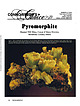
| January 2015 Wulfenite Figure 2. Western side of Stapleton Gulch in the Argenta district. The Stapleton...of the center below the crest of the hill. in Montana Unless otherwise noted, all photographs by the... CHRISTOPHER S. TUCKER PO Box 22575 Billings, Montana 59104 tuckerj@mcn.net W ith the variety of colors...colors and habits that characterize wulfenite, it is easy to understand why this mineral has long been...collectors even specialize in wulfenite; however, they seldom have specimens from Montana in their collections |
 | | Journal (article/letter/editorial) |
| Montana Mineral Locality Index Downloaded by [University of Nebraska, Lincoln] at 20:00 09 April 2015...2015 K NOWN AS THE TREASURE STATE, Montana is rich in mineral and gemstone localities. The state motto...with its representation of mining tools clearly proclaim Montana’s mining origins. Montana’s production...published describing the occurrence, collecting, mining, and cutting of the two state gemstones. Figure...2. Granville Stuart established Montana’s first mining camp at Gold Creek in 1860. Geologic Provinces |
 | | Journal (article/letter/editorial) |
| University] at 01:02 21 December 2014 79 Mine, Gila County, Arizona E veryone likes blue minerals....including the Harborside mine at Brooksville, Hancock County, and the Lubec lead mine and prospects at Pembroke...Washington County. It has also been found at the old lead mines at Middletown, Middlesex County, Connecticut;...Easthampton, Hampshire County, Massachusetts; the old Gorham (Mascot mine), Coos County, New Hampshire; as...iron mine at Andover, and as an accessory mineral at Franklin and Sterling Hill, Sussex County, New Jersey; |
 | | Report (volume) |
| DIRECTOR BuiiIiETIN 574 MINING DISTRICTS OF THE DILLON QUADRANGLE, MONTANA AND ADJACENT AREAS BY ALEXANDER................................................. Mining districts...................................................................................... Mining development. ...................... .. - - ' -..................................... 18 Placer mining....... ~................................................................ 20 Present status of mining .....:........................................ |
 | | Report (volume) |
| ....................................... 102 District of Columbia ......................................... 139 144 146 153 158 163 169 . 172 174 Montana..................................................to refer to Geological Survey Bulletin 507, "The mining districts of the western United States," and to...abundant it may have been completely exhausted by mining or quarrying. Deposits of minerals that are widely...because they occur in sufficient quantity to warrant mining for their usual products, but because they furnish |
 | | Report (volume) |
| it helpful to refer to Survey Bulletin 507, "The mining districts of the western United States," and to...abundant, it may have been completely exhausted by mining or quarrying. Deposits of minerals of wide distribution...because they occur in sufficient quantity to warrant mining for their usual products but because they furnish...See Bauxite and Hallpysite. Asbestos. Tallapoosa County, with corundum deposits near Dudleyville; not found...commercial quantity or quality. Asphalt. Colbert County, small quantity has been shipped from near Leighton; |
 | | Report (issue) |
| Resources of the Elkhorn Wilderness Study Area, Montana A cooperative study by the U.S. Geological Survey...deposit':?.. Elkhorn-Tizer Basin zone Elkhorn district -»_»_.,H"1 -? r7Q f i-L^ifciL P. d o-i-n DdO-Lll...Ridge prospect Breccia pipe deposits Skyline Mine Blackjack Mine Chicago and Last Hope Mines Group I - Precious-...(Mo-W-Nb-La-Y-Th) Cont inued Hidden Lake Lava Mountain area T? r\ ** r\ -rt JL>vJLL/ll « Continued...geology Important occurrences Mining districts (lodes) Beaver Creek district C O O /-\ t£ +L fU -t-L Y-* |
 | | Report (issue) |
| . . . . . . . . . . . . . . . . . 1 Chapter I. Mining Districts of Counties and the State of Utah. .... . . . . . . . . . . . . . . . . . . . . . . 1 County Listings. . . . . . . . . . . . . . . . . . . ... . . . . . . . . . . . . . . . . 1 Chapter II. Mining Districts of Utah . . . . . . . . . . . . . . .... . . . . . . . 4 Mineral Localities Listed by County . . . . . . . . . . . . . . . . . . . . . . . .... . . . . . . . . . . . . . . . . . . 7 Beaver County . . . . . . . . . . . . . . . . . . . . . . . |
 | | Book (volume) |
| United States SOUTH DAKOTA This northwestern Great Plains state varies from nearly level farmland to hill...in elev. From 1,000’ on the eastern border with Montana and Iowa to 3,500’ along the western boundary with...rocks are exposed as thick bands around the entire mountain system. The rising granite mass intruded the famed...Dakota sandstone, which underlies most of the Great Plains, and bent the broken edges sharply upward into...extraordinary homogeneity. Throughout the Great Plains, wells drilled deep into this unit provide an inexhaustible |
 | | Book (volume) |
| ..........................................258 Montana ................................................................548 Table of Maps Page Alabama County Map ...................................................................................4 Alaska County and Stream Map ..................................Co. Mining Districts ............................................................22 Arizona County Map.........................23 Arizona – Cochise Co. Mining Districts .................................... |
 | | Book (volume) |
| Dahlonega Co. and Rabum Co., and the McDuffie County Belt extending through portions of McDuffie, Warren...Sphalerite. BALDWIN COUNTY MILLEDGEVILLE, at state farmjasper. BANKS COUNTY COMMERCE, along Hwy. 59...along adjoining Co. linerock crystal. BARROW COUNTY WINDER, along rd. to Jefferson and 1½ mi. inside...Guide for Rock Hounds in the United States BARTOW COUNTY AREA, Saltpeter Cave, as floatjasper. CARTERSVILLE:...agate, (banded, various colors), jasper. BIBB COUNTY MACON: at Holton Quarry, 7½ mi. NWagate; N |
 | | Book (volume) |
| Most specimen collecting is done in the Lead-Zinc mining dists. of northwestern Illinois, the glacial drift...600 to 800 feet thick in the north. ALEXANDER COUNTY FAYVILLE, area stream gravels⎯agate, jasper, rare...⎯agate, jasper; d RR siding of Clay⎯agate. CALHOUN COUNTY AREA, shores of the Mississippi R., in the Warsaw...crystals). CRAWFORD COUNTY PALESTINE, area deposits⎯Siderite. EDWARDS COUNTY AREA, T. 1 S, R. 10 E...deposits⎯Siderite. FULTON COUNTY FARMINGTON, W 6 mi. on Rte. 116 to the Rapatee No. 5 strip mine⎯pyritized gastropods |
 | | Report (issue) |
| ever since. Besides the La Grange mine, the largest hydraulic mine now in active operation, it contains...mines, particularly in the northern portion of the county. Large bodies of gravel of lower grade yet remain... Murphy, of the Union Hill mine; Mr. Pierre Bouery, of the La Grange mine; Mr. W. D. Ayers, of Poker...Globe mine; but more particularly to Mr. H. L. Lowden, formerly county surveyor of Trinity County, who...prominent, remarkably even crested ridge of South Fork Mountain, having an altitude of nearly 6,000 feet. The |
 | | Journal (article/letter/editorial) |
| specimens, are either inaccessible or are in closed mining districts, or are closed for political reasons...• Idaho Falls 1 ' r_ r--- 'f"Q --; - Souu,;Mountain : I•__ .... _ Spencer ,(~\ - -, _Custer r j'...City-D~Lamar Mining Dlstricts / J\. I,' -r-, - L..... ~ rl.. kl \ , 50 I 100 I Miles old mining and...scientific significance. In this index, the better known mining districts that have produced many high-quality...across, on blue thomsonite. Lucky Peak Dam, Ada County; Lanny Ream specimen and photo. Figure 3 (below) |
 | | Journal (article/letter/editorial) |
| 23:16 02 June 2016 Bunker Hill Mine, Coeur d’Alene District, Shoshone County, Idaho 190 ROCKS & MINERALS...and from a relatively large number of European mining districts. Strikingly perfect, transparent pyromorphite...malachite, leadhillite, descloizite, mottramite, wulfenite, vanadinite, and bayldonite, to name a few. Pyromorphite...occurred at the Lubec lead mine, the Gouldsboro mine, and with wulfenite at the upper Colton Hill quarry...Foord 1994). Recently the old lead mine at Loudville, Hampshire County, Massachusetts, once again produced |
 | | Book (volume) |
| ..........................................221 Montana .................................................rights, so remember you were told. If in doubt, a county map will tell you who the legal owner is. Good...gemmy qualities for cutting and polishing. AUTAUGA COUNTY PRATTVILLE, N. 6 mi., and just E of the Birmingham...were well known to prehistoric Indians.) BARBOUR COUNTY BAKER HILL, SE 1 mi. : 1 in a deep ravine, as a...deep red to variegated⎯ocher. BIBB COUNTY GENERAL AREA: c county gravel pits along the Cahaba R.⎯gemmy |
 | | Report (volume) |
| Part of the Townsend Valley Broadwater and Jefferson Counties,x Montana GEOLOGICAL SURVEY BULLETIN...OF PART OF THE TOWNSEND VALLEY BROADWATER AND JEFFERSON COUNTIES, MONTANA By V. L. FREEMAN, E. T. RUPPEL...Valley, a broad intermontane basin in west-central Montana, extends from Toston to Canyon Ferry. The area...folded Elkhorn Mountains volcanics west of Lone Mountain was almost certainly emplaced after the main...indicate GEOLOGY OF PART OF TOWNSEND VALLEY, MONTANA 483 epeirogenic movement, or crustal warping |
 | | Report (issue) |
| description of the geology, mining history, and production of the major gold-mining districts in 21 States...relations ---------------------------History of gold mining and trends in production_ J\labama -----------...--------------Cleburne County ----------~----------------- Tallapoosa County --------------------------Alaska...------------------Cochise County -----------------------------Gila County --------------------------------Greenlee...ee County ----------------------------R[aricopa County ----------------------------R[ohave County -- |
 | | Book |
| stumble over a valuable nugget and stake your own mining claim? Indeed it to is, and author book Jay...prospecting, he points out, is in abandoned mining districts, where valuable mineral ores are present...commercial ores and secondary minerals by state, county, township, and geologic range. For easy identification...RANSOM 1875-1948 An to the Eastern '‘Schoolmarm” Mining Camps of the Old West I I a s I \ h K... CONTENTS Preface ix PART I 1 Introduction to Mining and Mineralogy 2 Preparation for Mineral Collecting |
 | | Report (issue) |
| 31 University of Nevada Press, Reno, Nevada 89557 USA Copyright © 2004 by University of Nevada Press Photographs...copyright © 2004 unless otherwise noted Map of Mining Districts and significant mineral occurrences of...Olivenite, 1.6-cm cluster, Majuba Hill Mine, Antelope district, Pershing County. N. Prenn collection. Photograph...production of environmental protection equipment. Mining and the discovery, identification, and development...to Nevada in 1929 and was actively involved in mining in the state and the western U.S. for the rest |
 | | Journal (article/letter/editorial) |
| to collectors. Many specimens were produced when mining districts were active in the late 1800s through...districts mentioned below, most historically active mining districts in the state have been inactive for decades...exploration activity occurs on an irregular basis. Beaver County MINERAL COLLECTING IN THE STATE of Utah has undergone...article does not give permis- Lincoln district: The Creole mine, located at the south end of the Mineral...frozen in the matrix, occurs in a few locations. Wulfenite is known from one small prospect, and scheelite |
 | | Report (issue) |
| INTERIOR GEOLOGICAL SURVEY MINERAL RESOURCES OF ELKO COUNTY, NEVADA By Roscoe M. Smith Prepared in cooperation...Acknowledgment -Mining districts Commodities Production Descriptions of mining districts . Alder district-Aura district...district -Beaver district Black Mountain district Bootstrap district Burner district Burns Basin district--...-Carlin district Cave Creek district ----Charleston district_--Coal Mine district~ Contact district Cornucopia...Cornucopia district - -Corral Creek district - Decoy district Delano district Delker districtDivide district |
 | | Journal (issue) |
| stock certificates for mines in the Cripple Creek District, Colorado, in 1898 and 1901. Sponsorship: This...Kile Brian Kosnar Bryan & Kathryn Lees Ian Merkel Mining Hall of Farne, Steve Whittington curator Nick North...did not escape the notice of some of the earliest mining men to work in there. Unlike the neighboring states...beautiful crystals of secondary minerals like wulfenite, vanadinite and azurite. Mineralogically, Colorado...is basically a hardrock state where mining (and specimen mining) must typically cut through granite and |


Summit Mine, Radersburg Mining District, Broadwater County, Montana, USA