 | | Report (volume) | | 69 71 (133) 5 6 , - CONTENTS. Page. North Carolina ........................................................_........................... South Carolina ................................................the United States. Moorman's Mineral Springs of North America, issued in 1873, refers to or describes...Addison, Washington County. Auburn, Androscoggin County. Androscoggin County. County. Boothbay Medicinal...Medicinal Mineral Spring East Boothbay, Lincoln County. Chalybeate springs : 1 o 45 1,800 Alkaline, calcic |  | | Report (volume) | | ......... North Carolina. .......................................................... North Dakota............................................. South Carolina......................................:..........1888. Branner, J. C., The zinc and lead region of north Arkansas: Arkansas Geol. Survey Ann. Kept, for 1892...Fair edition, 1904. Genth, F. A., Minerals of North Carolina: U. S. Geol. Survey Bull. 74, 1891. Shannon...Catalogue of the mineral localities of South Carolina: South Carolina Geol. Survey, ser. 4, Bull. 2, 1908. Scott |  | | Report (volume) | | .Prof. E. H. Barbour, University of Nebraska, Lincoln. Nevada...........Dr. W. S. Tangier Smith, Berkeley...State Museum, Albany. North Carolina.. .Dr. Joseph Hyde Pratt, Chapel Hill. North Dakota... .Dr. A. G...... .Prof. Charles W. Brown, Providence. South Carolina.. .Dr. Earle Sloan, Charleston. South Dakota....See Bauxite and Hallpysite. Asbestos. Tallapoosa County, with corundum deposits near Dudleyville; not found...commercial quantity or quality. Asphalt. Colbert County, small quantity has been shipped from near Leighton; |  | | Report (issue) | | GENERAL FEATURES OF THE MAGNETITE ORES OF WESTERN NORTH CAROLINA AND EASTERN TENNESSEE.1 By W. S. BAYLEY. INTRODUCTION...DISTRIBUTION. The iron ores of western North Carolina and Carter County, Tenn., comprise brown hematite (limonite...of North Carolina have increased in importance. Brown ore and magnetite produced in western North Carolina...353 60,593 43,483 44,482 o From reports of North Carolina Geol. and Econ. Survey and Mineral Resources...total recorded .production of magnetite from North Carolina is about 1,331,600 tons and of brown hematite |  | | Book (edition) | | LOCALITIES NORTH CAROLINA, BEING CHAPTER I, OP THE SECOND VOLUME OF THE GEOLOGY OF NORTH CAROLINA. Reprinted...OF E. M. UZZELL RALEIGH, N. C. GEOLOGY OF NORTH CHROLINS. CHAPTER I. MINERALOGY. BY It has F...data have been embodied. Sev- GEOLOGY OF NORTH CAROLINA. 4 eral causes have been operative in giving...matter of commercial interest. GEOLOGY OF NORTH CAROLINA. 6 Dr. C. L. Hunter has also kindly furnished...obtained quite an extended survey list Gaston, Lincoln and elsewhere. And list of mineral localities |  | | Report (volume) | | 'THE GEOLOGICAL vt- ,(231 > ' " ^THE MINERALS CAROLINA''" i '- OF, - :l|^fe^H - GOTEENMENT LIBRARY... W. Powell, director | | The | minerals of North Carolina | by | Frederick Augustus Geiitk | [Vignette]...J. W. Powell, director | | The | mineralsof North Carolina | by | Frederick Augustus Genth | [Vignette]...W. Powell, director | | The | :aainerals of North Carolina | by | FrederickAugustusGenth j [Vignette]...separately. Price $2.50. XVI. The Paleozoic Fishes of North America, by John Strong Newberry. 1889. 4°. 340 |  | | Report (issue) | | Carrington, J. C., 1951, Current developments in the sulphur situation: Am. Inst. Min. Met. Eng. Trans. , paper...molten sulfur by superheated water through wells at Sulphur mine, Louisiana, are fully detailed. Exploration...are given in 22 tables. 3. Lundy, W. T. , 1949, Sulphur and pyrites, in Industrial Minerals and Rocks:...8. Swager, W. L. , and Sullivan, J. D. , 1951, Sulphur: Mining Engineering, vol. 3. , pp. 403409. The...described. SULFUR General 1. Anonymous, 1930, Oil and sulphur development in the Texas and Louisiana Gulf Coast |  | | Book (edition) | | Geology of North Carolina. QE 147 .A22 1866-1887 Pt.2 V.2 Chap.1 Digitized by the Internet Archive...org/details/mineralsminerall01 nort n o o / Geology of North Carolina. CHAPTER I. MINERALOGY. BY It F. A. GENTH...brought to a Pi 7 ? f 3 : GEOLOGY OP NORTH CAROLINA. 2 many new and rare species. The Mica veins...mineral localities of the neigh- ties in Gaston, Lincoln From Mr. •also also G. B. boring gold region...within a few days , so that the list of North Carolina mineral species has been very considerably |  | | Book (edition) | | mmed at Broken Arrow aud Trout creek, in Sc. Clair county. The strata in this field are more faulted und...prong of Canoe creek, in St. Clair county, to Ha\sop creek, in Bibb county, a distance of 60 miles. Down to...to Helena, in Shelby county, the field has an average width of 5 or 6 miles. Below that point the width...miles being in the latitud" of Blocton, in Bibb county. The south ern end of this field has a greater...Jefferson county; Helena, Montevallo, and Brierfield, Shelby county; and at Blocion. Bibb county. The Warrior |  | | Report (issue) | | photo: Mil8ing PDant, Parks GoUd Mine, McDuffie County, Georgia. Photo courtesy Georgia Department of...District. ......... ,........................ Greene County................................................................................ Lincoln County ................................................................................ McDuffie County ................................ ·.............................................. Oglethorpe County ................................ : ............................. | 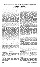 | | Journal (article/letter/editorial) | | Amcnnpijiite: In the Emery Mining district (Powell County) the mineral is found in wellformed crystals in...Crevasse Mountain Mining district near Jardine (Park County). At the Kennebec mine in the Crevasse Mountain...the Crevasse Mountain district near Jardine (Park County) on the Vindicator claim, one-half inch tabular...cummingtonite. In the Hog Heaven Mining district (Flathead County) at the Flathead Mine, pale yellowish to colorless...property, accessible by county road. MINERALS Andakisite: Near Dillon (Beaverhead County) in Axes Canyon, |  | | Report (volume) | | headwaters of the North Branch of Potomac River; from this stone the line runs due north to Mason and Dixon's...43i' and longitude 80° 31', and from that corner north along the western boundary of Pennsylvania until... known as New River, heads in northwestern North Carolina and cuts a gorge throughout the entire breadth...manufactures are mainly in the narrow strip in the north lying between Pennsylvania and Ohio River, in and...Pocahontas GANNETT.] GAZETTEEK OF WEST VIRGINIA. 9 County, above the crest of the Allegheny Plateau, are |  | | Journal (article/letter/editorial) | | Rock and Cheyenne River Indian Reservations, .... North and South Dakota. Review by V. O. T. The Flora of...... Geology and Geography of a Portion of Lincoln County, Wyoming. By Alfred Reginald Schultz. Review...Fuller. Review by V. O. T. ......... Geology of North Creek Quadrangle. By William J. Miller. Review B...Standing Rock and Cheyenne River Indian Reservations, North and South Dakota. By W. R. Calvert, A. L. Beekly...Knowlton. Review by R. C. M. ........... Kanawha County, West Virginia. By Charles E. Krebs. Review by |  | | Journal (article/letter/editorial) | | Library] at 14:12 03 February 2015 Bernalillo County Cerro Colorado, W. of Albuquerque: carnotite. Placitas...Milagros mine): copper, cuprite, malachite. Catron County Apache Creek, N. of Reserve: quartz (chalcedony)...Library] at 14:12 03 February 2015 Chaves County DeBaca County Bosque Draw, E. of Roswell: gypsum, pyrite...Fort Sumner: quartz (“Pecos diamonds”). Cibola County Bear Canyon district, San Andres Mountains. Stevens...mines: barite, fluorite, malachite. Doiia Ana County Figure 2: Spessartine and topaz, 1-cm specimen |  | | Report (issue) | | deposits Florida Georgia Idaho Montana North Carolina South Carolina Tennessee Utah Wyoming Foreign deposits...sections. State and by are listed alphabetically county; foreign deposits are listed by country and political...Number of deposits Florida Georgia Idaho Montana North Carolina, , , 97 2 2 6 Utah 17 , A TABLE ...the State, the next three digits designate the county, and the last four digits designate a number unique...unique to each deposit within that State and county. For foreign deposits, the first three digits designate |  | | Report (volume) | | .......................................... North Carolina............................................................................................ North Dakota ................... .-.....................results for samples from the Taggart coal bed in Wise County, Va. Subsequent microscopic studies were carried...the Elkhorn coal of Letcher County, Ky., the Chilton bed of Logan County, W. Va., the Black Creek coal...coals, from northwestern South Dakota, southwestern North Dakota, and from the Red Desert area and the Powder |  | | Report (issue) | | Prof. W. S. Yeates was born at Murfreesboro, North Carolina, December 15, 1856, where his father, Hon......- The Hall County Belt ---------------------c------------------The McDuffie County Belt ---------...The Carroll County Belt ---------------,---------------------- 36-37 The Oglethorpe County Belt ----...------------------------------------ 37 The Madison County Belt ------------------------------------- 37...Page Warren County ~~- ____ -~-- _ -~~- _~ ___ ~~- -~~~- _~ __ ~- __ ~- _ -~~ :McDuffie County ~---- __ |  | | Journal (issue) | | variety of forms and colors exceeds that of any other North American locality. Mr. William Niven, the well...discrimination. The amethysts found in Delaware County are superior to those afforded by any other American...natural colors in “ Gems and Precious Stones of North America,” to appreci ate the truth of the assertion...specimens of amethyst from any of the Delaware County localities fetch high prices. Prase is found at...and Howard House, Delaware County. At Hen derson Station, Montgomery County, transparent and milky groups |  | | Report (volume) | | 543 GEOLOGY AND GEOGRAPHY OF A PORTION OF LINCOLN COUNTY, WYOMING BY ALFRED REGINALD SCHULTZ WASHINGTON...ranges................................ 117 ' Uinta County .................................................Topographic and geologic map of a portion of Lincoln County, Wyo.........................................conglomerate of the Almy formation in Jackson Hole north of Fall River and east of Snake River; B, Sharp...115 GEOLOGY AND GEOGRAPHY OF A PORTION OF LINCOLN COUNTY, WYOMING. By ALFRED REGINALD SCHULTZ. INTRODUCTION |  | | Report (issue) | | DEVELOPMENT POTENTIAL OF THE PINE KNOLL QUADRANGLE, UINTA COUNTY» WYOMING Prepared for UNITED STATES DEPARTMENT...Knoll quadrangle is located in southwestern Uinta County, Wyoming, approximately 11 airline miles (18 km)...with Park City, Utah, to the southwest, crosses north-south through Billiard Flat in the northwestern...the east. An improved light-duty road crosses north-south on the eastern side of Billiard Flat with...branch to the east and northeast to serve the Sulphur Creek oil field. Several unimproved dirt roads |  | | Report (issue) | | Devonian granodiorite, Attean quadrangle, Somerset County, Maine: 3 p. Mar. 3, 1965. (Wa, Da, M; Rm. 1, 270...andKruger, C. L. Aeromagnetic map of northeastern Iron County, Michigan: 1 sheet, scale 1:31,680. Aug. 27, 1965...L., Aeromagnetic map of part of eastern Baraga County, Michigan: 1 sheet, scale 1:62,500. June 11, 1965...geologic map of Bradley Peak quadrangle, Carbon County, Wyoming: 1 sheet, scale 1:20,000. May 17, 1965...RedBuffalo Route of Interstate Highway 70, Summit County, Colorado: 10 p., 1 fig. Jan. 29, 1965. (Wa, Da |  | | Journal (article/letter/editorial) | | Caldwell Stone Company quarry, Danville, Boyle County. Terry Huizing specimen and photo. K entucky...Commonwealth is Black Mountain in the Appalachians (Harlan County) at 4,139 feet. The lowest point is the floor of...of the Reed quarry near Grand Rivers (Livingston County) in western Kentucky, at 100 feet below sea level...small, nondiamondiferous kimberlite in Elliott County in eastern Kentucky and alnöite intrusions in Crittenden...Greb, Kentucky Geological Survey. in Crittenden County has one major shaft called the “Rock shaft.” The |  | | Report (issue) | | Each article was read, annotated, and indexed by county, subject, and geological age where applicable....geographic area of the subject was. greater than a county, subdivisions of the state, based upon physiographic...a , Emory G e o r fl I a iii University, NORTH\_jFLOYD Figure 1. Subdivisions of Georgia used...Published by the North Carolina Academy of Science from Chapel Hill, North Carolina. FLORIDA GEOL. SURVEY...Arbor, Michigan. SO UTH CAROLINA ACAD. SCI. BULL. Bulletin of the South Carolina Academy of Scien ce. Published |  | | Report (issue) | | Reconnaissance of the ore deposits in northern Yuma County, Ariz.: Bull. 451, 130 pp., 1911. 30c. -. The ore...geology and mining district'of Leadville, Lake County, Colo.: Second Ann. Rept, pp, 201-290, 1882. $2...42-65, 1913. GENTH, F. A., The minerals of North Carolina: Bull. 74, 119 pp., 1891. 65c. GRANT, U. S...pp., 1912. The Grand Gulch mining region, Mohave County, Ariz.: Bull. 580-D, pp. 39-58, 1914. Some mining...LINDGREN, WALDEMAR, and BANCROFT, ROWLAND, Ferry County, Republic (Eureka) district [Washington]: Bull |  | | Report (issue) | | DEVELOPMENT POTENTIAL MAPS OF THE SULPHUR CREEK RESERVOIR QUADRANGLE, UINTA COUNTY, WYOMING [Report includes...Chemical analyses of coals in the Sulphur Creek Reservoir quadrangle, Uinta County, Wyoming.......... 18 Coal...lands (in short tons) in the Sulphur Creek Reservoir quadrangle, Uinta County, Wyoming....................lands (in short tons) in the Sulphur Creek Reservoir quadrangle, Uinta County, Wyoming....................Potential (CDP) Maps of the Sulphur Creek Reservoir quadrangle, Uinta County, Wyoming. This report was |
|


