 | | Journal (article/letter/editorial) |
| from St. Louis and Lake Counties Minnesota MIKE HEDTKE PO Box 258 Clearbrook, Minnesota 56634-9649 All...Basalt lava flow exposed along the Knife River, St. Louis County, Minnesota. Fieldwork during fall 2000...basalt flow exposed along the Knife River, north of Duluth, Minnesota. Prehnite and prehnite with native...along the rivers that flow into Lake Superior, the westernmost Great Lake. Rock outcrops along Mike Hedtke...& Minerals. 136 ROCKS & MINERALS the shore of Lake Superior show good transverse cross sections but |
 | | Journal (article/letter/editorial) |
| Copyright © 1999 Elsevier Science Ltd Printed in the USA. All rights reserved 0016-7037/99 $20.00 ⫹ .00 Pergamon...Volcanic Group and Related Hypabyssal Sills, Minnesota YOUNG-ROK PARK and EDWARD M. RIPLEY* Department...Indiana University, Bloomington, IN 47405-1403, USA (Received September 14, 1998; accepted in revised...have occurred during the late stages of Portage Lake volcanism, and periodically thereafter. Copyright...Park and E. M. Ripley Fig. 1. Geologic map of the Lake Superior area. Samples for this study were collected |
 | | Journal (issue) |
| Sulfosalts New to Darwin Mining District, Inyo County, California Gail E. Dunning 773 Durshire Way Sunnyvale...California 95060 The Darw in mining district, Inyo County, California has lo ng been known for its deposits...Kinoite? from Lake County, Minnesota Mike Hedtke Route 1 Box 267 Clearbrook, Minnesota 56634 - What...rare mineral best known as micro inclusions in calcite and quartz from the Laurium and other mines in...for copper mineralization along the north shore of Lake Superior. In early June of 2000, because of extremely |
 | | Report (issue) |
| Geological report Annual Minnesota of Survey History Natural and Minnesota of Survey History Natural...^tcsciitcb to By N. H. WINCHELL, State Geologist of Minnesota. Minneapolis. Minn. On behalf of the Regents of...Paul. ex-oeitcio. JOHN S. PILLSBURY, Governor of Minnesota, Minneapolis. DAVID BURT, Superintendent of Public...Eames, on the Metalliferous Region bordering on Lake Superior, 1866. 8vo. 23 pages. 6. Report of H. H...on some of the northern and middle counties of Minnesota. 1866. 8vo. 58 pp. Out of print. 7. Report of |
 | | Journal (article/letter/editorial) |
| maPeter Young, Box 601, Kentfield, terial, butterfly calcite on a rare shade of Calif., has visited the bastnasite...tunnel located west of Tucson. There were also calcite and aragonite crys- site in massive form, occurs...near Glen wood, Pike ROCKS AND MINERALS, p. 123. County, Arkansas. Mr. Young also sends a note on a Downloaded...development near Mountain Pass, San Bernardino County, Calif. Molybdenum Corporation of America is at...Darby, Pa., who has a summer camp at Shallcross Lake in Delaware. According to Mr. Jochen, petrified |
 | | Report (edition) |
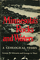
| .i WM. R. JUDD UNIVERSITY OF MINNESOTA Minnesota Geological Survey GEORGE M. SCHWARTZ, DIRECTOR...Min1leapolis Copyright 1954 by the UNIVERSITY OF MINNESOTA All rights reserved. No part of this book may...attempt to make available to the citizens of Minnesota a general summary of the major geological features...Yet how many of the thousands of citizens of Minnesota employed in these enterprises understand the geological...foundation of our wellbeing, the hope of our future. Minnesota, though known as an agricultural state, has great |
 | | Report (edition) |
| UNIVERSITY OF MINNESOTA Minnesota Geological Survey PAUL K. SIMS, DIRECTOR BULLETIN 37 PHOTOGRAPH...University of Minnesota Press, MinncajJolis Copyright 195.4,19138 by the UNIVERSITY OF MINNESOTA All rights...Departments of Botany and Geology of the UniveTsity of "Minnesota Preface THIS volume has been prepared in an...attempt to make available to the citizens of Minnesota a general summary of the major geological features...Yet how many of the thousands of citizens of Minnesota employed in these enterprises understand the geological |
 | | Journal (article/letter/editorial) |
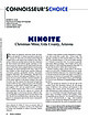
| cookrob@auburn.edu KINOITE Christmas Mine, Gila County, Arizona F ew states can approach, much less...the northwest and Rosemont to the southeast, Pima County, Arizona. The locality is about 30 miles (48 kilometers)...fluorapophyllite from the Christmas mine, Gila County, Arizona. Les and Paula Presmyk specimen, Jeff...kinoite crystals from the Christmas mine, Gila County, Arizona. Les and Paula Presmyk specimen, Jeff...quartz from the Laurium mine, Calumet, Houghton County, Michigan. Dan Behnke specimen and photomicrograph |
 | | Journal (article/letter/editorial) |
| related hypabyssal sills, Midcontinent Rift System, Minnesota Young-Rok Park, Edward M. Ripley ) Department... 1005 East Tenth Street, Bloomington, IN 47405, USA Received 19 March 2000; accepted 7 April 2000 Abstract...North Shore Volcanic Group ŽNSVG. Žnortheastern Minnesota. and related hypabyssal sills demonstrate the...hypabyssal intrusions located in northeastern Minnesota ŽFig. 1.. The Complex intrudes beneath and partly...Volcanic Group ŽNSVG, Fig. 1; Green, 1982. of western Lake Superior, with emplacement focused along the unconformity |
 | | Journal (article/letter/editorial) |
| NEWS AN OCCURRENCE OF SAPONITENEAR SILVERBAY, MINNESOTA J. A. WnoraN, DepL of Mineralogy, Llnittersity...were described from the flows of the north shore of Lake Superior by some of the first geologists in the...Mining Company's taconite plant at Silver Bay, Minnesota. This clay mineral was first definitely identified...identified as saponite by Whelan at the University of Minnesota, utilizing *-ray difiraction. Following the discovery...constituent of the Keewanawan flows of the north shore of Lake Superior. The saponite occurs in amygdules and in |
 | | Journal (article/letter/editorial) |
| SHORE OF LAKE SUPERIOR By FRED 6 . K N O W L T O N Bayfield, Colorado A Guidebook to Minnesota T r u n...shore of Lake Superior is recommended. This is a very beautiful drive as the highway follows the lake very...and mileage is figured from Lake Ave., on U. S. Highway No. 61. 0.00 Lake Avenue on U. S. Highway 61 in... 12.2 miles—French River. A few agates have been found on beach at mouth of river. Fish hatchery here...Point. McClean's cabins and gas. 18.0 miles—Knife River. Go to beach and work southwest to end of beach |
 | | Journal (article/letter/editorial) |
| SERIES, MICHIGAN RICHARD E. STOIBER THE PORTAGE LAKE LAVA COPPER DISTRICT AND EDWARD S. DAVIDSON...hasstatedthatthedifferentiation of thelavasof the Portage Lake lava seriestendstowarddevelopment of a spiliticassociation...origin. The liquidinclusions in bothquartzand calcite (Table 3) suggestthe presence of hydrothermal liquidsat...temperaturehad decreased. This suggestionis upheld by the calcite inclusiontemperatures whichare muchlowerthan thoseof...namelychloriteand feldspar,followed by epidote,quartz,and calcite(generallyin that order), is alsoin line with the |
 | | Journal (article/letter/editorial) |
| metamorphism in the North Shore Volcanic Group, Minnesota, USA S . Th. SC H M I D T Mineralogisch-Petrographisches...ABSTRACT The North Shore Volcanic Group in northern Minnesota is part of the Middle Proterozoic Keweenawan sequence...= agate; ab = albite; act = actinolite; cal = calcite; cc = chalcocite; chl = chloritic phyllosilicate;...native copper deposits in the Keweenawan rocks in the Lake Superior region and the relationship of their genesis...the first time a mineral zonation in the Portage Lake lava series on Keweenaw 401 402 S. T h . SCHMIDT |
 | | Journal (article/letter/editorial) |
| Arkansas which furnishes nice brownish stalactites (calcite). Byron C. Marshall, 204 Central Avenue, Hot Springs...specimens at the famous Magnet Cove, Hot Spring County, Arkansas. I have just received a report from the...nice jasper. "The green chalcedony is from Marin County, north of San Francisco. It was picked up on a...ledge (Coyote Point). The chalcedony from Marin County is a beautiful dark green specimen. COLORADO—W...intere->;ng specimen of amazonstone from Rabun County. This is the first true amazonstone believed to |
 | | Report (issue) |
| >VGEOLOGY OF THE KXIFS RIVER AREA NORTH DAKOTA By William E. Benson U. S. GEOLOGICAL SURVEY 'S FILE...Paleocene rocks ......... 31 Rooks exposed in Knife Mver area ................... 36 Historical Background.............. 45 Fort Union formation - Tongue River member.. 45 Distribution and composition ....... 92 Younger formations not present in the Knife River area . ................ 93 Tertiary System...series .............................. 93 "White River formation ...................... 93 General Description |
 | Winter, T.C., Benson, R.D., Engberg, R.A., Wiche, G.J., Emerson, D.G., Crosby, O.A., Miller, J.E. (1984) Synopsis of ground-water and surface-water resources of North Dakota. Open-File Report Vol. 1984 (84-732) US Geological Survey doi:10.3133/ofr84732 | Report (issue) |
| ..................................... Missouri River mainstem basin................................ General......... Yellowstone River.................................. Little Missouri River................................. Knife River........................................ Heart River........................................... Cannonball River................................... General description of minor tributaries........................................... James River basin.......................................... |
 | | Report (issue) |
| CLARENCE KING DIRECTOR THE COPPER-BEAEING ROOKS LAKE SUPERIOR Bv ROLAND IDXJER IRVIN'a WASHINGTOls^...Irving's memoir on the Copper-Bearing Rocks of Lake Superior. Very respectfully, your obedient servant... on the Copper- Bearing or Keweenawan Rocks of Lake Superior. I am, sir, with great respect, your...VI.— The Keweenaw an Rocks op the South Shore of Lake Superior Introductory 152 Section I.— Keweenaw...Section II.— The Region between Portage Lake and the Ontonagon River Section III. The South Range Section |
 | | Report (issue) |
| • .:. .' /,' " '. f ',. . }'. , " - :MINNESOTA GEOLOG;ItAL SURVEY,' WIL~IAM H. EMM;ON:S, ,DIRECTOK-...BULLETnfNO.20, '. ,. ".): " . " A ,GUIDEB:OOKTO MINNESOTA TRUNK HIGHWAY,NO.·f "'j', BY " . ,, G. M.SCHWARTZ... FRONTISPIECE. FALLS OF THE MANITOU RIVER m4t llluiutr.aity of ~iuut.anta MINNESOTA GEOLOGICAL SURVEY WILLIAM...GUIDEBOOK TO MINNESOTA TRUNK HIGHWAY NO.1 BY G. M. SCHWARTZ MINNEAPOLIS The University of :Minnesota PREFACE...features that may be seen along Highway No. I of Minnesota. This highway begins at the Iowa state line south |
 | | Book (edition) |
| NORTH DAKOTA NEBRASKA • INDIANA • MISSOURI • MINNESOTA I By JUNE CULP ZEITNER THIRD EDITION Completely...FOSSILS . 27 THE MISSION AREA ......... Sand Calcite Crystals . 27 28 8 8 8 38 THE HIGH PLAINS Moss.......................... 44 44 44 .44 THE RED RIVER VALLEY .... 32 NORTH DAKOTA .. 30 WESTERN NORTH............. .50 .50 .50 ILLINOIS MISSISSIPPI RIVER BORDER ..... Gems ................................... . Fossils....................... MINNESOTA ... 54 Lake Superior Agate .54 THE NORTH SHORE . |
 | | Report (issue) |
| ", UNIVERSIT-Y OF MINNESOTA MINNESOTA GEOLOGICAL SURVEY WILLIAM H. EMMONS, DIRECTOR BULLETIN 80 MINERAL...MINERAL RESOURCES OF MINNESOTA EDITED BY WILLIAM H. EMMONS AND FRANK F. GROUT' MINNEAPOLIS . 1943... MIN N E SOT APR E S S UNIVERSITY OF MINNESOTA MINNESOTA GEOLOGICAL SURVEY WI L L I AM H. EM M 0 N...IRE C TOR BULLETIN 30 MINERAL RESOURCES OF MINNESOTA EDITED BY WILLIAM H. EMMONS AND FRANK F. GROUT...UNIVERSITY OF MINNESOTA PRESS FOREWORD This resume of the mineral resources of Minnesota is introduced |
 | | Journal (article/letter/editorial) |
| Copyright © 1999 Elsevier Science Ltd Printed in the USA. All rights reserved 0016-7037/99 $20.00 1 .00 Pergamon...metasedimentary rocks located beneath the Duluth Complex, Minnesota YOUNG-ROK PARK,1 EDWARD M. RIPLEY,*,1 MARK SEVERSON...Bloomington, IN 47405, USA Minnesota Natural Resources Research Institute, University of Minnesota, Duluth, Duluth...Duluth, MN 55811, USA 2 (Received July 6, 1998; accepted in revised form February 11, 1999) Abstract—Thin...metasedimentary footwall rocks of the Duluth Complex, Minnesota. The sills were emplaced prior to the major intrusions |
 | | Report (issue) |
| ijJ~t 1tuiUtfaity of .fIiuutania MINNESOTA GEOLOGICAL SURVEY WILLIAM H. EMMONS, DIRECTOR IN...PRELIMINARY REPORT ON THE GEOLOGY OF EAST CENTRAL MINNESOTA INCLUDING THE CUYUNA IRON-ORE DISTRICT BY E....A. W. JOHNSTON MINNEAPOLIS The University of Minnesota 19 1 8 CONTENTS Introduction ................ . . . . . . . . .... . 2 General geology of Minnesota. . . . . . . . . . . .... . . . . . . . . . .... . . . . . ... 4- 1 5 Rocks of east central Minnesota. . . . . . . . . . . . . . . . . . . . . . . . |
 | | Report (chapter) |
| Sciences, Harvard University, Cambridge, MA 02138, USA 2 School of Earth and Ocean Sciences, University... Correlative strata were studied in the Hayhook Lake area (Fig. 36.1), 300 km to the SE, by Upitis (1966)...type section for the Rapitan Group near Hayhook Lake at 63834’03”N, 127802’41”W. It includes the Sayunei...HALVERSON 134 oW 132 oW platfor Iron SNAKE RIVER Ck mou ntain Cranswick R. m a ck Norman Wells...zi e Ri 65oN v e r u t Th Stone Knife R. Shale Lake M on fr Gayna R. P la Arctic te Red R |
 | | Report (issue) |
| publication) Page (A) Moraines and shore lines of the Lake Superior Basin, by. Frank Leverett (published July...1929)___________________ (G) Algae reefs and oolites of the Green River formation, by W. H. Bradley (published Mar. 28,1929)...________ (.l) Additions to the flora of the Groen River formation, by R. VV-. Brown (published Apr. 22,...ILLUSTRATIONS 1. Glacial map of northeastern Minnesota, northern Wisconsin, and northern peninsula of...formerly covered by glacial lakes of northeastern Minnesota, northern Wisconsin, and northern peninsula of |
 | | Book |
| took place in 1810 near Murphysboro in Jackson County. The first production of natural gas occurred in...Champaign County. Commercial-quality oil was first discovered in 1906 near Casey in Clark County. Fluorspar...Fluorspar was first discovered at Rosiclare in Hardin County in 1818 but was not mined until 1842. Lead has...has been mined at Galena in Jo Daviess County area since the year 1700. MINES AND PLANTS YOU CAN SEE FROM...has a sand and gravel plant 1 mile east of Crystal Lake, on U.S. Highway 14 (map location 2). This is approximately |


