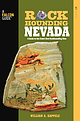
 | | Book | | A FIELD GUIDE Rockhounding Nevada is a must-have book for anyone interested in collecting rocks, minerals...back cover photos of fossil plate (left) and the Lost Creek Road site (right) © William A. Kappele Printed...Globe Pequot Press NEVADA A Guide to the State’s Best Rockhounding Sites NEVADA 2nd Edition Essential...experience—concisely describes the best places to locate agate, opal, jasper, fossils, fluorescent minerals, obsidian...and minerals WILLIAM A. KAPPELE Rockhounding Nevada RockhoundingNV 3pp.indd 1 6/27/11 3:02 PM Help |  | | Report (issue) | | MINERALS OF NEVADA MINERALS OF NEVADA Peer Hen By CASTOR oan eGORY.C.oFER DOCK NEVADA AND BUREAU... UNIVERSITY Reno & Las Vegas OF NEVADA PRESS GEOLOGY Nevada Bureau of Mines and Geology Special...University of Nevada Press, Reno, Nevada 89557 USA Copyright © 2004 by University of Nevada Press Photographs...Districts and significant mineral occurrences of Nevada by Nevada Bureau of Mines and Geology All rights reserved...Cataloging-in-Publication Data Castor, Stephen B, Minerals of Nevada / Stephen B. Castor and Gregory C. Ferdock.— Ist | | | Report (issue) | | MINERALS OF NEVADA MINERALS OF NEVADA STEPHEN B. CASTOR and G R EGOR Y C . F E R D OC K l NEVADA BUREAU...association with the UNIVERSITY OF NEVADA PRESS Reno & Las Vegas Nevada Bureau of Mines and Geology Special...University of Nevada Press, Reno, Nevada 89557 USA Copyright© 2004 by Uni versity of Nevada Press Photographs...Districts and si gnificant minernl occurrences of Nevada by Nevada Bureau of Mines and Geology All rights reserved...-Publ ication Dat,i Castor, Stephen B. Minerals of Nevada/ Stephen B. Castor and Gregory C. Ferdock.- rst |  | | Report (volume) | | ........................................ 187 Nevada..................................................See Bauxite and Halloysite. Asbestos. Tallapoosa County, with corundum deposits near Dudleyville; not found...commercial quantity or quality. Asphalt. Colbert County, small quantity has been shipped from near Leighton;...following localities : Bibb County, Pratts Ferry; Calhoun County, near Tampa; Clay County, T. 20 S., R. 7 E.;...; Jefferson County, at Ely ton; Lee County, at Chewacla lime works"; St. Clair County, at Greensport; |  | | Book (volume) | | of the Pine Ridge Escarpment and along Whiteclay Creek near the Sioux Indian community of the same name...and breaks in the hills along the Minnechaduza Creek and the Niobrara, as well as all tributary canyons...chalcedony, jasper and gem petrified wood. BUFFALO COUNTY KEARNEY, area gravel bars and pits along the Platte...townagate, chalcedony, jasper, petrified wood. CASS COUNTY WEEPING WATER, SE, on rd. to Nehawka, in the Snyderville...chalcedony, jasper, fossils. CHERRY COUNTY VALENTINE, in the Sandhills county along the Niobrara R. and Minnechaduza |  | | Book (edition) | | describes sites under of the nearest town and county. and the many maps included book contain such...opals were unlucky long unfashionable, and amethyst lost some of its made them when high status American...it materials the crystal structure is is so lost in not evident to the eye. Minerals of this sort...microscope. is — — A few gem materials notably, opal and obsidian are amorphous, lacking crystal structure...with light such as creates the unique beauty of opal or labradorite, the starry splendor of star sapphire |  | | Journal (issue) | | photographed by Adrian Atwater of Carson City, Nevada, and is this month's second prize winner. Raised...Assissi, Santa Fe, N. M. October 3-7—San Bernardino County Fair, Victorville, California. Volume 19 October...State Fair and Rodeo, Roswell. October 10-14—Graham County Fair, Safford, Arizona. October 11-14—Sixth Annual...October 13-14—Tri-City Sports Car Gymkana, Ely, Nevada. October 14—Aspencades from Alamogordo, Santa Fe...Calif. October 18-21 — Old Timers' Days, Hidalgo County Fair and Sheriff's Posse Rodeo, Lordsburg, N. M |  | | Report (issue) | | map and section of the Thursday property, Juab County, Utah ......................... 15 Geologic map...Geologic maps of the Fluorine Queen property, Juab County, Utah............................ .17 Chart showing...upper cut, East Slope no. 2 uranium prospect, Piute County, Utah...... 23 Map showing location of secondary..... 27 Section of cliff face, Oyler mine, Wayne County, Utah........................................ 28...uranium deposits occur in the Goodsprings district, Nevada (Harder and Wyant, Figure 1. --Distribution of |  | | Book (volume) | | 600 to 800 feet thick in the north. ALEXANDER COUNTY FAYVILLE, area stream gravels⎯agate, jasper, rare...⎯agate, jasper; d RR siding of Clay⎯agate. CALHOUN COUNTY AREA, shores of the Mississippi R., in the Warsaw...crystals). CRAWFORD COUNTY PALESTINE, area deposits⎯Siderite. EDWARDS COUNTY AREA, T. 1 S, R. 10 E...E, regional deposits⎯Siderite. FULTON COUNTY FARMINGTON, W 6 mi. on Rte. 116 to the Rapatee No. 5 strip...mine⎯pyritized gastropods (Pennsylvanian age). GRUNDY COUNTY AREA: c Regional rd. and RR cuts and banks of Mason |  | | Book (volume) | | 600 to 800 feet thick in the north. ALEXANDER COUNTY FAYVILLE, area stream gravels⎯agate, jasper, rare...⎯agate, jasper; d RR siding of Clay⎯agate. CALHOUN COUNTY AREA, shores of the Mississippi R., in the Warsaw...crystals). CRAWFORD COUNTY PALESTINE, area deposits⎯Siderite. EDWARDS COUNTY AREA, T. 1 S, R. 10 E...E, regional deposits⎯Siderite. FULTON COUNTY FARMINGTON, W 6 mi. on Rte. 116 to the Rapatee No. 5 strip...mine⎯pyritized gastropods (Pennsylvanian age). GRUNDY COUNTY AREA: c Regional rd. and RR cuts and banks of Mason |  | | Report (volume) | | -f Sweetwater County, Wyoming ^By DOUGLAS M. SHERIDAN, CHARLES H. MAXWELL, and JOHN T. COLLIER ^CONTRIBUTIONS...tongue.----_----------_-------------___--._ Morrow Creek member.____________________________ Bridger for...---__--__.___ , 441 General features of water in Lost Creek area_____________ 441 Water samples.____-__-...-i----_- 456 Stratigraphic sections in the Lost Creek area__________________________ Index_ ___-__...location of the Lost Creek area, Sweetwater County, Wyo. 36. Areal geology of the Lost Creek area. 37. Geologic |  | | Report (volume) | | E. H. Barbour, University of Nebraska, Lincoln. Nevada...........Dr. W. S. Tangier Smith, Berkeley, Cal...See Bauxite and Hallpysite. Asbestos. Tallapoosa County, with corundum deposits near Dudleyville; not found...commercial quantity or quality. Asphalt. Colbert County, small quantity has been shipped from near Leighton;...following localities: Bibb County, Pratts Ferry; Calhoun County, near Tampa; Clay County, T. 20, Pv. 7 E.; Jefferson...Jefferson County, at Elyton; Lee County, at Chewacla lime works; St. Clair County, at Gfeensport; Shelby |  | | Report (issue) | | Limnogeology Congress— Field Trip Guidebook, Reno, Nevada, June 15–19, 2015 1 Trip 3 Trip 2 Trip Trip...Mono Lake at South Tufa looking west to the Sierra Nevada Mountains. Pleistocene glacial moraines and valleys...northeastern shore near Butte Creek. Photograph by Kerry Howard, University of Nevada, June 2012. Sixth International...Limnogeology Congress— Field Trip Guidebook, Reno, Nevada, June 15–19, 2015 Compiled by Michael R. Rosen...Limnogeology Congress—Field Trip Guidebook, Reno, Nevada, June 15–19, 2015: U.S. Geological Survey Open-File |  | | Book (edition) | | MARIN COUNTY FREE LIBRARY 3 1111 00289 4184 \ I s Fifth Revised Edition A complete, state-by-state...live. The Appalachians, the Smokies, the Sierra Nevada, the Rockies and Black Hills, the Cascades and...North Carolina, a big diamond or two in Arkansas, opal in Idaho, and so on. Old locations suddenly are...unlucky long made them unfashionable, and amethyst lost some of its high status when the abundant South...In many gem materials the crystal structure is so lost in the mass that it is not evident to the eye. Minerals |  | August, M.H., Jacoboni, J.M., Jeton, A.E., Parker, R.S., Pupacko, Alex, Ruddy, B.C., Smith, J. LaRue, Redmond, K.T. (1992) Hydrologic and climatic data bases used to assess potential effects of climate change on water resources of American River, Carson River, and Truckee River basins, California-Nevada, and of Gunnison River basin, Colorado. Open-File Report Vol. 1992 (92-627) US Geological Survey doi:10.3133/ofr92627 | Report (issue) | | Carson River, and Truckee River Basins, California-Nevada, and of Gunnison River Basin, Colorado By MARIANNE...Geological Survey KELLY T. REDMOND University of Nevada Desert Research Institute U.S. Geological Survey...Survey Open-File Report 92-627 Carson City, Nevada 1992 U.S. DEPARTMENT OF THE INTERIOR MANUEL LUJAN...River and Truckee River basins, California and Nevada, and Gunnison River basin, Colorado 2 2. American...River, and Truckee River basins, California and Nevada, showing geographic features and hydrologic-basin |  | | Report (volume) | | of Uranium Deposits in the Red Desert Sweetwater County Wyoming GEOLOGICAL SURVEY BULLETIN This report...of Uranium Deposits in the Red Desert Sweetwater County Wyoming By DONALD G. WYANT, WILLIAM N. SHARP, and...______ Origin______.__ ..________.____________-_ Lost Creek schroeckingerite deposit______________________...sections, Lost Creek schroeckingerite deposit. 20. Geologic sections in five trenches, Lost Creek schroeckingerite...exploration, Lost Creek schroeckingerite deposit. 22. Geologic section C-C' (pi. 21), Lost Creek schroeckingerite |  | | Journal (issue) | | SHOW PROGRAM Don't miss this event 55 NEW FORM OF OPAL FROM BRAZIL DEPARTMENTS Offlcera 8111 Cox. President...Casting Equipment Jewelry Making Supplies Australian Opal Much More- COMPASS MINERAL- METAL DETECTOR 910...rest in (see drawing). She also uses it • To remove opal from a dop stick, Joe when putting new pads on the...State street In downtown Carlsbad, Calif. (Outside USA send $2.00 for catalOC) GEMS & MINERALS - 7 KEIJIJY...Springs near the tiny village of Magdalena, Socorro County. No notable production resulted, but this discovery |  | | Book (volume) | | El Paso, Texas. Information on the Virgin Valley opal deposits was given by G. Keith Hodson of Scottsdale...Stevens Point, Wisconsin, and by A. L. Mahaffey of Nevada, Missouri. The well-known Texas agate localities...Kobuk jade locality. Descriptions of San Diego County, California, gemstones and the mines in which they...the generous assistance of many residents of that county. My special thanks are extended to Elbert H. McMacken...Diamond, Corundum (Ruby and Sapphire), Beryl, Topaz, Opal. IMPORTANT GEMSTONES The Feldspar Group, Spodumene |  | | Book | | HfiRIN COUNTY FREE LIBRfiRY 311110G386652Q I V Russell P MacFal A COLOR TREASUF FOR COLLECTORS...to Hunting Locations ? i 9 GIVEN TO THE MARIN COUNTY LIBRARY BY MARI N L MTNF.RAT. SOCTETY DAVID...may be able to buy specimens. map of Keweenaw County. Mich- Part of the U.S. Geological Survey topographic... feldspar, hornblende, and mica is shape is lost. Granite with its an easily identified rock....obsidian, found with other volcanic ejecta. and opal. Minerals are classified according to their structure |  | | Report (volume) | | 1 uranium mine, Seven Mile Canyon area, Grand County, Utah: TEI-287, Jan. 11, 1954. GJ, SL. Fischer...exploration at the Old Leyden coal mine, Jefferson County, Colo.: TEM-292, Mar. 30, 1953. D, GJ. Hinrichs...pegmatites of the Errington-Thiel mine, Elko County, Nevada: TEI-71, Dec. 28, 1949. Office of Director...Ridge, and West End claims near Clancy, Jefferson County, Mont.: TEM-31, Oct. 19, 1951. D, SL, T. (332,...Geology of the Small Horn Canyon, Daly's Spur, Cedar Creek and Dell areas, southwestern Montana: Dec. 8, 1949 |  | | Journal (issue) | | DESERT CALENDAR June 29-July 1—Rodeo at Elko, Nevada. June 30-July 1—Sierra Club members will climb...Livestock Association holds its annual rodeo at Reno, Nevada. COVER July 1-4 — Frontier Day Roundup, Prescott...We Camped With the Pai-Pais By RANDALL HENDERSON LOST GOLD July 4—Rabbit Ear Roundup rodeo at Clayton...fiesta, Espanola. New Mexico. . MINING INDIANS Lost Loma Gold, by KARL HUDSON 8 . . . . Death Valley...archeologist, was transferred to the Boulder City, Nevada headquarters from the Montezuma Castle national |  | | Report (volume) | | Lincoln County, Nev.... Lander County, Nev.. ...... . Virgin Valley opal district........ Lyon County, Nev............... Tonopah area, Esmeralda County, Nev. Clark County, Nev.---------- . Olancha, Calif. _ ._...Shirley May Mine Lucky Strike claim, Troublesome Creek area Meeker area ...... . - ............ 21 22...14 15 16 1 2 3 4 5 6 7 8 9 10 11 12 13 Skull Creek area... --.----.. ________________ Rifle and Garfield........._ Uravan mineral belt (includes Atkinson Creek quadrangle, Bull Canyon quadrangle, Egnar-Gypsum | | | Book | | topographic map of the Delaware q uadrangle o f Keweenaw County, Michigan This ,s an example o f the more picturesque...crowded toge ther that much of their crystal shape Is lost Granite wi th its quartz, feldspar, hornblende and...as obs1d1an found with other volcanic eiecta and opal M inerals are classified according to their structure...Oregon are nodules of agate o ft en associated with opal Reniform marcas1te 5 inches 1n diameter, with crystals...all around the old bonanza town of Virg1n1a City, Nevada, stand huge dumps where traces of silver minerals | | | Report (issue) | | Center Denver, CO 80225 _^ ^ _ _ ^ _ _^ ^ Sage Creek Mtn § ¦ ¨ av R 191 ! ( Bridger Pass Red Rim...__ ^ ^ _ ^ _ ^ _ ^^ _ _ _ ^^ 487 NTAI ME Lost Creek In-Situ Recovery Project Wamsutter § ¦ ¨ MOU...Area _ ^ _^ ^ _ ^ _ __ ^ ^ Rock Springs Uinta County _ ^ _ ^ __^ ^ ^_ Twm ROCK North Rock Springs..._ ^ __ ^ ^ Tml ! ( Sand O Basin REB RT G Opal 80 Flat 191 Great Divide Basin Uranium Area...Kemmerer ! ( _^ _ ^^ _ _E _ _^ ^ ^ _ ^^_ _ ^ D^ _ Lost Creek FER RIS _ _^ ^ Enq Solution Mine Site DE |  | | Book (volume) | | Arizona, Arkansas, California, Colorado, Louisiana, Nevada, New Mexico, Oklahoma, Texas, and Utah Also...volumes, through very precise directions and accurate county maps, to get you to the best and most accessible...for the county in which it is located. This site number also appears under the given county in the text...under the heading of Nebraska, on the map of Sioux County, the site x How to Use This Book indicated...Crawford in adjoining Dawes County and 5 miles south of Ardmore in Fall River County, South Dakota): 0.5 mile |
|


