 | | Report (issue) | | Ore Deposits of the Oilman District, Eagle County, Colorado GEOLOGICAL SURVEY Study made in cooperation...cooperation with the Colorado Mining Industrial Development Board PROFESSIONAL PAPER 1017 Ore Deposits...Deposits of the Oilman District, Eagle County, Colorado By THOMAS S. LOVERING, OGDEN TWETO, and T. G. LOVERING... 1017 Study made in cooperation with the Colorado Mining Industrial Development Board Description of...geologic setting of a mining district that is the leading source of zinc in Colorado and an important source |  | | Journal (article/letter/editorial) | | January 2015 Minerals of the Gilman District and Eagle Mine Eagle County, Colorado WILLIAM J. WARREN JR. Front...632 Golden, Colorado 80402 wjwmineral@aol.com ED PEDERSEN 11582 Ash Circle Thornton, Colorado 80233 pedersencpg@aol...298 ROCKS & MINERALS T he Gilman district, in Eagle County, Colorado, and its premier mineral specimen...Company’s Eagle mine, are located about 120 kilometers west-southwest of Denver. The Gilman district was originally...known as the Battle Mountain district and was later referred to as the Red Cliff district. Much of the |  | | Journal (article/letter/editorial) | | JANUARY, •9•5 AND ORE DEPOSITS No, OF RED CLIFF, COLORADO. A. H. MEANS. INTRODUCTION. Muchatt[ntion...fissureveins to blanketdepositsin that district. At Red Cliff theconditions of deposition aresimilartc•Leadville...Leadville,there are fissuresand blanketdeposits. In Red Cliff, however,it was possibleto determinethe relationof...following paper. LOCATION. The Red Cliff or Bn•le Mountain District (altitude 8,600 feet) is locatedin...locatedin the southeastern part of Eagle County,Colorado, about 2o miles north-northwestof Leadville, and 75 | 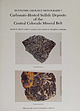 | | Report (issue) | | Carbonate-Hosted Sulfide Deposits of the Central Colorado Mineral Belt DAVID W . BEATY, GARY P . LANDIS...paralle l to host-rock bedding. Black Cloud mine, Leadville district. Sherman-type ore (bottom) in paleokarst...fragments (dark gray), white tabular barite. green sphalerite , and pyrite aggregates in a light hrownis11-gray...veined with ferroan dolomite. rv1oose mine, North Alma district. Photographs b)' \Villiarn Sacco, Peabody...Carbonate-hosted sulfide deposits of the central Colorado mine ral belt: Introduction, general discussion, |  | | Report (issue) | | GEOLOGY AND ORE DEPOSITS OF TILE LEADVILLE MINING DISTRICT, COLORADO BY S. F. EMMONS, J. D. IRVING, AND G...anticline _ Origin of the Iron-Mikado fault 61 Colorado Prince anticline _ group _ 95 61 Mosquito Gulch...fold-fault _ Faults in the eastern part of the district 95 62 Kokomo syncline_ Faults southeast_ of _..._ Leadville 62 the_ Fryer Hill folds _ 62 district _ 95 Warping and drag along normal faults, _ _ _ 96...103 66 and Mike faults _ Iron Hill _ 103 66 Tucson mine _ Area between Iron and Adelaide faults_ _ _ Yak_ |  | | Journal (volume) | | Cause and Prevention of Mine.. Accidents, Cause for Accidents. Fire Boss and Mine Accidents in French Coal...in Pa., Coal-Mine Accident, Preventable Shaft-Sinking Accidents, Some Features of Mine Disasters Acetylene...of Acetylene Lamps, Gases from 189,254, Acetylene Mine Lamp, New Acids on Concrete, Action of Action of...Afterdamp Ahmeek Mining Co., Concrete Shaft Lining Ainsworth & Sons, Wm., Arnold Acetylene Mine Lamp 1 293...Mountains Anthracite Mine-Cave Commission Report, 468, Anthracite Mine, Cerrillos Anthracite Mine Law, Proposed |  | | Journal (issue) | | Conference - France 20 — 21 September 2008 London Open House 26 — 28 September 2008 - Hidden Earth, OTLEY, West...locations, with at least six different styles of coal-mining represented, dating from the 17th to the 20th centuries...2008, Middleton Park, Leeds. Newsletter Northern Mine Research Society, May 2008, page 8. FURTHER THOUGHTS...excavation may have been commenced as a chalk or flint mine, and was subsequently used as a prison during which...makes it sound rather more like a chalk or flint mine than a chapel. As a prison it would be decidedly |  | Edmons, E. A., Wright, J. E., Beer, K. E., Hawkes, J. R., Williams, M., Freshney, E. C., Fenning, P. J. (1968) Geology of the Country around Okehampton (Explanation of One-inch Geological Sheet 324, New Series) Memoirs of the Geological Survey. Institute of Geological Sciences | Report (issue) | | K.) Ltd. l ••• 111 PREFACE THE OKEHAMPT0N district was first surveyed by Sir Henry T. De la Beche...Economic Geology in a house in Craig's Court, Charing Cross, and in 1840 of the Mining Record Office. Unfortunately...the old series maps (Sheets 25 and 26) of the district, in common with other early Geological Survey...(1956), 'The Metalliferous Mining Region of South-West England'. The district formed part of the area in...under Dr. F. B. A. Welch and Mr. G. Bisson as District Geologists, commenced six-inch survey of the Oke |  | | Report (issue) | | under the supervision of Mr. W. N. Edwards as District Geologist. The revised six-inch maps, published...Carboniferous rocks. The Chesterfield district has a long mining history based on exploitation of its...depth. The new geological maps of the Chesterfield district, as well as this accompanying memoir, will form...generous help, together with that provided by private mining firms, quarry owners, water undertakings, drilling...Introduction, 8. Matlock-Wirksworth area, 10. Millclose Mine, 27. Ashover, 32. Crich, 35. Provings in deep boreholes |
|


