Ralph S Bottrill's Photo Gallery
View of the Neck

View of the Neck, Bruny Island, with my sister Carol.
This is a sandy isthmus or tombolo.
Drill rig at the mine.

A drill rig on the old mine site testing for new ore zones.
View of flooded pit

View of flooded pit in granite, with a mafic dyke to the RHS.
View of quarry from the east.

View of quarry from the east.
Zeolite-bearing fault

Zeolite-bearing fault zones in Dolerite.
View over quarry

View over quarry from south.
View over quarry
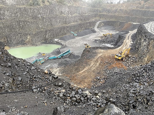
View over the quarry from the south ( in the rain).
View of Upper level.

View of upper level looking NW.
LA8-VHKBuchite, Basalt

Dimensions: 150 mm x 100 mm
An aggregate of angular buchite fragments in basalt, formed from the melting of a siliceous xenolith.
OLYMPUS DIGITAL CAMERA
VY7-77CScoria, Basalt

Field of View: 100 mm
Scoria or highly vesicular basalt.
OLYMPUS DIGITAL CAMERA


