 | | Journal (article/letter/editorial) | | fluorite, marcasite, pyrite, sphalerite, and strontianite are present in small amounts at many localities...first re ported occurrence of smythite was from Indiana ( E r d , 1957), where it was found as inclusions...geodes. Other species reported as occurring in Indiana, 136 ROCKS AND MINERALS { RICHARD E . RUSSELL... 4 cm across; Meshberger Stone, Inc. quarry, Bartholomew County. Richard Russell specimen and photo....largest crystal 3.5 cm across; Berry Materials quarry, Jenn ings C o . J . Kielbaso specimen; R . Russell |  | | Report (issue) | | Guysborough County, Nova Scotia. This little-known locality is an abandoned road-fill quarry where the...= Quartz, 3.1 cm, from Boylston, Guysborough County, Nova Scotia, Canada. Tyson’s Fine Minerals specimen...bursts of white strontianite, from the Faylor-Middlecreek quarry, Winfield, Union County, Pennsylvania...Pennsylvania. (The Faylor-Middlecreek is a road-fill quarry in limestone, commercially worked between the 1940s and...Calcite and Strontianite, 11.5 cm, from the Faylor-Middlecreek quarry, Winfield, Union County, Pennsylvania |  | | Journal (article/letter/editorial) | | State Park 201 West Riverside Drive Clarksville, Indiana 47129 agoldstein@dnr.in.gov Figure 1. Twinned calcite...calcite, 8 cm, Caldwell Stone Company quarry, Danville, Boyle County. Terry Huizing specimen and photo....Appalachians (Harlan County) at 4,139 feet. The lowest point is the floor of the Reed quarry near Grand Rivers...Rivers (Livingston County) in western Kentucky, at 100 feet below sea level. There are some noteworthy mineral...small, nondiamondiferous kimberlite in Elliott County in eastern Kentucky and alnöite intrusions in Crittenden |  | | Report (issue) | | MINERALS OF INDIANA by RICHARD C. ERD AND SEYMOUR S. GREENBERG Indiana Department of Conservation GEOLOGICAL...GEOLOGICAL SURVEY Bulletin No. 18 1960 STATE OF INDIANA HAROLD W. HANDLEY, GOVERNOR DEPARTMENT OF CONSERVATION...________________________________ MINERALS OF INDIANA BY RICHARD C. ERD AND SEYMOUR S. GREENBERG PRINTED...PRINTED BY AUTHORITY OF THE STATE OF INDIANA BLOOMINGTON, INDIANA September 1060 _____________________...______________ For sale by Geological Survey, Indiana Department of Conservation, Bloomington, Ind. Price |  | | Book | | Fossil and Mineral Trails Lakes States Wisconsin, Indiana, Illinois, Michigan, by June Culp Zeitner $5...knowledge and enjoyment of this great owners, mine and quarry operators and science by collecting. Thanks too...species of fossils have been collected in Illinois, Indiana, and Michigan. Dow Chemical has reported finding...and Huron virtually surrounding it. Illinois and Indiana are bordered in part by Lake Michigan, and Ohio...peninsula of Michigan. Southern Illinois, southern Indiana and southern Ohio have milder winters than the |  | | Journal (article/letter/editorial) | | Sphalerite and calcite, 5 cm across, Denton mine, Hardin County. Ross Lillie specimen. +!.+!+%% 34!2+ +./8 ...chalcopyrite, and sphalerite, 12.7 cm high, Hardin County. Marv Rausch specimen. 3(%,"9 -!#/50). /5 ....and barite, 6 cm high, Minerva No. 1 mine, Hardin County. Ross Lillie specimen. Figure 5 (above right).... Barite, 12.9 cm across, Denton mine, Hardin County. Ross Lillie specimen. Figure 6 (right). Fluorite...Fluorite, 1.9 cm on edge, Minerva No. 1 mine, Hardin County. Harris Precht specimen, Terry Huizing photo. Arthur |  | | Journal (article/letter/editorial) | | Calgary] at 13:58 04 February 2015 Maybee Quarry, Monroe County, Michigan C elestine, the only commercially...associated with a variety of minerals, including strontianite, gypsum, calcite, dolomite, fluorite, and sulfur;... Celestine, Michigan Stone Company quarry, Maybee, Monroe County, Michigan. Unusual celestine and associated...Stone Company quarry, also known as the Woolmith quarry, Borin Brothers quarry, Maybee quarry, and Scofield...Scofield quarry. Here, celestine occurs in pockets and crevices ranging from a few inches to several feet |  | | Journal (issue) | | written content Paul E. Desautels Washington, DC Pete J. Dunn Washington, DC Peter G. Embrey British Museum...Weber Mamaroneck, N.Y. Articles Celestite from Salem, Indiana..............................................uncommon lithium-mica from Coyote Peak, Humboldt County, California .....................................tour of the mineral facilities at the Los Angeles County Museum of Natural History (where Tony is curator)...Record, January-February, 1983 Celestite from Salem, Indiana by Lawrence D. Wells 761 Bravington Way Lexington |  | | Journal (issue) | | Fluorapatite, 3.3-cm crystal, from the Pulsifer quarry, Maine. Collected by Terry Szenics; Jeff Scovil...rosette, with prehnite, 14 cm, from the Centreville quarry, Fairfax, Virginia. Smithsonian Institution collection...C6649; Lee Boltin photo. Fairfax Quarry, Virginia, 1967 The Fairfax quarry in Virginia is a classic locality...northeastern corner of the Fairfax quarry in Centreville, Virginia. I visited the quarry the next weekend. Nothing...15 feet to the left, parallel to the wall of the quarry. This tube varied from 6 inches to 2 feet wide |  | | Book (volume) | | Dahlonega Co. and Rabum Co., and the McDuffie County Belt extending through portions of McDuffie, Warren...Sphalerite. BALDWIN COUNTY MILLEDGEVILLE, at state farmjasper. BANKS COUNTY COMMERCE, along Hwy. 59...along adjoining Co. linerock crystal. BARROW COUNTY WINDER, along rd. to Jefferson and 1½ mi. inside...Guide for Rock Hounds in the United States BARTOW COUNTY AREA, Saltpeter Cave, as floatjasper. CARTERSVILLE:...(banded, various colors), jasper. BIBB COUNTY MACON: at Holton Quarry, 7½ mi. NWagate; N of Calloway |  | | Report (issue) | | . . . . . . . . . . . . . . . . . . . . . . 1 County Listings. . . . . . . . . . . . . . . . . . . .... . . . . . . . 4 Mineral Localities Listed by County . . . . . . . . . . . . . . . . . . . . . . . .... . . . . . . . . . . . . . . . . . . 7 Beaver County . . . . . . . . . . . . . . . . . . . . . . . ... . . . . . . . . . . . . . . . . . 7 Box Elder County . . . . . . . . . . . . . . . . . . . . . . . .... . . . . . . . . . . . . . . . . . . 10 Cache County . . . . . . . . . . . . . . . . . . . . . . . |  | | Journal (article/letter/editorial) | | weeks for refund. R. E. Hoffman, 824 Hoosier Ave., Evansville, Indiana. WE ARE MINING EVERY DAY-Gem material... All guaranteed for fortifications. Postpaid in USA. the Breitweisers, 510B N. Division, Powell, W y...platínente, smithsonite, iridescent sphalerite, strontianite, vanadinite, and others. Localities given. Prices...than 24" $3.00. 8 # of agatized and opalized Washington wood $5.00. Slab of agatized or opalized wood...$1.00 per slab. All above postpaid. Wood from Washington available in quantity. Free price list. HELEN'S |  | | Book (volume) | | 600 to 800 feet thick in the north. ALEXANDER COUNTY FAYVILLE, area stream gravels⎯agate, jasper, rare...⎯agate, jasper; d RR siding of Clay⎯agate. CALHOUN COUNTY AREA, shores of the Mississippi R., in the Warsaw...crystals). CRAWFORD COUNTY PALESTINE, area deposits⎯Siderite. EDWARDS COUNTY AREA, T. 1 S, R. 10 E...E, regional deposits⎯Siderite. FULTON COUNTY FARMINGTON, W 6 mi. on Rte. 116 to the Rapatee No. 5 strip...mine⎯pyritized gastropods (Pennsylvanian age). GRUNDY COUNTY AREA: c Regional rd. and RR cuts and banks of Mason |  | | Book (volume) | | 600 to 800 feet thick in the north. ALEXANDER COUNTY FAYVILLE, area stream gravels⎯agate, jasper, rare...⎯agate, jasper; d RR siding of Clay⎯agate. CALHOUN COUNTY AREA, shores of the Mississippi R., in the Warsaw...crystals). CRAWFORD COUNTY PALESTINE, area deposits⎯Siderite. EDWARDS COUNTY AREA, T. 1 S, R. 10 E...E, regional deposits⎯Siderite. FULTON COUNTY FARMINGTON, W 6 mi. on Rte. 116 to the Rapatee No. 5 strip...mine⎯pyritized gastropods (Pennsylvanian age). GRUNDY COUNTY AREA: c Regional rd. and RR cuts and banks of Mason |  | | Book | | ADULARIA Adu Iaria from the Howard-Montgomery quarry, Howard County, Maryland (by J. S. White) 25:53-54 AFGHANISTAN...Iron-manganese phosphates of the Williams pegmatites, Coosa County, Alabama (by P. B. Leavens & T. A. Simpson) 6:66-73...ALICE GLORY HOLE The Alice glory hole, Clear Creek County, Colorado (by T. A. Hanson & W. B. Craft) 18:185187...Hawleyite and phosphate minerals from Bethel Church, Indiana, including a second occurrence for ferrostrunzite...--and W. Hunt: The Tonopah-Belmont mine, Maricopa County, Arizona 19:139-144 ALLGOOD, GENNE MYERS --and |  | | Book (volume) | | beds, excavations, etc.Selenite roses. BRULE COUNTY AREA: in the Oacoma zone of the Pierre Fm. On Elm...gray Barite rosette up to 5 or 6 inches. CAMPBELL COUNTY MOUND CITY, W to the Missouri R., regional hillsides...gravels, etc.petrified wood, wood opal. CORSON COUNTY LITTLE EAGLE: area ridges, slopes, stream beds...Guide for Rock Hounds in the United States CUSTER COUNTY AREA: The November Mine, 1.2 mi. SE of the Needles...minesColumbite, Gold, Silver, etc.; and (2) Old Marble Quarry on the Needles Hwy. 5.5 mi. NEScheelite, and deep |  | | Book | | commercial ores and secondary minerals by state, county, township, and geologic range. For easy identification...cities, and many of today’s prosperous western county seats began as mining-boom camps. trating sand...Whether you such as those listed alphabetically by county, township, and range in Part II of this book. Where...Geological Survey is in the Interior Building, Washington 25, D.C., perhaps your most important source...will help you prospect and explore any state and county. etc., for mineral deposits in Finding Suitable |  | | Journal (issue) | | KRISTALLE Est.1971 Laguna Beach, California, USA • Tel: +1 949 494 5155 • Email: info@kristalle.com...only): $139/one year (Canada) $231/one year, (outside USA other than Canada) $325 for one year Subscription...Society, supported gem and mineral shows around the county as a museum exhibitor and speaker, and served on...near the Itamarandiba River. Nearby there is a quarry for experimental exploration of ornamental pegmatite...cjstefanoxls@gmail.com Born and raised on a farm in southern Indiana, Harris Precht grew up surrounded by nature. He |  | | Book (volume) | | ..........................................174 Indiana ..........................................................................................506 Washington ..............................................................548 Table of Maps Page Alabama County Map ...................................................................................4 Alaska County and Stream Map ......................................................................22 Arizona County Map .......................................... |  | | Report (issue) | | BIBLIOGRAPHY OF INDIANA GEOLOGY THROUGH 1955 by GEORGE M. NEVERS AND RICHARD D. WALKER Indiana Department...has been intentionally left blank. STATE OF INDIANA MATTHEW E. WELSH, GOVERNOR DEPARTMENT OF CONSERVATION...BLOOMINGTON BULLETIN NO . 24 ANNOTATED BIBLIOGRAPHY OF INDIANA GEOLOGY THROUGH 1955 BY GEORGE M. NEVERS AND RICHARD...STATE OF INDIANA BLOOMINGTON, INDIANA JA NU ARY 196 2 For sale by Geological Survey, Indiana Department...intentionally left blank. ANNOTATED BIBLIOGRAPHY OF INDIANA GEOLOGY THROUGH 1955 BY GEORGE M. NEVERS1 AND RICHARD |  | | Book | | Delaware Florida Georgia Hawaii Idaho Illinois Indiana Iowa Kansas Kentucky Louisiana Maine Maryland...Dakota Tennessee Texas Utah Vermont Virginia Washington West Virginia Wisconsin Wyoming Appendixes 615...listed by county and community, range and distance. Whenever the collector crosses a county line, he will...of the county he is entering posted alongside the highway. By looking up the state and county, the user...guide can determine the collecting sites in that county by range and distance from the major cities and |  | | Report (issue) | | Four areas of peridotite near Murfreesboro, Pike County, Ark., were known at the time of the writer's visit...indicated in the following list: Kunz, G. F., and Washington, H. S., Notes on the forms of Arkansas diamonds:...pp. 187-194. Fuller, J. T., Diamond mine in Pike County, Ark.: Eng. and Min. Jour., vol. 87, 1909, pp....C., and Brackett, E. N., The peridotite of Pike County, Ark.: Am. Jour. Sci., 3d ser. vol. 38, 1889, pp...C., and Brackett, R. N., The peridotite of Pike County, Ark.: Am. Jour. Sci., 3d ser., vol. 38,1889, p |  | | Book (edition) | | DIVISION OF MINING STATISTICS AND TECHNOLOGY WASHINGTON GOVERNMENT PRINTING OFFICE 18 8 8 USEFUL MINERALS...mmed at Broken Arrow aud Trout creek, in Sc. Clair county. The strata in this field are more faulted und...prong of Canoe creek, in St. Clair county, to Ha\sop creek, in Bibb county, a distance of 60 miles. Down to...to Helena, in Shelby county, the field has an average width of 5 or 6 miles. Below that point the width...miles being in the latitud" of Blocton, in Bibb county. The south ern end of this field has a greater |  | | Book (volume) | | ..........................................150 Indiana ..........................................................................................411 Washington ...............................................rights, so remember you were told. If in doubt, a county map will tell you who the legal owner is. Good...gemmy qualities for cutting and polishing. AUTAUGA COUNTY PRATTVILLE, N. 6 mi., and just E of the Birmingham...were well known to prehistoric Indians.) BARBOUR COUNTY BAKER HILL, SE 1 mi. : 1 in a deep ravine, as a |  | | Book (volume) | | ..........................................150 Indiana ..........................................................................................413 Washington ...............................................rights, so remember you were told. If in doubt, a county map will tell you who the legal owner is. Good...gemmy qualities for cutting and polishing. AUTAUGA COUNTY PRATTVILLE, N. 6 mi., and just E of the Birmingham...were well known to prehistoric Indians.) BARBOUR COUNTY BAKER HILL, SE 1 mi. : 1 in a deep ravine, as a |
|


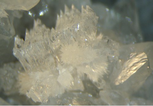


Hoosier Quarry, Salem, Washington County, Indiana, USA