| Locality type: | Mountain |
| Classification |
|---|
|
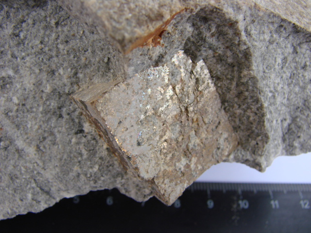
| Species: | Pyrite |
| Formula: | FeS2 |
| Confirmation |
|---|
|
| Validity: | Believed Valid |
| Data |
|---|
|
| Mineral Data: | Click here to view Pyrite data |
| Locality Data: | Click here to view Ayu-Dag Mountain, Alushta, Crimea, Ukraine |
| Photo Gallery | View Gallery (2 photos) |
| Data Identifiers |
|---|
|
| Mindat Occurrence Record ID: | 632644 |
| Long-form Identifier: | 1:3:632644:9 |
| GUID (UUID V4): | 4efb4336-7207-46a8-9c3b-bd108f40b816 |
| Nearest other occurrences of Pyrite |
|---|
|
|
| 6.4km (4.0 miles) | ⓘBondarenkovo Village (Karabakh), Alushta, Crimea, Ukraine |
| 9.9km (6.1 miles) | ⓘKastel Mountain, Alushta, Crimea, Ukraine |
| 33.9km (21.1 miles) | ⓘPervomaiskii quarry, Trudolyubovka, Bakhchysarai, Crimea, Ukraine |
| 51.0km (31.7 miles) | ⓘChernorechye, Balaklava district, Sevastopol, Ukraine |
| 57.7km (35.9 miles) | ⓘPerchem Mountain, Sudak Area, Crimea, Ukraine |
| 59.7km (37.1 miles) | ⓘPsilerakhsky Quarry (Pselerakhsky Quarry), Balaklava district, Sevastopol, Ukraine |
| 66.8km (41.5 miles) | ⓘCape Fiolent, Balaklava district, Sevastopol, Ukraine |
| 76.4km (47.5 miles) | ⓘMalyi Agarmysh Mountain, Staryi Krym area, Belogorsk area, Crimea, Ukraine |
| 76.8km (47.7 miles) | ⓘAgarmysh Mountain, Staryi Krym area, Belogorsk area, Crimea, Ukraine |
| 94.7km (58.8 miles) | ⓘKiik-Atlama mys (Kiik-Atlama cape), Ordzonikidze Village area, Crimea, Ukraine |
| References |
|---|
|
|


Ayu-Dag Mountain, Alushta, Crimea, Ukraine