 | | Report (volume) |
| ......... North Carolina. .......................................................... North Dakota............................................. South Carolina......................................:..........1888. Branner, J. C., The zinc and lead region of north Arkansas: Arkansas Geol. Survey Ann. Kept, for 1892...Fair edition, 1904. Genth, F. A., Minerals of North Carolina: U. S. Geol. Survey Bull. 74, 1891. Shannon...Catalogue of the mineral localities of South Carolina: South Carolina Geol. Survey, ser. 4, Bull. 2, 1908. Scott |
 | | Report (edition) |
| Information Circular GOLD RESOURCES OF NORTH CAROLINA by P. A. Carpenter, D oc ms C% M:*L Raleigh...for the general welfare of the citizens of North Carolina. The section conducts a number of basic and...Geological Survey Section, P.O. Box 27687, Raleigh, North Carolina 26711. Jeffrey C. Reid Chief Geologist Cover...3 Mining Methods and Recovery 3 Gold in North Carolina 5 History of Mining 5 Production 7 General...Deposits of North Carolina 12 Eastern Carolina Belt 12 Portis Mine 14 Other Mines 14 Carolina Slate |
 | | Report (issue) |
| IN NORTH CAROLINA INFORMATION CIRCULAR 29 DEPARTMENT OF ENVIRONMENT, HEALTH AND NATURAL RESOURCES ...agencies for the general welfare of the dtizens of North Carolina. The Section conducts basic and applied research...Resources, at Post Office Box 27687, Raleigh, North Carolina 27611-7687, or call (919) 733-2423. Jeffrey...Chief Geologist GOLD NORTH CAROLINA IN . by P. Albert Carpenter III NORTH CAROLINA GEOLOGICAL SURVEY INFORMATION...INFORMATION CIRCULAR 29 STATE OF NORTH CAROLINA James B. Hunt, Jr., Governor DEPARTMENT OF ENVIRONMENT |
 | | Report (volume) |
| State Museum, Albany. North Carolina.. .Dr. Joseph Hyde Pratt, Chapel Hill. North Dakota... .Dr. A. G...... .Prof. Charles W. Brown, Providence. South Carolina.. .Dr. Earle Sloan, Charleston. South Dakota....See Bauxite and Hallpysite. Asbestos. Tallapoosa County, with corundum deposits near Dudleyville; not found...commercial quantity or quality. Asphalt. Colbert County, small quantity has been shipped from near Leighton;...following localities: Bibb County, Pratts Ferry; Calhoun County, near Tampa; Clay County, T. 20, Pv. 7 E.; Jefferson |
 | | Report (issue) |
| feet above the adjacent lowlands, culminating in North Franklin Peak, whose elevation is 7,140 feet. The...Two prominent sets of joints, striking in general north-south and east-west, traverse the rocks of the Franklin...main faulting is approximately parallel with the north-south trend of the range, and as the strata dip...base of the Franklin Mountains about 12 miles due north of El Paso, but'not enough development has been...that the prospect lies adjacent to one of the main north-south faults. Here the displacement amounts approximately |
 | | Report (issue) |
| Central group ____________________________ _ _ Carolina gneiss ________________________ _ Mica schist...SoutherngrouP----------------------~-- 7 --- Talladega slate ______ ~ _________________ _ Hillabee chlorite schist...__________________________________ _ ~ orth Carolina and South Carolina ______ ____ _ Georgia ______________...34 35 35 36 39 44 44 45 46 47 47 49 49 50 50 Mine descriptions ___________ --------- -- .. -------...___ _______________________ _______ _ Fauquier County ____ ______ ______ _____ _____ _ Franklin ____ |
 | | Report (issue) |
| Gold, base-metal, and related deposits of North Carolina 1011 by Gwendolyn W. Luttrell 12 U.S. Geological... Gold, base-metal, and related deposits of North Carolina Abstract Gold, silver, copper, lead, zinc,...barite, and rare-earths have been mined in North Carolina. Gold, with by-product silver, occurs in veins...along the borders of a granite body in Halifax 18 County. 19 and Vanoe Counties. 20- Tungsten minerals...occur with sulfides in vein|j deposits in Cabarrus County. 21 22 23 24 25- U. S. GOVERNMENT PRINTING OFFICE: |
 | | Report (issue) |
| .'.' .., Mineral Collecting Sites in North Carolina By W. F. Wilson and B. J. McKenzie RUTILE GUMMITE...Information Circular 24 Mineral Collecting Sites in North Carolina By W. F. Wilson and B. J. McKenzie Raleigh...copies of this publication may be obtained from: North CarOlina Department of Natural Resources and Community...for the general welfare of the citizens of North Carolina. The Section conducts a number of basic and...Geological Survey Section, P. O. Box 27687, Raleigh, North Carolina 27611. Eldon P. Allen, Chief Geologist FRONT |
 | | Journal (article/letter/editorial) |
| géodes from the Pinal Mountains about 90 miles north of Tucson. These have been split in half to show...be recorded." Pala is in northwestern San Diego County of Southern California. COLORADO: Prof. Richard...found recently at the essonite (garnet) locality, Redding Station, Fairfield Co., Conn. DELAWARE: A nice...Castle Co., Del. Writes Mr. Pickett: "Iron Hill and Mine Hill are one and the same with Iron Hill being the...occur at the abandoned Laurel Creek corundum mine in Rabun County, where it is associated with corundum. The |
 | | Book (edition) |
| mmed at Broken Arrow aud Trout creek, in Sc. Clair county. The strata in this field are more faulted und...prong of Canoe creek, in St. Clair county, to Ha\sop creek, in Bibb county, a distance of 60 miles. Down to...to Helena, in Shelby county, the field has an average width of 5 or 6 miles. Below that point the width...miles being in the latitud" of Blocton, in Bibb county. The south ern end of this field has a greater...Cahaba field appear to be less interbedded with slate than those of the Warrior; and theCahaba eontains |
| | Report (issue) |
| Information Circular 24 Mineral Collecting Sites in North Carolina By W. F. Wilson and B. J. McKenzie Raleigh...copies of this publication may be obtained from: North Carolina Department of Natural Resources and Community...Geological Survey Section, P. O. Box 27687, Raleigh, North Carolina 27611. Eldon P. Allen, Chief Geologist i ...FRONT COVER PHOTO Twinned emerald crystal from North Carolina, photo from Smithsonian Institution (slide...viable mineral collecting sites through out North Carolina. Some sites are commercially operated during |
 | | Journal (volume) |
| Ore-Buyers' Inspector Henry H. Symons, J. O. Redding San Francisco Technologist Statistician San...Pagh Reports of District Mining Engineers 7 Redding Field District 7 Sacramento Field District 7...classes: 1. Mines and mineral resources of a given county or area (describing kind, character, distribution...and developments). Conejo Oil Field, Ventura County. Shallow wells (100 pumped by jacks and cables...out from field offices that were established in Redding, Auburn, San Francisco and Los Angeles, respectively |
 | | Journal (issue) |
| Cluster of Amethyst Crystals Ellis Jones Amethyst Mine, Due West, S. C. (See page 890 for story of the...STATE’S MINERAL INDUSTRIES — Torn Geiitze! 929 REDDING QUADRANGE MAP SHEET READY .......... ATLANTIC COAST...Tucson Gem and Mineral Society will be held at Pima County Fairgrounds, 4700 S. 6th Ave., Tucson, Ariz. Gc-n...844, Jackson, Miss. 39205. March 4-6, 1966—Gila County Gem & Min eral Show, Miami, Ariz. Chairman: Ernest...San Antonio Rock & Lapi dary Society and Bexar County Mineral Hobby Club. Chairman: Fred Stevenson, P |
 | | Book (volume) |
| .......................................346 North Carolina ........................................................................................356 North Dakota ...............................................................................427 South Carolina ...............................................................548 Table of Maps Page Alabama County Map ...................................................................................4 Alaska County and Stream Map ............................... |
 | | Journal (article/letter/editorial) |
| Fairfield County, Connecticut A CLASSIC MINERAL LOCALITY E D W A R D J. MARCIN 244 Eadon Lane North St. Petersburg...area. Later in the year Reverend J . Dickenson of Redding. Connecticut, a mineral collector, sent a fairly...phosphates and a host of other minerals. History of the Mine As mentioned, the initial opening was in search...minerals by Brush and Dana led to the reopening of the mine purely for the study o f its minerals. After several...and keep all minerals o f no commercial value. The mine was operated until 1895 when its depth made it unprofitable |
 | | Report (issue) |
| varying energy to the present time. The La Grange mine, which is one of the largest hydraulic placers in...KLAMATH MOUNTAINS. GENERAL RELATIONS. The mountain belt of the Pacific coast in California and Oregon includes...the accompanying geologic map (fig. 1). On the north are the Cascade Range and the Coast Range of Oregon...mountain ridges and peaks extending from a point north of the mouth of Rogue River in Oregon to Mad River...of South Fork Mountain and the Salmon Mountains north of Weaverville were formed. The extensive development |
 | | Report (issue) |
| Valley and Ridge slate belt__________ West Virginia slate belt______________ Pennsylvania slate belt______________...belt______________ Other slate-bearing areas____________ Miscellaneous dimension stone____________ Gypsum and anhydrite...Introduction___________________________ Expanded clay, shale, and slate~---------Expanded slag__________________________...____ Districts in Appalachia__________________ North Carolina_____________________ South Carolina_____________________...___________ Ne~ 1:ork_________________________ North Carolina__ _ ________ __ ______ __ Ohio________ |
 | | Journal (volume) |
| Engineer (Librarian) Los Angeles Los Angeles Redding San Francisco San Francisco San Francisco TABLE...Angeles Field Division 1 Redding Field Division 3 Gold Deposits of the Redding and Weaverville Quadrangles...Current Notes 74 Geologic Formations of the Redding-Weaverville Districts, Northern Cali- 77 fornia...of Portions of Del Norte and Siskiyou Counties, North- westernmost California 123 Applications of Geology...classes: 1. Mines and mineral resources of a given County (describing kind, and extent of development). |
 | | Book |
| commercial ores and secondary minerals by state, county, township, and geologic range. For easy identification...61 232 PART The Making 43 II 5 7 3 III Mine PART 267 IV Glossary 279 Bibliography 291...cities, and many of today’s prosperous western county seats began as mining-boom camps. trating sand...Whether you such as those listed alphabetically by county, township, and range in Part II of this book. Where...minerals which make lovely cabinet specimens. old mine western states, to kick up and oxidation, |
 | | Journal (issue) |
| Sacramento San Francisco Los Angeles Los Angeles Redding San Francisco San Francisco San Francisco San...Angeles District 7 Redding Field District 8 Mineral Resources of Trinity County, by Chas. Volney Averill...classes: 1. Mines and mineral resources of a given county or area (describing kind, character, distribution...out from field offices that were established in Redding, Auburn, San Francisco and Los Angeles, respectively...1923 the Redding and Auburn field offices were consolidated and moved to Sacramento. The Redding office |
 | | Report (volume) |
| GEORGE OTJS SMITH, DIRECTOR 372 BIBLIOGRAPHY OF NORTH AMERICAN GEOLOGY FOli 1906 AND 1907 WITH SUBJECT...for 1907. Ottawa, Ontario. 5 6 BIBLIOGRAPHY OF NORTH AMERICAN GEOLOGY, 1906-1907. Canada, Royal Society:...10,11, 12, pp. 1-94. Davenport, Iowa. Delaware County Institute of Science: Proceedings, vol. 1, nos...nos. 1->20. Rochester, N. Y. BIBLIOGRAPHY OF NORTH AMERICAN GEOLOGY, 1906-1901 7 Georgia Geological...features of Maryland; vol. 6; Calvert County; St. Mary's County; State Map. Baltimore, Md. Mazama, vol |
 | | Journal (volume) |
| Sacramento San Francisco Los Angeles Los Angeles Redding San Francisco San Francisco San Francisco San...Page 7 Reports of District Milling' Engineers Redding Field District Sacramento Field District San Francisco...classes Mines and mineral resources of a given county or area (describing kind, character, distribution...out from field offices that were established in Redding, Auburn, San Francisco and Los Angeles, respectively...1923 the Redding and Auburn field offices were consolidated and moved to Sacramento. The Redding office |
 | | Journal (issue) |
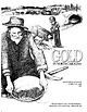
| recreational area on Lake Greeson that is just north of Murfreesboro, Arkansas. He had already examined...(Continues on page~-z) Grand Canyon Uranium: The Orphan Mine Dr. Vivien Gornitz vgornitz@giss.nasa.gov Better...deposit was the Orphan Lode (later renamed the Orphan Mine), located on the south rim of the Grand Canyon,...Grand Canyon National Park are aware that a uranium mine operated here as recently as 35 years ago. The...into park land, beyond the -original claim, but the mine reverted to the National Park Service by 1987. During |
 | | Report (issue) |
| greatest individual increase that of the Copper Queen mine at Bisbee, Ariz. The following table shows the production...Pounds. 3, 565, 629 2,043,586 4,518,034 ton. North Carolina....... Georgia. .. ........... 1905. Pounds...27, 1905; and information furnished the writer by mine owners and managers. 93 94 CONTRIBUTIONS TO...from the fact that preparations are being made to mine and mill 12,000 tons of this ore a day at Bingham... Nev., Nevada Consolidated Copper Company, Ruth mine................ 2.6 Ely, Nev., Nevada Consolidated |
 | | Report (issue) |
| York------------------------------North Carolina-------------------------South Carolina--------------------------South...was discovered in east Northumberland Canyon, Nye County, Nev., by geologists assigned to a Heavy Metals...of Alaska continental shelf. Duke University-North Carolina continental shelf. Louisiana State University-Gulf...geochemical investigations of the Ester-Cleary mineralized belt, Fairbanks district, Alaska. University of Colorado-the...Mountaia, in the lndepenctence Mo·.mtains, 15 miles north of Carlin, Nev. Drilling began in May 1967 and was |


