| Locality type: | Mine |
| Classification |
|---|
|
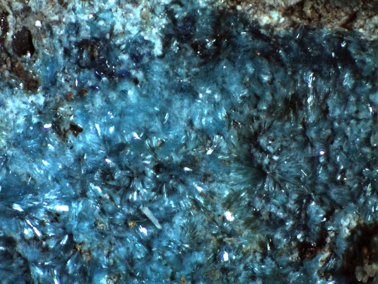
| Species: | Serpierite |
| Formula: | Ca(Cu,Zn)4(SO4)2(OH)6 · 3H2O |
| Confirmation |
|---|
|
| Validity: | Confirmed |
| Confirmation Methods: | Visually Identified |
| Associated Minerals Based on Photo Data: |
|---|
|
| Linarite | ⓘ2 photos of Serpierite associated with Linarite at this locality. |
| Data |
|---|
|
| Mineral Data: | Click here to view Serpierite data |
| Locality Data: | Click here to view Flux Mine (Goshen Mine), Flux Gulch, Alum Gulch, Harshaw Mining District, Patagonia Mountains, Santa Cruz County, Arizona, USA |
| Data Identifiers |
|---|
|
| Mindat Occurrence Record ID: | 1091704 |
| Long-form Identifier: | 1:3:1091704:6 |
| GUID (UUID V4): | e72a79c2-2ac4-4cdf-bfac-abd2033a431c |
| Nearest other occurrences of Serpierite |
|---|
|
|
| 45.0km (28.0 miles) | ⓘNelly James Mine (Miller Canyon deposit; Miller Canyon prospect; Nellie James prospect; Holenstein Mine), Miller Canyon, Miller Peak, Cochise County, Arizona, USA |
| 58.8km (36.5 miles) | ⓘManila Mine, Tombstone Mining District, Cochise County, Arizona, USA |
| 60.0km (37.3 miles) | ⓘGallagher Vanadium & Rare Minerals Corp Mine, Tombstone Mining District, Cochise County, Arizona, USA |
| 85.2km (52.9 miles) | ⓘSan Juan Mine (San Juan group; Gordon Mine; Mann adit; Sulphide adit; Silver adit), Gordon Camp, Middle Pass Mining District, Cochise County, Arizona, USA |
| 87.8km (54.6 miles) | ⓘMiddlemarch Mine, Middle Pass Mining District, Cochise County, Arizona, USA |
| 87.9km (54.6 miles) | ⓘMiddlemarch Mine slag locality, Middlemarch Mine, Middle Pass Mining District, Cochise County, Arizona, USA |
| References |
|---|
|
|


Flux Mine, Flux Gulch, Alum Gulch, Harshaw Mining District, Patagonia Mountains, Santa Cruz County, Arizona, USA