 | | Journal (article/letter/editorial) |
| crystals, Arkansas also boasts an array of other minerals, as evidenced by this county-by-county description...R K A N S A S H A S A R I C H M I N E R A L and mining heri tage that started in the early 1800s with...of Magnet Cove, continued with mining in north ern and western Arkansas and Magnet Cove during the Civil...extensive collecting in Magnet Cove. In the 1900s, mining and minerals continue to play important roles in...the state, with obvious peaks in exploration and mining having occurred during World Wars I and I I . |
 | | Journal (article/letter/editorial) |
| Fluid Inclusion Studies in the Northern Arkansas Zinc District D. L. L•-ACa,R. C. N•-r.SON,AN• D. Wmr...depositsof the MississippiValley type occur in northern Arkansas alongthe southernflank of the Ozark uplift. Geologicallythe...approximately15 weightpercentsalts. The freezingdata for calcite showthat calcitewas deposited from solutions havingsalinitiesfrom...(1935). northeastern Arkansas,but are mainlyconcentrated The rocks of northern Arkansas are all sedimenin...sedimenin Marion, Boone,Searcy, Sharp, and Lawrence Counties. The earliestzinc mining was in the tary and range |
 | Stoffell, B., Appold, M. S., Wilkinson, J. J., McClean, N. A., Jeffries, T. E. (2008) Geochemistry and Evolution of Mississippi Valley-Type Mineralizing Brines from the Tri-State and Northern Arkansas Districts Determined by LA-ICP-MS Microanalysis of Fluid Inclusions. Economic Geology, 103 (7) 1411-1435 doi:10.2113/gsecongeo.103.7.1411 | Journal (article/letter/editorial) |
| Mineralizing Brines from the Tri-State and Northern Arkansas Districts Determined by LA-ICP-MS Microanalysis...United Kingdom Abstract The Tri-State and Northern Arkansas districts of the Ozark plateau, North America...that infiltrated both districts. In the Tri-State district, precipitation of sulfides was most likely driven... possibly rich in reduced sulfur. In northern Arkansas the compositional variations observed are best...from fluorite from the Illinois-Kentucky fluorite district and used neutron activation (Czamanske et al. |
 | | Journal (article/letter/editorial) |
| districts,aswell asthe smaller Introduction Northern Arkansas, Central Missouri, and Southeast korea foreland...the Southeast Mistype deposits. souri, Northern Arkansas,and Tri-State districts, Fluid inclusiondatafrom...brine, in which positionof the ore fluids in each district and can be reactionsbetween the migratingbrine...luidsreflectthe lower Southeast Missouri lead district potassium content of the basinal brine. The relative...relative The Southeast Missouri lead district includes the durationof the zinc-andlead-richstages, andthere- |
 | | Journal (article/letter/editorial) |
| geosciences Article Legacy Lead from Past Mining Activity and Gasoline Additives: Evidence from Lead...in the White River Basin, Southern Ozark Region, USA Adriana Potra 1, *, Laura S. Ruhl 2 and John R. Samuelsen...Geosciences, University of Arkansas, 340 N Campus Drive, Fayetteville, AR 72701, USA Department of Earth Sciences... University of Arkansas at Little Rock, 2801 S University, Little Rock, AR 72204, USA; lsruhl@ualr.edu...edu Arkansas Archeological Survey, 2475 N Hatch AVE, Fayetteville, AR 72704, USA; jsamuel@uark.edu Department |
 | | Report (volume) |
| Bulletin 853 ZI CA D LEAD DEPOSITS OF ORTHER ARKANSAS BY EDWI T. McKNIGHT Prepared in coo pera tion...pper Cave Creek d i tricL _ _ ___ _______________ __________ __ M ount H ersey-lower Cave Creek di t ri..._____ ___ ~ill Creek distri ct_ __________________ _____ _______________ _ Davis Creek-Hurri cane Branch...________ Tomahawk Creek di tri cL _________________________ __ _____ _ ~aum ee-Water Creek d istrict____...ll C reek-Rock Creek district_______________ __ ___ ______ Pa nther Creek-Ingram Creek di t ri ct_ __ |
 | | Book |
| AND MINING AREAS SLICK ROCK DISTRICT GYPSUM VALLEY DISTRICT BULL CANYON DISTRICT URAVAN DISTRICT GATEWAY...GATEWAY DISTRICT (EASTERN GATEWAY AREA) MC ELMO CREEK DRAINAGE AREA LA SAL CREEK AREA PARADOX DISTRICT BEAVER...VALLEY (BIG INDIAN) DISTRICT MOAB DISTRICT GREEN RIVER DISTRICT THOMPSONS DISTRICT INTER-RIVER REGION...INDIAN CREEK REGION DRY VALLEY DISTRICT COTTONWOOD AND BUTLER WASH AREAS MONTEZUMA CANYON DISTRICT SEVEN-MILE...PLATES Paradox Basin Uranium Districts Uranium Mining Areas Within Districts Paradox Basin Domes and |
 | | Report (issue) |
| ____________________________________ _ History of mining and production ________________ _ General description...States. FIGURE 1. Map showing location of uranium-mining districts in West-Central United States-------------------------2...in 1874 at Mauch Chunk (now Jim Thorpe), Carbon County, Pa. ('Genth, 1875, p. 144B). In 1898 a deposit...vanadiferous sandstone was found at Roc Creek, Montrose County, Colo. This deposit was soon exploited...10-year supply at the 1962 mining rate. Parts of the history of exploration and mining are presented in many |
 | | Report (issue) |
| of the Cracow-Silesian Mississippi Valley-type district, southern Poland, with Mississippi Valley-type...MVT district 5 Time of mineralization 6 Source and migration of the ore fluids 7 District ore controls...of the Cracow-Silesian Mississippi Valley-type district, southern Poland, with Mississippi Valley-type...of the Cracow-Silesian Mississippi Valley-type district, southern Poland, provide new constraints on the...provide a basis for comparing the CracowSilesian ore district with deposits of the Mississippi Valley-type in |
 | | Report (issue) |
| Acknowledgments__ _ __________________________ History of mining and ore production _________________ Geologic setting...Formation, __________-_-_-__--_-_Ambrosia Lake district. _________________ Stratigraphy. ________--_--_------_Structure-...-Color relations of the host rocks. _____ Laguna district..-..--.-.--------------Stratigraphy- _______-...Continued Morrison Formation Continued Laguna district Continued Structural relations of the deposits...Color relations of the host rocks _ _____ Gallup district. _________________________ Stratigraphy. ..___________---__-____ |
 | | Journal (article/letter/editorial) |
| ................. Supergene minerals of Arizona mine.................................................................................. Plan of Arizona mine.................................................................. Plan and section of the Wheeler mine................................................................. Plan and section, American Basin mine...................................................Black Warrior mine.......................................................... Plan of Pflum mine.......... |
 | | Report (issue) |
| Paper 172 GOLD QUARTZ VEINS OF THE ALLEGHANY DISTRICT CALIFORNIA BY HENRY G. FERGUSON AND ROGER W...___________________ Mine descriptions. __--__.-_-__-_________ Mines of Oregon Creek drainage basin Brush Creek mine----_---------Finan...prospect--_---_^--_Tomboy prospect___-----____:_-.Eureka mine. _____^-__ __________ Oak prospect..---.-.--...... Ore deposits Continued. Mine descriptions Continued. Mines of Oregon Creek drainage basin Con. Mugwump... Gold Bug prospect._.__________________ Federal mine.________________________ South Fork mine______________________ |
 | | Journal (issue) |
| 11 LOUIS Boost Output wit Bucyrus-Eries. / Mine owners all over the world ee sizes. toVeittherequirements...Wisconsin MINING v ORLD DRIFTS AND PINS: Lest We with which is combined THE MINING JOURNAL Publication...Reliance on U. S. Mine Output ® plans for Greater Told at j Openpit Denver Mining at Joplin * Carson...Divide—by > Mining Men and Their INTERNATIONAL Designs Men Chute by 1952 in International Mining PUBLISHING...evencesanatens HMS 7, SAND PUMPS CONDITIONERS MINING %* A L.P OR FETTERS? HEA States is in one |
 | | Report (issue) |
| i o n a p p r o x i m a t e l y . u r a n i u m mine s i t e s were v i s i t e d . distributed throughout...location, type and s i z e ofmine, condition of mine, host formation, dimensions of remaining water...i s phase of t h e i n v e s t i g a t i o n . Mine o p e r a t i o n d a t a h a s b e e n i n c l...e State Mine I n s p e c t o r s o f f i c e were h e l p f u l i n t h i s area. The mine r e p o r...eachmine ” numberingsystemdevised A NM- by county with o r AZ-mine i d e n t i f i c a t i o n name i n |
| | Report (issue) |
| i o n a p p r o x i m a t e l y . u r a n i u m mine s i t e s were v i s i t e d . distributed throughout...location, type and s i z e ofmine, condition of mine, host formation, dimensions of remaining water...i s phase of t h e i n v e s t i g a t i o n . Mine o p e r a t i o n d a t a h a s b e e n i n c l...e State Mine I n s p e c t o r s o f f i c e were h e l p f u l i n t h i s area. The mine r e p o r...eachmine ” numberingsystemdevised A NM- by county with o r AZ-mine i d e n t i f i c a t i o n name i n |
 | | Report (issue) |
| majority the Grants of the potential uranium district. About 112,500 tons (102,058 metric tons)of $30...understood Grants with such ii uranium a data district New in Mexico base. may Table of Contents ...Sandstone Deposits in the Jurassic Grants uranium district Laguna subdistrict Morrison . Formation 34...mineralization in the Grants uranium district ....... Shiprock district ................ Carrizo Mountains...dates of uranium mineralization in the Grants district . . . . . 40 . . 110 Table 6 .Beach-placer sandstone |
 | | Journal (volume) |
| Bingham, Utah, Mining Black Sand Page. Abbott, James W A Visit to Ely, Nevada Mining at Bingham, Utah...Greenwater District Ditto Ditto Ditto Abyssinia, Minerals In The Requirements of Modern Mining 70S 52...Charles [64 James W. 82 431 114 Nelll 815 District, British W Columbia, The 783 431 795 736 241...Tube-Mill Lining Forbes Rlckard 511 17 The Boundary District The Mineral Output of. In 1906 Broken Hill, Acid...Proprietary Mine, He Treatment at G. D. Del prat Brown, Walter 8 A Filing System for Mining Engineers llucke |
 | | Journal (volume) |
| f.p. for for:v -" ...THE EN. N o GI "RNAL MINE NI'N NG G. J ou VOLUN/1E JANUARY TO LXIII. ...YORPQ. : - . - ". • : THE ENGINEERING AND MINING JOURNAL. VOLUME LXIII. JANUARY TO JULY, 1897...Aluminum, Prices of.................. 565 Accident Mine, Colo.......... 97 63, 159 Aluminum Reduction, Gooch's...118 Alabama Industrial and Scientific Amador Queen Mine, Cal..... ...... 263 Acetylene Gas, Conner's Pat... Doddridge's Pat...... 487 "Alabama, Johns Coal Mine. 74 Amalgamating Process, FischerAcetylene Gas, |
 | | Journal (volume) |
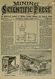
| thorough surprise to the Mining and Scientific Press. possessing the colors of Mining and Scientific Press...Press. ESTABLISHED 1S«50. Oldest Mining; Journal on the American Continent. e. No. 220 Market Street ,...California Delegation in Congress; The Revival of Mining and Mining Machinery; "Jumping," 2. MECHANICAL PROGRESS...Power; Gas Light Unit; Magnetic Map of the Earth, 8. MINING From the Various Counties of California, Nevada...Eastern and Local Metal Markets; Coal and Coke; Mining Share Market; Sales in San Francisco Stock Board; |
 | | Journal (volume) |
| Nevada w^.- *HKI£K UOLXuVKH fKK ANNUM. 2, 1897. Mining Legislation. 'City. \\\'-- Bloffle Copies. ...for keeping the streams dredged. The Champion Mining Company's properties near The Committee on Legislation...The reopening of the old G win mine in Calaveras proposed by the Mining and Scientii-io Pkess and A 10-stamp...Spanish mine is also included putilisiied in the issues of October 31st and November county is an event... shaft, and putting ing properties in Nevada county. There was, when they took charge, up a 40-stamp |
 | | Journal (volume) |
| machines, ventilating apparatus, emery wheels, mining and milling machinery. Particis being given to...employ a large foroe of skilled workmen. a Mining and Scientific Press. through the rotten boards...and Salt- habitants, nearly all of whom follow mining for an occupation. From Huatajia it is about peter...Juan."J [Written Huatajia, is the most productive mining-camp In my last letter (page 448 of Dec. 14tb)...— [Jan. I, 18J0 of Roseburg, has opened a coal mine, located fourteen miles west of this place, that |
 | | Journal (volume) |
| have Mining and Scientific Press. The Miners' Association of Nevada Co. At the recent Mining Convention...crops Is Illimitable^ while the area for profitable mining Is very limited the world over. This and other...this, the Government should protect and foster the mining industry. It ia and with any State organization...the mines proaperlty that would quickly place the mining coantles on their former important level in every...dams, barriers and catchment basins, hydraulic mining may be resumed the debris therefrom restrained |


