Log InRegister
Quick Links : The Mindat ManualThe Rock H. Currier Digital LibraryMindat Newsletter [Free Download]
Home PageAbout MindatThe Mindat ManualHistory of MindatCopyright StatusWho We AreContact UsAdvertise on Mindat
Donate to MindatCorporate SponsorshipSponsor a PageSponsored PagesMindat AdvertisersAdvertise on Mindat
Learning CenterWhat is a mineral?The most common minerals on earthInformation for EducatorsMindat ArticlesThe ElementsThe Rock H. Currier Digital LibraryGeologic Time
Minerals by PropertiesMinerals by ChemistryAdvanced Locality SearchRandom MineralRandom LocalitySearch by minIDLocalities Near MeSearch ArticlesSearch GlossaryMore Search Options
Search For:
Mineral Name:
Locality Name:
Keyword(s):
 
The Mindat ManualAdd a New PhotoRate PhotosLocality Edit ReportCoordinate Completion ReportAdd Glossary Item
Mining CompaniesStatisticsUsersMineral MuseumsClubs & OrganizationsMineral Shows & EventsThe Mindat DirectoryDevice SettingsThe Mineral Quiz
Photo SearchPhoto GalleriesSearch by ColorNew Photos TodayNew Photos YesterdayMembers' Photo GalleriesPast Photo of the Day GalleryPhotography

Graphite from
Foote Lithium Co. Mine, Kings Mountain, Cleveland County, North Carolina, USA


Locality type:Open-Cast Mine
Classification
Species:Graphite
Formula:C
Confirmation
Validity:Believed Valid
Data
Mineral Data:Click here to view Graphite data
Locality Data:Click here to view Foote Lithium Co. Mine, Kings Mountain, Cleveland County, North Carolina, USA
Data Identifiers
Mindat Occurrence Record ID:45091
Long-form Identifier:1:3:45091:3
GUID (UUID V4):f6231a53-756e-43bd-aa26-c62d66be8c23
Nearest other occurrences of Graphite
5.3km (3.3 miles) Kings Mountain Mine (Catawba Mine), Cleveland County, North Carolina, USA
9.1km (5.7 miles) Unnamed Limestone Quarry Fl - 048, Cherokee County, South Carolina, USA
9.5km (5.9 miles) Blacksburg Quarry, Cherokee County, South Carolina, USA
9.7km (6.1 miles) Unnamed Limestone Quarry Fl - 049, Cherokee County, South Carolina, USA
10.1km (6.3 miles) Gaffney-Kings Mountain Manganese, Gaffney area, Cherokee County, South Carolina, USA
11.0km (6.9 miles) Unnamed Limestone Quarry Fl - 052, Cherokee County, South Carolina, USA
11.1km (6.9 miles) Unnamed Limestone Quarry Fl - 050, Cherokee County, South Carolina, USA
12.1km (7.5 miles) Unnamed Limestone Quarry Fl - 054, Kings Mountain Range, Cherokee County, South Carolina, USA
12.4km (7.7 miles) Unnamed Limestone Quarry Fl - 053, Cherokee County, South Carolina, USA
14.3km (8.9 miles) Unnamed Limestone Quarry Fl - 055, Cherokee County, South Carolina, USA
References
Reference Search (possible matching items)
Journal (article/letter/editorial)
atencioite, from the Foote mine, Kings Mountain, Cleveland County, North Carolina, U.S.A., and its relationship...Santos, SP, Brazil 3 303 Church Street, Belmont, North Carolina 28012-3320, U.S.A. 4 Institute of Problems...ne pegmatite at the Foote mine, Kings Mountain, Cleveland County, North Carolina, U.S.A. Associated minerals...mineral from Foote mine described as “triclinic roscherite.” The name is for the Foote mine, type locality...Mn-phosphate, crystal structure, atencioite, Foote mine, North Carolina Introduction approved by the IMA-CNMMN
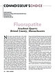
Journal (article/letter/editorial)
rakovajf@miamioh.edu Fluorapatite Acushnet Quarry Bristol County, Massachusetts N orth America has produced some...gemmy, intense purple apatites from this pegmatite mine have made Pulsifer the premier locality for fluorapatite...opinion, and the opinion of many others, another of North America’s finest fluorapatite specimens. It is from...as the J. Keating Company stone quarry), Bristol County, Massachusetts. Rather than a granite pegmatite...fissures form under special conditions during mountain-building events (orogens) that result from collisional
 
and/or  
Mindat Discussions Facebook Logo Instagram Logo Discord Logo
Mindat.org is an outreach project of the Hudson Institute of Mineralogy, a 501(c)(3) not-for-profit organization.
Copyright © mindat.org and the Hudson Institute of Mineralogy 1993-2024, except where stated. Most political location boundaries are © OpenStreetMap contributors. Mindat.org relies on the contributions of thousands of members and supporters. Founded in 2000 by Jolyon Ralph.
Privacy Policy - Terms & Conditions - Contact Us / DMCA issues - Report a bug/vulnerability Current server date and time: May 8, 2024 01:14:11
Go to top of page