 | | Report (issue) |
| Geological Survey editorial standards (or with the North American Stratigraphic Code). Any use of trade,...Site Number, Site Name ...................... 6 County, State, Quadrangle, Latitude, Longitude ................. .61 A. Section A: Occurrences located north of the Hartford basin, New Hampshire .............. 185 I. Section I: Occurrences located in North Carolina ........ 187 INVENTORY OF METAL MINES AND...location ( county, state, quadrangle, latitude, and longitude) 2. deposit size (occurrence type - mine, prospect |
 | | Journal (issue) |
| occurrences, as well as one revised-updated site (Concord mine). Data on these new listings were compiled from...Interest by mining companies continues in the Gold-pyrite belt located in the Piedmont Province and in the mineralized...Piedmont Mining Corporation at the old Moss mine in Goochland County and the Gold Crown Mining Company at the...the Kentuck prospect in Pittsylvania County. It is reported that Minerals and Chemicals Corporation produced...produced five ounces of gold in Ooochland County within the past year. Because of the continuing interest |
 | | Report (volume) |
| applications to be made direct to MINERALS SEPARATION NORTH CORPORATION AMERICAN Head Office, Engineering...Battery Street, New York, N. Y. San Francisco, California. THE MINES HANDBOOK BALL GRANULATORS For...Canada THE MINES HANDBOOK Meeting tbe Needs of Mine and Smelter Hundreds of plants on both American...(all types) Crushers Crushing Rolls NEW YORK Mine Pumps Oil Engines Sampling Machinery Screens Stamp...all the metals, and a corresponding expansion of mine work. The MINES HANDBOOK will hereafter be published |
 | | Report (volume) |
| prospect____________________,.____ 136 Buckeye prospect Wall mine _______________________________ Maris mine_ __ _...Four mine___________ __________________ Mayflower mine _____________________________ Riley Fraction mi...mine______________-___________ Jumping Jack mine.-__________________________ Golden Crater mine_______...No. 9 mine_________ __________________ Stray Dog mine __________________ _________ Little Grey mine__...mine_____________________________ Thanksgiving mine _..__________________________ Deposits in limestone.__ |
 | | Report (issue) |
| & TECHNOLOGY Mineral Deposits of Western Grant County, New Mexico by Elliot Gillerman NEW MEXICO INSTITUTE... . . . . . . . . . . . . 55 Deadman Canyon-California Gulch-Whitewater Canyon area 56 West Burro...Production of metals in the Steeple Rock district, Grant County, 1932-1947 . . . . . . . . . . . . . . . . . ....in the Burro Mountains (Tyrone) district, Grant County, 1904-1929 . . . . . . . . . . . . . . . . . ....Volcanic rocks in western Grant County 20 FIGURES 1. Grant County,. showing area included in this report |
 | | Report (issue) |
| GOLD QUARTZ VEINS OF THE ALLEGHANY DISTRICT CALIFORNIA BY HENRY G. FERGUSON AND ROGER W. GANNETT ...-_____--_--_ Lower slate and greenstone member _ Chert member. ___________________ Upper slate and greenstone...________ Summary. _ _ _ _ _ _ ___________________ Mine descriptions. __--__.-_-__-_________ Mines of Oregon...Oregon Creek drainage basin Brush Creek mine----_---------Finan prospect. ________________ Kate Hardy...prospect--_---_^--_Tomboy prospect___-----____:_-.Eureka mine. _____^-__ __________ Oak prospect..---.-.--... |
 | | Report (issue) |
| the fortieth parallel and adjacent portions of California: U. S. Geol. Survey Bull. 208, pp. 90-93, 1903...4 Jones, C. C., Notes on Manhattan placers, Nye County, Nev.: Eng. and Min. Jour, vol. 88, pp. 101-104...there are steep canyons and rugged hills. A narrow belt along the crest . of the range, above 9,000 feet...contrast to the rough topography below. Here there is a belt of rolling upland, not flat enough to be called...range, as far as Shoshone Creek, a short distance north of Round Mountain, no stream carries sufficient |
 | | Report (issue) |
| OTIS SMITH, DIRECTOR OF THE SIERRA NEVADA OF CALIFORNIA : I I / BY WALDEMAR - LINDGREN OFFICE ...gravels-Continued. Flora of the auriferous gravels of California, by F.' H. Knowlton ...................... ...... _..... _........... : ..... . 92 Perschbaker mine ...................... ...................... .......................... ...... .......... . 139 North Columbia ....................... .......... . ................. . ... : .................. . 139 North Bloomfield, Derbec, and Relief. ............... |
 | | Book (volume) |
| individual mines. ................... T h e Gulick mine. ............................ I 19 23 25-32 25...mines. .............. Roseberry mine. .......................... Shiloh mine ................................. Swayze's hematite mine. .................. Scott farm exploration. ................... (ii i) NEW..................... Edsall mine. ............................. Pochuck mine. ...........................Hamlen mine. ............................ Thatcher mine. ........................... New Village mine. . |
 | | Book |
| Quartz - mudstone - stibnite breccia vein. Eleanora mine. Hillgrove (xO.2). Bibliographic reference Gilligan...Quaternary sediments Granitoids "Deformed granitoid belt" .•..............................................."Massive granitoid belt" Oban River granitoid belt Gundle granitoid belt Coastal granitoid belt ..••.. .•................................... Gundle granitoid belt Round Mountain Leucoadamellite Botumburra Range... Carrai area Willi Willi area Coastal granitoid belt Valla - Nambucca district Yarrabapinni district |
 | | Report (issue) |
| United States are in the Great Basin region in California and Nevada and northwestern Utah, but Oregon...Morango district, Calif.; 5, Weldon, Calif.; Humboldt County, 6, Glendale, Calif.; 7, Darwin, Calif.; 8, Bishop...made to develop a deposit in Euby Valley, Elko County, Nev., and in the same month COFTACT-METAMORPHIC...the Humboldt County Tungsten Mines & Mills Co. Other claims were located west and north of Lovelocks;...west side of Smoky Valley; around Mount Osgood, north of Golconda; in the Eugene Mountains neat Mill City; |
 | | Report (volume) |
| Cover illustration Beryl crystal in quartz, Lacorne mine. The crystal is 39 mm long and 18 mm wide. National...2359J Molybdenite crystal in quartz, Moly Hill mine. The crystal is 33 mm across. National Mineral Collection...Baldwin (Kelmac) mine Swastika (Crescent Kirkland) mine Lucky Cross (Golden Gate) mine Adams mine Boston molybdenite...Boston Creek gold mine Barry-Hollinger (Patricia) mine Boston-McRae mine Planet Gold mine Miller Independence...Independence mine Kennedy-Boston mine Cathroy Larder (Yama) mine Macassa mine Kirkland Lake gold mine Teck-Hughes |
 | | Report (volume) |
| BLACK MOUNTAINS, AND.GRAND WASH CLIFFS MOHAVE COUNTY, ARIZOiNA BY F. C. SCHRADER WASHINGTON GOVERNMENT..._____________ ______.____ ___ 45 Production of Mohave County._____________ 47 General character of deposits...Tennessee mine _____________________._ 54' Schuylkill mine____________________________ 57 Elkhart mine _______:..._______: __________________ 57 Distaff mine ______________________________. 60 Mollie Gibson mine________________________...mine________________________ 60 Hercules mine ________________________ 60 Badger mine______________________________ |
 | | Report (issue) |
| 34 35 35 36 36 36 36 37 CHAPTER 5 CENTRAL AND NORTHERN AUSTRALIAN PLATFORM COVER Geology .................................................. Whim Creek mine ...................................................................................... Mons Cupri mine ...................................................... Evelyn copper mine ............................... Yannery Hill copper mine ....................................................... Breens copper mine ............................................... |
 | | Report (edition) |
| of 407 4L3 Acquiring Titles- ta Prospect or Mine for Copper on 415 South Wales, showing Mining Districts...of New LIST OF PLATES. pa(;k. Cobar Copper mine IJreat Broken Hill Lin>ite(l, , , , P'rontispioce...converted ,, ,, Converter Plant Lloyd Copper Mine into Shell of Copper 113 114 — General View ...Refining Plant 12.1 126 Reservoir Cadia Copper Mine 127 .. Duke Outcrop Smelting Works Iron Duke...186 Plan and Section H>8 Cobar Chesney Main Shaft Mine Section 199 Crowl Creek, Shuttleton, Plan and |
 | | Report (issue) |
| erosion dotted with low residuals. Plain dips gently north and west to Darling River. Dust storms. Local streams...Tower Belt Description and petrography The Alley Belt Description and petrography Biddabirra Belt Description...ore Later faulting of veins Future development of mine (ft) .. The Cobar-Chesney Gold and Copper MineHistory...development (c) 121 121 124 124 127 The Cobar Copper Mine (Old Fort Bourke) Leases History and development...Mines embraced Geology 138 138 The Occidental Mine Leases History and development Veins, character |
 | | Report (issue) |
| throughout the S t a t e from the Kimberleys in the north t o Ravensthorpe near the south coast. The former... . . . . . . . . Other Deposits (Blaelis Copper Mine and Tarraloola) The Gascoyne GoldfieldThe Mangaroon...('attlrn Group T h e Klverdton Mine The 1)esmond Mine l'lre 311. Renwn Mine 181 1$2 182 183 184 185 hillips...have been mined in Western Australia from as far north as the Kimberley Division t o a s far south as Ravensthorpe...Whim Creek, Thaduna, Eulaminna, and the Elverdton Mine at Ravensthorpe. The Northampton deposits lie in |
 | | Book (volume) |
| OFFICE 1956 BERKELEY LIBRARY UNIVERSITY OF CALIFORNIA DEPARTMENT OF SCIENTIFIC AND INDUSTRIAL RESEARCH...Bodmin Moor (p . 578). 10 . Liskeard district North Hill (p . 582) ; Caradon and Phoenix (p. 589); St...district . . 719 .. .. Central Dartmoor (p. 720); North -eastern Dartmoor (p. 725); Southern Dartmoor (p...Cyres Upton Pyne (p. 754). 14. North Devon and Somerset district North Devon (p . 757) ; West Somerset...Wolfram Lode .. . FIG . 35. — Castle-an -Dinas Wolfram Mine; longitudinal section .. .. FIG . 36 . — The |
 | | Report (issue) |
| 29 29 29 CHAPTER nI.-JOHNSON CAMP AREA, COCHISE COUNTY, ARIZONA. By John R. Cooper .....................39 39 39 39 39 40 41 42 43 43 44 45 San Xavier Mine...................................................Extension Mine .................................................................. Olivette Mine ............................................. Helmet Peak Mine............................................................ ......................... Paymaster Mine ................................................. |
 | | Journal (issue) |
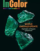
| page: Rough emeralds mined by Gemfields at the Kagem mine in Zambia. (Photo courtesy of Gemfields) CONTENTS...The New Dynamics of the Colombian Emerald Sector Mine Tour 44 22 32 In Search of Colombia’s Green Dreams...Emerald Mines Education 44 50 Education and the Mine-to-Market Story Beautifying Emeralds - The Perennial...Russia: The Geology and Gemology of the Malyshev Mine Emerald Origins 88 98 106 78 4 InColor ׀Special...Yeong ashlynn.yeong@gemstone.org InColor Bureau USA Claudiu Margarit claudiu@gemstone.org [1] (212) 620-0900 |
 | | Book (volume) |
| Bodmin Moor (p. 578). I 0. Liskeard . district . 582 North Hill (p. 582); Caradon and Phoenix (p. 589); St...Valley district 719 Central Dartmoor (p. 720); North-eastern Dartmoor (p. 725); Southern Dartmoor (p...Cyres Upton Pyne (p. 754). 14. North Devon and Somerset district North Devon (p. 757); West Somerset (p...Wolfram Lode 523 FIG. 35.-castle-an-Dinas Wolfram Mine; longitudinal section 524 FIG. 36.-The Phoenix...United Mines Lode 592 FIG. 37.-South Phoenix Mine; transverse section showing the lodes occupying |
 | | Report (issue) |
| . . . . . . . . 77 Faults in the quartzite and slate.. 77 Faults closely connected with folding ....... . . . . . . . . . . . . . . . . . . 79 Faults north of Eureka Gulch......... .. .. .. .. 79 Faults between...170 Northern ore bodies.................. 198 Generalfeatures ~ ___ ..... ___ ... . 170 California column...Channel of the Gemini Chief mine ............................. . 205 mine·---------------------------------... ·... ·._. ___ . __ _ 182 . Eagle and Blue Bell mine .............. . 207 . Principal features of deposits |
 | | Book (volume) |
| Tel: +44 (0)29 2167 4280 Geological Survey of Northern Ireland Dundonald House Upper Newtownards Road.... . . . . . . . . . . . . . . . . . . . . 5 82 North Hill (p. 582); Caradon and Phoenix (p. 589); St....................... Central Dartmoor (p.720); North-eastern Dartmoor (p.725); Southern Dartmoor (p....754 ). 750 14. North Devon and Somerset district ................................ North Devon (p. 757);............. 523 FIG. 35.-Castle-an-Dinas Wolfram Mine; longitudinal section .................. 524 FIG |
 | | Journal (issue) |
| ewslett. Field trip to Bull Run Quarry Loudoun County, Virginia Brander Robinson P.O. Box 76 1 Midd lesburg...co llecting trip to the Bull Run Quarry, Loudoun County, Vi rgini a. This quarry has been in operation...stilbite, and calcite, and has been a favorite of mine for a number of years. Less commonly, molybdenite...with minor stilbite , Bull Run Quarry, Loudoun County, Virginia collected by Brander Robinson, July 1998...than 1 mm long from the Blackbird District, Le mhi County, Idaho, photo by the author. and gives me something |
 | | Book (edition) |
| h • o-•,. • ,!!~' ,I/. (Cover) Nantymwyn Mine, Angred Engine House, Upper Boat Level in background...An attempt has been made to locate and list every mine and trial - an attempt which cannot have been entirely...overall picture as possible of the operations at each mine, •together with some details of any features of...several possess special interest - the Ogofau gold mine not least of these. The location of the occurrences...Brecknock,the valleys behind Cilycwm, Penegarreg mine; and western Pembrokeshire. The silver content of |


