 | | Report (volume) | | ........ 7 Stop 1: Superior (Ash Grove) Silica Quarry .................................................10 Stop 3: Scatter Creek (James Hardie) Silica Quarry..................................................13 Stop 5: Osceola Mudflow in the Corliss Gravel Quarry .................................................inundated by Holocene debris flows from Mount Rainier ....................... 17 3. Photograph of vuggy...alteration in the Scatter Creek (James Hardie) silica quarry ..... 17 4. Geologic map of the White River area |  | | Journal (article/letter/editorial) | | (Mexico), and Mount Adams, Hood, Rainier, and Shasta (Cascade Range, USA), was investigated using field...SO2 in magmatic vapor) and shallow (oxidation of pyrite or H2S) sources. The hydrogen and oxygen isotopic...derived from supergene oxidation of hydrothermal pyrite above the water table. Soluble Al- and Fehydroxysulfates...fumaroles, and from the oxidation of hydrothermal pyrite. Anhydrite/gypsum, often associated with native...minamiite around fumaroles on the summit of Mount Rainier, Washington. Gypsum and anhydrite have been described |  | | Journal (article/letter/editorial) | | expanse of rock contain zeo lites. The Miocene Columbia River plateau, which makes up most of the eastern...volcanic cones (Mount Baker, Glacier Peak, Mount Rainier, Mount St. Helens, and Mount Adams), which make...zeolite local ity found at the surface of the Columbia River Basalt of eastern Washington is the type...these localities have ever been reported. BRITISH COLUMBIA MT BAKER ^ GLACIER PEAK ' SEATTLE PACIFIC*...> MkS^i (^i^^i'M^^j^/'-i. ^ 'W - - D E E COLUMBIA RIVER BASALTi. T / i l / l f TEST WELLS ^ |  | | Journal (issue) | | Vol . 32, April No." 1970 STATE Of OREGON DEPARTMENT Of GEOLOGY AND MINERAL INDUSTRIES The Ore...Ore Bin PubUshed Monthly By STATE OF OREGON DEPARTMENT OF GEOLOGY AND MINERAL INDUSTRIES Head Office: 1009...1009 State Office Bldg., Portland, Oregon - 97201 Telephone, 226 - 2161, Ext. 488 FIELD OFFICES 2033...each. Second c:lass postage paid at Portland, Oregon GOVERNING BOARD Fayette I. Bristol, Rogue River...Information contained herein. Oedit given the State of Oregon D.pcrtmeftt of Geology and Mlnerol Incltslries |  | | Report (issue) | | Bedrock Geology of the Lake Tapps Quadrangle Pierce County Washington GEOLOGICAL SURVEY PROFESSIONAL PAPER... Bedrock Geology of the Lake Tapps Quadrangle Pierce County Washington By LEONARD M. CARD, JR. GEOLOGIC STUDIES...BEDROCK GEOLOGY OF THE LAKE TAPPS QUADRANGLE, PIERCE COUNTY, WASHINGTON By LEONARD M. GARD, JR. ABSTRACT Bedrock... BEDROCK GEOLOGY OF THE LAKE TAPPS QUADRANGLE, PIERCE COUNTY, WASH. their stratigraphic significance. Mr. Brown...have their headwaters in the glaciers of Mount Rainier, a volcanic cone about 15 miles southeast of the |  | | Report (issue) | | o A < ing the mapping. devastated by the Mount Rainier May 18, 1980, erup\\ u* ...the defined by Fiske and others (1963) in Mount Rainier past 50,000 yrs mantles all units (Mullineaux,...1983; Vance and others, 1987) in areas near Mount Rainier and haVe been tentatively extended throughout the...assigned to the Ohanapecosh Formation near Mount Rainier (Vance and others, 1987). ACKNOWLEDGMENTS I appreciate...some from Tower Rock, McCoy Peak, Mt. Rainier 3 SW, and Mt. Rainier 3 SE quadrangles. x, phenocryst observed |  | | Journal (article/letter/editorial) | | specimen of the following minerals. Chalcopyrite, Pyrite, Malachite, Fluorite, Molybdenite, Ferrimolybdite...and chalcocite. In the pegmatite of Strickland Quarry, Portland, uraninite, lepidolite, beryl, columbite...April 4th. Dr. Ralph Holmes, Dept. of Geology, Columbia University, was the Speaker. He gave an illustrated...we found our way up to Mt. Adam. The old granite quarry on the West slope afforded a breathtaking view...explored the Atlas quarry, his property, now mainly used to grow onions. This quarry is an abandoned limestone |  | | Report (issue) | | ..................................171 British Columbia........................................................................................ ..203 Rainier.............................................................................................257 Oregon..................................................Yellowstone 369 Valles 287 Redoubt 250 Spurr 141 Rainier 137 Crater Lake 121 Augustine 100 The second... The single remaining volcano is Mount Rainier. Mount Rainier has been designated a “Decade Volcano” |  | | Journal (issue) | | WASHINGTON May 1, 2010 9:00 am to 5:00 pm Clark County P. U. D. Building 1200 Fort Vancouver Way Vancouver...“Minerals in jasper/chert from the Biggs Area, Oregon” and Don Howard will be showing pictures of “What’s...Park Washington Interstate Bridge Oregon Ft. Vancouver Way Columbia River 2 IN MEMORY OF STAN JOHNSON...because the drive down from Salmon Arm, British Columbia had become just too difficult. We have missed...upper Okanogan Valley and south-central British Columbia. We were sad to not see them regularly any more |  | | Report (issue) | | Prepared in collaboration with the Mount Rainier Natural History AssoCiation GEOLOGICAL SURVEY PROFESSIONAL...GEOLOGY OF MOUNT RAINIER NATIONAL PARK WASHINGTON \I I l GEOLOGY OF MOUNT RAINIER NATIONAL PARK ... Mount Rainier from the northwest. Willis Wall and the head of the Carbon Glacier at left. Mount Adams...from Mount Rainier, at upper right. Photograph by H. Miller Cowling. Geology of Mount Rainier National...PAPER 444 Prepared in cooperation with the Mount Rainier Natural His tory Association .JUL 19 198Q UNITED |  | | Journal (issue) | | OREGON GEOLOGY published by the Oregon Department of Geology and Mineral Industries VOLUME 50, NUMBER...NUMBER 5/6 MAYIJUNE 1988 OREGON GEOLOGY OIL AND GAS NEWS (ISSN 0164-3304) VOLUME 50, NUMBER 5/6 MMS...conference MAY/JUNE 1988 Published bimonthly by the Oregon Department of Geology and Mineral Industries (Volumes...Supervisor Second class postage paid at Portland, Oregon. Subscription rates: 1 year $6; 3 years, $15. Single...subscription orders, renewals, and changes of address to Oregon Geology, 910 State Office Building, Portland, OR |  | John, David A., Lee, Robert G., Breit, George N., Dilles, John H., Calvert, Andrew T., Muffler, L.J. Patrick, Clynne, Michael A. (2019) Pleistocene hydrothermal activity on Brokeoff volcano and in the Maidu volcanic center, Lassen Peak area, northeast California: Evolution of magmatic-hydrothermal systems on stratovolcanoes. Geosphere, 15. 946-982 doi:10.1130/ges02049.1 | Journal (article/letter/editorial) | | California 94025, USA Mineral Deposits Research Unit, University of British Columbia, Vancouver, B.C....Denver, Colorado 80225, USA 4 Oregon State University, Corvallis, Oregon 97331, USA 5 Volcano Science Center...Middlefield Road, Menlo Park, California 94025, USA 1 14 figures; 5 tables; 1 set of supplemental files...eroded stratovolcanoes worldwide, notably Mounts Rainier and Adams in the Cascades and several volcanoes...adularia through intermediate argillic (smectite-pyrite ± illite) to deep propylitic (chlorite-calcite-albite-illite) |  | | Book | | milky quartz stems. Denny Mountain area of King County. Specimen from the collection of Cary A. Maykut...DESCRIPTIONS 21 ABBREVIATIONS 24 GLOSSARY 25 COUNTY INDEX OF MINERAL OCCURRENCES 29 MINERAL DESCRIPTIONS...(using a code explained on page 21) and a county by county list mentioning the nature of their occurrence...Parks and Monuments prohibit all collecting. state, county and city parks usually prohibit collecting. Please...anatase, tourmaline, zircon, chlorite, magnetite, pyrite, chalcopyrite,allanite Rarely: riebeckite, aegirine |  | | Book (edition) | | Mount Rainier Park —U.S. 12 Tacoma— Mount Rainier 151 Washington 706, 123 V The Columbia Plateau...Plateau —Spokane — — — River — Ellensburg Columbia 97 U.S. U.S. 195 Spokane — Lewiston-Clarkston U.S. 395...Coulee City —Moses Lake Washington 129 Clarkston — Oregon Line 1-90 Ellensburg U.S. 2 Wenatchee Spokane...level ice; Spokane floods scour the Columbia Plateau. Mt. Rainier reached maximum size 75,000 years ago;...andesite, basalt loess Winds blow dust east across Columbia Plateau to BEGAN BETWEEN gravel, volcanic debris |  | Frizzell, V.A., Tabor, R.W., Booth, D.B., Ort, K.M., Waitt, R.B. (1984) Preliminary geologic map of the Snoqualmie Pass 1:100,000 Quadrangle, Washington. Open-File Report Vol. 1984 (84-693) US Geological Survey doi:10.3133/ofr84693 | Report (issue) | | Don Swanson provided unpublished data on the Columbia River Basalt Group. Jim Mattinson, Joe Vance,...where it disappears under Miocene lava of the Columbia River Basalt Group, the Straight Creek Fault intersects...expression, stretches from the Wallowa Mountains in Oregon to the Strait of Juan de Fuca between the Olympic...andesite and tuffaceous sandstone Basslt flows (Columbia River Basalt) Andesite and basalt (including...of the southern Cascade Range in Washington and Oregon. In the Snoqualmie Pass quadrangle these rocks |  | | Journal (issue) | | pattern in emerald from Pakistan • Quarterly Crystal: Pyrite in quartz 298 p. 312 Gem News International...from Indonesia • Field trip to Crater of Diamonds, USA • Greenish blue glass imitating gem silica • Marble...Mouawad Campus 5345 Armada Drive Carlsbad, CA 92008 USA © 2020 Gemological Institute of America All rights...operations did take place under managers Peter W. Rainier and Russell W. Anderton. Yet these were not enough...key mine managers or administrators, Peter W. Rainier (1890–1945), Russel W. Anderton (1909–1982), and |  | | Journal (article/letter/editorial) | | mineralization in the southwestern Nevada volcanic field, USA S t e p h e n B. C a s t o r a a n d S t e v e n...School of Mines, Universityof Nevada, Reno, NV 89557. USA bDepartment of Geological Sciences, Mackay School...School of Mines, Universityof Nevada, Reno. NV 89557, USA (Received August 27, 1991; accepted after revision...mineralization in the southwestern Nevada volcanic field, USA. Ore Geol. Rev., 7: 193-223. The southwestern Nevada...of Mines, University of Nevada, Reno, NV 89557, USA. 0169-1368/92/$05.00 © 1992 Elsevier Science Publishers |  | | Report (issue) | | Mount Shasta) and third highest (behind Mount Rainier and Mount Shasta) stratovolcano in the Cascade...Tertiary age. These are predominantly lavas of the Columbia River Basalt Group (Swanson and others, 1979)...active stratovolcanoes near Mount Adams: Mount Rainier (Fiske and others, 1963), Mount St. Helens (Lipman...stratovolcanoes (Mounts Hood, St. Helens, and Rainier), few fragmental deposits have been noted at Mount...than anticipated and sulfides other than sparse pyrite are conspicuously absent (table 3). A few samples |  | | Report (issue) | | MINERALIZATION IN THE VICINITY OF YUCCA MOUNTAIN, NYE COUNTY, NEVADA By EDWIN H. McKEE 1 and JOEL R. BERGQUIST...comprised of two very widespread ash-flow tuffs, the Rainier Mesa Member and overlying Ammonia Tanks Member...Menlo Park, Calif, in 1990. Sample: quartz-calcite-pyrite vein and adularized welded tuff. Comment:: vein...mineralogy: quartz, 75%; adularia, 20% illite, 5%, trace pyrite Analytical data: 4°Ar/39Ar= 3.157, ^Arfl9Ar = 2...1990. Sample: adularia-quartz-pyrite altered ash-flow tuff of the Rainier Mesa Member of the Timber Mountain | | Symonds, Robert B., Janik, C.J., Evans, William C., Ritchie, B.E., Counce, Dale, Poreda, R.J., Iven, Mark (2003) Scrubbing masks magmatic degassing during repose at Cascade-Range and Aleutian-Arc volcanoes. Open-File Report 2003-435. US Geological Survey doi:10.3133/ofr03435 | Report (issue) | | Mount Shasta, Mount Hood, Mount St. Helens, Mount Rainier, Mount Baker, Augustine Volcano, Mount Griggs,...3He/4He coupled with intrusion of new magma (Mount Rainier, Augustine Volcano, Makushin, Mount Shasta). Repose...forms a 1200-km-long arc that extends from British Columbia to northern California. The much longer Aleutian...can be consumed by reacting with Fe2+(aq) to form pyrite (Holland, 1965; Armannsson and others, 1982). Recently...fumarole on September 1984 lobe of lava dome), Mount Rainier (2 cold 4 soda springs at Longmire near base |  | | Report (volume) | | drainage 17 Lahars near the confluence with the Columbia River Lahars in Lower Cascade Creek Trout Lake...curves of the size distribution of lahar near the Columbia River and of two lahars in Cascade Creek near...Washington State about 50 km (kilometers) north of the Columbia River and 50 km east of Mount St. Helens (fig...Salmon River, a southerly flowing tributary of the Columbia River (fig. 1). On other sides of Mount Adams...of Mount Adams, Washington 15' 30' 45' A OREGON 5 0 I 0 I I I 10 KILOMETERS 'iII 'i' \I |  | | Report (issue) | | Renton, Auburn, and Black Diamond Quadrangles, King County, Washington GEOLOGICAL SURVEY PROFESSIONAL PAPER...Renton, Auburn, and Black Diamond Quadrangles, King County, Washington By DONAL R. MULLINEAUX GEOLOGICAL...RENTON, AUBURN, AND BLACK DIAMOND QUADRANGLES, KING COUNTY, WASHINGTON By DONAL E. MULLHSTEAUX ABSTRACT The...continental glacier that originated in British Columbia the Puget lobe moved from there sovthward into...minerals is typical of the mountains of British Columbia and northern AVashington, but these rocks and |  | | Report (issue) | | Geologic Map of the Goat Mountain quadrangle, Cowlitz County, Washington by Russell C. Evarts1 and Roger P...GEOLOGIC MAP OF THE GOAT MOUNTAIN QUADRANGLE, COWLITZ COUNTY, WASHINGTON sy Russell C. Evarts and Roger P....is correlated with similar deposits near Mount Rainier that represent the last two major advances of alpine...variation in three Cascade stratovolcanoes: Jefferson, Rainier, and Shasta: Bulletin Volcanologique, v. 37, p...stratigraphy and extent of glaciation in the Mount Rainier region, Washington: U.S. Geological Survey Professional |  | | Journal (issue) | | OREGON GEOLOG Y Oregon Department of Geology and Mineral Industries Volume 62, Number 3, July 2000 ...available from: Nature of the Northwest, 800 NE Oregon St. #5, Portland, OR 97232, info@naturenw.org or...parallel publication, the magazine Cascadia. —ed OREGON GEOLOGY (ISSN 0164-3304) VOLUME 62, NUMBER 3 ...January, March, May, July, September, November by the Oregon Department of Geology and Mineral Industries. (Volumes...Construction, and Environmental Engineering at Oregon State University. The project scope involves the | 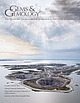 | | Journal (issue) | | emerald source through the adventures of Peter W. Rainier, who directed the mine from 1926 to 1931 and restored...Mouawad Campus 5345 Armada Drive Carlsbad, CA 92008 USA © 2016 Gemological Institute of America All rights...footsteps of its remarkable manager, Peter W. Rainier. Our second paper, by Tim Adams and Christel Ludewig...president and founder of colored gemstone wholesaler Columbia Gem House, noted, “I think we can come up with...“Regulations and Frameworks” section). Eric Braunwart of Columbia Gem House sees financing as a major roadblock; |
|


Rainier Quarry, Rainier, Columbia County, Oregon, USA