 | | Report (issue) | | of the Dark Canyon Instant Study Area, San Juan County, Utah By Joseph L. Weitz, U.S. Geological Survey...location of the Dark Canyon Instant Study Area, Utah, and areas having moderate potential for uranium...occurrences near Dark Canyon Instant Study Area, Utah.................................... 2. 8 Test...of the Dark Canyon Instant Study Area, San Juan County, Utah. MINERAL RESOURCE POTENTIAL SUMMARY STATEMENT...STATEMENT The Dark Canyon Instant Study Area, San Juan County, Utah, (fig. 1) has a low potential for mineral |  | | Book | | White Spruce / 8 5 II Monument Valley / 12 San Juan River / 117 Geology in the Grand Canyon / 129...marked by Mount Taylor, or Tsoodzil. To the west, the San Francisco Peaks, Dook ' o' oosliid, near Flagstaff...the La Plata Range, called Dibe Nitsaa, and the San Juan River distinguish Dine Bikeyah from Ute territory...Shiprock on the west, along a strip south of the San Juan River, through where Farmington arid Aztec are...of 1952 after graduating from the University of Utah. I was beginning my professional career as a petroleum |  | | Book | | Published by Utah Geological Association and Bryce Canyon Natural History Association Utah Geological Association...Canyon National Park Bryce Canyon, Utah 84717 v,rww.nps.gov / brca Utah Geological Association P.O. Box...Salt Lake City, Utah 84152-0100 wvvv.r.utahgeology.org Copyright© 2003 by the Utah Geological Association...1d..'y Oarke, Graphic Designer, Salt Lake City, Utah Printed in Hong Kong by Regal Printing Limited through...photograph: Goblin Valley State Park Courtesy of Utah Di ision of Parks and Recreation (unknown photographer) |  | | Report (issue) | | Hopi Indian Reservations, Arizona, New Mexico, and Utah GEOLOGICAL SURVEY Prepared in cooperation with...Hopi Indian Reservations, Arizona, New Mexico, and Utah By]. H. IRWIN, P.R. STEVENS, and M. E. COOLEY HYDROGEOLOGY...HOPI INDIAN RESERVATIONS, ARIZONA, NE\V MEXICO, AND UTAH GEOLOGICAL SURVEY PROFESSIONAL PAPER 521-C...---------------------------------------Supai Formation and Hermit Shale________________________ Coconino...-------------------------------------------------Toroweap Formation -----------------------------------------------Kaibab |  | | Book | | of erosion, Balanced Rock, Arches National Park, Utah Library of Congress Cataloging-in-Publication Data... North Wilson Trail in Oak Creek Canyon: A Tale of Two Canyons 52 CHAPTER 2. THE SAN FRANCISCO VOLCANIC...VOLCANIC FIELD 57 Hike 3. Inner Basin: San Francisco Mountain’s Glaciated Caldera 60 Hike 4. Bonito Lava...SLICKROCK COUNTRY 118 Hike 16. Honaker Trail: Entrenched Meanders of the San Juan River Hike 17. 123 Twin... Gunnison @ River a San J 8 Mounegat ts IS Durango OF = 1 ©. Juan Basin oe & os 7 Grand |  | | Report (issue) | | and Butler Wash Wilderness Study Areas, San Juan County, Utah U.S. GEOLOGICAL SURVEY BULLETIN 1754-A...and Butler Wash Wilderness Study .Areas, San Juan County, Utah By CHARLES G. PATTERSON, MARGO I. TOTH,...WILDERNESS STUDY AREAS UPPER COLORADO RIVER REGION, UTAH DEPARTMENT OF THE INTERIOR DONALD PAUL MODEL,...and Butler Wash Wilderness study areas, San Juan County, Utah. (Mineral resources of wilderness study...study areas upper Colorado River region, Utah ; ch. A) (U.S. Geological Survey bulletin ; 1754-A) Bibliography: |  | | Book | | r(5a3side EOLOGY of UTAH HALKA CHRONIC Digitized by the Internet Archive in 2014 https://archive...org/details/roadsidegeologyoOOchro_0 roadside VJeology of Utah Halka Chronic MOUNTAIN PRESS PUBLISHING COMPANY...ation Data Chronic, Halka. Roadside geology of Utah / Halka Chronic. cm. (Roadside geology series) p... — Utah—Guide-books. ravel— 1981— Guide-books. QE169.C48 1989 557.92— dc20 dc20 t I. 2. Utah Title...visible on the surface. A more detailed, full-color Utah Geological Highway Map is available from bookstores | 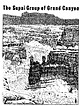 | | Report (issue) | | The two sandstone monuments in the Wescogame Formation, center foreground, are referred to as Wigieeva.......... F. Biostratigraphy of the Watahomigi Formation, by Mackenzie Gordon, Jr. ......................1954, Stratigraphy and history of the Moenkopi Formation of Triassic age: Geological Society of America...Kaibab Formations of northern Arizona and southern Utah: Carnegie Institution of Washington Publication...canyon during some of his classic studies of that formation in 1928. Accessibility to the rocks in the Grand |  | | Report (issue) | | Arizona, Colorado, New Mexico, Utah, and Wyoming^ Excluding the San Juan Basin Regional Aquifer-System...Aquifer-System Analysis Professional Paper 1411-A UTAH r \ * -L.J uses science tor a changing world ^M Geology...Arizona, Colorado, New Mexico, Utah, and Wyoming, Excluding the San Juan Basin By ARTHUR L. GELDON REGIONAL...ANALYSISUPPER COLORADO RIVER BASIN, EXCLUDING SAN JUAN BASIN U.S. GEOLOGICAL SURVEY PROFESSIONAL PAPER...Arizona, Colorado, New Mexico, Utah, and Wyoming, Excluding the San Juan Basin / by Arthur L.Geldon. p |  | | Report (issue) | | ............. . Pennsylvanian System-Hermosa Formation ................. . Paradox Member ............. . Moenkopi Formation ............................................... . Chinle Formation ................................................ . Kayenta Formation ............................................................................................. . San Rafael Group ........................................ . Summerville Formation ................................... . Morrison Formation ................ |  | | Journal (issue) | | largely disqualified. (Cremo and Thompson 1998) The formation of plateau gravels The Plateau Gravels, on which...come in amazing colours and showed me pictures of jasper, various agates, jet, carnelian, obsidian and many...There was almost an ‘alchemical’ aspect and the trail led to fossils, although the triggering influences...in Britain, we have a rich mineral store in the county of Cornwall. A large proportion of the world’s...organic matter in former sediments, leads to the formation of phosphate, mainly as calcium phosphate, in |  | | Report (issue) | | COVER Swamp-forest landscape at time of coal formation : lepidodendrons (left) , sigillarias (in the...Montana, by Donald L. Smith and Ernest H. Gilmour Y. Utah, by John E. Welsh and Harold J. Bissell Z. Arizona...Ernest H. Gilmour______________________________ Y. Utah., by John E. Welsh and Harold J. BisselL_______...environments of deposition a.s they relate to· the formation and occurrence ·of coal beds, particularly with...from Lee County in the southeast corner of the State northwestward to southeastern Kossuth County in north-central |  | | Book | | contributions begins with the earliest European and Mexican explorers who traversed the region and recorded...different from those found in New Mexico, Colorado, Utah or California. Even if some geologic features should...types and the processes responsible for their formation. Although each region on earth has a unique history...occurs in an exceptional deposit on Peridot Mesa near San Carlos, where nodules of the olivine have been brought...event occurred throughout Arizona between the formation of the older Precambrian igneous and metamorphic |  | | Book (edition) | | largest groups of new terms have been U.S. county names; rock-formation names (mostly North American); geophysical...include local geographic terms, U.S. county names, rock-formation names, and fossil names. Indexing for...than 12. The same applies to North American rock-formation names mentioned in the indexed literature (up...term must be a name unique to one area. Lincoln County is not assigned coordinates in the Thesaurus, because...North America from the broader terms of Hanover County. There is no reciprocal entry for each broader |  | | Report (volume) | | Weeks, Fred B., 1902, North American geologic formation names: U.S. Geol. Survey Bull. 191. 2. Wilmarth...reports. LEXICON Abernathy Member (of Joachim Formation) Middle Ordovician: Southeastern Missouri, southern...feet of Abernathy overlies 1 foot of Dutchtown Formation, but is on upthrown side of a fault. Basal member...74, Ph miles east of Dutchtown, Cape Girardeau County, Mo. Type section cut by northtrending fault with...stream in NEIA sec. 33, T. 16 N., R. 14 E, Wayne County. Named after village of Abington, about 3 miles |  | | Book (edition) | | Group, Great Smoky Conglomerate, Great Smoky Formation and Great Smoky Quartzite. By examining the frequencies...the total of 4,284 new Terms were United States county and city Terms. Counties and Cities in the United...States Earlier editions had Terms such as Washington County and Portland for counties and cities of the United...for example: Washington County Arkansas and Portland Maine. Each new county Term can now autopost its...to counties was a major task. The scope of U.S. county and city Terms can now be clear even when they |  | | Report (volume) | | described. Div. Mines, 1; Jenkins, O. P., Choctaw County, Highway 17 area: 3. Toulmin, L. D., Jr., 3. Minor:...analysis: KelH. D., 5. ler, W. D., 3. Talladega County, hematiteOklahoma, potash agstone, granite magnetite...ground water: Powham, C. E. ell, W. J., 4. Marengo County: Newton, J. G., 1. Core-drilling program, ChattanooMica:...J.,4. Excursion, Tertiary type-localiMontgomery County: Reade, ties: Rainwater, E. H. , 1. H. L. , Jr...Harris, H. B. trolled: Braunstein, J., 3. Escambia County: Cagle, J. W. ,Jr. Pollard field: Jones, W. B. |  | | Book (edition) | | Terrane © Springs e Events That Preceded the Formation of the Present Basins and Ranges 49. Sequoia...Other Natural Features 759 Geologic History 764 San Miguel Island ¢ Prince Island ¢ Santa Rosa Island... . ote Nous shorl Bag parr By Bhs IAS ROR hat OE Desh PeCR SEM) Soph) bet cettrst ey if Totigi:...National Park, Utah 9 Badlands National Park, South Dakota 3. Bryce Canyon National Park, Utah 10 Theodore...National Park, Utah 11. Kobuk Valley National Park, Alaska 5 Canyonlands National Park, Utah 12 Great |  | | Report (volume) | | The first compilation, "North American Geologic Formation Names," Bulletin 191, by F. B. Weeks, was published...alphabetical listing of 1,500 North American sedimentary formation names and 100 names applied to igneous rocks,...they had been assigned, and (3) an index list of formation names. The next con1pilation, "The Geologic Time...the history of the nomenclature of a particular formation. For example, the entry for the Ste. Genevieve...superscript (1) shows that the accepted name of the formation as of 1935 was the "Ste. Genevieve Limestone 1n |  | | Report (volume) | | Listed by name of formation; only detailed information indexed Area listing of all formation tables and sections...water: Spencer, G. H., Jr. Minnesota, Fillmore County: Pederson, C. A. New Jersey, Dover district, magnetite:...University Research Studies Geology Series. Provo, Utah. British Columbia Dept. Mines Ann. Rept.-British...Bulletin; Mineral Information Service; Special Report. San Francisco, Calif. Calif. Jour. Mines and Geology-California...Mines and Geology. San Francisco, Calif. Calif. Oil Fields-California Oil Fields. San Francisco, Calif |  | | Book (edition) | | Other Natural Features of the Channel lsiands 363 San Miguel Island Prince Island 365 365 36. . Shenandoah...National Park, Utah Bryce Canyon National Park, Utah Canyonlands National Park, Utah Arches National...National Park, Utah Capitol Reef National Park, Utah Mesa Verde National Park, Colorado Badlands National Park...Period Super- | Group group Geologic Events Formation Slump and slide deposits, Development of Grand...Limestone Deposition in a warm shallow sea; uplift; formation Temple Butte Limestone rine of karst topography |  | | Report (volume) | | University Brigham Young Univ. Geology Studies Provo, Utah. Museum of Comparative Zoology. Brigham Young...Spec. Pub. Studies. Special Publication. Provo, Utah. Brigham Young University Geology British Columbia...Proceedings of the California Academy of Sciences. San California Dept. Water Resources Bull. Bulletin...California Div. Mines and Geology Bull. Bulletin. San Francisco, Calif. California Division of Mines and... Mines and Geology Map Sheet Geology Map Sheet. San Francisco, Calif. California Division of Mines and |  | | Book (volume) | | OnifgBid itm'4\| ^ N « C Ul tXkmA drivlaii) |P USA OTHS* 4dvi»g K.: SiikT irm O4s»**o« hmily 0«!MU...Dyula (African people) Dabasu Formation (China) USE Iren Dabasu Formation (China) Dabba (African people)...family USE Dobson family Dabsu Formation (China) USE Iren Dabasu Formation (China) Dabud (Egypt) USE Temple...Creek (Washington County, Or.) BT Rivers—Oregon Dairy Creek Watershed (Washington County, Or.) BT Watersheds—Oregon...Dakota folk songs USE Folk songs, Dakota Dakota Formation UF Dakota Sandstone BT Formations (Geology)—Great |  | McKee, Edwin D., Crosby, Eleanor J., Bachman, George O., Bell, Kenneth G., Dixon, George H., Frezon, Sherwood E., Glick, Ernest E., Irwin, William P., Mallory, William W., Mapel, William J., Maughan, Edwin K., Prichard, George E., Shideler, Gerald L., Stewart, Gary F., Wanless, Harold R., Wilson, Richard F. (1975) Paleotectonic investigations of the Pennsylvanian System in the United States, Part I: Introduction and regional analyses of the Pennsylvanian System. Professional Paper 8531. US Geological Survey doi:10.3133/pp8531 | Report (issue) | | ar Each int r al i compo d of a mbla member , formation , and group that li tv n reco nizable lithologic...ugg t d, and t he time pan repre ented b each formation i hov n onl in a eneral wa . On plate 1 and throu...ur\ e wa ummarized on data cards, one for each formation or inter al at ach localit or for the entire geolo.... L tt r ymbol indicate elected roup name or formation nam in th eneral area of their u a e. No attempt...be n made to draw boundary lin bet\ en roup or formation of comparable a e . CRO 1 Th writ r ar ind bt |
|


Honaker Trail Formation, Mexican Hat, San Juan County, Utah, USA