 | | Report (issue) | | DIAMOND-BEARING PERIDOTITE IN PIKE COUNTY, ARKANSAS. By HUGH D. MISEK and CLARENCE S. Ross. LOCATION...four places near Murfreesboro, Pike County, in southwestern Arkansas, and at three of these places diamonds...related igneous rocks FIOUKE 65. Map of parts of Arkansas, Oklahoma, and adjacent States, showing the area...that contains the diamond-bearing peridotite of Pike County, Ark. was first discovered, which has been known...TO ECONOMIC GEOLOGY, 1922, PART I. Mauney, and Arkansas. All the other exposures of peridotite occur within |  | | Report (edition) | | STATE OF ARKANSAS BULLETIN 23 S P EC I ES O F A RKA N SA A DIGEST By J. Michael Howard \ 1987... / ARKANSAS GEOLOGICAL COMMISSION Norman F. Williams State Geologist s·' , STATE OF ARKANSAS BULLETIN...23 SPECIES OF ARKANSAS A DIGEST By J. Michael Howard 1987 Little Rock ARKANSAS GEOLOGICAL COMMISSION...State Geologist STATE OF ARKANSAS Bill Clinton, Governor ARKANSAS GEOLOGICAL COMMISSION Norman...Magnet Cove areas of Arkansas. The trip was conducted by Mike Howard of the Arkansas Geological Commission |  | | Report (edition) | | STATE OF ARKANSAS BULLETIN 23 MINERAL SPECIES OF ARKANSAS A DIGEST By J. Michael Howard 1987 Revised...Little Rock ARKANSAS GEOLOGICAL COMMISSION Norman F. Williams State Geologist STATE OF ARKANSAS BULLETIN...SPECIES OF ARKANSAS A DIGEST By J. Michael Howard 1987 Revised 2007 Little Rock ARKANSAS GEOLOGICAL...Williams State Geologist STATE OF ARKANSAS Bill Clinton, Governor ARKANSAS GEOLOGICAL COMMISSION Norman F...Magnet Cove areas of Arkansas. The trip was conducted by Mike Howard of the Arkansas Geological Commission |  | | Book | | Collecting Arkansas JVlinerals A Reference and Guide By Arthur E. Smith, Jr. ,'T Collecting Arkansas...Box 2043 Coeur d’Alene, Idaho 83816-2043 iii Arkansas Counties 1 \ I •( 11 o •« c »««ou cxi ju4«iO«J...573-308-3500 703-648-6045 or phone 800-USA-MAPS Map 3. Arkansas’ Ouachita Mountains 7.5 Minute Quadrangal...Quadrangal Map index. V Contents and Locality Index Arkansas Quartz Crystal Deposits Special Quartz Types....Location 1 Montgomery County quartz deposits................. Other Montgomery County quartz mines...... |  | | Report (volume) | | Bulletins, nos. 10-12. Hartford, Conn. Delaware County Institute of Science: Proceedings, vol. 3, nos...Development Company's Survey. Charleston, Kanawha County, W. Va., 1907. 28 pp., 4 pis. Gives information... and Clement, J. K. 12. The rdle of water in tremolite and certain other minerals. Am. Jour. Sci., 4th...oil-bearing Tertiary formations of Santa Barbara County, California. Smithsonian Misc. Coll., vol. 50 (Quart...1908. 27. The Miner ranch oil field, Contra Costa County, California. U. S. Geol. Survey, Bull. 340, pp |  | | Report (volume) | | GEOLOGY OF THE DE QUEEN AND CADDO GAP QUADRANGLES, ARKANSAS BY HUGH D. MISER AND A. H. PURDUE *"**» » ..._______ General geography and geology of the Arkansas Valley _________ ____ 12 General geography...system_________________ __________.____________ Arkansas novaculite.___---____-_-___-__-_--____-_-_-__...rocks of Arkansas. Age of the peridotite-_____________________________________ Comparison of Arkansas and...period._______________________-_----__---_---------Arkansas novaculite deposition... __________________________ |  | | Journal (article/letter/editorial) | | purple, and grey. These géodes are found in Pike County, Ala., which is about 50 miles north of Montgomery...scattered all over the county, but they are especially abundant just south of Troy, (Pike Co.), Ala, about...Santa Cruz Co., Ariz ARKANSAS—"Last July I spent three weeks at Hot Springs, Arkansas. During my stay I...made several trips to Magnet Cove (Hot Springs County) which is about 15 miles east of Hot Springs on...brachiopod in gray chert. Fowlers Beach is in Sussex County, Delaware, on Delaware Bay. FLORIDA—At the 6th |  | | Journal (article/letter/editorial) | | Alabama P.O. Box 0 Tuscaloosa, Alabama 35486 85° • County Seat ALABAMA'S MINERAL INDUSTRY began in 1818...iron furnace was built near Russellville, Franklin County, utilizing local brown iron-ore (goethite) deposits...Tennessee River Valley area near Huntsville, Madison County, the first such mineralogical description in the...1831 along tributaries of the Coosa River (Chilton County). Utilization of mineral resources in Alabama has...iron ore, clay, marble, bauxite, and Figure 1. County map of Alabama. Courtesy U.S. Geological Survey |  | | Book (volume) | | ...........................................22 Arkansas ...............................................................548 Table of Maps Page Alabama County Map ...................................................................................4 Alaska County and Stream Map ......................................................................22 Arizona County Map .............................................area Site Map ................................48 Arkansas – Carroll Co. Busch area Site Map ........... |  | | Book (volume) | | beds, excavations, etc.Selenite roses. BRULE COUNTY AREA: in the Oacoma zone of the Pierre Fm. On Elm...gray Barite rosette up to 5 or 6 inches. CAMPBELL COUNTY MOUND CITY, W to the Missouri R., regional hillsides...gravels, etc.petrified wood, wood opal. CORSON COUNTY LITTLE EAGLE: area ridges, slopes, stream beds...Guide for Rock Hounds in the United States CUSTER COUNTY AREA: The November Mine, 1.2 mi. SE of the Needles...of rd. a few yds., outcropRose Quartz. DOUGLAS COUNTY CORSICA, S on US 281 to Armour, area rd. cuts, |  | | Book (volume) | | ASHTABULA COUNTY CONNEAUT, area pits, quarries, rd. cuts, etc.⎯cone-in-cone Calcite. CLERMONT COUNTY MILFORD...CLINTON COUNTY WILMINGTON, area of Todd’s Ford, a mineral deposit⎯Hematite. COSHOCTON COUNTY AREA, townships...CUYAHOGA COUNTY CHAGRIN FALLS (on Geauga Co. line), area quarries⎯oilstone. DELAWARE COUNTY DELAWARE...nodules⎯Pyrite (crystals sharply cubic). FRANKLIN COUNTY COLUMBUS, area countywide exposures of blue clay...HIGHLAND COUNTY SINKING SPRING, area ore deposit (most important in Ohio) ⎯Hematite. HOCKING COUNTY AREA |  | | Report (issue) | | Donald Bruce 1. A geologic map of a part of Marion County, Missouri: unpublished Masters thesis, Univ....Mid-Continent Region, KansasMissouri-Oklahoma-Arkansas: American Assoc. Petroleum Geologists, Tulsa...and origin of sulfa-saline ground water, Saline County, Missouri, in Annual report, Water Resources Research...adjoining parts of Oklahoma, Kansas, Missouri, and Arkansas: unpublished Doctoral dissertation, Univ. of Texas...of Highway 21 in Jefferson County as a scenic highway: Jefferson County Planning and Zoning Comm., |  | | Book (volume) | | ASHTABULA COUNTY CONNEAUT, area pits, quarries, rd. cuts, etc.⎯cone-in-cone Calcite. CLERMONT COUNTY MILFORD...CLINTON COUNTY WILMINGTON, area of Todd’s Ford, a mineral deposit⎯Hematite. COSHOCTON COUNTY AREA, townships...CUYAHOGA COUNTY CHAGRIN FALLS (on Geauga Co. line), area quarries⎯oilstone. DELAWARE COUNTY DELAWARE...nodules⎯Pyrite (crystals sharply cubic). FRANKLIN COUNTY COLUMBUS, area countywide exposures of blue clay...HIGHLAND COUNTY SINKING SPRING, area ore deposit (most important in Ohio) ⎯Hematite. HOCKING COUNTY AREA |  | | Report (issue) | | 4, A1 2 O 3 26.8, Na 2 O 16.3, Lenni, Delaware County. Crystals. Eyerman, 1911, 11. Composition: Analysis:...Sp.gr LOCALITIES: Berks County: Birdsboro, and Gickerville; Delaware County: Leiperville, Lenni (druses...Felton's farm (Chester), and Ward's quarry; Montgomery County: Sumneytown, and Perkiomenville ; Philadelphia:...cut east of Reading (probably Birdsboro), Berks County. White, Smith, 1910, 540. silky mass of radiating...42 9.86 4.77 13.60 100.69 2.277 LOCALITY: Berks County: Birdsboro. MESOLITE m Na Al Si3Oio.2H O 2 2 |  | | Report (volume) | | Alabama.........Dr. Eugene A. Smith, University. Arkansas..........Dr. A. H. Purdue, Nashville, Tenn. California...See Bauxite and Hallpysite. Asbestos. Tallapoosa County, with corundum deposits near Dudleyville; not found...commercial quantity or quality. Asphalt. Colbert County, small quantity has been shipped from near Leighton;...following localities: Bibb County, Pratts Ferry; Calhoun County, near Tampa; Clay County, T. 20, Pv. 7 E.; Jefferson...Jefferson County, at Elyton; Lee County, at Chewacla lime works; St. Clair County, at Gfeensport; Shelby |  | | Journal (article/letter/editorial) | | Occurrence in Carroll County, Georgia" (November/December 1988). Banks County 184 ROCKS & MINERALS...Bentley provided many of the photographs. Baldwin County Milledgeville district—between the State Sanitarium...pit—east of S.R. 243 near the Baldwin-Wilkerson County line: kaolinite (Martin and Stafford, 1972). Cheatham...property—Route 3, Commerce, 4.8 km from the Jackson County line, 8 km east of Commerce on S.R. 59, and 0.8...[University of Calgary] at 09:55 07 August 2017 Barrow County Arnold mine—1.6 km northeast of Statham, near the |  | | Book (volume) | | ...........................................19 Arkansas ................................................rights, so remember you were told. If in doubt, a county map will tell you who the legal owner is. Good...gemmy qualities for cutting and polishing. AUTAUGA COUNTY PRATTVILLE, N. 6 mi., and just E of the Birmingham...were well known to prehistoric Indians.) BARBOUR COUNTY BAKER HILL, SE 1 mi. : 1 in a deep ravine, as a...deep red to variegated⎯ocher. BIBB COUNTY GENERAL AREA: c county gravel pits along the Cahaba R.⎯gemmy |  | | Book (volume) | | ...........................................19 Arkansas ................................................rights, so remember you were told. If in doubt, a county map will tell you who the legal owner is. Good...gemmy qualities for cutting and polishing. AUTAUGA COUNTY PRATTVILLE, N. 6 mi., and just E of the Birmingham...were well known to prehistoric Indians.) BARBOUR COUNTY BAKER HILL, SE 1 mi. : 1 in a deep ravine, as a...deep red to variegated⎯ocher. BIBB COUNTY GENERAL AREA: c county gravel pits along the Cahaba R.⎯gemmy | 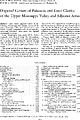 | | Journal (article/letter/editorial) | | sphene, spinel, staurolite, topaz, tourmaline, tremolite, zircon, zoisite, and others. Although all these... 1943, p. 536-537), epidote, hornblende, and tremolite (Grawe and Cullinson, 1931, p. 320-326; Derry...Kentucky, southern Illinois, and southeast Missouri Arkansas, west Kentucky, south Illinois southeast Missouri...staurolite, monazite, topaz, sphene, actinolite, and tremolite. These minerals do not exhibit corrosive structures... 1951, Petrography of the Wilcox formation of Arkansas (Abstract): Am. Mineralogist, v. 36, p. 310 Alty |  | | Report (volume) | | Boletin de Minas, no. 1. Habana, Cuba. Delaware County Institute of Science: Proceedings, vol. 7, nos...Chicago, 111. West Virginia Geological Survey: County Reports, Lewis and Gilmore; Raleigh, Summers, and.... 3. The Weedon or McDonald copper mine [Wolf County, Province of Quebec, Canada] : Canadian Min. Inst...economic value of the pitchblende deposits of Gilpin County, Colorado: Econ. Geology, vol. 11, no. 3, pp. 266-275...Ball, Sydney H. . 30. The lead mines of Washington County, Missouri: Min. and Sci. Press, vol. 113, no. 23 |  | | Book (edition) | | from the Tourmaline Q ueen .1ine, Pala, San Diego County, California. From a pen-and-ink drawing by W. E...illemite, Sphene, Augelite, Scheelite, Diopside, Tremolite, Augite, Scapolite, Tugtupite, Hemimorphite, Legrandite...1. Crater of Diamonds, Arkansas 2. Star of Arkansas crystal 3. Star of Arkansas marquise cut gem 4. Mounce...of tourmaline crystal forms 38. Map of San Diego County, California gem sources 3 9. Stewart Lithia· and...View of Clear Creek, San Benito County, California 55. Monterey County jade-producing shoreline, California |  | | Report (volume) | | ............................................. Arkansas.................................................mineralogic reports, especially from those of Arkansas, California, Colorado, New Mexico, Oregon, South...examination of the geology of western central Arkansas: Arkansas Geol. Survey Ann. Kept, for 1888, vol. 1...J. C., The zinc and lead region of north Arkansas: Arkansas Geol. Survey Ann. Kept, for 1892, vol. 5...relative to the economic-geologic products of Arkansas, prepared for the Southern Commercial Congress |  | | Report (chapter) | | diamondiferous micaceous peridotite at Prairie Creek, Arkansas, as a lamproite substantiate their economic importance...micaceous peridotite at Prairie Creek, Murfreesboro, Arkansas, from a kimberlite (albeit anomalous) (Miser &... Rosenbusch (1887) classed the Prairie Creek, Arkansas, lamproite with biotite-peridotites but the Leucite...albanites. Tr6ger (1935) placed the Prairie Creek, Arkansas, lamproite in his glimmerite Family (no. 721,...a mineral assemblage of phlogopite, diopside, tremolite (or talc), K-feldspar, apatite, sphene, monazite |  | | Report (issue) | | ___________ Clinochrysotile (Globe-type), Gila County, Ariz___________________________________________...Clinoehrysotile (iron-bearing serpentine), Stillwater County, Mont_________________________ Clinochrysotile...Hill, Harford County, Md____________________ Clinochrysotile and lizardite, Morris County, N.J________...Clinochrysotile and lizardite, variant form, Morris County, N.J.____________________________ Lizardite plus...section___________-___ Lizardite (deweylite), Delaware County, Pa__-___________-_____________-_---__---__--_-Lizardite |  | | Journal (article/letter/editorial) | | location a~ included at the end of each entry. Adair County Chariton River (40-04-05N 92-4 I -23W). septarian...septarian concretions about 2 miles north of the Macon county line. CALCITE crystals enclosing bundles of acicular...hematite, quartz (Broadhead 1873b, 1877). Audrain County Mexico, in fire clay pits and spoil piles: PYRITE...University Library] at 19:58 29 October 2014 Barton County McKarrow’s coal bank (37-37N 94-28W), 2.5 miles...PICKERINGITE, pyrite, siderite (Broadhead 1873b). Bates County Panther Creek, northwest of Rockville in coal deposits: |
|


