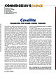
 | | Journal (article/letter/editorial) | | November 2014 Covellite Summitville, Rio Grande County, Colorado Two minerals are typically formed when...exposed to near-surface weathering environments: chalcocite and the somewhat less abundant covellite. Both...discovery in an active mine makes them briefly available to collectors. Chalcocite has been featured in...chalcopyrite, chalcocite, enargite, arsenopyrite, sphalerite, and bornite. Excellent chalcocite pseudomorphs...description of the fundamental chemistry of covellite, chalcocite, and related secondary copper minerals and of |  | | Journal (article/letter/editorial) | | BEDS" OF TEXAS. M. R•CHARD. INTRODUCTION. A generalreconnaissance of the Permianin Texas was undertakenby...Theareatowhich thisarticle refersisa partof north-central Texas, comprisingthe countiesof Hardeman,Knox, King, Haskell...Northern Texas," Bull. Geol. Soc. •tmerica, Vol. •4, •9o3 ß Cummins, W. F., "The Permian of Texas and its... COPPER DEPOSITS IN "RED BEDS" OF TEXAS. 635 Beds,"First Ann. Rept. Texas Geol.Survey,•898. Gordon,C. H...the geologyof northwestTexas: Fourth Ann. Rept. Texas Geol. Survey, I892. Professional PaperNo. 68. U |  | | Journal (article/letter/editorial) | | Texas mineral locality INDEX Whereas Texas is well known for its vastness, cattle industry, and oil...I T S T O P O G R A P H Y A N D G E O L O G Y , Texas, the second largest state, has produced relatively...famous localities. A s this article will show, Texas has had—or currently has—nu merous mineral occurrences...produce good specimens; yet when specimens from Texas are sought in collections and dealers' stocks, few...some basic facts that help explain the situation. Texas has very little federal land in its mineralized |  | | Journal (article/letter/editorial) | | Copper Mine Downloaded by [North Carolina State University] at 23:01 15 March 2015 SAN JUAN COUNTY, UTAH...his collection THE BIG INDIAN COPPER MINE is an open-pit copper mine located within the Big Indian mining...mining district in San Juan County, Utah, approximately 33 miles northwest of Monticello and about the same...same distance southeast of Moab. The mine has been a noted source of exceptionally fine specimens of azurite...miles south of the Big Indian Copper mine along San Juan County Route 106 (Big Indian Road). 372 ROCKS |  | | Report (issue) | | for foreign countries, if a given name refers to a mine or deposit, a nearby location or administrative...names may be used to refer to a single deposit or mine. For large deposits or mineralized areas, a 3 single...is meant to identify the area, deposit, district, mine, or occurrence to which the geologic, economic,...note on the deposits in Georgia and South Carolina, USA, in Notholt, A.J.G., Sheldon, R.P., and Davidson...B., 1989b, The phosphate deposits of Tennessee, USA, in Notholt, A.J.G., Sheldon, R.P., and Davidson |  | | Journal (article/letter/editorial) | | also present. "Specimen comes from a mine somewhere in Yuma County, Arizona."—on label. ARKANSAS—In the...of Diamonds is an abandoned diamond mine (the only diamond mine in the U.S.) that has been opened up...(west of the city). That would be in Jefferson County."—letter dated—June 31, 1956, from Marie Kennedy...of a fish. Nokomis, in the S.W. part of Sarasota County, is on the Gulf of Mexico. GEORGIA—The following...between Canton and Ball Ground (both in Cherokee County, Ga.). It is 2 cm. across, dark red apparently |  | | Report (volume) | | .......Mr. George H. Ashley, Washington, D. C. Texas............Dr. William B. Phillips, Austin. Vermont...See Bauxite and Hallpysite. Asbestos. Tallapoosa County, with corundum deposits near Dudleyville; not found...commercial quantity or quality. Asphalt. Colbert County, small quantity has been shipped from near Leighton;...following localities: Bibb County, Pratts Ferry; Calhoun County, near Tampa; Clay County, T. 20, Pv. 7 E.; Jefferson...Jefferson County, at Elyton; Lee County, at Chewacla lime works; St. Clair County, at Gfeensport; Shelby |  | | Journal (article/letter/editorial) | | Nickeline*2/safflorite Orcelite Chalcopyrite 'Bornite' 'Chalcocite' Pyrite Galena Sphalerite Titanium dioxide Quartz...nickeline (or maucherite ). The exact nature of the "chalcocite" and "bornite" is not known. *~lncludes apatite...of Cu sulfides (chalcopyrite, "bornite" and "chalcocite"). For simplicity, we refer only to nickeline...nickeline. It has a grayish blue color and looks like chalcocite, but analysis of a relatively large patch (10...composition (Cu 1.65-1.68S ) during anodic oxidation of chalcocite. X-ray diffraction showed that struc- J.O. NYSTROM |  | | Book (volume) | | Dahlonega Co. and Rabum Co., and the McDuffie County Belt extending through portions of McDuffie, Warren...Sphalerite. BALDWIN COUNTY MILLEDGEVILLE, at state farmjasper. BANKS COUNTY COMMERCE, along Hwy. 59...along adjoining Co. linerock crystal. BARROW COUNTY WINDER, along rd. to Jefferson and 1½ mi. inside...Guide for Rock Hounds in the United States BARTOW COUNTY AREA, Saltpeter Cave, as floatjasper. CARTERSVILLE:...agate, (banded, various colors), jasper. BIBB COUNTY MACON: at Holton Quarry, 7½ mi. NWagate; N |  | | Report (volume) | | 248 259 269 271 275 281 r 4 CONTENTS. Page. Texas...................................................New Mexico, Oregon, South Dakota, Tennessee, and Texas; to list all the literature consulted would be impracticable...Phillips, W. B., The mineral resources of Texas: Univ. Texas Bull. 365, Sci. Ser. 29, 1914. Among other...See Bauxite and Halloysite. Asbestos. Tallapoosa County, with corundum deposits near Dudleyville; not found...commercial quantity or quality. Asphalt. Colbert County, small quantity has been shipped from near Leighton; |  | | Book | | commercial ores and secondary minerals by state, county, township, and geologic range. For easy identification...61 232 PART The Making 43 II 5 7 3 III Mine PART 267 IV Glossary 279 Bibliography 291...cities, and many of today’s prosperous western county seats began as mining-boom camps. trating sand...Whether you such as those listed alphabetically by county, township, and range in Part II of this book. Where...minerals which make lovely cabinet specimens. old mine western states, to kick up and oxidation, |  | | Book (volume) | | ...........................................444 Texas .................................................................548 Table of Maps Page Alabama County Map ...................................................................................4 Alaska County and Stream Map ......................................................................22 Arizona County Map ..................................................................45 Arizona – Yuma Co. Hull Mine Site Map ...................................... |  | | Book (volume) | | 600 to 800 feet thick in the north. ALEXANDER COUNTY FAYVILLE, area stream gravels⎯agate, jasper, rare...⎯agate, jasper; d RR siding of Clay⎯agate. CALHOUN COUNTY AREA, shores of the Mississippi R., in the Warsaw...crystals). CRAWFORD COUNTY PALESTINE, area deposits⎯Siderite. EDWARDS COUNTY AREA, T. 1 S, R. 10 E...deposits⎯Siderite. FULTON COUNTY FARMINGTON, W 6 mi. on Rte. 116 to the Rapatee No. 5 strip mine⎯pyritized gastropods...gastropods (Pennsylvanian age). GRUNDY COUNTY AREA: c Regional rd. and RR cuts and banks of Mason Cr.⎯fossils; |  | | Book (volume) | | 600 to 800 feet thick in the north. ALEXANDER COUNTY FAYVILLE, area stream gravels⎯agate, jasper, rare...⎯agate, jasper; d RR siding of Clay⎯agate. CALHOUN COUNTY AREA, shores of the Mississippi R., in the Warsaw...crystals). CRAWFORD COUNTY PALESTINE, area deposits⎯Siderite. EDWARDS COUNTY AREA, T. 1 S, R. 10 E...deposits⎯Siderite. FULTON COUNTY FARMINGTON, W 6 mi. on Rte. 116 to the Rapatee No. 5 strip mine⎯pyritized gastropods...gastropods (Pennsylvanian age). GRUNDY COUNTY AREA: c Regional rd. and RR cuts and banks of Mason Cr.⎯fossils; |  | | Report (issue) | | ....................................... Bonanza mine... . . . . . . . . . . . . . . . . . . . . . . .... . . . . . . . . . . . . . . . . . . . Nikolai mine . . . . . . . . . . . . . . . . . . . . . . . ....20 A, View of Nikolai mine across upper Nikolai Creek; B, View of Bonanza mine from Horseshoe trail ••...the Chistochina in 1898), and the Nikolai copper mine on the Chitina was located. In spite of the undoubted...continue eastward as the McClellan trail to the Nizina in the vicinity of the Nikolai mine. Another route, sometimes |  | | Journal (issue) | | Tim Neall Mud-filled fluorite vugs in Greenlaws mine, Weardale, Co. Durham Stephen Moreton Gearksutite...lding and Andy G. Tindle Cotunnite from Penrhyn Du Mine, Gwynedd, Wales Neil Hubbard and David I. Green...An update of the supergene mineralogy of Hilton mine, Scordale, Cumbria Trevor F Bridges and David I...fluorite from Rampgill, Coalcleugh and Bameycraig mine system, Nenthead, Cumbria, England - an update Trevor...an update on the supergene mineralogy of Hilton mine in Cumbria where they have found the arsenates adamite |  | | Report (volume) | | Augusta, M . Maryland Geological Survey: Baltimore County. Baltimore, Md. Meddelelser om Gronland, Bd. 71-76~...Science: Journal, vols. 4, 5. Nashville, Tenn. Texas, University, Bureau of Economic Geology and Technology:...West Virginia Geological Survey: (County Reports) Pocahontas County. Mor· gantown, W. Va. I · Wisconsin... and Smith, R. H.) . . Hendrick field, Winkler County, Tex.: Am. Assoc. Petroleum Geologists, Bull.,...September-October, 1930. Adams, John Emery. 7. Triassic of west Texas: Am. Assoc. Petroleum Geologists, Bull., vol. 13 |  | | Report (issue) | | 3i University of Nevada Press, Reno, Nevada 89557 USA Copyright© 2004 by Uni versity of Nevada Press Photographs...te, r.6-cm cluster, Majuba Hill Mine, Antelope district, Pershing County. N. Prenn coJlection. Photograph...Goodsprings (Yellow Pine) Mining District, Clark County John C. Kepper MINERAL CATALOG 91 121 Gregory...Hen1in1orphite Azurile Barite, N1eikJe Mine Barite, '\forthun1berland Mine Bante, Rosebud t1ine Barile v;ith...inclusions Bolt½'OOdite Calcite, Meikle Mine Calcite, Getchell Mine Callaghanite Cassiterite and Hema tile |  | | Book | | volume is dedicated is four-fold: (1) To locate by mine, deposit, or community those mineralized areas of...Co. Hematite CALERA, Shelby Co. Wavkllite CLAY COUNTY, Sec. 24. T. 19 S R., 7 E. STATUARY, Coosa Co...Co., (W. border of* Marble Crystalline TALLADEGA COUNTY Marble, (crystalline) VALLEY HEAD, DeKalb Co. Hematite...VILLAGE SPRINGS, Blount Co. Hematite WOODS COPPER MINE, Cloaburne Co. Sphalerite ARIZONA COVEI.I.ITE...Feldspar HISSOP, Coosa Co., (near) Beryl JACKSON COUNTY Hematite KENNEDYS, Clay Co., (near) Magnetite MILLERVILLE |  | | Book (volume) | | ...........................................380 Texas ..................................................rights, so remember you were told. If in doubt, a county map will tell you who the legal owner is. Good...gemmy qualities for cutting and polishing. AUTAUGA COUNTY PRATTVILLE, N. 6 mi., and just E of the Birmingham...were well known to prehistoric Indians.) BARBOUR COUNTY BAKER HILL, SE 1 mi. : 1 in a deep ravine, as a...deep red to variegated⎯ocher. BIBB COUNTY GENERAL AREA: c county gravel pits along the Cahaba R.⎯gemmy |  | | Book (volume) | | ...........................................380 Texas ..................................................rights, so remember you were told. If in doubt, a county map will tell you who the legal owner is. Good...gemmy qualities for cutting and polishing. AUTAUGA COUNTY PRATTVILLE, N. 6 mi., and just E of the Birmingham...were well known to prehistoric Indians.) BARBOUR COUNTY BAKER HILL, SE 1 mi. : 1 in a deep ravine, as a...deep red to variegated⎯ocher. BIBB COUNTY GENERAL AREA: c county gravel pits along the Cahaba R.⎯gemmy |  | | Report (issue) | | INDEX OF MINING PROPERTIES IN COCHISE COUNTY., ARIZONA by Stanton B. Keith Geologist Bulletin 187...Employer. INDEX OF MINING PROPERTIES IN COCHISE COUNTY, ARIZONA by Stanton B. Keith Geologist Bulletin...Warren (Bisbee) mining district, which includes this mine, yielded 167,242,000 tons of ore from 1880 to 1981... 10. Index Map to Mining Districts in Cochise County and Explanation of Geologic Symbols. . • • California...geologic framework and mineral resources of Cochise County have been released. Because the bulletin was reprinted |  | | Report (issue) | | ROGER P. ASH LEY The Republic Gold District, Ferry County, Washington By MORTIMER H. STMTZ and ROBERT C....ores-Wash1ngton-Ferry County 3 Hydrothermal deposits-Nevada 4 Hydrothermal depos1ts-Wash1ngton-Ferry County I Geologrcal...cited HU H11 The Republic gold district, Ferry County, Washington Abstract H14 Introduction H14 Geologic...Generalized geology of the Republic graben, Ferry County, H16 Washington H6 Index map showing the mines...Gold Deposits- Part I H1 except the Florence mine were consolidated as the Goldfield Consolidated | | | Report (issue) | | 31 University of Nevada Press, Reno, Nevada 89557 USA Copyright © 2004 by University of Nevada Press Photographs...Olivenite, 1.6-cm cluster, Majuba Hill Mine, Antelope district, Pershing County. N. Prenn collection. Photograph...Goodsprings (Yellow Pine) Mining District, Clark County John C. Kepper 91 References 467 Contributors...COLOR PLATES (following page 242) Gold, Mexican Mine Gold, Majuba Placer Pyromorphite after Galena with...with Conichalcite Gold, Round Mountain Mine Quartz, Lovelock area Acanthite Grossular, Nightingale |  | | Report (volume) | | Shepard, Mount Shields, and McNamara Formations. County records show that 131 mining claims have been located...18.2 and 45.2 percent copper, from the Porto Rico mine at Mineral Hill and a group of prospects at Bugle...began in 1884 with the discovery of the Jay Gould mine, which by 1915 had produced gold and minor amounts...metamorphosed Belt rocks. Placer deposits in McClellan Gulch, about 6 miles west of Stemple Pass, produced...through World War II, especially in the Mike Horse mine. Lead, some silver and gold, and small but appreciable |
|


