 | | Journal (article/letter/editorial) | | known for its wire and leaf gold, smoky quark, and turquoise specimens, New Mexico boasts an array of mineral...Albuquerque, New Mexico 87110 THE PURPOSE OF THIS INDEX is to provide a comprehensive listing of New Mexico...Particular attention was directed toward incorporating new information on discoveries and occurrences, although...to compile all of the mineral occurrences in New Mexico-a venture of that magnitude is beyond the scope...Minerals of New Mexico is the basic reference for locations. Abstracts from the New Mexico mineral symposia |  | | Book (edition) | | org/details/mineralsofnewmexOOnort MINERALS OF NEW MEXICO Before all things, there which has them ...that 1825 mining opened the West- . —Charles W. Henderson, 1933 MINERALS of New Mexico STUART A...Mew Mexico PROPERTY OF HBSIER JR. HIGH SCH LIBRARY Revised Edition UNIVERSITY OF NEW MEXICO PRESS...ALBUQUERQUE © 1944. 1959. UNIVERSITY OFNEW MEXICO PRESS ALL RIGHTS RESERVED REVISED EDITION LIBRARY...BOUND AT THE UNIVERSITY OF NEW MEXICO PRINTING PLANT ALBUQUERQUE, NEW MEXICO, U. S. A. FOR IVAH 1 |  | | Report (issue) | | BULLETIN 39 The Metal Resources of New Mexico and Their Economic Features Through 1954 A revision of...RESOURCES NEW MEXICO INSTITUTE OF MINING & TECHNOLOGY CAMPUS STATION SOCORRO, NEW MEXICO NEW MEXICO INSTITUTE...INSTITUTE OF MINING & TECHNOLOGY E. J. Workman, President STATE BUREAU OF MINES AND MINERAL RESOURCES Alvin...THE HONORABLE EDWIN L. MECHEM………...Governor of New Mexico MRS. GEORGIA L. LUSK ......................Superintendent...Dealing With the Geology and Mineral Resources of New Mexico ............................................ | 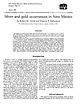 | | Map | | New Mexico Bureau of Mines & Mineral Resources Resource Map 15 March 1986 Silver and gold occurrences...occurrences in New Mexico by Robert M. North and Virginia T. Mclemore New Mexico Bureau of Mines and Mineral Resources...Resources, Socorro, New Mexico 87801 Abstract Anomalous amounts of silver and/or gold have been identified...identified in 153 mining districts or prospect areas of New Mexico. Production from most of these occurrences...000 troy ounces of gold or 200,000 ounces of silver. Silver and gold in New Mexico occur in 14 distinct |  | | Report (volume) | | WILDERNESS, NEW MEXICO Gila Wilderness looking northeast from Leopold Vista, Catron County, N. Sheridan...the Gila Primitive Area and Gila Wilderness, New Mexico By JAMES C. RATTE, DAVID L. GASKILL, GORDON P...the Gila Primitive Area and Gila Wilderness, New Mexico. (Studies related to wilderness) (Geological...mineral resources-New Mexico-Gila Wilderness Area. 2. Mines and mineral resources-New Mexico-Gila Primitive.... . . . . . . . . . . . . . . . . . . . . . . . Gold, silver, and tellurium......................... |  | Ratte, James Clifford, Gaskill, D.L., Eaton, G.P., Peterson, D.L., Stotelmeyer, R.B., Meeves, H.C. (1972) Mineral resources of the Gila Primitive area and Gila Wilderness, Catron and Grant Counties, New Mexico. Open-File Report Vol. 1972 (72-306) US Geological Survey doi:10.3133/ofr72306 | Report (issue) | | PRIMITIVE AREA AND GILA WILDERNESS, CATRON AND GRANT COUNTIES, NEW MEXICO By James c. Ratte, Gordon P. Eaton...the Gila Primitive Area and Gila Wilderness, New Mexico; as defined, and some bordering areas that may...Wilderness looking northeast from Leopold Vista, Catron County, N.Mex. (1) Nabours Mountain, (2) Wilcox Peak...Primitive Area and Wilderness, Catron and Grant Counties, New Mexico Please place the enclosed statement...Primitive Area and Wilderness, Catron and Grant Counties, New Mexico. R£C'EtY£D US(;S W~O DEC 4-1972 |  | | Journal (article/letter/editorial) | | STATES, 1939-PRELIMINARY ANNUAL FIGURES The total mine production of recoverable silver in the United States...percent: New Mexico, 2 percent; and Texas, 2 percent. The table on page 267, covering mine production...silver in 1938 and 1939, and brief State reviews of mining operations were summarized from current reo ports...silver is produced only as a byproduct of gold and copper mining. In 1939 the output of silver decreased...of the Kennecott Copper Corporation at Kennecott. Gold lode mines, of which the Alaska Juneau is by far |  | | Map | | resource map 24 Mining Districts and Prospect Areas in New Mexico by Virginia T. McLemore edited by...Shari Kelley New Mexico Bureau of Geology and Mineral Resources A division of New Mexico Institute of...of Mining and Technology Socorro, New Mexico 2017 Mining Districts and Prospect Areas of New Mexico by...McLemore Shari A. Kelley (editor) Copyright © 2017 New Mexico Bureau of Geology and Mineral Resources Nelia...Director and State Geologist Mining Districts and Prospect Areas in New Mexico by Virginia T. McLemore edited |  | | Report (issue) | | NEW MEXICO SCHOOL OF MINES STATE BUREAU OF MINES AND MINERAL RESOURCES E. H. WELLS Pre.tdent and Director...Literature of New Mexico By Thomas Peltier Wootton SOCORRO, N. M. 1930 CONTENTS Page The New Mexico Bureau....... 125 2 THE NEW MEXICO BUREAU OF MINES AND MINERAL RESOURCES The New Mexico Bureau of Mines and...established by the New Mexico Legislature of 1927. It was made a department of the New Mexico School of Mines...and to publish statistics relative to New Mexico geology, mining, milling, metallurgy and oil and natural |  | | Report (issue) | | Chiricahua Mountains 4 Deer Creek Field 5 Mogollon Rim 6 Pinedale Field Whetstone Mountains 8 General...Idaho Goose Creek Field 12 Willow Creek-Caribou District 13 General references selected for coal in Idaho...Coaldale Field Easton coal mining district (Buckland's 21 Station) Eldorado Canyon Mine 22 Elko 24 Gamma...Field 26 Lewis Coal Mine 27 Pahranagat 28 Palisade 29 Pancake Coal Mine 30 Table Mountain 31...31 Verdi 32 Wilson District (Pine Grove district) 33 General references selected for coal in Nevada |  | | Report (issue) | | OF NEW MEXICO FAYETTE A. JONES, DIRECTOR BULLETIN 1 THE MINERAL RESOURCES OF NEW MEXICO BY FAYETTE... ALBRIGHT & NEW ANDERSON. ALBUQUERQUE. MEXICO PRINTERS NEW • BINDERS MEXICO STATE SCHOOL...SCHOOL OF MINES MINERAL RESOURCES SURVEY OF NEW MEXICO FAYETTE A. M. B. JONES, DIRECTOR DONAHUE...MINERAL RESOURCES OF NEW MEXICO BY FAYETTE A. JONES 1915 SOCORRO, NEW MEXICO ÜBRIdMr A ANDERSON...Board by Authority of the of Regents of the New Mexico State School of Mines LETTER To OF TRANSMITTAL |  | | Report (issue) | | New Mexico Bureau of Mines & Mineral Resources Socorro, New Mexico 87801 OPEN FILE REPORT ,55 This...not been edited or reviewed for conformity to New Mexico Bureau of Mines standards. i n Veins RadioactiveOccurrences...Rocks of N e w Mexico with. Annotated Bibl2ography by V i r g i n i a T. McLemore New Mexico Bureau of...in veins and igneous and metamorphic rocks of New Mexico. The citations are indexed by individual radioactive...radioactive occurrence, geographic area, county, fluorspar deposits and occurrences, geochemical analyses |  | | Report (issue) | | NEW MEXICO BUREAU OF MINES AND MINERAL RESOURCES A DEPARTMENT OF THE SCHOOL OF MINES E. C. ANDERSON...B U L L E T I N 2 1 Fluorspar Resources of New Mexico By HOWARD E. ROTHROCK, C. H. JOHNSON, AND A....SOCORRO 1946 THE NEW MEXICO BUREAU OF MINES AND MINERAL RESOURCES The New Mexico Bureau of Mines and...Resources, designated as "a department of the New Mexico School of Mines and under the direction of its...its Board of Regents," was established by the New Mexico Legislature of 1927. Its chief functions are |  | | Report (issue) | | Resource Areas of the Basin and Range Province of New Mexico Compiled by Michelle Frodey Hutchinsl' U.S....resource areas of the Basin and Range province of New Mexico........................................... In...resource areas of the Basin and Range province of New Mexico................................................Province which include areas of past or present mining and prospecting activity as well as areas of potential...map are not legal Mining District boundaries and may include more than one district (see table 1) as well | | | Report (issue) | | SURVEY OF NEW MEXICO FAYETTE A. JONES, DIRECTOR BULLETIN 1 THE M I N E RAL RESOURCES OF N E W MEXICO BY FAYETTE...FAYETTE A. JONES 1915 SOCORRO, NEW MEXICO ALBRIGHT & ANDERSON, PRINTERS-BINDERS, ALBUQUERQUE Published... Published by Authority of the Board of Regents of the New Mexico State School of Mines L E T T E R OF TRANSMITTAL...Governor, Santa Fe, New Mexico. DEAR SIR: On behalf of the Board of Regents of the New Mexico State School...Resources Survey, entitled "The Mineral Resources of New Mexico," which I trust may prove of some value to the |  | | Report (volume) | | GEOLOGY AND OEE DEPOSITS OF THE MOGOLLON MINING DISTRICT, NEW MEXICO BY HENRY G. FERGUSON WASHINGTON...Deadwood Gulch rhyolite tuff____________________ Mogollon andesite___ _______ ___ ____ Dog Gulch format...and prospects.-___ ______ _________________ Eureka mine _ _ ____ ________________ Veins of the Pacific...groups__,____________ Gold Dust mine_____________________________ Veins between Gold Dust and Last Chance...Chance veins_________ Deadwood mine __________________ __________ Last Chance mine_____________________________ |  | | Report (issue) | | OR PROFE SIONAL PAPER 68 THE ORE DEPOSITS OF NEW MEXI.CO BY WALDEMAR LINDGREN, LOUIS C. GRATON AND...PRQ)tESSIONAL PAPER 68 T·H E ORE DEPOSITS O.F NEW MEXICO.. . . ., .,· ;,.: BY WALDEMAR LINpGREN,........ . J,5 Historical sketch of mining and smelting in New Mexico....... . . . . . . . . . . . . . ....... : . .............. - ........ .. . . T~os County, by L. C. Graton and W ..Lindgren ..... ................. . . , ... -.. . Rio Hondo. (Twining) district . . . . . . . . . . . . . ................... |  | | Report (issue) | | Coal Zone, Puget Group, John Henry No. 1 Mine, King County, Washington Brownfield, M. E., Affolter, R...History of the Lower Virgin and Muddy Rivers, Clark County, Nevada Williams, V. S. .........................16 ORE DEPOSITS REE, Th, Nb, F Enrichment in the New Madrid Test Well, Reelfoot Rift, Southeast Missouri-Evidence...of an Analytical Method for the Determination of Gold in Ground Water McHugh. J.B., and Grimes, D.J.....the Homestake Breccia Au-Ag-Cu Deposits, New World District, Cooke City, Montana Van Gosen, B. S. .. |  | | Report (issue) | | BERYLLIUM RESOURCES IN NEW MEXICO AND ADJACENT AREAS Virginia T. McLemore New Mexico Bureau of Geology and...and Mineral Resources New Mexico Institute of Mining and Technology Socorro, NM 87801 ginger@gis.nmt...preliminary and has not been reviewed according to New Mexico Bureau of Geology and Mineral Resources standards...considered final and is subject to revision based upon new information. Any resource or reserve data are historical...reactors. Beryllium deposits in Utah, New Mexico, Texas, and Mexico range from small (Apache Warm Springs |  | | Report (issue) | | THE MOGOLLON DISTRICT, NEW MEXICO.1 By HENRY G. FERGUSON. INTRODUCTION. The Mogollon (mo-go-yohn') or...or Cooney district is in the southwestern part of Socorro County, N. Mex., about 14 miles from the Arizona...miles to the southeast. The district lies near the western border of the Mogollon Range, which here presents...29. Map of southwestern New Mexico showing the location of the Mogollon district. steep front facing the...feature of the landscape as they are near the Mogollon district. 1 This paper was transmitted for publication |  | | Report (issue) | | (cont.) Early Cretaceous stratigraphy . Cochise County . Other areas . . Sections including early and...Cretaceous rocks Patagonia Mountains . Santa Rita Mountains . . • Tucson Mountains Late Cretaceous sections...sections . Greenlee County . Deer Creek-Christmas area . Northern Arizona . Central Arizona . Cretaceous igneous...Ajo area . Sauceda Volcanics . Yuma County . Western Mohave County . Economic features of the Cretaceous...General features . 96 Grand Canyon Region . 97 Mogollon Slope . 98 . 98 Navajo Country CHAPTER IV: ECONOMIC |  | | Report (issue) | | HORSE MESA AREA, NORTHEASTERN BURRO MOUNTAINS, GRANT COUNTY, NEW MEXICO Virginia T. McLemore Open-file...August 2005 New Mexico Bureau of Geology and Mineral Resources New Mexico Institute of Mining and Technology...Mesa in the eastern Telegraph district of the northern Burro Mountains are volcanic-epithermal veins...west of the Schoolhouse Mountain fault, copper with gold and silver are found along the fault, and barite...moderate certainty of assurance. The presence of gold concentrations in surface samples and the interpretation |  | | Report (issue) | | States ofArizona, California, Idaho, Nevada, New Mexico, Texas, and Utah x^ .v ' ~ A%JJ&yb...States of Arizona, California, Idaho, Nevada, New Mexico, Texas, and Utah UNITED STATES GOVERNMENT...States of Arizona, California, Idaho, Nevada, New Mexico, Texas, and Utah." Bibliography: p. Supt. of... Reno Reno, NV NEW MEXICO Member: James M. Hill Chief, Bureau of Geology New Mexico Energy and Minerals...Fe, NM Alternate: Frank E. Kottlowski Director New Mexico Bureau of Mines and Mineral Resources Socorro |  | | Report (issue) | | 13 13 13 13' 14 New Hampshire ...... ..................................... 14 New Jersey ............................. New Mexico ....................................... ...... . New York ........................................ Western United States mining districts ....................... World distribution...(21) (22) *114 *115 Geology of the Globe copper district, Arizona, by F. L. Ransome, 168 pp., 1903. The...The mineral resources of the Mount Wrangell district, Alaska, by W. C. Meudenhall and F. C. Schrader, 71 |  | | Book | | A GUIDE NEW TO TREASURE MEXICO IN A GUIDE TO TREASURE IN NEW MEXICO By Thomas Penfield Cover...TREASURE IN NEVADA ¢ A GUIDE TO TREASURE IN NEW e A GUIDE TO TREASURE IN MISOURI e A GUIDE ...TREASURE IN KENTUCKY Treasure Reference — MEXICO A GUIDE FREE LOST — ¢ A GUIDE ¢ AND AND...ig , *re Le wotom Ae a INTRODUCTION Ne Mexico is a land of dead cities, of ghosts of the Conquistadores...hunt in the United States. In the folk tales of New Mexico, stories of buried treasure weave their plots |
|


