 | | Book (edition) |
| and often gems can be found. valuable For the mountain ranges and level for the ist to States contain...for gems and recognize the associated formations rock they occur, and through field how in which...malachite, an ore of the heavy metal copper, or hematite, an ore of iron, will be heavy in the hand. a...iLTHOUGH find it, there reason that certain rock formations, some is a saying that gold is where...are associated with such rocks. Because hard rock mining amateur will usually get is tedious and expensive |
 | | Report (issue) |
| prospects of the Tyrone stock and vicinity, Grant County, New Mexico By D. C. Hedlund 1 Open-File Report...volcanism.............................. Hasin-and-range faulting and late Tertiary deposits...............of the quartz-pyrite veins of the White Signal district............................... Quartz-molybdenite.... Quartz-pyrite veins, including White Signal district............... Silver-lead-manganese oxide veins...prospects of the Tyrone stock and vicinity, Grant County, New Mexico.......................... in pocket |
 | | Journal (article/letter/editorial) |
| Because most of its mine development occurred in the late 1800s, this district, with its approximately...HAWK (also known as Bullard Peak) district is the largest district of the silver-nickel-cobaltbismuth-uranium-arsenic...Kongsberg, Norway; Bou Azzer, Morocco; and the Consols mine at Broken Hill, New South Wales, Australia. These...also in number of mineral species. The Black Hawk district contains over fifty recorded species, while some...replacement features. During mining operations in the Black Hawk district, significant amounts of specimen |
 | | Report (issue) |
| CHARLES D. WALCOTT, DIRECTOR GEOLOGY ASPEN MINING DISTRICT, COLORADO WITH ATLAS JOSIAH EDWARD SFURR ...investigations Literature. ... OUTLINE OF THIS MONOGRAPH I. Rock formations CHAPTER xxxii xxxiii 1 . Granite... _ 53 _ 54 _ 54 Aspen special map Aspen Mountain 56 v CONTENTS. vi CHAPTER II. General...Aspen Mountain Continued. 5(3 Folding.- 58 Faulting Resume of structure on Aspen Mountain... Smuggler...Smuggler Mountain Resume of structure on 72 74 : Smuggler Mountain 77 Red Mountain 78 Description |
 | | Journal (volume) |
| Geologist C A. Logan, District Mining Engineer C. McK. Laizure, District W. Burling Tucker, Reid...Reid J. Frank Sanborn, District Mining Engineer District Engineer Mining Engineer Mineral Technologist...Henry H. Symons, J. C. District Sampson, Assistant Ohas. V. Averill, John Mining Engineer Statistician...Statistician and Curator O'Brien, Junior Mining Engineer (Librarian) San Francisco — Sacramento San Francisco...Reports of District Milling' Engineers Redding Field District Sacramento Field District San Francisco |
 | | Report (issue) |
| MEXICO INSTITUTE OF MINING & TECHNOLOGY Mineral Deposits of Western Grant County, New Mexico by Elliot...Elliot Gillerman NEW MEXICO INSTITUTE OF MINING & TECHNOLOGY KENNETH W. FoRD, President NEW MEXICO BUREAU...PATRICIA E. CANDELARIA, Secretary JAMES M. ROBERTSON, Mining Geologist RoNALD J. RoMAN, Chief Research Metallurgist... . . 7 Climate and vegetation 8 HISTORY OF MINING 9 Production . . . . . . . . . . . . . . . ..... . . . . . . . . . . . . . . . . . . . Burro Mountain granite . . . . . . . . . . . . . . . . . . . |
 | | Report (issue) |
| org/details/reportofstatemin15cali CALIFORNIA STATE MINING BUREAU FERRY BUILDING, SAN FRANCISCO ^LETCHER...Statement xxiii Participation of the California State Mining Bureau in the Panama-Pacific International Exposition...Features I. Alpine County. 5 6 6 , Mining Districts The Mogul and Monitor Districts Rock Formations of...Hercules Company 14 23 Silver Mountain District Silver King District Mineral Water Grover's Hot Springs...27 27 27 , , Bibliography Chapter II, Inyo County. Introduction and Acknowledgments Location and |
 | | Report (issue) |
| standards and nomenclature. • CONTENTS Page Page County and site name Kelly Camp Kettle Key East Knob...Minnehaha Morning Glor Morning Star Mount Tolman Mountain Lion North San Poil Fraction Old Hickory Overlook...Negro Creek placers Peshastin Creek placers Red Mountain Rex • 562 557 558 564 565 563 650 561 556...placer Sunset Creek placer Victor FERRY Republic district Addison Alva Stout placer Belcher Ben Hur Black...Huckleberry liberty Mineral Creek Mount Hawkins Mountain Daisy Old Bigney placer Ollie Jordan Silver Creek |
 | | Report (issue) |
| Resources A DIVISION OF NEW MEXICO INSTITUTE OF MINING & TECHNOLOGY Mineral and Water Resources of New...of Mines SOCORRO1977 NEW MEXICO INSTITUTE OF MINING & TECHNOLOGY Cibutus R. HOLMES. Acting President.... Director, &M.—Pub. Other ROBERT W. EVEI.ETH, Mining Engineer K. BABF.TTE FARIS. X-ray Lab Manager ROUSSEAU...RENAULT, Senior Geologist JAMES NI. ROBERTSON. Mining Geologist GuE . rritEN H. ROYBAL, Coal Geologist...interested citizens, to professional personnel in mining and water development, and to government., civic |
 | | Journal (issue) |
| Fe, followed by a checklist of her books. • • • MINING BUREAU REPRINTS FIELD TESTS OF COMMON METALS Used...reprinted in the past by Queensland Government Mining Journal of Brisbane, Australia, the engineer's...George R. Fansett, mining engineer of Arizona Bureau of Mines. Fansett has worked in mining for 40 years,... 30 of them as field mining engineer s.mong Arizona prospectors and miners fcr the state bureau. Many...of that company of guides, Indian fighters and mountain men about whom legends have grown for almost a |
 | | Book (edition) |
| years were the primary reference for geologists, mining men, professional prospectors, and mineral enthusiasts...prospecting equipment, the legal intricacies of staking a mining claim, and the identification of promising geological...organized Now manual has been culled from a whole range of public and private sources, many scattered and...12. Sampling, Testing, Assaying 13. Staking a Mining Claim 137 149 157 167 Contents PART 3 14...Manufacturing Materials 378 28. PART 33. 6 Opening a Mine 34. Mineral Processing PART Glossary Index |
 | | Report (issue) |
| ASHLEY SCHMITT "As !look back on four decades in mining geology I am impressed by the magnitude of the...geologists who developed the art and science of mining geology into a leading factor in the unprecedented...Southwest-Christmas, Esperanza, Mineral Park and Battle Mountain- suggests that we have strayed too far. In the...geology in 1926. His thesis work in the Parral District of Chihauhua, Mexico, (1931) and other investigations...southern Arizona, Virginia and the Central Mining District of New Mexico from 1927 to 1931 and subsequently |
 | | Report (issue) |
| snowcapped, is outlined against a higher snow-covered range on the horizon. At the extreme right Oakland Bay...part of Moiitara Mountain is in the extreme lower left cMountain is the central topographic...Wells Magnesite Mineralizaticui in the Red .Mountain District, by A. J. Bodenlos Uiatoin Deposits, by G...confluent rivers lay concealed behind coastal mountain ranges, — CONTENTS OF PART I Page Golden Gate...it off and the rare recreational advantages of mountain and These nattiral qualities, in addition to the |
 | | Journal (volume) |
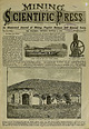
| machines, ventilating apparatus, emery wheels, mining and milling machinery. Particis being given to...employ a large foroe of skilled workmen. a Mining and Scientific Press. through the rotten boards...and Salt- habitants, nearly all of whom follow mining for an occupation. From Huatajia it is about peter...Juan."J [Written Huatajia, is the most productive mining-camp In my last letter (page 448 of Dec. 14tb)...— [Jan. I, 18J0 of Roseburg, has opened a coal mine, located fourteen miles west of this place, that |
 | | Journal (volume) |
| raya it never receives the of the ann. — — Mining and Scientific Press. Mineral and Other Resources...the Press by Jambs H. CaosBMAN.J Providence Mining District, SUaated on Providence MoDDtain, haa been subdivided... the Gold Bait and the Arrow Mining Districts. Providence Mountain haa been previously described In...South is develsylvania. The General Custer is a gold mine developed oping in an industrial way very rapidly...The Gold Belt Mining District, the collection of information regarding the foron is district, Providence |
 | | Book |
| \ Cow ( Springs ) HOPI ""INDIAN RES / / Rough Rock • >--J CM l C I \. 'I 2E Mishonghovi (...134 Naschitti / - k White Rock 1 ' N~orrb § !g Nakaibito G Coal Mine Twin lakes -- CHACO CULTURE...rich cultural heritage. Dine Bikeyah is a land of rock, little water, sparse vegetation, and beauty: the...Grande, guarded by Blanca Peak, known as the holy mountain called Sis Naajini. The southern limits are marked...and to the north, Hesperus Peak in the La Plata Range, called Dibe Nitsaa, and the San Juan River distinguish |
 | | Report (volume) |
| Geology, Stratigraphic-Mesozoic. 3. Geology-Sierra Nevada (Calif. and NE!v.) 4. Paleontology, Stratigraphic...Taylorsville area 39 Mount Jura block 41 Kettle Rock block 43 Mesozoic tectonic slivers 44 Summary 45...fossils in the Peale and Reeve Formations on Dyer Mountain 25 Geologic map showing fossil localities in Homer...Middle Fork American River region of eastern Placer County 30 Stratigraphic columns of the Lake Tahoe sequence...North Fork American River region of eastern Placer County 38 Generalized geologic maps of Taylorsville area |
 | | Book |
| Hillside Publicati Tony Brooks A History of Iron Mining in Cornwall by Tony Brooks Cornish Hillside Publications...............13 Chap/er 2 Restormel Royal Iron Mine....................................................53 Cliapler 4 Perran Iron Lode & Gravel Hill Mine .....................................61 Chapter...Holmes, on the history of the Restormel Royal Iron Mine. My publisher, Charles Thurlow, who specialises...that there was not enough on the Re tormel [ran Mine alone to make a reasonable s.ized publication. One |
 | | Book |
| GRAVEL-MORAINE: NOBLE HOUSE, LAMANCHA: LEADI-ULLS DISTRICT: G. Y. Craig 89 102 115 E. B. Bailey and R...Corrom. Crag and tail. A coarse-grained, fragmental rock with angular blocks usually set in a fine-grained...vapour cavity in an igneous rock filled with secondary ininera1s. A volcanic rock composed essentially of...orthoclase in the ground mass. A .fine-grained igneous rock occurring as a lava or minor intrusion; composed...labradorite) and augite and sometin1es olivine. A basaltic rock with felspathoids (nepheline, analcite or leucite) |
 | | Report (volume) |
| ) and Alum Mountain, Black Range, Leura Springs, Mogollon, Silver City, and Steeple Rock (N. Mex.) quadrangles...Rio Blanco, and Routt counties (Colo.) and Carbon County (Wyo.).... 3 150677 9 9 9 9 10 11 11 11 25 31................................ Cartecay, Talking Rock, and Waleska quadrangles (Barton, Cherokee, Dawson...32 and 33 and Honomo No. 17 quadrangles (Hawaii County).. Illinois...................................... Muscatine, and Wapello quadrangles (Mercer and Rock Island counties)............................... |


