| Locality type: | Mine |
| Classification |
|---|
|
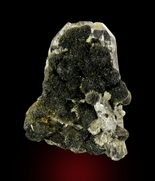
| Species: | Schorl |
| Formula: | NaFe32+Al6(Si6O18)(BO3)3(OH)3(OH) |
| Confirmation |
|---|
|
| Validity: | Believed Valid |
| Associated Minerals Based on Photo Data: |
|---|
|
| Quartz | ⓘ14 photos of Schorl associated with Quartz at this locality. |
| Tourmalinated Quartz | ⓘ1 photo of Schorl associated with Tourmalinated Quartz at this locality. |
| Data |
|---|
|
| Mineral Data: | Click here to view Schorl data |
| Locality Data: | Click here to view PC Mine (P.C. Crystal Mine; Penn placer), Cataract Mining District (Comet Mining District; Basin Mining District), Jefferson County, Montana, USA |
| Data Identifiers |
|---|
|
| Mindat Occurrence Record ID: | 45516 |
| Long-form Identifier: | 1:3:45516:7 |
| GUID (UUID V4): | 16d76271-4246-4dcc-aea6-c0df830433fb |
| Nearest other occurrences of Schorl |
|---|
|
|
| 17.0km (10.6 miles) | ⓘMontana Tunnels Mine (Part of Corbin Copper Claims), Colorado Mining District (Prickly Pear Mining District; Corbin Mining District), Jefferson County, Montana, USA |
| 42.0km (26.1 miles) | ⓘBeehive #1 pegmatite, Goldflint Mountain, Boulder Batholith, Jefferson County, Montana, USA |
| 48.1km (29.9 miles) | ⓘHomestake Pass, Boulder Batholith, Jefferson County, Montana, USA |
| 48.1km (29.9 miles) | ⓘRailroad Cut, Delmoe Lake Road occurrences, Pipestone Mining District, Jefferson County, Montana, USA |
| 54.1km (33.6 miles) | ⓘPohndorf Mine (Pondorff Mine), Toll Mountain, Boulder Batholith, Jefferson County, Montana, USA |
| 79.8km (49.6 miles) | ⓘSappington deposit, Madison County, Montana, USA |
| References |
|---|
|
|


PC Mine, Cataract Mining District, Jefferson County, Montana, USA