 | Bemrose, H. Arnold, Dawkins, Boyd, Hubbertsy, H.H., Lapworth, H., Kidner, H. (1904) Excursion to Buxton and North Derbyshire. Proceedings of the Geologists' Association, 18 (8) 419-427 doi:10.1016/s0016-7878(04)80057-9 | Journal (article/letter/editorial) |
| EXCURSION TO BUXTON AND DERBYSHIRE. 'VHITSUNTIDE, Directors: H. 1\Lw NORTH 21ST TO MAY 25TH, 1904·...through 420 EXCURSION TO BUXTON AND NORTH DERBYSHIRE. the disturbed ground will be intercepted after...the rule rather EXCURSION TO BUXTON AND NORTH DERBYSHIRE. 421 than the exception in all valleys cut...In all cases the creep extends to no great depth, and the rocks are undisturbed below. These wrinkles...believes to have taken place slightly before the great" Pennine" movement. Leaving the Howden Dam the party |
 | | Book |
| DER by Peter R. Rodgers Derbyshire Geology £1.50 By the same author: YORKSHIRE MINERALS Of...Of related interest: CAVES OF DERBYSHIRE DERBYSHIRE: EARLY A Visitor’s Guide SETTLEMENT GEOLOGICAL...GEOLOGICAL LAKELAND IN DERBYSHIRE EXCURSIONS GEOLOGY IN LAKELAND Derbyshire Geology by Peter R. Rodgers...Yorkshire. 1977 0 85206 377 6 To Lucy _ Printed in Great Britain by Galava Printing Company Ltd., Hallam... Nelson, Lancs. Contents Geological Map of Derbyshire sk, este 6 ECE, 2s yh 8 Gere) Mer aise |
 | | Journal (article/letter/editorial) |
| of Dolerite Boulders In the Glaciation of N.E. Derbyshire by A. C. DALTON Received 30 October 1954 CONTENTS...northern portion of the limestone district of Derbyshire is considered. These travelled stones include...include a few Lake District and Scottish rocks, but by far the most abundant are basalts and dolerites ('Toadstones')...over the limestone area. 1. INTRODUCTION the Derbyshire Dome, in the past, was commonly thought of as...forming the eastern flank of the ice, burying the Derbyshire Dome on the west and south-west. '2. The direct |
 | | Journal (issue) |
| MINERALS PEAK of rhe DISTRICT A joint publication of Rockbottom Publications and the Peak District...Mines&Mineralsand vol. 12 no. 1 of the Bulletin of the Peak District Mines Historical Society. COVER:BLUE JOHN...JOHN FLUORITE, Blue John Mine, Castleton, Derbyshire, polished slab 7 x I 0cm. Bob King Collection (KI052)...Mick Cooper. 2 THE PEAK DI TRI T MI E HISTORIC L SOCIETY 3-----------BL The UK Jouma/ of 1Jfi11es...and advertising. EJOHN 4-----------ORIGI of the PEAK DISTRICT DC Quirk ORE FIELD EDITOR Mick Cooper |
 | | Book |
| UNIVERSITY ■ / LIMESTONES AND CAVES OF THE PEAK DISTRICT *' compiled and edited by Trevor D....Beck, Sheffield c/o Doug Nash, Don Bramwell, Derbyshire 'Fulwood', N.J.D. Butcher, University Glebe...Norwich, NR4 7TJ, England Ford 0 86094 004 1 0 86094 005 X 1977 paper cloth Printed in Great Britain by...xiii List of tables xviii Chapter 1 The White Peak 1 Chapter 2 An outline of early research 7 ...Chapter 5 The Millstone Grit deltas of the Dark Peak 71 Chapter 6 Sands and solution in the Tertiary |
 | | Report (edition) |
| ASSOCIATION ESE LIVERPOOL JMU LIBRARY Se ope The Peak District CONTENTS PREFACE LIST OF FIGURES INTRODUCTION...Wye from Buxton to Miller’s Dale Miller’s Dale to Monsal Head Monsal Dale and Ashford-in-theWater Castleton...Castleton and Mam Tor Glutton Dale, Parkhouse Hill, Dowel Dale and Chrome Hill Eyam and Stony Middleton...Manifold Mam Tor, Edale and Kinder Scout XI Ramshaw Rocks, the Roaches and Goldsitch Moss XI The headwaters...EARTH HERITAGE RESOURCE OF THE PEAK DISTRICT FURTHER READING 74 76 The Peak District PREFACE This is the |
 | | Journal (article/letter/editorial) |
| clay wayboards in the Lower Carboniferous of the Derbyshire Dome G. M. Walkden Interbedded clays, or clay...wayboards. from the Lower Carboniferous Limestones of Derbyshire and Staffordshire, are discussed in terms of...Introduction The Carboniferous Limestone of the Derbyshire Dome consists largely of massivebedded marine...wayboard localiti in the Lower Carboniferous of the Derbyshire Dome. For locality details see Table 1 . Map...only the D1/D2 junction is shown and intrusive rocks are omitted. 2. Description and distribution of |
 | | Report (issue) |
| dolomite resources of the country around Tideswell, Derbyshire Description of 1 :25 000 sheets SK 17 and parts...of some 124 km 2 of country around Tideswell, Derbyshire, shown on the accompanying 1:25 000 resource...THE DISTRICT General Topography Geology Dinantian rocks Structure Mineralisation 1 1 3 3 6 8 8 ASSESSMENT...DESCRIPTION OF RESOURCES Woo Dale Limestones Chee Tor Rock Miller's Dale Limestones Bee Low Limestones...Limestones Apron-reef limestones Monsal Dale Limestones Eyam Limestones 9 9 10 10 10 10 10 13 NON-CARBONATE |
 | | Book |
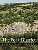
| The Peak District LANDSCAPE AND GEOLOGY Ladybower Reservoir and the Dark Peak, seen from Bamford Edge...Edge. The Peak District L A N D S C A P E A N D G E O L O GY Tony Waltham First published in 2021...original underground surveys. A huge thank you and great credit go to the late Paul Deakin, mine surveyor...surveyor, caver and photographer who lived in the Peak District and left a massive legacy of excellent photographs...to the late Trevor Ford, whose knowledge of the Peak District was both massive and infectious. The book |
 | | Journal (article/letter/editorial) |
| THE GEOLOGY OF THE LOVVER CARBONIFEROUS ROCKS OF DERBYSHIRE. WITH SPECIAL REFERENCE TO THE LONG EXCURSION...AND LEAD MINING . METAMORPHIC LIMESTONES YOREDALE ROCKS MILLSTONE GRIT • . SANDS AND FIRE-CLAYS . GLACIAL...• . . CALCAREOUS TUFA AND WARM SPRINGS IGNEOUS ROCKS PETROGRAPHY REFERENCES 165 169 169 169 175 175...north-west portions of Derbyshire, and roughly coincides with the whole of the High Peak Division and the northern...the county. It consists of the hill country of Derbyshire, which forms the southern spur of the Pennine |
 | | Journal (issue) |
| Peterborough exhibition — A. Dawn and A. Filmer Peak District Mining Museum — L. Willies T. D. Ford 161...161 The Growth of Geological Knowledge in the Peak District M. Evans 191 A new reconstruction of the...Precambrian of Charnwood Forest, Leicestershire, England The Mercian Geologist is published by the East...for ‘The Rock Exchange’. Under the control of the Peak Lapidary and Mineral Society and the guidance of...test the method in the generally less favourable UK environment. In addition to EM, gamma spectrometer |
 | | Journal (article/letter/editorial) |
| TOADSTONESOF DERBI~SHIRB. 241 14. The TOAVSTONES of DERBYSHIRE: their FIELI)-RKLATIONS a,td P~rROGRXP~rY. By................ I[. The North-Western or Miller's-Dale Area .................. III. The South-Eastern or...Structure of the Carboniferous Dolerites & Tufts of Derbyshire' Quart. Journ. Geol. See. vol. 1, pp. 603-44...the relations in the field between the igneous rocks and the limestones in which, they occurred. During...necessary. In 1897, in his ' Ancient Volcanoes of Great B r i t a i n ' vol. ii, p. 12, Sir Archibald expressed |
 | | Journal (issue) |
| ·- 0 ° Mn g &story 'fll'ne lBuHetin of the Peak District Mines Historical Society Ltd. Volume 17...Lead Mines in the Northern Part of the White Peak, Derbyshire Trevor D. Ford 1 Associate Editors: Evelyn...the geological setting of the lead mines of the Peak District, this one covering the important Castleton...Mines within Bradwell Liberty, Derbyshire: 1216- 1890 Chris Heathcote PEAK DISTRJCT MINES HISTORICAL SOCIET...Charity 504662) Company No. 1227931 (Registered in England) - Liability Limited by ;uaran c Member of the |
 | | Journal (article/letter/editorial) |
| 414 F. W. Cope— A Tholeiite Dyke near Buxton, Derbyshire. By F. WOLVEESOX COPE, M . S C , Bedford College...because a dyke actually cutting the limestones of Derbyshire has never been recorded, and secondly on account...contains. Associated with the Carboniferous rocks of Derbyshire are lava flows, tuffs, sills, and volcanic...on the Toadstones of Derbyshire, stated that " the few dykes observed in Derbyshire were found in the agglomerates...of Hargatewall crosses Great Rocks Dale (Ordnance Survey : Sixinch, Derbyshire, Sheet XV, S.W.). A few |
 | | Report (volume) |
| Guide No. 56 <7 f Curry The Castleton Area, Derbyshire by Trevor D. Ford The Geologists'Association...meetings in London and, via Local Groups, throughout England and Wales. It conducts field meetings and publishes...Association Guide No. 56 The Castleton Area, Derbyshire WW by Trevor D. Ford Edited by J. T. Greensmith...Speedwell Cavern, Winnats Pass, New Rake & Peak Cavern 64 3. Cave Dale, Dirtlow Rake & Pindale 75 4. Losehill...distribution of fossils across the reef complex. 7. Cave Dale lava and Speedwell agglomerate relationships and |
 | | Journal (issue) |
| • 0 llll g History The Bulletin of the Peak District Mines Historical Society Ltd. Volume 17, No...Hill, Ladmanlow and Stanley Moor near Buxton, Derbyshire: 1835-1877 Chris Heathcote John Barratt and...Working the Coal at Whaley Bridge in Northwest Derbyshire: 1883 to 1903. Its Impact on the Local RailwayNetwo�...Heathcote Index to Volume 17 David Williams 19 -PEAK DISTRICT MINES HISTORICAL SOCIF I LTD (Registered...Charity 504662) Company No. 1227931 (Registered in England) - Liability Limited by Guarar cc Member of the |
 | | Report (edition) |
| GEOLOGISTS' ASSOCIATION GUIDES Noo 26: The Peak District by F. WOLVERSON COPE. with contributions by...Glutton Dale, Parkhouse Hill, Dowel Dale and Chrome Hill 19 Wolfscote Dale and Dove Dale 22 Peak Forest...Forest, Tideswell Dale, Litton, Great HuclDale 25 Castleton 27 Edale 31 Stony Middleton...collecting from, exposures. They should also take great care 1101 to cause any damage to property. /11 recent...for incorporation in any further edition. The Peak District by F. WOLVERSON COPE with contributions |
 | | Journal (issue) |
| Mining History The Bulletin of the Peak District Mines Historical Society Ltd. Volume 16, No. 5, Summer...Dr Lynn Willies. Hilderston, 174 Dale Road, Matlock Bath, Derbyshire. DE4 3PS. Contents Associate Editors:...collections and run the better or rarer slides through as high-a-grade film-scanner as possible, making several...Mineral Deposits at Brassington and Carsington, Derbyshire Trevor D. Ford and John A. Jones 1 Geophysical...at Perryfoot, Derbyshire Bernard Chandler 32 The History of Coalpithole Vein in Peak Forest and Chapel-en-le-Frith |
 | | Report (issue) |
| of limestone .resources in the Carboniferous of Great Britain 58 Figure10 General Distribution of Carboniferous...Carboniferous li1nestone in south Wales and south-west England showing variations in thickness 59 Figure11 ...Shropshire 66 Figure14 Carboniferous limestone in Derbyshire and Staffordshire 68 Figure15 (:arboniferous...northern England 73 Figure17 Vertical sections showing the major limestones in north-east England and adjacent...fonnations in the Carboniferous of north-east England and southern Scotland 76 Figure19 Carboniferous |
 | | Report (issue) |
| dolomite resources of the country around Buxton, Derbyshire Description of 1:25000 sheet SK 07 and parts...resources of some 50 kmi of country around Buxton, Derbyshire, shown on the accompanying 1 :25 000 resource...the district 3 Topography 3 Geology 3 Dinantian rocks 3 Structure I 0 Lead-zinc mineralisation 10 Assessment...Classification 11 Results 11 Woo Dale Limestones 11 Bee Low Limestones 14 Monsal Dale Limestones 17 Eyam Limestones...dolomite resources of the country around Buxton, Derbyshire In pocket TABLES 1 Classification of limestones |
 | | Book |
| PO Box 315. Harpenden. Hertfordshire AL5 2ZD. England Telephone: +44 (0)1582 762413 Fax: +44 (0)870 055................................... 428 8: babel quartz to bytownite .............................. 66...Microsystems for rnicrophotographic advice. tvfBI owes a great debt to one other individual, without whom the entire...Lettsom's famous book, Manual of the mineralogy of Great Britain and lrela11d, published in 1858. Such was...intervening years, the Mineralogical Society of Great Britain and Ireland produced a series of supplementary |
 | | Book |
| and gemstones are traced by their geographical England and Wales, Scotland and Ireland occurrence. detail...0 0§ 002472 8 — Hardback Paperback Printed in Great Britain by R. & R. Clark Ltd., Edinburgh Preface...permission of Mr E. A. Jobbins. The crystal forms of quartz, topaz and fluorite are given after R. P. Greg...headings have come from Rudolf Bérner’s book Minerals, rocks and gemstones*, and the permission to use these...AND PORTENTS 7 ROUND THE BRITISH ISLES PART I, ENGLAND AND WALES ROUND THE BRITISH ISLES PART 2, SCOTLAND |
 | | Book |
| 74 Carter Lane London E.C.4 Made and printed in Great Britain by William Clowes and Sons Limited London...T. War wick page 7 Sedimentary rocks-igneous rocks- metamorphic rocks-enlargement of natural cavities-factors...caves-sources of geological information I. CAVES AND ROCKS by G. T. Warwick page 27 Ground-water movernent...Yorkshire-Peak District-Mendips- South Devon -South Wales-North Wales-other areas of· England-SCOTLAND-IRELAND:...counties Durham-Westmorland and LancashireYorkshire-Derbyshire and North Stafford- ShropshireHereford- Glouceste |
 | | Book |
| held at the Holiday Inn Crowne Plaza, Manchester, UK, 4- 6 February 1992 ORGANIZING COMMITTEE M. T. Anthony...Services, UK H. E. K. Allen A. K. Barbour D. S. Flett M. S. Johnson A. Mutter G. Nash RTZ, UK Environmental...Environmental Scientist, UK Leeds Mineral Services, UK University of Liverpool, UK UK International Council...and the Environment, Canada NERC, UK ASARCO Inc., USA Mining Journal, UK C. R. Neary K. Parameswaran N...Crown House, Linton Road, Barking, Essex IG11 8JU, England Sole Distributor in the USA and Canada ELSEVIER |


