 | | Journal (article/letter/editorial) | | H E GEOLOGY OF THE LOWEB COAL-MEASUEES OF THE DERBYSHIRE AND NOTTINGHAMSHIRE PORTION OP THE YORKSHIRE...explorations in the equivalent measures of the Derbyshire and Nottinghamshire portion of the coalfield...of the Coal-measures of Yorkshire and that of Derbyshire and Nottinghamshire is still generally unknown...of the Millstone Grit Series and a well-known Derbyshire seam, the Kilburn Coal. These lower measures...measures continue from Yorkshire through Derbyshire with *a north and south strike which changes to east and | 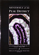 | | Journal (issue) | | COVER:BLUE JOHN FLUORITE, Blue John Mine, Castleton, Derbyshire, polished slab 7 x I 0cm. Bob King Collection...TRI T MI E HISTORIC L SOCIETY 3-----------BL The UK Jouma/ of 1Jfi11es a11dMinerals publishes articles...------------ /[INER LS of the PEAK DISTRICT of DERBYSHIRE TD Ford· WAS Smjer1111 • 1/E Smith DESIGN Julie...Limited Services available to members tvlatlock, Derbyshire, DE4 SGQ. Tel. (0629) 534775. Society Collections:...of the Councv Librarian, Derbyshire County Council Offices, Matlo~k. Derbyshire. DE4 3AG. Tel. (0629)580000 |  | | Journal (volume) | | non-member subscription rates for this volume are: UK £13 (including P&P) and Overseas £15 (including P&P)...mineralisation associated with the Whin Sill of northern England is described in a geological context in an account...Mineralogy Publications, Bromsgrove, Worcestershire, England. Tindle, A.G. (2008). Minerals of Britain and Ireland...Ireland. Terra Publishing, Harpenden, England. David Green and Malcolm Southwood, Journal Editors Erratum...acid); Hollandtwine Mine, Dirtlow Rake, Castleton Derbyshire; 90×50×40 mm; Frank Ince Collection (FI-1644) |  | | Book | | study, or criticism or reveiw, as permitted under the UK copyright Designs and Patents Act, 1988, this publication...licences issued by the Copyright licensing Agency in the UK, or in accordance with the terms of licences issued...appropriate Reproduction Rights Organization outside the UK. Enquiries concerning the reproduction outside the...Caledonian structures in Britain South of the Midland Valley Edited by).E. Treagus 4. British Tertiary Volcanic...and M.e. Gyopari 5. Igneous Rocks of South-West England P.A. Floyd, e.s. Exley and M.T. Styles 6. Quaternary |  | | Report (volume) | | PRE·CAR.BONJFEROUS AND CARBONTFEROUS BEDDED ORES OF ENGLAND AND \VALES. BY SlR A. STRAHAN, K.B.E., Sc ..D....PRE-CARBONIFEROUS AND CARBONIE'EROUS BEDDED ORES OF ENGLAND . AND \VALES. BY SIR A.. STRA.HAN, K.B.E., Sc.D... LIBRARY ~ Geological Survey Office, Northern England. LONDON: PRINTED UNDER THE ..A.UTHORITY OF 'HIS...(raw stone) of the Carboniferous Bedded Ores in England and Wales •.• .•• ,, rr.-PRE-CARBONIPEROUS BEDDED...(continued)-DETAILS : Northumberland and Durham. Yorkshire, Derbyshire and Nottinghamshire. Warwickshire, Leicestershire |  | | Book | | .97 Details of the Leicestershire and South Derbyshire Coalfields . 98 Possible Concealed Coalfields...117 .123 .132 8 THE BURIED FLOOR OF EASTERN ENGLAND by P. E. Kent.138 9 PERMIAN AND TRIASSIC FORMATIONS...and R. J. King.324 A. The Pocket Deposits of Derbyshire ..... 324 B. Tertiary (?) Deep Weathering in...Correlation chart of Coal Measures . . . . . .96 South Derbyshire and Leicestershire seam correlation . . .101...Bedfordshire .... 320 Map of sand-filled pockets in the Derbyshire limestone . . 325 Map of sand-filled pockets |  | | Journal (issue) | | the Alton Marine Band, Ridgeway opencast site, Derbyshire . . . . . 35 FIG. 5.- Radioactivity measurements...cores frorn the three neighbouring boreholes, Derbyshire . . . . . 35 FIG. 6.-Radioactivity n1easurements...tests of a prototype unit were carried out in England, with encouraging results. In the autumn of the...strength of the anomalies suggests that, locally, the valley deposits n1ay zontain as much as 0·3 per cent equivalent...produced by acid granites, e.g. those of South \,Vest England, and it emphasizes the unusually low radiation |  | | Report (volume) | | limonite, glauconite, pyrites, calcite, dolomite, siderite, gypsum, barytes, etc. Since all clays are formed...(pyrites, ma.rcasite, pyrrhotite), carbonates (siderite, sphrerosiderite) or oxides, hydrated and an hydrous...Description and Source. CE CF CG Test: Page. 30 DERBYSHIRE AN]) WARWICKSIU R.E.! 84 CH 84 90 01 92 92...dale • Test : Page. 34 Sot:TII AND \VEST OF ENGLAND. l 162 DN DO 162 DP 162 DQ 158 CORNWALL...Sheffield, Yorks White clay; Bullbridge, Ambergate, Derbyshire Bottom clay; do. do. do. Under clay of ganister |  | | Report (issue) | | GREAT BRITAIN I. District Reports A. Southern England and Wales I. South-Western District • • • 2. Bristol-Southampton...Midlands and Central Wales District B. Northern England and Wales I. Yorkshire and East Midlands District...three regions : Soutl1ern England and Wales, based on London ; Northern England and \-Vales, based on Leeds...Director and four field units of the Southern England and Wales Region, the Overseas REORGANIZ ATION...in the Midlands whicl1 ,vould eventually house England and Wales field staff, the geomagnetic work and |  | | Book (volume) | | Durham and East Cumberland ••• North Wales and Derbyshire ... ••• Bristol, Somerset, and North Devon ....(turgite) ; and the ca.r bonate, chalybite or siderite (spathic iron-ore). Iron silica,t es, represented...and those of Cumbe1·la11d and LancashiT·e, in England, are largely Ca1:boniferot1s limestone replacen1e11ts...time from the low-grade 01~es so abundant in England. Production, Imports, and Consumption of Iron Ore...serious blow to the iron manufacture of France. In England the outcrop& of. the Jurassic straita stretch a |
|


