| Locality type: | Valley |
| Classification |
|---|
|
| Species: | Quartz |
| Formula: | SiO2 |
| Confirmation |
|---|
|
| Validity: | Believed Valid |
| Data |
|---|
|
| Mineral Data: | Click here to view Quartz data |
| Locality Data: | Click here to view Amasa Valley, House Range, Millard County, Utah, USA |
| Photo Gallery | View Gallery (2 photos) |
| Data Identifiers |
|---|
|
| Mindat Occurrence Record ID: | 635753 |
| Long-form Identifier: | 1:3:635753:5 |
| GUID (UUID V4): | ae45c21c-5016-4547-8eee-7d803a4a24bf |
| Nearest other occurrences of Quartz |
|---|
|
|
| 3.3km (2.1 miles) | ⓘBaldy Peak Mine (Treasure Mountain Mining Company), Notch Peak Mining District, Millard County, Utah, USA |
| 25.1km (15.6 miles) | ⓘTule Valley, Millard County, Utah, USA |
| 49.8km (31.0 miles) | ⓘKing Tut Mine (Yellow Cat Claim), Detroit Mining District (Drum Mining District; Joy Mining District), Millard County, Utah, USA |
| 50.7km (31.5 miles) | ⓘHigh Grade Hill prospect, Wildcat Project, Detroit Mining District, Juab County, Utah, USA |
| 51.4km (31.9 miles) | ⓘIbex Mine, Detroit Mining District, Juab County, Utah, USA |
| 59.3km (36.8 miles) | ⓘSK Star Claim #2, Thomas Range, Juab County, Utah, USA |
| 59.9km (37.2 miles) | ⓘBell Hill Mine, Spor Mountain Mining District, Thomas Range, Juab County, Utah, USA |
| 60.2km (37.4 miles) | ⓘStarvation Canyon, Thomas Range, Juab County, Utah, USA |
| 60.3km (37.4 miles) | ⓘBrush Wellman Mine, Spor Mountain Mining District, Thomas Range, Juab County, Utah, USA |
| 61.1km (38.0 miles) | ⓘSpider Mine, Honeycomb Hills Mining District, Juab County, Utah, USA |
| References |
|---|
|
|
| Reference Search (possible matching items) |
|---|
 | | Report (volume) | | of the Notch Peak Wilderness Study Area, Millard County, Utah U.S. GEOLOGICAL SURVEY BULLETIN 1749-C...of the Notch Peak Wilderness Study Area, Millard County, Utah By DOUGLAS B. STOESER, DAVID L CAMPBELL...RESOURCES OF WILDERNESS STUDY AREAS WEST-CENTRAL UTAH DEPARTMENT OF THE INTERIOR MANUEL LUJAN, JR.,...of the Notch Peak Wilderness Study Area, Millard County, Utah / by Douglas B. Stoeser... [et al.]. p....resources of wilderness study areas west-central Utah) Includes bibliographical references. Supt. of Docs |  | | Report (volume) | | SURVEY BULLETIN 1357 Placer Gold Deposits of Utah By MAUREEN G. JOHNSON GEOLOGICAL SURVEY BULLETIN...................... History of placer mining in Utah..................................... Purpose and...study................................... Garfield County. ................................................(Crescent Creek placer).......................... Grand County........................................................ Millard County........................................................ 5. House Range placers |  | | Report (issue) | | CALITI ES OF UTAH by Kenneth C. Bullock UTAH GEOLOGICAL AND MINERAL SURVEY a division of the UTAH DEPARTMENT...LOCALITIES OF UTAH by Kenneth C. Bullock Nature displays her most common mineral, quartz, in this beautiful...State of Utah. . . . . . . . . . . . . . . . . . . . . . . . . . . . . . . . . . . . . . 1 County Listings.... . . . . . . 1 Chapter II. Mining Districts of Utah . . . . . . . . . . . . . . . . . . . . . . . ..... . . . . . . . 4 Mineral Localities Listed by County . . . . . . . . . . . . . . . . . . . . . . . |  | | Journal (article/letter/editorial) | | azurite, Utah boasts an array of mineral species. AN OVERVIEW OF RECENT Mineral Collecting in Utah Downloaded...Drive Salt Lake City, Utah 84106-3313 JAMES R. WILSON Weber State University Ogdeo, Utah 84408-2507 PAULA...PAULA N. WILSON University of Utah Salt Lake City, Utah 84112-1183 sion to visit or collect material; indeed...an irregular basis. Beaver County MINERAL COLLECTING IN THE STATE of Utah has undergone a resurgence...many more species new to Utah. Here we present a list of localities in Utah that have either been historically |  | | Book (volume) | | from 18’ to 27’ long. In addition, gem Garnets, Quartz crystals, Topaz and Tourmaline add to the fascination...beds, excavations, etc.Selenite roses. BRULE COUNTY AREA: in the Oacoma zone of the Pierre Fm. On Elm...gray Barite rosette up to 5 or 6 inches. CAMPBELL COUNTY MOUND CITY, W to the Missouri R., regional hillsides...gravels, etc.petrified wood, wood opal. CORSON COUNTY LITTLE EAGLE: area ridges, slopes, stream beds...Guide for Rock Hounds in the United States CUSTER COUNTY AREA: The November Mine, 1.2 mi. SE of the Needles |  | | Book | | AFRICA widely in Litchfield County, where good crystals were taken from quartz veins in a variety of metamorphic...Litchfield, where a mass of white quartz on a ridge had once been mined for quartz, and large ilmenite masses...ilmenite crystals to 7 .5 cm in matrix of massive quartz from these dumps-adding that, in his judgment,...region (Brunet, I 977b ). NEW YORK Amity, Orange County. At many isolated collected sites between the towns...Litchfield County. Ilmenite masses and crystals from somewhere near Washington, Litchfield County, were described |
|

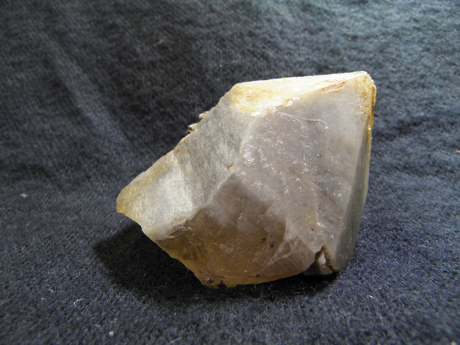


Amasa Valley, House Range, Millard County, Utah, USA