 | | Report (issue) |
| ES80·1 Gold Mines of Manitoba by J. W. Stewart Cover Plate: San Antonio Mine, Bissett Area, circa 1940...under the Canada/Manitoba Sub-Agreement on Mineral Exploration and Development by the Manitoba Department...Mines, Resources and Environmental Management, and Canada Department of Regional Economic Expansion. J...for Manitoba Gold Mines 6 FIGURES 1. Deposits of the Falcon Lake Stock 4 2. San Antonio Mine 5 ... 3. Jeep Mine 7 4. Central Manitoba Mine 8 5. Solo - Oro Grande Mine (Beresford Lake) 8 6. Ogama-Rockland |
 | | Report (issue) |
| Energy, Mines and Resources Canada E:nergie, Mines et Ressourees Canada Canada THE ENERGY OF OUR RESOURCES...Gypsum (selenite) - Red River Floodway, Winnipeg, Manitoba. Specimen measures 7 cm from left to right. National...no. 17206. GSC 204971-1 Geological Survey of Canada Miscellaneous Report 49 ROCKS AND MINERALS FOR... © Minister of Supply and Services Canada 1991 Available in Canada through authorized bookstore agents...bookstores or by mail from Canada Communication Group - Publishing Ottawa, Canada KIA OS9 and from. Geological |
 | | Report (edition) |
| users should still verify critical information. Manitoba Energy and Mines Economic Geology Report ER86-1...ER86-1 (2nd Edition) Gold Deposits of Manitoba By D.J. Richardson and G. Ostry (revised by W. Weber and...grade gold specimen from the San Antonio Mine, Bissett, Manitoba. It measures 24x20x5 cm and contains an... TABLE OF CONTENTS PREFACE Page 1 _ INTRODUCTION Manitoba Gold Production Gold Exploration and Production:...Acknowledgements _ 3 .4 .4 5 5 7 REGIONAL GEOLOGY OF MANITOBA Superior Province Churchill Province Churchill-Superior |
 | | Journal (article/letter/editorial) |
| SunbeamandGrouseCreek Gold-SilverDeposits,Yankee Fork Mining District, EoceneChallisVolcanicField, Idaho:A Volcanic...1776LincolnStreet,Denver,Colorado80203 Abstract The Sunbeam andGrouseCreekepithermalgold-silverdeposits lie...system. 0361-0128/94/1648/1964-19,4.00 1964 SUNBEAM ANDGROUSE CREEKAu-AgDEPOSITS, IDAHO Introduction...YankeeFork of the SalmonRiver at itsjunctionwith The Sunbeam and GrouseCreek depositsare loJordanCreek. More... ':'='• ß RHYOLITE • d'ALENE MISSOULA Kqm SUNBEAM Kqm SALMON RIVER LOWER STANLEY I BOISE 45' |
 | | Report (volume) |
| ................................... Bay Horse district.................................................prospects...................................... Ramshorn mine.......................................................................................... Skylark mine........................................................ River View mine.............................................. Excelsior mine........................... Beardsley mine................................................ Pacific mine.................. |
 | | Report (issue) |
| DIVISION MRD Educational Series 78/2 Minerals of Manitoba Volume II: Metallic minerals by K.A. Phillips...Ph.D., P. Eng. Winnipeg 1979 1 Minerals of Manitoba Volume II: Metallic Minerals Foreword .........(Dumbarton mine) Bottom left - Chalcopyrite ore with graphitic gangue material (Mandy mine) Bottom right...- Sphalerite ore with minor pyrite and white plagioclase (Chisel Lake Mine) 2 Foreword This publication...the rocks and minerals of Manitoba. The first, entitled Common Rocks in Manitoba (1975), introduced the |
 | | Journal (article/letter/editorial) |
| supergene ore minerals have been recognized, of which pyrite is the most common and finely disseminated pyrargyrite...,,~ .~., fg?' REGION _~227 I'v ,v" . ,v v" SUNBEAM REGION 50 )u 0.5 0 0,5 t.0 km ~ ~ ~ I-'~-...rock in the vein zone and the abundant presence of pyrite disseminated throughout the zone of silicifieation...contained in the porous and cavity filled vein. 2. Sunbeam and Barrier Reefs Region This comprises the other...other two important mineralized areas. Sunbeam region located on the south-west flank and Barrier Reefs |
 | Criss, R. E., Champion, D. E., McIntyre, D. H. (1985) Oxygen isotope, aeromagnetic, and gravity anomalies associated with hydrothermally altered zones in the Yankee Fork mining district, Custer County, Idaho. Economic Geology, 80 (5) 1277-1296 doi:10.2113/gsecongeo.80.5.1277 | Journal (article/letter/editorial) |
| Hydrothermally Altered Zones in the Yankee Fork Mining District, Custer County, Idaho R. E. CR•SS, U.S. GeologicalSurvey...vein and disseminateddepositsin the YankeeFork district are hosted in alteredvolcanicrockshavinglow 5180values...alsoassociatedwith the altered zonesin the Yankee Fork district. The intensitiesof these geophysicalfeaturesare...GeologicSetting The study area encompasses the Yankee Fork district,a miningregionin the SalmonRiver Mountains of...Thispaperdemonstrates thatthe Au-Agorebodies in the YankeeFork district,Idaho, were formedby a process essentiallyidentical |
 | | Report (issue) |
| Molybdenum-copper deposits B30 Banner mine B30 Central part B31 Stanley district B31 History and production B31...Gold-bearing resources B31 Custer graben B31 Yankee Fork district B32 History and production B32 Character of the...resources B33 Loon Creek district B33 Loon Creek placers B34 Lost Packer mine B34 Other mines and prospects...Yellowjacket district B34 Yellowjacket mine B35 Northeast part B35 Mackinaw (Leesburg) district B36 History...Characteristics of the deposits B37 Mineral Hill district B38 History and production B38 Geologic setting |
 | | Journal (issue) |
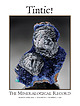
| Gressman tom.gressman@minrec.org The Tintic District: Juab and Utah Counties, Utah...................COVER: CLINOCLASE, 3.9 cm, from the Mammoth mine, Tintic District, Utah. Rock Currier collection; Jeff Scovil...only): $145/one year, (Canada) $231/one year, (outside U.S.A. other than Canada) $325 for one year Subscription...holds a sample of a pascoite group mineral at a mine in Grand County, Utah. Died, Alex Earl, 26 Jayson...over the American West. A trip to the Blue Bell mine near Baker, California, in 2016 was particularly |
 | | Journal (article/letter/editorial) |
| TUREKIAV pure Co,O, in various proportions with a pyrite containing 9 p.p.m. cobalt (determined by neutron...depth 400 cm Pyrite, French Creek, 3* Deep sea YCM 6* Pyrite, Carrel YCM 9* Pyrite, as for YCi\I...YCi\I 6 Pa. Mine, Central * Used to monitor emission spectrographic City District, ___- CO (JOlO...Region 01. diabase, near S. Porcupine, Ontario, Canada Gabbro, Tatlock, Ontario Basalt, Isle Royal, Mich...suggested that the cobalt will enter arsenopyrite, pyrite, pyrrhotite and chalcopyrite with decreasing ease |
 | | Report (volume) |
| Douglas-Fir at the Red Mountain Stockwork, Yellow Pine District, Idaho, by J. A. Erdman, B. F. Leonard, and D...FAULT Sawteeth on upper plate CALDERA BOUNDARY MINE OR PROSPECT AREA CONTAINING ABUNDANT MINES AND PROSPECTS...dolomite, siltstone, and shale in the Bayhorse district (Hobbs, chap. K, this volume) and in middle and...deposits are the zinc and barite ores at the Hoodoo mine (fig. A8) in the Paleozoic Salmon River assemblage...possibly the lead-silver ores at the Livingston mine (fig. A8). The Lower Permian fine-grained carbonaceous |
 | | Report (issue) |
| INDEX TO "METALLIC" MINERAL INVENTORY CARDS OF MANITOBA ER79-6 (INCLUDES APPENDIX E - MICROFICHE COPIES...COPIES OF MINERAL INVENTORY CARDS OF MANITOBA) (To accompany Economic Geology Report ER79-6) INTRODUCTION...Cards of Manitoba (as of March 31,1979) serves as Appendix D of the Mineral Inventory of Manitoba. The Index...Appendix D). • f REPORI' 1 NrS AREA • MANITOBA MINERAL RESOURCES DIVISION MINERAL INVENTORY NTS...02:1912 06:1942 06: 1942 06:1946 06:1918 THOMPSON SUNBEAM WAVERLEY MOORE RAD M.J.T. THOS. 60YES JEWEL HALL |
 | | Journal (article/letter/editorial) |
| sulfosalts in a gangue o f pyrite and fine-grained quartz. At the S u n b e a m Mine, near the center o f the...p o r t a n t part in localizing ore at the Sunbeam Mine. Pipe-like masses o f silicified breccia, interpreted...Deposits o f the T h u n d e r Mountain Mining District, Valley County, Idaho OPAL A D A M S Freeport...Nevada, U.S.A. The T h u n d e r Mountain mining district is located in Valley County, central Idaho. Epithermal...silicifation and argillization. At the Sunnyside Mine gold and silver occur at a 3:1 ratio along goethiteh |
 | | Book |
| A HANDBOOK for MINE PROSPECTING tn MANITOBA Geology and Minerals of MANITOBA Prepared for the...Instruction and Guidance of Those Prospecting in Manitoba By W. Late L. GOODWIN, Dean D.Sc, LL.D....this book, the reports of the Geological Survey of Canada and of the Mines Branch have been freely drawn...the Industrial Development Board of Manitoba and of the Manitoba Department of Mines. These sources and...The author's acknowledgments are also due to the Manitoba Department of Mines for permission to reproduce |
 | | Report (issue) |
| ...... Carbonate rocks in the Bayhorse mining district.................................................Hobbs.................................... Bayhorse district subterrane.......................................................................... Golden Sunbeam mine area..........................................Idaho black shale terrane and the Bayhorse mining district.................................................Ib lead, and 60 million Ib zinc. The Bayhorse district produced silver and base metals every year from |
 | | Report (issue) |
| GEOLOGY AND ORE DEPOSITS · OF THE TINTIC MINING DISTRICT, UTAH BY WALDEMAR LINDGREN AND G. F. LOUGHLIN...History of mining 'and· metallurgy in the Tintic district, by V. C.l!eikes ............... . Production...water: .. ~.~~ ............... . Drainage of the district ....-... ·......... . Mineralization ...........Channel of the Gemini Chief mine ............................. . 205 mine·---------------------------------... ·... ·._. ___ . __ _ 182 . Eagle and Blue Bell mine .............. . 207 . Principal features of deposits |
 | | Report (volume) |
| some thrusts postdate a granitic pluton at the Troy mine in the Grant Range. The isotope age of the pluton...important contact trending north from the Dresser mine past the Mammoth, are believed to be fault contacts...containing noticeable to abundant disseminated pyrite (Nyco mine). 2. Large tabular fluorite deposits. Fluorite...portions of the altered zones contain disseminated pyrite. In the following discussion, the deposits are...quartz, jasperoid, pyrite, and hematite, which is generally pseudomorphous after pyrite. Many deposits exhibit |
 | | Report (issue) |
| ................................. 3 Rocky Bar District—43 ............................................................................... 8 Black Pine Mine—12 .................................................................................... 8 Hecla District—41 ......................................................................... 9 Elkhorn Mine—17 .............................................................................. Chilco Mountain (a.k.a. Pyrite Creek)—34 ............................. Pre-Laramide |
 | | Report (issue) |
| GEOLOGICAL ASSOCIATION PRECAMBRIAN ee OF CANADA SULPHIDE SPECIAL PAPER 25 DEPOSITS H.S. Robinson...Suite 520, J.M. Franklin, Geological Survey of Canada, 601 Booth Street, KIA 0E8 Ontario International...the Geological Association of Canada. Geological Association of Canada Department of Earth Sciences University...University of Waterloo Waterloo, Ontario Canada N2L 3G1 Printed by: Johanns Graphics, Waterloo,...Thompson W.V. Peredery and Geological Staff .. Belt, Manitoba Evidence for a Volcanogenic-Exhalative Origin |
 | | Report (volume) |
| . . . . . . . . . . . . . . . . . . . . . . . Sunbeam Formation . . . . . . . . . . . . . . . . . . ...(1908), who investigated the Fort Hall mining district, which was established in 1902 on land ceded from...Papoose Creek and the canyon leading to the Fort Hall mine. The outcrop widens north of the Portneuf River...the ridge east of the Fort Hall mine, from Portneuf to the Fort Hall mine. It is also present on the west...probably is about 1,800 feet thick east of Fort Hall mine and about the same thickness east of the south end |
 | Vishiti, Akumbom, Petersen, Sven, Devey, Colin, Suh, Cheo Emmanuel (2013) Arsenian pyrite-bearing altered volcanics dredged SE of Cheshire Seamount, western Woodlark Basin, Papua New Guinea. Neues Jahrbuch f??r Mineralogie - Abhandlungen: Journal of Mineralogy and Geoche, 190 (3) 327-340 doi:10.1127/0077-7757/2013/0241 | Journal (article/letter/editorial) |
| 327–340 Stuttgart, August 2013 Article Arsenian pyrite-bearing altered volcanics dredged SE of Cheshire...ore deposits arsenian pyrite is an important host for Au, however, arsenian pyrite is rare on the modern...volcanic breccias containing abundant arsenian pyrite were dredged from the flanks of a volcanic seamount...silicification as a significant alteration process. Pyrite is the dominant ore mineral with only minor amounts...generations of pyrite are recognized on the basis of morphology. Arsenic-free, early framboidal pyrite (py1) is |
 | | Journal (article/letter/editorial) |
| nearly three page article on the Arkansas Diamond Mine, with three pictures, and is quite true to facts...incrustations, has been found in the St. Kevin mining district, 8 miles west of Leadville, Lake Co., Colo. CONNECTICUT—Dark...fluorite, are common in the Delhi-Babb fluorite mine near Salem, Livingston Co., -Ky. LOUISIANA — Something...Sulphur Co. when it begins to operate its new sulphur mine at Bay Ste Elaine, La. The sulphur deposit is located...under the waters of Gulf of Mexico and in order to mine it, the operations will be conducted from a huge |
 | | Report (volume) |
| within the Forest 10 5. Map showing location of type mine localities for mineral deposit types and boundaries...Mineral-materials transactions 1983-1986 7 Type mine localities for mineral deposit types 8 Description...Geochemical signatures of mineral deposit types at type mine localities 18 Size classification of deposit types...since th turn of the century; the Clayton Silver mine recorded the I rgest production. Tungsten was produced...1911, with major production, mainly from the lma mine, from 1936 into the late 1950's. Extensive exploration |
 | | Book (edition) |
| CITY, UTAH. WRITE FOR PRICES. YOU WANT A GOOD MINE! MANY YEARS EXPERIENCE IN MINl^S AND MINERALS...white to nearly colorless. Beaver Lake District; azurite. 0. K. Mine; bornite, chalcocite, chalcopyrite...copper, limonite, malachite, molybdite, pyrite. Bradshaw District; aragonite, aurichalcite, cerussite, cuprite...often phosphorescent, wollastonite. Granite District; almandine garnet, barite, bismuth - inite....quartz crystals, prase. Rocky District; Adelia Mine, wulfenite. Star District; azurite, bismuthinite, galena |


