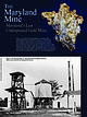
 | | Journal (article/letter/editorial) | | THE Maryland Mine Downloaded by [Australian National University] at 04:12 13 March 2015 Maryland’s...Maryland’s Last Underground Gold Mine Figure 1. according to Huntley Ingalls, this amazing sample, containing gold...gold as wires and flakes in quartz, was once part of a much larger ore specimen that was nearly a foot...recovered from a rich ore shoot in the Maryland mine sometime between 1900 and 1910. Such a specimen...only when prospective investors would visit the mine. This much smaller, yet remarkable, piece was saved |  | | Report (issue) | | Mica Deposits of the Blue Ridge in North Carolina GEOLOGICAL SURVEY PROFESSIONAL PAPER 577 Work done...done in part in cooperation with the North Carolina Department of Conservation and Development and in part...Administration Mica Deposits of the Blue Ridge in North Carolina By FRANK G. LESURE GEOLOGICAL SURVEY PROFESSIONAL... Work done in part in cooperation with the North Carolina Department of Conservation and Development... Geologic map of part of the Blue Ridge of North Carolina and Tennessee. 2-6. Maps showing location of |  | | Journal (article/letter/editorial) | | suite of a dozen or so common minerals (ubiquitous quartz; simple carbonates, sulfates, and sulfides; and...maps on Google seemed to average twelve states (North Dakota, South Dakota, Nebraska, Kansas, Minnesota...phosphate species being described from just one mine, the Tip Top, in South Dakota. (Note: There are...locality occurrences in only four Midwestern states: North Dakota, Nebraska, Oklahoma, and Kentucky; these...or IMA approval Species Type locality Initial North American references (not necessarily the very first |  | | Report (issue) | | etc New Mexico Colfax County. 2. Volcanic ash, tuff, etc. New Mexico Union County. 3. Potassium-argon dating...4. Geology New Mexico Colfax County. 5. Geology New Mexico Union County. I. Wilcox, Ray E. (Ray Everett)................................................. Slagle Trachyte ........................................southwest of Turkey Mountain ......... Syenite and quartz monzonite vent rocks at Turkey Mountain .................... 14. Pumiceous rhyodacitic lahar on north flank of Laughlin Peak ........................ |  | | Report (issue) | | noRm c ult * 4 NORTH CAROLINA DEPARTMENT OF CONSERVATION AND DEVELOPMENT R. BRUCE ETHERIDGE, DIRECTOR...MICA DEPOSITS OF THE FRANKLIN-SYLVA DISTRICT, NORTH CAROLINA BY J. C. OLSON AND OTHERS PREPARED BY GEOLOGICAL...WITH THE NORTH CAROLINA DEPARTMENT OF CONSERVATION AND DEVELOPMENT RALEIGH 1946 NORTH CAROLINA DEPARTMENT...MICA DEPOSITS OF THE FRANKLIN SYLVA DISTRICT, NORTH CAROLINA By J. C. OLSON and Others PREPARED BY GEOLOGICAL...DEPARTMENT OF THE INTERIOR IN COOPERATION WITH THE NORTH CAROLINA DEPARTMENT OF CONSERVATION AND DEVELOPMENT |  | | Journal (article/letter/editorial) | | cm across, Texas quarry, Cockeysville, Baltimore County, Maryland. John S. White specimen and photo. F...iron-stained quartz, 2 cm across, Parkesburg, Sadsbury Township, Chester County, Pennsylvania. Jake Slagle specimen... Beryl variety emerald, 10 cm across, Malyshevo mine, northwest of Asbest, Sverdlovskaya Oblast, Middle...been broken, typically per- Figure 4. Beryl in quartz, segments each 7 cm across, Oxford, Maine. Maine...fibrous tourmaline but may be another mineral such as quartz.” These broken and healed tourmaline crystals seem |  | | Report (issue) | | H. Hudson ...................................... Mine drainage ................................... Water...flow systems .................. Geochemistry of mine spoils, by Robert E. Davis ..... General geochemical...geochemical processes ................. Evolution of mine-spoils water quality at selected sites ............Abandoned mine, Oklahoma ................ Big Sky Mine, Montana ................... West Decker Mine, Montana...Montana ............... Seneca Mine, Colorado ..................... Mine drainage, by Arthur N. Ott ... |  | | Journal (issue) | | gneisse of the Blue Ridge thrust sheet, which lies north, east and south of Roanoke. The low lands just to...Interstate liixhway . Cloverdale exit and proceed north on U.S. Highway 220. Daleville, leave Salem syncline...Massanutten syncline in northern Augusta County and southern Rockingham County. Middle Ordovician limestones and...location of the Needmore(?) shale about 350 yards north of the U.S. 220 - State 43 intersection. The section...described at the Fetzer Gap section in Shenandoah County (Rader and Biggs, 1976). Measured Section: Footwall |  | | Report (issue) | | 14 1. 2. 3. 4. 5. Asbestos ore Lead ore, Balmat mine, N. Y. Chromite-chromium ore, Washington Zinc ore...ore, Poncha Springs, Colo. 14. Tungsten ore. North Carolina Geology and Description of the Thorium and...Rare-Earth Veins in the Laughlin Peak Area, Colfax County, New Mexico By MORTIMER H. STAATZ GEOLOGY AND ...rare-earth veins in the Laughlin Peak area, Colfax County, New Mexico (Geology and resources of thorium in...Mexico—Colfax County. 2. Thorium ores—New Mexico—Colfax County. 3. Earths, Rare—New Mexico—Colfax County. I. Title |  | | Journal (article/letter/editorial) | | displays and mineral occurrences of amazonite—smoky quartz and selenite-calcite-aragonite as they are found...most noteworthy meteorite, the Johnstown (Weld County) achondrite, is on exhibit with an interpretation...alloys. Also on display is the Bear Creek, Jefferson County, Colorado, iron meteorite which weighed 500 pounds...piece of allanite, Lookout Mountain area, Fremont County, Colorado, part of the recently donated E. W. Heinrich...7/8 inches. Upper left: "Penn Hill" nugget, Park County, Colorado. This 2'/2-by-3-inch nugget, the largest |  | | Report (issue) | | of Billings quadrangle (MT101) .................. Mine spoils (MT103). ............................ National...development of a coal mine in Canada, in an area drained by a tributary of the North Fork Flathead R^ver...Survey Water Resources Division 2525 Fourth Avenue North Billings, MT 59101 Fort Peck Field Headquarters...Governor's Office University of Montana Daniels County Conservation District Montana Department of State...south-central areas, and plains in the east and north-central areas. Precipitation and mountain snowpack |  | | Report (issue) | | under a cooperative agreement with the State of North Carolina and the Tennessee Valley Authority Physical...under a cooperative agreement with the State of North Carolina and the Tennessee Falley Authority UNITED...___._ — —— __-__-_-____ Inclusions of muscovite, quartz, and apatite in muscovite..-._-_.____-__-_-_--...Production of sheet and punch mica, 1912-14, in North Carolina, the Southeastern States, and the entire United...data for mica specimens, arranged by lot and by mine or prospect-_-___--_-___-_-.___---___-_____--_ Results |  | | Journal (article/letter/editorial) | | the inner sea of the Maldives is enclosed by a north-south oriented double row of about 1200 small atolls...during summer (April to November), whereas the north-easterly winds predominate during winter (November...calcite (average 20%), aragonite (average 20%), quartz (about 2%) and clay (about 2%). If we use the content...Mahiques et al., 2004; Gischler, 2006; Catunda and Carolina, 2015) and clay mineral in Maldives marine sediments...increased, reached to 44% in average. The content of quartz and clay mineral are used to represent terrigenous |  | | Report (issue) | | deposits________________________ Quartz-tungsten veins......._____________________ Quartz-gold veins.._________..._________________ ___. Nevada ___________ Elko County. - ______ ... _ Star mine, Harrison Pass _____ ____ Pag« 59...63 Good Hope barite mine, Tuscarora Range _____ _ ._. ________ Humboldt County Golconda manganese-tungsten...64 64 65 65 65 65 Barium Products Corp., Ltd., mine...... --_--______.______ Lincoln County__-__-----_-----_-----___...district____ .________..__ Nevada Scheelite mine.. _ ______ Hooper No. 2 mine __ _____ _ _ Yankee Girl mine_______________ |  | | Journal (article/letter/editorial) | | Frederick-Baltimore Highway (now State Route 144) in Howard County, Maryland. Near the town of Ellicott City (in 1860...was called Ellicott Mills), he began to notice quartz crystals on the surface of the ground near a small...I was delighted to find it [to be] a huge smoky-quartz crystal; but I was also greatly Jeffrey W. Nagy...Gem, Lapidary, and Mineral Society of Montgomery County, Maryland, for which he serves as the society’s...where Edward Mitchell found the crystal in Howard County; prepared by William Besse. disappointed in finding |  | | Book (volume) | | grading to 600 to 800 feet thick in the north. ALEXANDER COUNTY FAYVILLE, area stream gravels⎯agate, jasper...⎯agate, jasper; d RR siding of Clay⎯agate. CALHOUN COUNTY AREA, shores of the Mississippi R., in the Warsaw...Amethysts, or Quartz crystals). CRAWFORD COUNTY PALESTINE, area deposits⎯Siderite. EDWARDS COUNTY AREA, T...deposits⎯Siderite. FULTON COUNTY FARMINGTON, W 6 mi. on Rte. 116 to the Rapatee No. 5 strip mine⎯pyritized gastropods...gastropods (Pennsylvanian age). GRUNDY COUNTY AREA: c Regional rd. and RR cuts and banks of Mason Cr.⎯fossils; |  | | Book (volume) | | grading to 600 to 800 feet thick in the north. ALEXANDER COUNTY FAYVILLE, area stream gravels⎯agate, jasper...⎯agate, jasper; d RR siding of Clay⎯agate. CALHOUN COUNTY AREA, shores of the Mississippi R., in the Warsaw...Amethysts, or Quartz crystals). CRAWFORD COUNTY PALESTINE, area deposits⎯Siderite. EDWARDS COUNTY AREA, T...deposits⎯Siderite. FULTON COUNTY FARMINGTON, W 6 mi. on Rte. 116 to the Rapatee No. 5 strip mine⎯pyritized gastropods...gastropods (Pennsylvanian age). GRUNDY COUNTY AREA: c Regional rd. and RR cuts and banks of Mason Cr.⎯fossils; |  | | Book (volume) | | vertebrate remains. The breaks of the White River north of Crawford in Dawes Co. and the rather extensive...chalcedony, jasper and gem petrified wood. BUFFALO COUNTY KEARNEY, area gravel bars and pits along the Platte...townagate, chalcedony, jasper, petrified wood. CASS COUNTY WEEPING WATER, SE, on rd. to Nehawka, in the Snyderville...chalcedony, jasper, fossils. CHERRY COUNTY VALENTINE, in the Sandhills county along the Niobrara R. and Minnechaduza...CHEYENNE, DEUEL, GARDEN & KEITH COUNTIES AREA, between North and South Platte rivers and in all tributary branches |  | | Report (issue) | | Division Eastern Montana College, Box 111 1500 North 30th Billings, MT 59101-0111 Fort Peck Field Headquarters...University Wyoming State Engineer Lewis and Clark City-County Health Department Fort Peck Tribes Montana Department... Smaller streams, particularly in the east and north-central areas of the State, do not provide dependable...densely populated areas of Cascade County, Lewis and Clark County, and Belt Creek near Belt. Streamflow...parts of the Yellowstone River, Clark Fork, and North Fork Flathead River; trace-metal concentrations |  | | Report (chapter) | | instruments. On the lower slope, the floors of North Heyes and South Heyes Canyons have lineations trending...(Fig. 2). The canyons that dissect the slope just north of Wilmington Canyon feed into Wilmington on the...(1981) showed that two distinct populations of quartz sand can be mapped on the shelf and that a third...1981: Neisen & Bennett 1981). On the slope, the quartz sand content in canyon cores averages 18.6% and...are believed to have been exposed in the adjacent north wall of South Wilmington Canyon. We believe that |  | Shibuya, Takazo, Yoshizaki, Motoko, Masaki, Yuka, Suzuki, Katsuhiko, Takai, Ken, Russell, Michael J. (2013) Reactions between basalt and CO2-rich seawater at 250 and 350°C, 500bars: Implications for the CO2 sequestration into the modern oceanic crust and the composition of hydrothermal vent fluid in the CO2-rich early ocean. Chemical Geology, 359. 1-9 doi:10.1016/j.chemgeo.2013.08.044 | Journal (article/letter/editorial) | | Technology, 4800 Oak Grove Drive, Pasadena, CA 91109, USA b c a r t i c l e i n f o Article history: Received...hydrothermal reactions between basalt (synthesized under quartz–fayalite–magnetite oxygen fugacity) and CO2-rich...well-preserved Archean greenstone belts, namely the 3.5 Ga North Pole and Marble Bar greenstones (Kitajima et al...Kelemen and Matter, 2008; Andreani et al., 2009; Slagle and Goldberg, 2011; Takaya et al., 2011; Rosenbauer...for 1 h while regulating oxygen fugacity at QFM (quartz–fayalite–magnetite) buffer under an H2–CO2 mixed |  | | Journal (issue) | | of May will be a field trip to the Morefield Gem Mine. Please refer to pages 6-7 of this newsletter for...parts of the mine that the general public is not permitted access to. Note that this mine is up for sale...there will be a visit to another gem mine, the Lucky Lake mine located west of Petersburg, VA. Please...Morefield Mine 06 June Field Trip collecting Road-Side Fossils 20 June Field Trip to Lucky Lake Gem Mine 22...meeting. Door Prizes by Cheryl Simms were won by Ned Slagle & Dave McLean. Program: MARS by Dr. John Grant |  | | Report (issue) | | region Geographic Information System data base and mine-spoils geochemistry (MT118) ......................Division Eastern Montana College, Box 111 1500 North 30th Billings, MT 59101-0111 Fort Peck Field Headquarters...south-central areas, and plains in the eastern and north-central areas. Precipitation and mountain snowpack...Smaller streams, particularly in the eastern and north-central areas of the State, do not provide dependable...southcentral Montana to 82 percent of normal in north-central Montana. Annual precipitation, measured |  | | Report (issue) | | region Geographic Information System data base and mine-spoils geochemistry (MT118).... Fort Peck Indian...Division Montana State University-Billings 1500 North 30th, Box 111 Billings, MT 59101-0111 Fort Peck...Irrigation District Lewis and Clark County Health Department Ravalli County Board of Commissioners Two Leggings...Smaller streams, particularly in the eastern and north-central areas of the State, do not provide dependable...surface- and ground-water sources2. Total water use by county is shown in figure 5. Surface water was the source |  | | Journal (article/letter/editorial) | | Copyright 0 1996 Elsewer Science Ltd Printed in the USA. All rights reserved 0016-7037/96 $15.00 + 00 0016-7037(...alumina), CaCOx (Merck extrapure), and SiO, (Fluka Quartz-Ign. loss < 0.3%). The starting materials were...bufferrods. Chrome-gold, coaxially-plated, 2 MHz quartz X-cut compressional wave transducers were used...extrapolated from the high temperature data of Slagle and Nelson (1970). 1987) shows that a 2-10% difference...extrapolated from the high temperature data of Slagle and Nelson (1970). Compressibility Table 4 Composition |
|


