 | | Report (issue) |
| The Geology of the Upper Mississippi Valley Zinc-Lead District By ALLEN V. HEYL, Jr., ALLEN F. AGNEW...PROFESSIONAL PAPER 309 Prepared in cooperation with the Wisconsin Geological and Natural Histoyy Survey, the Iowa...Cultural development and facilities related to mining Field work and acknowledgments Scope of the report...geologic work in the district Geology Stratigraphy Precambrian rocks Cambrian system Upper Cambrian series...Platteville formation Decorah formation Galena dolomite Upper Ordovician series Maquoketa shale Silurian system |
 | | Report (volume) |
| DEPOSITS Gi.OLOGI C4( SC, • OF THE 119629 UPPER MISSISSIPPI V ALL IgRA RY 13Y 1 I.� I� I A1.1\1-�...1 9 1) CONTENTS. Introduction � Location and area Historical sketch Bibliography Production_� Past...production� Lead Zinc � Present production Recent mining act ivitScope of this report � Topography. Relief...Calcite 51 � Dolomite 51 � Selenite 52 � Barite 52 � Quartz 52 � Paragenesis � 52 Galena or lead ores � 52...General relations 72 � Mines in Iowa 72 � Dubuque district 72 History� � Geographic limits 73 � 73 Geologic |
 | | Report (volume) |
| Eocene Paleocene Upper (Late) Lover (Early Upper (Late) Middle (Middle) Lover (Early) Upper (Late) Middle...Middle (Middle) Lover (Early) Upper (Late) Lower (Early) Tertiary Cenozoic Cretaceoue!f Mesozoic Jurassic...Pennsylvanian~ Upper (Late) Middle (Middle) Lower (Early) Hieaisaippian!!/ Upper (Late) Lover (Early)...Paleozoic Upper (Late) Middle (Middle) Lower (Early) Upper (Late) Middle (Middle) Lover (Early) Upper (Late)...Lover (Early) Upper (Late) Middle (Middle) Lower (Early) Informal subdivision• such as upper 1 middle,and |
 | | Report (issue) |
| 501. During fiscal 1963, numerous Federal, State, County, or Municipal agencies listed on page A247 have..._____________________ Virgin Islands.____-_---______ Midcontinent area._______________ Minnesota.__________________ Wisconsin__..._________________ Mississippi...- _ ______________ Louisiana.___________________ Rocky Mountain area.____________...Continued Water resources Continued Rocky Mountain area Continued South Dakota __ __ _ _______ __ ___ _..._____________ ___________________ Pacific coast area. __________________________ Alaska. _ _________ |
 | | Report (issue) |
| listed on pages A259-A264. Numerous Federal, State, county, and municipal agencies listed on pages A211-A215...resources. ______________________________ Atlantic coast area.. _ _______________________ Interstate studies....______________________ Minnesota __ ___ _ ____________________ Wisconsin __ __________________________ Michigan ____ _----__---___...Continued Water resources Continued Midcontinent area Continued Ohio-_____________________________ Indiana...________________________ Alabama-.--_________________________ Mississippi- _______-_---_-__-_---_______ Louisiana.____ |
 | | Report (issue) |
| A293-A298 of this chapter. Numerous Federal, State, county, 1and local agencies and other organizations and..._ Resource compilations_______________________ Upper Yukon-Taiya project, Alaska______ Resources of the...the Coastal Plains__ Appalachian Plateaus and the Valley and Ridge provinces______________________ The Blue...--------------Minnesota ____________________________ _ Wisconsin ______ -- ____ -----------------Michigan-----...cooperators ____________________________ _ 251 State, county, and local cooperators ______________ _ 251 Other |
 | | Report (issue) |
| 1965. 1966. 1967. 1968. Numerous Federal, State, county, and local agencies and other organizations and...and the Coastal Plains. Appalachian Plateaus and Valley and Ridge provinces ____________________________...______-_-_-----------68 Minnesota.-___-__--------------------68 Wisconsin _____-__----------------69 Michigan ___-_____..._____-71 Tennessee _ ___---__--_-_---------71 Mississippi ____-_-_-----------------71 Louisiana-__-_-_...cooperators________-____________________ State, county, and local cooperators_____________ Other cooperators |
 | | Report (issue) |
| listed on pages A253A258. Numerous Federal, State, county, and municipal agencies listed on pages A205-A210...VVater-Data Coordination _________ _ Atlantic coast area -----------------------Interstate studies --------------------New...bbean region ---------------------]didcontinent area ------------------------Interstate studies ----...resources--Continued Water resources-Continued Midcontinent area-Continued lCentucky -----------------------------...--30 Alabama ----------------------------30 Mississippi --------------------------31 Louisiana ----- |
 | | Report (issue) |
| Professional Paper 525. Numerous Federal, State, county, and municipal agencies listed on pages A221-A225...________________________________ _ Atlantic coast area _________________________ _ New England _________________________...Islands _________________________ _ Midcontinent area _________________________ _ Minnesota ____________________________...resources-Continued Page Midcontinent area-Continued Wisconsin _____________________________ _ A30 Michigan...investigations ________________ _ 34 Rocky Mountain area ______________________ _ 35 Montana _____________________________ |
 | | Report (issue) |
| 1966 1967 1968 1969 1970 Numerous Federal, State, county, and local agencies and other organizations and....•..••.••••••••.• Appalachian Plateaus and the Valley and Ridge provinces ••........•••••.•.•.•..•.•...•••••••• Minnesota ...•.•••••••••..•.•..•.•.•.•••..• Wisconsin .•.•.•.•.•.....••.•.•....•••••.•• Northern Rocky...Minnesota ••••.••••..••••.••••...•......•.. Mississippi •...•••..•.••..•.•..•........••. Missouri •.... Tennessee •••.•.••••.•••.••..•••..•.•...•.. Wisconsin •••..•••••.•••.•••••..•.•.•.••.•. Rocky Mountain |
 | | Journal (article/letter/editorial) |
| that help explain the situation. Texas has very little federal land in its mineralized areas, most of...owners and users. (Even the private land in the upper New England states is generally more accessible...importance of deer hunting to many landowners, there is little unused land. In this open country, trespassers...collecting. Although Texas is not known for its mining industry, be cause of its large oil and gas exploration...specimen preservation or locality rec ords, there is little to show for their exploration efforts. During the |
 | | Report (issue) |
| Estonskol SSR. Tartu : Ulikool, 1959G(573) T174t Upper Cretaceous and Cenozoic geology of the southeastern...Michael D. The feasibility of mining in the Valdez Creek Mining District, Alaska. [Anchorage, Alaska?]...of the Hunting Hill serpentine mass, Montgomery County, Maryland : Hunting Hill Quarry, Maryland, July...of the Powhatan 7. 5-minute quadrangle, Johnston County, North Carolina. Raleigh, N.C. : North Carolina...midcontinent rift system Lake Superior basin (Minnesota, Wisconsin, Michigan), July 20-25, 1989. Washington, D.C |
 | Janzer, Victor J., Stanley, G.W., Long, H.K., Farrar, J.W., Brezina, K.A. (1991) Data for gross alpha, gross beta, gross radium as radium-226, and uranium in ground and surface waters in the United States, mid-1954 through 1965. Open-File Report Vol. 1991 (91-70) US Geological Survey doi:10.3133/ofr9170 | Report (issue) |
| gross radioactivity in water samples from a specific area commonly obviates the need for repetitive sampling...records, and when available, includes the state, county, location of point of collection, and date and...pCi/L, picocuries per liter; fluor.. fluorometric; County Nearest community Location of point of collection...Court Street plant, finished water Dayst plant City of Montgomery 8/29/61 8/29/61 Delta Junction ...Coconino Chino Valley Oraibi Tuba City Tuba City Tuba City 3 mi N. of Chino Valley 22 mi SW. of Oraibi |
 | | Book (edition) |
| 32-33 2-3 4-5 22-23 46 53 71 36-37 52 76 AFRICA CITY PLANS TIMES BOOKS A Division of H arperCollinsPublishers...information from the Flag Research Center, Massachusetts, USA Mr. P.J.M Geelan, Place-name consultant Mr Michael...addition to name, title and status, the population and area, the national currency, the major religions and...been to show the situation as it pertains in the area at the time of going to press. This must not be...Consultant to The Times THE MAPS INTRODUCTORY SECTION CITY PLANS States & Territories of the World 4-43 KeytoSymbolsonmaps |
 | | Report (issue) |
| south end of Lake Traverse and the town of Browns Valley. to Big Stone Lake at a distance of 6 miles ....AGASSIZ 14 River Warren 15 15 The Red River Valley 19 Shore-lines 26 Deltas 27 Dunes Wooded...Coteau des Prairies 36 Ascent from the Red River Valley in North Dakota 39 The Manitoba escarpment 40...Forest and prairie 44 44 Existing lakes within the area of Lake Agassiz 46 Tiger Hills . . 47 Lake...Rivers tributary to Lake Agassiz and draining its area 50 Rainy and Winnipeg rivers. 52 Red Lake River |
 | | Journal (issue) |
| R. Kampf L.A. County Mus. of Nat. Hist. Los Angeles, CA Steven R. Morehead Green Valley, AZ Donald R....E. Wilson The Minh Tien tourmaline mine, Luc Yen Mining District, Yenbai Province, Vietnam . . . . ....Tourmaline from the Minh Tien pegmatite, Luc Yen Mining District, Yenbai Province, Vietnam . . . . . . . . .... . . . . . . . . . . . 495 COVER: ELBAITE on Quartz, 12 cm, from the Minh Tien pegmatite, Yenbai Province...(Bunny later coauthored, with Richard W. Holmes, Mine and Mineral o he rea merican Ri .) Curtis had first |
 | | Report (volume) |
| ........................................... 7 Area ......... '. .....................................Survey. 1 A GAZETTEER OF TEXAS. HENRY GANNETT. AREA. Texas, formerly a State of Mexico, was settled...constituted when admitted it embraced, besides its present area, the region lying east of the Rio Grande which is...main channel of the Rio Grande to its mouth. The area of Texas is 265,780 square miles. It stretches in...average altitude of the State is 1-,TOO feet. The area is distributed ( in altitude as follows: Square |
 | | Book (volume) |
| Freeway (Calif.) 1-215 (Salt Lake City, Utah) USE 215 (Salt Lake City, Utah) 1-255 (111. and Mo.) USE...USE USE I-liu ladrang Valley (Vietnam) BT Valleys —Vietnam Drang Valley (Vietnam), Battle of, ...language USE lai language ladrang Valley (Vietnam) USE la Drang Valley (Vietnam) laai (Papua New Guinea...(African people) (China) Taipa Island (China) I-liu District UF laido Gilbertese language Yi kuan tao (Cult)...Interstate I-Kiribati language USE la genes Drang Valley (Vietnam) USE USE Kasanga (African people) Ho |
 | | Journal (issue) |
| Cooper Nottingham, England Anthony R. Kampf L.A. County Mus. of Nat. Hist. Los Angeles, CA Joseph A. Mandarino...Museum Toronto, Ontario Steven R. Morehead Green Valley, AZ Donald R. Peacor University of Michigan Ann...can be applied to labels. They are as follows: Mining Engineer Shortage The decline in the number of...an effect on at least one profession: mining engineering. Mining engineers obviously have to know their...continues to grow while the number of new graduates in mining engineering has fallen so low that it is no longer |
 | | Report (issue) |
| wind into unusual landforms. On older maps of the area, badlands are indicated by the French name "Mauvaises...the National Gazetteer is identified by geographic area and year and will be revised periodically; the year...divisions, or any other cultural features (city, village, county, township, crossroad, and railroad siding)...name is a written variant for a place, feature, or area that has another name as its official name. Information...appropriate variants. County (fourth column) This column lists the name of the county in which the entity |
 | | Report (issue) |
| and form of the bedrock surface __________ Pre-Wisconsin glacial deposits _____ ___________________ Regional...______________________ Physical characteristics of pre-Wisconsin tills______Description of exposures-__-_-____-_------_-----Tills..._------_-----Tills certainly or probably pre-Wisconsin because of their stratigraphic relations._____________...pre-Wisconsin on topographic evidenee____-_______________-_____ Tills believed to be pre-Wisconsin 011...tills._____________--------___ Other possible pre-Wisconsin deposits_________ Tills found in borings ___________________ |
 | | Report (volume) |
| Upham, Warren. ...The upper beaches and delta^ of the glacial lake Agassiz... 1887. . .*>* .« *. » ... viz: II. Tertiary History of the Grand Canon District, with atlas, by Clarence E. Dutton, Capt. U. S...III. Geology of the Conutock Lode and the Washoe District, with afclas, by George F. Becker. 1882. 4°. xv...atlas of 21 sheets folio. Price $11. IV. Comstock Mining and Miners, by Eliot Lord. 1883. 4°. xiv, 451 pp...Price $,1.20. V^n. Palaeontology of tho Eureka District, by Charles D. Walcott. 1884. 4°. xiii, 298 pp |
 | | Book (volume) |
| Universal N.Y.C. Marathon, New York, N.Y. USE New York City Marathon, New York, N.Y. Na (Kingdom) USE Na no...Rivers—Germany Naab River Valley (Germany) UF Naab Valley (Germany) BT Valleys—Germany Naab Valley (Germany) USE...USE Naab River Valley (Germany) Na’ami sheep USE Awassi sheep Na‘ar (The Hebrew word) BT Hebrew language—Etymology...Nabeshima BT Porcelain, Japanese Nabesna language USE Upper Tanana language Nabesnatana Indians USE Tanana Indians...Nacimiento River Valley (Calif.) UF Nacimiento Valley (Calif.) Nacimiento River Valley (Calif.) (Continued) |
 | | Report (issue) |
| the list of British formations, and mapped in that area by Mr. Bristow, the lines of the Oolitic strata...first engaged upon the Geological Survey of that area. . ·- The insertion of the. Penarth Beds, and...observations which have been published on the district, �quent quotations have been made; and, although...some of the Eruptive rocks which occur within the area, and of the appearances which they present under...Senior Director. PREF . A C E. chief part of the area described in this memoir was surveye4 many years |
 | | Show/Event (guide) |
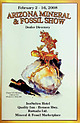
| spaces are scarce. Thanks for putting up with life's little problems like crowded restaurants, poor lighting...Parking Area Building B 126-132 & 226-233 Building D 134-144 & 234-24S (2nd floor) Parking Area Shuttle...B (2nd floor) Shuttle Stop Restrooms Parking Area Fossil Hall/ Silver, Copper Ballrooms Building...Restaurant EJE] +- Granada Avenue Entrance Parking Area ...............,....,.........,..,..,.... Parkview...Office Registration Desk Hotel Entrance 0 Parking Area St. Mary's Street lnnSuites - Granada at St. Marys |


