 | | Report (issue) |
| CALITI ES OF UTAH by Kenneth C. Bullock UTAH GEOLOGICAL AND MINERAL SURVEY a division of the UTAH DEPARTMENT...JANUARY 1981 MINERALS AND MINERAL LOCALITIES OF UTAH by Kenneth C. Bullock Nature displays her most.... . . . . . 1 Chapter I. Mining Districts of Counties and the State of Utah. . . . . . . . . . . . .... . . . . . . . . . . . . . . . . . . . . . . 1 County Listings. . . . . . . . . . . . . . . . . . . .... . . . . . . . . . . . 1 Chapter II. Mining Districts of Utah . . . . . . . . . . . . . . . . . . . |
 | | Report (volume) |
| Fluorspar Deposits of Utah GEOLOGICAL SURVEY BULLETIN 1005 Fluorspar Deposits of Utah By W. R. THURSTON...in cooperation with the State of Utah through the University of Utah. This report concerns work done partly... ________ ___________ History of fluorspar mining in Utah __ --__-_________--_____--___ Classification..._____ Deposits in Indian Peak Range and Monarch claims, Beaver County, by W. R. Thurston. __ ____ _______...mine__________________________--_.___-____ Blue Bell mine...-- ____ _____ - __ __ _ ___________ Noonday p |
 | | Report (issue) |
| OCCURRENCES IN UTAH by K. C. Bullock UTAH GEOLOGICAL AND MINERAL SURVEY a division of the UTAH DEPARTMENT...Purple pit fluorspar pipe, Lost Sheep mine, Spar Mountain, Juab County. CONTENTS Page Dell No. 5 Claim.... 42 Evening Star Prospect . . . . . . . . . . . . . . . . . . . . . . 43 Floride Mine . . . . . . ....Floride No. 1 Mine . . . . . . . . . . . . . . . . . . . . . . . 44 Floride No.5 Mine . . . . . . . ...Floride No. 13 Mine . . . . . . . . . . . . . . . . . . . . . . 45 Floride No. 18 Mine ............ · |
 | | Report (issue) |
| DEPOSITS OF THE SAN FRANCISCO AND ADJACENT DISTRICTS UTAH BY B. S. BUTLER WASHINGTON GOVERNMENT PRINTING...Basin structure Structure in the San Francisco district Geology Sedimentary rocks Geologic periods represented...relations Morehouse (?) quartzite (Silurian?) of Star district Distribution General character Conditions of...GEOLOGY AND ORE DEPOSITS OF THE SAN FRANCISCO REGION, UTAH. Geology—Continued. Sedimentary rocks—Continued...features Composition . Quartz monzonite of the Beaver Lake area . Areal extent Petrographic features |
 | | Journal (article/letter/editorial) |
| study of the San Franc{sco and adjacer•t d{str{cts, Utah, wh{ch {s presented {n deta{1 {n Profess{onal Paper...CopperGulch,and in the 0 K ore zon'e,in the BeaverLake district. The depositsof this type are characteristica...resemblance to a GEOLOGY OF SAN FRANCISCO DISTRICT, UTAH. 531 coarsepegmatitethoughno feldsparor micaare...altered and mineralized quartz monzonitein the O K mine. x, pipe of pegmatiticquartz; :•, altered quartz...mineral mentioned 532 B. S. BUTLER. above,hematite,magnetite? tourmaline,siderite, anhydrite, and |
 | | Book (volume) |
| instance, a single Spodumene crystal from the Etta Mine near Keystone on the east side of the Mount Rushmore...beds, excavations, etc.Selenite roses. BRULE COUNTY AREA: in the Oacoma zone of the Pierre Fm. On Elm...gray Barite rosette up to 5 or 6 inches. CAMPBELL COUNTY MOUND CITY, W to the Missouri R., regional hillsides...gravels, etc.petrified wood, wood opal. CORSON COUNTY LITTLE EAGLE: area ridges, slopes, stream beds...Hounds in the United States CUSTER COUNTY AREA: The November Mine, 1.2 mi. SE of the Needles Eye Tunnel |
 | | Report (issue) |
| of the Richfield I°x2° quadrangle, west-central Utah Thomas A. Steven I and Hal T. Morris 2 Open-File........................................... Basin-Range tectonism and sedimentation....................................... Southern Needle (Indian Peak) Range............................ Central Wah Wah Mountains...geologic map of the Richfield I°x2° quadrangle, Utah, showing source areas for volcanogenic-hydrothermal...uranium deposits in the Richfield I°x2° quadrangle, Utah ii 43 44 47 ABSTRACT The geology of the Richfield |
 | | Catalog/List |
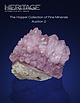
| Internet, Fax, and Mail) Heritage Auctions Design District Annex 1518 Slocum Street • Dallas, TX 75207 Session...Collection LOT VIEWING Heritage Auctions Design District Annex 1518 Slocum Street • Dallas, TX 75207 Wednesday...museum-quality Tourmalines, including the 2nd largest Sapo Mine “shaving brush” and an exceptional Elbaite on Feldspar...CALEDONITE Mammoth-Saint Anthony Mine, Tiger, Pinal Co., Arizona, USA Named by the Romans for the area...This example hails from the Mammoth-Saint Anthony Mine: a legendary Arizona locality. Unlike the vast majority |
 | | Report (issue) |
| UNIVERSITY OF UTAH VOL. X DECEMBER. 1919 NO. 11 I~ E THE I MINERAL INDUSTRY OF UTAH I ! ! ~ ~ §§...VARLEY ~ i I ~ ~ ~ ~ == ~ I ~ ~ LETIN No. 12 Utah En.,i,."en. Department of III eta//urgicaJ Research...~ I I! ~ PUBLISHED BY THE ;== JNIVERSITY OF UTAH. STATE SCHOOL OF MINES S !liE I In Co-operation...CENTURY~PRJNTlNG I ) ./ Utah Engineering Experilllent Station The Utah Engineering Experiment Station...Mines, the engineering college of the University of Utah. The station is authorized "to carryon experiments |
 | | Report (volume) |
| ....................................... 102 District of Columbia ............................................. North Carolina. .......................................................... North Dakota..................................................... Utah...................................................to refer to Geological Survey Bulletin 507, "The mining districts of the western United States," and to...abundant it may have been completely exhausted by mining or quarrying. Deposits of minerals that are widely |
 | | Report (issue) |
| Professional Paper Ill THE ORE ~DEPOSITS OF UTAH BY B. S. BUTLER, G. F. LOUGHLIN, V. C. HEIKES.... . . . . . . . . . . . Correlation with Uinta Range ......................... _......... _............81 83 84 84 85 87 87 87 87 THE ORE DEPOSITS OF UTAH. By B. S. BuTLER. PART !._:_GENERAL FEATURES. INTRODUCTION...INTRODUCTION. reports are those on the Mercur district, by J. E. Spurr and S. F. Emmons; the Bingham... began district, by J. M. Boutwell, Arthur Keith, and field work on the ore deposits of Utah in the S |
 | | Report (volume) |
| most important were those in the Central City district, Colorado, from which about 300 tons of high-grade...Silver Cliff mine, Wyoming; the Jesse D No. 1 and No. 2 claims, Utah; and the Merry Widow mine, New Mexico...important discoveries are the deposits at Marysvale, Utah; the Schwartzwalder (Ralston Creek) and Los Ochos...mines, Washington; the W. Wilson mine, Montana; the White King mine, Oregon; the deposits in the Pryor...deposits in the Dripping Spring quartzite, Gila County, Ariz. According to Nininger (1954, p. 43), as |
 | | Report (issue) |
| predecessor organization, the Manhattan Engineer District ; and, to a lesser extent, by staff members of...United States. The pre-1940 history of uranium mining and geology is concerned largely with veins in...New Mexico; in Big Indian Wash and White Canyon, Utah; and in the Gas Hills, Wyoming. Very large deposits...western United States in such areas as the Front Range mineral belt of Colorado; the Boulder batholith...Sierra Ancha region, Arizona ; and the Marysvale district, Utah. All the Western States, including Arizona |
 | | Book |
| Fossils in America A Range Guide to Mines and Minerals The Rock-Hunter's Range Guide Petrified Forest...different form in A Range Guide to Mines and Minerals and The Rock-Hunter's Range Guide, both by Jay Ellis...Hampshire New Jersey New Mexico New York North Carolina North Dakota Ohio Oklahoma Oregon Pennsylvania...Island South Carolina South Dakota Tennessee Texas Utah Vermont Virginia Washington West Virginia Wisconsin...of commercial mining is also long, beginning with the Kenya opal mines of 4000 B.C. Mining began with gemstones |
 | | Report (volume) |
| applications to be made direct to MINERALS SEPARATION NORTH CORPORATION AMERICAN Head Office, Engineering...so successful. Allis-Chalmers Manufacturing Co. Mining Machinery Dept. OFFICES For Canadian MILWAUKEE...Canada THE MINES HANDBOOK Meeting tbe Needs of Mine and Smelter Hundreds of plants on both American...service from Superior Jaw Crusher Worthington mining equipment the from the standpoint of first cost...most wear, Worthington meets the needs of the mining industries with a complete line of products, from |
 | | Report (volume) |
| 1922 The FLOTATION PROCESS MINERALS SEPARATION NORTH CORPORATION AMERICAN owns or controls over seventy...applications to be made direct to MINERALS SEPARATION NORTH CORPORATION AMERICAN Head Office, Engineering...California. THE MINES HANDBOOK, 1922 MACHINERY FOR MINE • MILL SMELTER Embodying recent developments...Hydraulic TurbinpM MILWAUKEE, Metallurgical Machinery Mining Machinery Perforated Oil l-:imini-- Metals I'liiiiliini:...are getting the most in service from Worthington mining equipment — :the most from the standpoint of first |
 | | Journal (issue) |
| 2002 • $15 Kristalle Wayne & Dona Leicht, 875 North Pacific Coast Highway, Laguna Beach, CA 92651 (949)...Mary Lynn Michela Associate Editors Piere Bariand Bill Birch Michael P. Cooper Anthony R. Kampf Joseph...COVELLITE crystal cluster, 3 cm across, From the Leonard mine, Butte, Montana. Frederick H. Pough collection;...(rightbackground) mines, Butte, ca. 1965. World Museum of Mining photo. 6 The Mineralogical Record, volume 33...hole.” The ground in the Butte mining camp, especially in the Kelley mine, was just full of vug holes |
 | | Journal (volume) |
| 4000 Salt Lake 3VHA مم • THE JOHNNIE MINING & MILLING COMPANY. - Illustrated . E rn lectre...lectre cel 2 Weste THE CROWN POINT GLOBE MINING COMPANY . - Illustrated .. سر/ SerT 19 CE W E VI ...11 , No. 1 000ook 1st. 1899. SALT LAKE CITY, UTAH, APRIL 15, 1909 11 SINGLE COPY, 15 CENTS 10 Association...GOES ON FOREVER The Mine & Smelter Supply Co. SALT LAKE CITY , UTAH 2. THE MINING REVIEW , SALT LAKE...LAKE CITY , UTAH , APRIL 15 , 1909 . Alamo Gasoline Hoists ed IN the latter part of 1908 the |
 | | Report (volume) |
| Geophysical Union.. Transactions, American Institute of Mining and Metallurgical Engineers _..._ American Journal...Colorado Mining Association publications . Economic Geology. _ . _ ___... Engineering and Mining Journal...of Sedimentary Petrology_...__._ Mines Magazine Mining Engineering ........___..._...._____ Advances in...Report ____________ ___._ Utah Geological and Mineralogical Survey.... Utah Geological Society, Guidebook...Guidebook to the Geology of Utah __..______._.______ Wyoming Geological Association Guidebook Miscellaneous |
 | | Journal (volume) |
| f.p. for for:v -" ...THE EN. N o GI "RNAL MINE NI'N NG G. J ou VOLUN/1E JANUARY TO LXIII. ...YORPQ. : - . - ". • : THE ENGINEERING AND MINING JOURNAL. VOLUME LXIII. JANUARY TO JULY, 1897...Aluminum, Prices of.................. 565 Accident Mine, Colo.......... 97 63, 159 Aluminum Reduction, Gooch's...118 Alabama Industrial and Scientific Amador Queen Mine, Cal..... ...... 263 Acetylene Gas, Conner's Pat... Doddridge's Pat...... 487 "Alabama, Johns Coal Mine. 74 Amalgamating Process, FischerAcetylene Gas, |
 | | Journal (volume) |
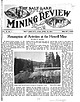
| CITY, UTAH , APRIL 15 , 1916 SINGLE COPY , 15 CENTS Resumption of Activities at the Howell Mine BY WILL...WILL C. HIGGINS The Howell Mining Company, of Salt Lake City, is making preliminary arrangements for the...property in the South Fork The property of the Howell Mining Com of Big Cottonwood canyon, about twentyfive...the great Cardiff mine, its near to the discovery of the property of the Howell Mining Company, of the...-roots. The discovery of the Howell reads al district has been not most like a romance . ed for its |
 | | Book (edition) |
| c-essrete eerer ere -ces cate face. eae eee 156 North. Wind River Basin: US 20, WY 789: Shoshoni—Thermopolis:...South Jenny Lake—North Jenny Lake Jct. wenny Make GON Drives wee ee eee aA US 287/89: North Jenny Lake Jct... Yellowstone National Park ou... ceeeeeeee 224 North Entrance—Mammoth Hot Springs.................cccceeneee...eruption of Yellowstone (3 times); uplift of the Teton Range; regional uplift of the western U.S. with concurrent...billion years ago. Black dike on Mount Moran (Teton Range) intruded about 1 billion years ago. First evidence |
 | | Journal (issue) |
| The DESERT MAGAZINE DESERT FEB. 27-MAR. 1 District basketball tournament at Santa Fe, New Mexico...fourth annual rodeo at Tucson city rodeo lot. 2-23 Utah State Institute of to hold 39th annual the Capitol...dedication near Tule Wells, Arizona. Sponsored by Yuma county chamber of commerce. 23-25 New Mexico Cattle Growers...American College of Surgeons convene in Salt Lake City, Utah. Surgeons from 11 Western states to attend. 26-29...By DICK FREEMAN PERSONALITY 'The West Wasn't so Wild,' Says San Diego Rawson, By OREN ARNOLD . . . DEVELOPMENT |
 | | Journal (issue) |
| CALIFORNIA FEDERATION OF MINERALOGICAL SOCIETIES Bill Burns. President 1038 Bradshawe. Monterey Park....Like his earlier maps, showing 300 gold sites in North Carolina, 500 in Georgia, 200 in Virginia, 140 in...out, bite, and loot very closely at abandoned old mine dumps and prospect pits. Make sure that the dumps...have found gold specimens include the Searchlight district, near Las Vegas, Nevada, where beautiful microcrystals...sluice box. As an example of how successful placer mining as a hobby can be, let me cite the folJowing vignette |
 | | Journal (issue) |
| Desert Calif. 92261. Subscription rates: $15.00 USA, $18.00 foreign, per year. See subscription form...Highway 99 at Merced, California, we proceed north along County Highway J-59. Soon we are paralleling another... The line served mining customers of North Tuolumne and Southwest Calaveras County. The Angels Branch...of the route. Tracks are still in place leading North from the Jamestown Station to just beyond the Pine...right-of-way headed north from here somewhat paralleling the present day Rawhide Road. Going north on Rawhide |


