 | | Report (issue) |
| 3 : ^> I North C: 3 Library NORTH CAROLINA DEPARTMENT OF CONSERVATION AND DEVELOPMENT GEORGE R. ROSS...BULLETIN NUMBER 61 SILLIMANITE DEPOSITS in North Carolina BY LEWIS J. HASH AND EARL C. YAN HORN EDITED...TENNESSEE VALLEY AUTHORITY RALEIGH 1951 NORTH CAROLINA DEPARTMENT OF CONSERVATION AND DEVELOPMENT...DEPOSITS in North Carolina By LEWIS J. HASH and EARL C. VAN HORN Edited by KEFTON H. TEAGUE North Carolina...Raleigh, North Carolina April 19, 1951 To His Excellency, HONORABLE W. KERR SCOTT Governor of North Carolina |
 | | Report (issue) |
| noRm c ult * 4 NORTH CAROLINA DEPARTMENT OF CONSERVATION AND DEVELOPMENT R. BRUCE ETHERIDGE, DIRECTOR...MICA DEPOSITS OF THE FRANKLIN-SYLVA DISTRICT, NORTH CAROLINA BY J. C. OLSON AND OTHERS PREPARED BY GEOLOGICAL...WITH THE NORTH CAROLINA DEPARTMENT OF CONSERVATION AND DEVELOPMENT RALEIGH 1946 NORTH CAROLINA DEPARTMENT...MICA DEPOSITS OF THE FRANKLIN SYLVA DISTRICT, NORTH CAROLINA By J. C. OLSON and Others PREPARED BY GEOLOGICAL...DEPARTMENT OF THE INTERIOR IN COOPERATION WITH THE NORTH CAROLINA DEPARTMENT OF CONSERVATION AND DEVELOPMENT |
 | | Journal (article/letter/editorial) |
| COUNTIES OF NORTH CAROLINA C. HENRY KING, FRANKUNVILLE, N.C. ALAMANCE—The North State pyrophyllite mine is located...by the Indians. ALLEGHANY—The Crouse manganese mine near Sparta has produced an interesting suite of...ASHE—Site of the Ore Knob copper mine in the eastern part of the county has produced chalcocite, bornite...Mountain. BURKE—Three diamonds have been found in this county. One specimen is at the State Museum in Raleigh...was found in the Reed mine. In 1803 a 28 lb. nugget was found in this same mine! This area has, in recent |
 | | Report (issue) |
| Vicinity North Carolina Mineral Resources of the Grandfather Mountain Window and Vicinity North Carolina...Falls ___ _-_ _-____ 3. Map of uranium prospects on North Harper Creek--------- ______ __ 2 5 6 TABLES ...of selected specimens from iron prospects on Big Ridge, Linville quadrangle _________________________________...the Grandfather Mountain Window and Vicinity, North Carolina By Bruce Bryant and John C. Reed, Jr. ABSTRACT...Mountain window and vicinity in northwestern North Carolina and presents these data independently of the |
 | Robinson, Gilpin R., Lesure, Frank G., Marlowe, J. I., Foley, Nora K., Clark, S.H. (2004) Bedrock geology and mineral resources of the Knoxville 1° x 2° quadrangle, Tennessee, North Carolina, and South Carolina. Open-File Report 2004-1075. US Geological Survey doi:10.3133/ofr20041075 | Report (issue) |
| Knoxville 1°x2° Quadrangle, Tennessee, North Carolina, and South Carolina By G.R. ROBINSON, Jr., F.G. LESURE...Knoxville 1°x2° quadrangle Tennessee, North Carolina, and South Carolina / by G.R. Robinson, Jr. ... [etaf...Geology—Tennessee. 2. Geology—North Carolina. 3. Geology—South Carolina. 4. Mines and mineral resources—Tennessee...and mineral resources—North Carolina. 6. Mines and mineral resourcesSouth Carolina. I. Robinson, G.R. II...Piedmont Lithotectonic Belt 10 Blue Ridge 13 East Flank Blue Ridge Lithotectonic Belt 14 Helen Thrust |
 | | Report (issue) |
| GENERAL FEATURES OF THE MAGNETITE ORES OF WESTERN NORTH CAROLINA AND EASTERN TENNESSEE.1 By W. S. BAYLEY. INTRODUCTION...DISTRIBUTION. The iron ores of western North Carolina and Carter County, Tenn., comprise brown hematite (limonite...titaniferous magnetite (mixtures of magnetite with ilmenite or with rutile). Hematite alone also occurs, but...of North Carolina have increased in importance. Brown ore and magnetite produced in western North Carolina...353 60,593 43,483 44,482 o From reports of North Carolina Geol. and Econ. Survey and Mineral Resources |
 | | Report (volume) |
| Knoxville 1 °X2° Quadrangle, Tennessee, North Carolina, and South Carolina U.S. GEOLOGICAL SURVEY BULLETIN...Knoxville 1°X2° Quadrangle, Tennessee, North Carolina, and South Carolina By G.R. ROBINSON, Jr., F.G. LESURE...Knoxville 1°X2° quadrangle Tennessee, North Carolina, and South Carolina I by G.R. Robinson, Jr. ... [et al...Geology- Tennessee. 2. Geology-North Carolina. 3. Geology-South Carolina. 4. Mines and mineral resources-...and mineral resources-North Carolina. 6. Mines and mineral resourcesSouth Carolina. I. Robinson, G.R. II |
 | | Report (issue) |
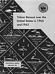
| concentration increases with latitude going from south to north. The relatively low values for total tritium rainout...distribution of tritium fallout in precipitation over North America: Internat. Assoc. Sci. Hydrol. Bull., v...and Hoffman, C. M., 1963, Tritium fallout over North America from the Soviet tests in 1961: Jour. Geophys...Vicinity North Carolina Mineral Resources of the Grandfather Mountain Window and Vicinity North Carolina...____ ___ - ______ 3. Map of uranium prospects on North Harper Creek-______________-__--__---_-- 2 5 6 |
 | | Report (volume) |
| North Carolina State Library Gift of "JYortk (^arolinti ^Ihranj 0 Digitized by the Internet Archive...in 2019 with funding from State Library of North Carolina https://archive.org/details/corundumperidoti01prat...OF WESTERN NORTH CAROLINA BY JOSEPH HYDE PRATT and JOSEPH VOLNEY LEWIS North Carolina State Library...Library Raleigh NORTH CAROLINA GEOLOGICAL SURVEY J. A. HOLMES, STATE GEOLOGIST VOLUME I CORUNDUM AND...WESTERN NORTH CAROLINA BY JOSEPH HYDE PRATT AND JOSEPH VOLNEY LEWIS RALEIGH NORTH CAROLINA 1905 |
 | | Report (volume) |
| 'THE GEOLOGICAL vt- ,(231 > ' " ^THE MINERALS CAROLINA''" i '- OF, - :l|^fe^H - GOTEENMENT LIBRARY... W. Powell, director | | The | minerals of North Carolina | by | Frederick Augustus Geiitk | [Vignette]...J. W. Powell, director | | The | mineralsof North Carolina | by | Frederick Augustus Genth | [Vignette]...W. Powell, director | | The | :aainerals of North Carolina | by | FrederickAugustusGenth j [Vignette]...separately. Price $2.50. XVI. The Paleozoic Fishes of North America, by John Strong Newberry. 1889. 4°. 340 |
 | | Report (issue) |
| Mica Deposits of the Blue Ridge in North Carolina GEOLOGICAL SURVEY PROFESSIONAL PAPER 577 Work done...done in part in cooperation with the North Carolina Department of Conservation and Development and in part...Administration Mica Deposits of the Blue Ridge in North Carolina By FRANK G. LESURE GEOLOGICAL SURVEY PROFESSIONAL... Work done in part in cooperation with the North Carolina Department of Conservation and Development..._-- _ __- _____ . Faults ____ ___ ___ ... Blue Ridge thrust sheet. ______ Metamorphism. _ _ _ _ _____________ |
 | | Report (issue) |
| _____________ _ Blue Ridge ________________________________ _ Valley and Ridge ___________________________..._________________________________ _ 27 28 30 30 Valley and Ridge province,.-_-----------Appalachian Plateaus provin...tensely disturbed local areas ___ --- - -- -- Blue Ridge and Piedmont provinces ____ --- 12 13 13 13 13...___ _ 96 Piedmont and Blue Ridge provinces ______ _ Valley and Ridge province ______________ _ Appalachian...Slate__________________________________ Valley and Ridge slate belt__________ West Virginia slate belt______________ |
 | | Report (issue) |
| OF THE GREAT SMOKY MOUNTAINS, TENNESSEE AND NORTH CAROLINA GEOLOGICAL SURVEY PROFESSIONAL PAPER 349-A...siltstone___________________ Rocks of Webb Mountain and Big Ridge __ Walden Creek group. ___________________ Licklog...... Folds south of Dunn Creek fault_____ Folds north of Dunn Creek fault-____ Dunn Creek fault--.---_---_-_--_-Faults...---_---_-_--_-Faults south of Dunn Creek fault-___ Faults north of Dunn Creek fault__ Postmetamorphism structural...----------------------------------Structural features north of Great Smoky and English Mountain faults.__________________ |
 | | Report (issue) |
| C. A. Michael. COLD NUGGET FROM SPOTSYLVANIA COUNTY: Longest dimension approximately 13 cm., photograph...updated “check list” just alluded to, (2) a county-by-county listing of the minerals, and (3) resumes of...Corundum Hematite (Spccularite) (Martite) (Turgite) Ilmenite Rutile (Leucoxene) 4 Checklist Pyrolusite...(Haydcnitc) 9 Virginia Mineral Localities by County This list is included for possible aid in planning...listed only* if localities arc given for them. The county lists do not include com mon rock-making materials |
 | | Book (volume) |
| along the southern slopes and ridges of the Pine Ridge Escarpment and along Whiteclay Creek near the Sioux...vertebrate remains. The breaks of the White River north of Crawford in Dawes Co. and the rather extensive...chalcedony, jasper and gem petrified wood. BUFFALO COUNTY KEARNEY, area gravel bars and pits along the Platte...townagate, chalcedony, jasper, petrified wood. CASS COUNTY WEEPING WATER, SE, on rd. to Nehawka, in the Snyderville...chalcedony, jasper, fossils. CHERRY COUNTY VALENTINE, in the Sandhills county along the Niobrara R. and Minnechaduza |
 | | Book (volume) |
| grading to 600 to 800 feet thick in the north. ALEXANDER COUNTY FAYVILLE, area stream gravels⎯agate, jasper...⎯agate, jasper; d RR siding of Clay⎯agate. CALHOUN COUNTY AREA, shores of the Mississippi R., in the Warsaw...crystals). CRAWFORD COUNTY PALESTINE, area deposits⎯Siderite. EDWARDS COUNTY AREA, T. 1 S, R. 10 E...deposits⎯Siderite. FULTON COUNTY FARMINGTON, W 6 mi. on Rte. 116 to the Rapatee No. 5 strip mine⎯pyritized gastropods...gastropods (Pennsylvanian age). GRUNDY COUNTY AREA: c Regional rd. and RR cuts and banks of Mason Cr.⎯fossils; |
 | | Book |
| CHAPTER 8 Tennessee 8 7 6 CHAPTER 10 South Carolina ......... _ .......... _ _ .... ____________________............._........... 7 3 6 CHAPTER 9 North Carolina 4 2 3 3 9 6 3 CHAPTER 1 GEM H U N T...l a c h i a n s a r e t h e spectacular B l u e Ridge a n d S m o k y M o u n t a i n r a n g e s w h...h i c h c r e s t a t M t . N o r t h Carolina, a n d C l i n g m a n ' s Dome, Tennessee. Because t h...was m e r e l y p a r t o f t h e waste o f t h e mine. W h a t t h e y needed was h i g h grade ore o |
 | | Book |
| commercial ores and secondary minerals by state, county, township, and geologic range. For easy identification...61 232 PART The Making 43 II 5 7 3 III Mine PART 267 IV Glossary 279 Bibliography 291...cities, and many of today’s prosperous western county seats began as mining-boom camps. trating sand...Whether you such as those listed alphabetically by county, township, and range in Part II of this book. Where...minerals which make lovely cabinet specimens. old mine western states, to kick up and oxidation, |
 | | Report (issue) |
| CAROLINA GEOLOGICAL SOCIETY FIELD TRIP GUIDEBOOK October 21 – 23, 1983 GEOLOGIC INVESTIGATIONS IN...IN THE BLUE RIDGE OF NORTHWE3STERN NORTH CAROLINA Edited by Sharon E. Lewis Virginia Division of Mineral...pit”, of the main adit and Stopes of the Cranberry mine Copies of this guidebook may be obtained from:...NRCD Post Office Box 27687 Raleigh, North Carolina 27611-7687 CAROLINA GEOLOGICAL SOCIETY 1983 OFFICERS...South Carolina 29613 Vice-President: John J. Chapman Department of Earth Science Western Carolina University |
 | | Book |
| York North Carolina North Dakota Ohio Oklahoma Oregon Pennsylvania Rhode Island South Carolina South...had been sending great expeditions to prospect and mine for it throughout the Sinai Peninsula since at least...and abandoned, one is also sure to find extensive mine dumps sloping steeply down from the shaft or tunnel...prodvced by atmospheric oxidation, can be found. Old mine dumps often reveal a varied assortment of brightly...unusual for a casual visitor to an old gold rush mine to kick up a solid gold, silver, or native copper |
 | | Report (volume) |
| General features____________________________ Coosa County _________ ____________________ Randolph County...Cherokee County_____________________________ 72 Elbert County _____________________________ 75 Hall County__...County_______________________________ 76 Hart County. ___ __ __________________ 77, Lumpkin and Union counti...___________ S3 Pickens County _______-______________________ 83 Rabun County-_____________________________...____________ 86 Troup County ________________________________ 86 Upson County _______________________________ |
 | | Report (issue) |
| CAROLINA GEOLOGICAL SOCIETY STUDIES OF PRECAMBRIAN AND PALEOZOIC STRATIGRAPHY IN THE WESTERN BLUE RIDGE...RIDGE edited by STEPHEN A. K ISH November 9-10, 1991 CAROLINA GEOLOGICAL SOCIETY 1991OFFICERS President:...Mitchell 1991Bill Hoffman Don Hathaway Vic Zuello Carolina Geological Society Field Trip 1991 Joseph G. Aylor...Tennessee Knoxville, TN 37996-1410 Carl Merschat North Carolina Geological Survey 59 Woodfin Place Asheville...University of Tennessee Knoxville TN 37996-1410 & Oak Ridge National Laboratory John Rodgers Dept. of Geology |
 | | Report (issue) |
| of the Great Smoky Mountains Tennessee and North Carolina GEOLOGICAL SURVEY This volume was published...OF THE GREAT SMOKY MOUNTAINS, TENNESSEE AND NORTH CAROLINA GEOLOGICAL SURVEY PROFESSIONAL PAPER 349-D...beneath Great Smoky fault________----_-__ Syncline north of Chilhowee Mountain. _______ Guess Creek fault...___________ Valley and Ridge province.---------------------Outliers of the Valley and Ridge province the coves__...Cove_________________-__-_------_--Miller Cove-- -_ _ -- -Blue Ridge province______________ -----------Post-Paleozoic |
 | | Report (issue) |
| the Grandfather Mountain Window and Vicinity, North Carolina and Tennessee By BRUCE BRYANT and JOHN C. REED..._____________________ _ 1 2 2 6 7 7 7 Page Blue Ridge thrust sheet-Continued Structure and metamorphism...metamorphism ____________________ 11 11 11 11 Blue Ridge thrust sheet ----------------------------Rock un~s...Chilhowee Group --------------------------- 45 Slices north of the Grandfather Mountain window ------------...tectonic map of the Blue Ridge and Valley and Ridge belts in parts of North Carolina, Tennessee, and southern |


