| Locality | Latitude | Longitude | Distance | Bearing |
|---|
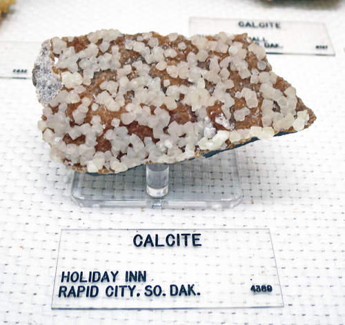
| Rapid City, Pennington County, South Dakota, USA | 44° 4' 49" N | 103° 13' 51" W | 0.0km (0.0 miles) | |
| Gyp Pit (MRDS - 10299374), Pennington County, South Dakota, USA | 44° 4' 47" N | 103° 15' 4" W | 1.6km (1.0 miles) | |
| Haydite Pit, Pennington County, South Dakota, USA | 44° 4' 47" N | 103° 15' 4" W | 1.6km (1.0 miles) | |
| Cowboy Hill, Rapid City, Pennington County, South Dakota, USA | 44° 5' 33" N | 103° 14' 57" W | 2.0km (1.2 miles) | |
| Museum of Geology, Rapid City, Pennington County, South Dakota, USA | 44° 4' 23" N | 103° 12' 22" W | 2.1km (1.3 miles) | |
| Dakota Lime & Brick Company Quarry, Pennington County, South Dakota, USA | 44° 5' 49" N | 103° 16' 32" W | 4.0km (2.5 miles) | |
| South Dakota State Cement Plant, Unorganized mining district [5], Pennington County, South Dakota, USA | 44° 5' 30" N | 103° 16' 55" W | 4.3km (2.7 miles) | |
| Hills Materials Limestone Quarry, Unorganized mining district [5], Pennington County, South Dakota, USA | 44° 5' 32" N | 103° 16' 59" W | 4.4km (2.7 miles) | |
| Lange Gypsum Quarry, Pennington County, South Dakota, USA | 44° 6' 41" N | 103° 16' 0" W | 4.5km (2.8 miles) | |
| Rapid City Limestone Quarry, Pennington County, South Dakota, USA | 44° 5' 42" N | 103° 17' 58" W | 5.7km (3.6 miles) | |
| Pete Lien Quarry, Pennington County, South Dakota, USA | 44° 7' 6" N | 103° 16' 57" W | 5.9km (3.7 miles) | |
| Everist Limestone Quarry, Pennington County, South Dakota, USA | 44° 7' 15" N | 103° 17' 4" W | 6.2km (3.9 miles) | |
| S. Dak Cement Company Gypsum Quarry, Meade County, South Dakota, USA | 44° 7' 55" N | 103° 17' 19" W | 7.4km (4.6 miles) | |
| Brooks Cave, Rapid City, Pennington County, South Dakota, USA | 44° 2' 24" N | 103° 19' 53" W | 9.2km (5.7 miles) | |
| Perli Quarry, Pennington County, South Dakota, USA | 43° 59' 56" N | 103° 15' 36" W | 9.4km (5.8 miles) | |
| Light Aggregates Inc Shale Pit, Pennington County, South Dakota, USA | 44° 6' 33" N | 103° 7' 3" W | 9.6km (6.0 miles) | |
| Dakota Plaster Company Pit (U.S. Gypsum Company Blackhawk Operation), Meade County, South Dakota, USA | 44° 9' 2" N | 103° 18' 10" W | 9.7km (6.0 miles) | |
| Nameless Cave, Rapid City, Pennington County, South Dakota, USA | 44° 3' 30" N | 103° 20' 56" W | 9.7km (6.1 miles) | |
| Wildcat Cave, Rapid City, Pennington County, South Dakota, USA | 44° 3' 38" N | 103° 21' 26" W | 10.3km (6.4 miles) | |
| State Shale Pit, Pennington County, South Dakota, USA | 44° 7' 52" N | 103° 5' 37" W | 12.3km (7.7 miles) | |
| Dakota Lime and Brick Company, Unorganized mining district [5], Pennington County, South Dakota, USA | 44° 6' 33" N | 103° 23' 55" W | 13.8km (8.6 miles) | |
| Green Granite quarry, McGees Station, Pennington County, South Dakota, USA | 44° 2' 1" N | 103° 23' 44" W | 14.2km (8.8 miles) | |
| Sitting Bull Caverns, Rockerville, Pennington County, South Dakota, USA | 43° 57' 43" N | 103° 18' 19" W | 14.4km (9.0 miles) | |
| Rockerville, Pennington County, South Dakota, USA | 43° 57' 28" N | 103° 21' 30" W | 17.0km (10.6 miles) | |
| Black Hills Silica Sand Company Mine (MRDS - 10299000), Pennington County, South Dakota, USA | 43° 56' 29" N | 103° 20' 52" W | 18.1km (11.2 miles) | |
| Stagebarn Caverns, Meade County, South Dakota, USA | 44° 11' 52" N | 103° 23' 49" W | 18.6km (11.6 miles) | |
| Ice Cave, Meade County, South Dakota, USA | 44° 11' 21" N | 103° 24' 52" W | 19.0km (11.8 miles) | |
| Baker Park, Sheridan Lake, Pennington County, South Dakota, USA | 43° 58' 26" N | 103° 25' 3" W | 19.0km (11.8 miles) | |
| Dexter Claim (Ashley & Nyswanger), Pactola Mining District, Pennington County, South Dakota, USA | 44° 3' 53" N | 103° 28' 14" W | 19.2km (12.0 miles) | |
| Copper Glance (Uranium Lode; Poisoned Ox Group), Pactola Mining District, Pennington County, South Dakota, USA | 44° 4' 37" N | 103° 28' 43" W | 19.8km (12.3 miles) | |
Minerals recorded nearby (within 19.8 km)
Rock types recorded nearby (within 19.8 km)
Entries shown in red are rocks recorded for this region.


Rapid City, Pennington County, South Dakota, USA