Sunstone Butte Mine, Harney County, Oregon, USAi
| Regional Level Types | |
|---|---|
| Sunstone Butte Mine | Pit (Active) |
| Harney County | County |
| Oregon | State |
| USA | Country |
This page is currently not sponsored. Click here to sponsor this page.

Latitude & Longitude (WGS84):
42° 49' 29'' North , 119° 53' 46'' West
Latitude & Longitude (decimal):
Type:
Pit (Active) - last checked 2019
Köppen climate type:
Mindat Locality ID:
333007
Long-form identifier:
mindat:1:2:333007:7
GUID (UUID V4):
83bdb5ce-f8ad-416a-9113-a630ee42fd06
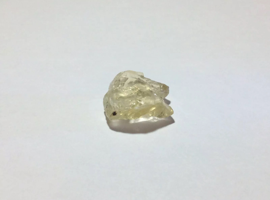
Sunstone Butte Mine is a series of claims situated on the side of an old volcano in Butte Basin and was originally part of the PANA Mine. In 2011 the PANA Mine was split into two halves with 5 claims under the new Sunstone Butte name and 4 claims under the original PANA name. Sunstone Butte Mine operates as an open pit mine with a large scale excavator that moves large amounts of cinder cone out of the pit. Then, for the rest of the season it's a matter of sifting through what has been brought up, hopefully finding large Sunstone crystals among all of the cinder cone. Ore is transported from the excavator to a separator and screened down to less than 20 cm in size and run through a small processing plant where crystals are removed from their volcanic matrix. From there, the material is reduced to fist-sized pieces with a small hammer, allowing the crystals to be handpicked. Sorting is done by hand on large steel tables on the top of the tailing pile. There is much Labradorite Feldspar to sort through, ranging from near-colourless to pale yellow to red and green, including bicolour specimens. The mine owners bring on a small number of employees to work the claim with them; the employees work for a share of the production. The actual term ‘Butte Basin’ is a made-up name which actually refers to the Eagle Butte region (PANA and/or Sunstone Butte mines) located 28 miles north of Plush. Sunstone Butte Mine is situated just inside Harney County about 2 miles from the Lake County line.
Select Mineral List Type
Standard Detailed Gallery Strunz Chemical ElementsDetailed Mineral List:
| ⓘ Anorthite Formula: Ca(Al2Si2O8) |
| ⓘ Anorthite var. Oregon Sunstone Colour: Near-colourless to pale yellow to red and green, including bicolor specimens. |
Gallery:

List of minerals arranged by Strunz 10th Edition classification
| Group 9 - Silicates | |||
|---|---|---|---|
| ⓘ | Anorthite | 9.FA.35 | Ca(Al2Si2O8) |
| ⓘ | var. Oregon Sunstone | 9.FA.35 | (Ca,Na)[Al(Al,Si)Si2O8] |
List of minerals for each chemical element
| O | Oxygen | |
|---|---|---|
| O | ⓘ Anorthite | Ca(Al2Si2O8) |
| Al | Aluminium | |
| Al | ⓘ Anorthite | Ca(Al2Si2O8) |
| Si | Silicon | |
| Si | ⓘ Anorthite | Ca(Al2Si2O8) |
| Ca | Calcium | |
| Ca | ⓘ Anorthite | Ca(Al2Si2O8) |
Other Regions, Features and Areas containing this locality
North America PlateTectonic Plate
This page contains all mineral locality references listed on mindat.org. This does not claim to be a complete list. If you know of more minerals from this site, please register so you can add to our database. This locality information is for reference purposes only. You should never attempt to
visit any sites listed in mindat.org without first ensuring that you have the permission of the land and/or mineral rights holders
for access and that you are aware of all safety precautions necessary.


Sunstone Butte Mine, Harney County, Oregon, USA