 | | Journal (volume) |
| STATE OF CALIFORNIA DEPARTMENT OF NATURAL RESOURCES WARREN T. HANNUM, Director DIVISION OF MINES FERRY...State Mineralogist JANUARY Vol. 41 1945 No. CALIFORNIA JOURNAL OF MINES AND GEOLOGY QUARTERLY CHAPTER...OF STATE MINERALOGISTS REPORT XLI printed in California state printing office SACRAMENTO, I945 41703... (L^^yt^W THE LIBRARY OF THE UNIVERSITY OF CALIFORNIA DAVIS DIVISION OF MINES EXECUTIVE AND TECHNICAL...Burling Tucker, C. A. District San Francisco Mining Engineer Logan, District Mining Engineer Sacramento |
 | | Journal (article/letter/editorial) |
| also found in the rock. The pink will fluoresce red under a short wave Mineralight." for the first time...Murdock, professor of geology at the University of California at Los Angeles. The only other known occurrence...the first phyllite we ever saw from sers" area, Sonoma County, Calif. It was noted by M. Vonsen in CALIF... ranging in in a road cut situated in Randolph County, size from 2 to 4 millimeters. Sometimes it Ala...other recognized psilomelane in the Batesville district, In- species as laumontite, thomsonite, datolite |
 | | Report (issue) |
| MINERALS OF CALIFORNIA THE GOLDEN BEAR The Golden Bear Nugget of Yankee is NUGGET said to have...have been found in the mining the nugget Jim, Placer County, California, in 1871 by a small girl in...are nuggets. The nugget was acquired by the California Federation of Minerologicol Societies insignia...in in the Cali- San Francisco MINERALS OF CALIFORNIA CENTENNIAL VOLUME by JOSEPH (1866-1966) MURDOCH...Ian Campbell and Eleanor M. Learned BULLETIN California Division of Ferry Building, San 189 Mines |
 | | Journal (article/letter/editorial) |
| specimens, are either inaccessible or are in closed mining districts, or are closed for political reasons...City-D~Lamar Mining Dlstricts / J\. I,' -r-, - L..... ~ rl.. kl \ , 50 I 100 I Miles old mining and...by a few collectors for about fifty years, this area was popular for little more than a decade, providing...granite, lies within a Wilderness Area in the Sawtooth National Recreation Area. There are many other proposed...scientific significance. In this index, the better known mining districts that have produced many high-quality |
 | | Book |
| MINERALS OF CALIFORNlA 299" 257889 PEMBERTON' HOFE CALIFORNIA MINERALS 2995 SEP 1933 OINCO Digitized by...org/details/mineralsofcalifo00pemb MINERALS OF CALIFORNIA - MINERALS OF CALIFORNIA H. Earl Pemberton ~ VAN NOSTRAND...H. Earl, 1907Minerals of California. An updating of: Minerals of California: centennial volume, 1866-1966...index. 1. Mineralogy - California. 2. Mines and mineral resources - California. I. MUidoch, J oseph, 1890Minerals...1890Minerals of California. 11. Title. QE375.C32P45 549.9794 81-15963 ISBN 0-442-274882 AACR2 Preface |
| | Book |
| 7 257989 R q549 PEMBERTON, H.E MINERALS OF CALIFORNIA P 2995 IpSl q 49 f 07. 257889 ^ pe B T...org/details/mineralsofcalifoOOpemb MINERALS OF CALIFORNIA MINERALS OF CALIFORNIA H. Earl r i L ] Pemberton ...H. Earl, 1907Minerals of California. An updating of: Minerals of California: 1866-1966 / by Joseph Murdoch...Includes index. 1. Mineralogy -California. 2. Mines and mineral resources- California. I. Murdoch, Joseph, 1890Minerals...1890Minerals of California. II. Title. centennial volume, QE375.C32P45 ISBN 0-442-27488 2 549.9794 |
 | | Book (volume) |
| ..........................................49 California ..............................................................548 Table of Maps Page Alabama County Map ...................................................................................4 Alaska County and Stream Map ..................................Co. Mining Districts ............................................................22 Arizona County Map.........................23 Arizona – Cochise Co. Mining Districts .................................... |
 | | Journal (volume) |
| STATE OF CALIFORNIA DEPARTMENT OF NATURAL RESOURCES GEORGE D. NORDENHOLT. Director DIVISION OF MINES...BRADLEY State Mineralogist JANUARY, 1939 No. CALIFORNIA JOURNAL OF MINES AND GEOLOGY QUARTERLY CHAPTER...BUILDING, SAN FRANCISCO CALIFORNIA 70803 LIBRARY UNIVERSITY OF CALIFORNIA DAVIS 1 DIVISION OF MINES...Logan, District Mining Engineer O. McK. Laizure, District W. Burling Tucker, Reid J. Mining Engineer...Engineer District Sampson, Assistant Mining Engineer District Engineer Ohas. V. Averill, District Mining |
 | | Book (volume) |
| ..........................................39 California ...............................................rights, so remember you were told. If in doubt, a county map will tell you who the legal owner is. Good...pegmatites and ore-bearing veins. Prior to the California gold rush of 1849, this portion of Alabama experienced...gemmy qualities for cutting and polishing. AUTAUGA COUNTY PRATTVILLE, N. 6 mi., and just E of the Birmingham...sandstone⎯red ocher. (Such deposits were well known to prehistoric Indians.) BARBOUR COUNTY BAKER HILL |
 | | Report (issue) |
| should read "The quicksilver mine.s of Colusa County are all located within the" etc. Digitized...http://www.archive.org/details/bulletin78cali CALIFORNIA STATE MINING BUREAU FERRY BUILDING, SAN FRANCISCO FLETCHER...No. 78 [May, 1918 Quicksilver Resources of California WITH A SECTION ON METALLURGY AND ORE-DRESSING...ORE-DRESSING By WALTER W. BRADLEY, E. M. CALIFORNIA STATE PKINTIXG OFFICE SACRAMENTO 19 18 88540 CONTENTS...Dorado Fresno Glenn Humboldt Inyo Kern Kings Lake Los Angeles Marin Mariposa Mendocino Merced Modoc |
 | | Report (volume) |
| east-west, northwest, and northeast within the district. Hawkins (1982) postulated that the east-west...scale east-west-trending faults in the Enfield Bell mine are are the Marlboro Canyon, Bell, and Ridge faults...upper- and lower-plate rocks in the Jerritt Canyon district is thought to be a high-angle fault. Exposure...cover in the district. REGIONAL STRATIGRAPHY Most of the rocks in the Jerritt Canyon district are Paleozoic...Enfield Bell mine, Jerritt Canyon district, Elko County, Nevada. � Geology of the Enfield Bell Mine and the |
 | | Report (volume) |
| -___-_..__.__'_______________________ Utah-Bellevue mine------------._-_-______________________ Penobscot...--_--------__-__-________________________ Overland mine.----_--------------_-_____--__._________-_Monday...Scorpion Gulch..__________________________ Climax mine.--.--- -----_-_--___________________________ Rowley...Mayflower lode.______________________________ Red Elephant mine-------------_--________________._______ New...group-----------___---_-_---___________________._ Red Cloud mine.-----__---_---_____-____________--_______ Pass |
 | | Journal (article/letter/editorial) |
| ElementContentof the Wood River Lead-SilverDeposits,Blaine County,Idaho WAYNE E. HALL AND G. K. CZAMANSKE Abstract...lead-silverdepositsare in Blaine County in the Mineral Hill district, south-central Idaho, in the vicinity...Bureau of Mines and Geology mapped the Mineral Hill district under the supervisionof A. L. Anderson (1950)...emissionspectrography. Geologyof the Mine ,4rea.--Rocks in the BellevueHailey area are predominantly blacksiliceous...Mississippianage is the oldestformationexposedin the area. This formationis apparentlyat least 3,000 feetthick |
 | | Book |
| Arizona Gem Trails and the Colorado Desert of California High Tension (A Biography) Jay Ellis Ransom...in L.\merica Alabama Alaska Arkansas Arizona California Colorado Connecticut Delaware Florida Georgia...possible by Howard and Hazel Michael, of Y reka, California, who opened their home and rock museum to me...Recently, archaeologists working in the remote Lake Rudolf area of Africa's Kenya found shaped stone implements...cultural evolution and the possibility of language. The Lake Rudolf implements are some 1,800,000 years older |
 | | Report (volume) |
| JARBIDGE, CONTACT, AND ELK MOUNTAIN MINING DISTRICTS ELKO COUNTY, NEVADA BY F. C. SCHRADER WASHINGTON... 58 __.____ 64 4 CONTENTS. The Jarbidge district Continued. Page. Description of properties._________...the west system of veins______________ 66 Pavlak mine. ________1_______ 67 Location _ _ ___________ 67..._____________ Pan property _ __ ____ Sunflower group Red Bird and Duffy claims____ _____________ Bourne mine__...group__ ____ 86 86 Vulcan group ________ Mahogany mine Amazon-Rainbow group __ __________ Properties of |
 | | Report (volume) |
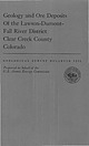
| Deposits Of the Lawson-DumontFall River District Clear Creek County Colorado By C. C. HAWLEY and FRANK BAKER...of the general geology and ore deposits of the district which forms the northwestern part of the important...important Central City-Idaho Springs mineralized area UNITED STATES GOVERNMENT PRINTING OFFICE, WASHINGTON...section of the Lawson-Dumont-Fall River district, Clear County, Colo. 2. ~ap showing major faults (veins)...(veins) of the Lawson-DumontFall River district projected to a horizontal plane having an elevation of 8 |
 | | Report (issue) |
| ] \ I ^,_|^_g|g„gy. MMM STATE OF CALIFORNIA GOODWIN I. KNIGHT, Governor DEPARTMENT OF... Chief BULLETIN December 173 MINERALS OF CALIFORNIA By JOSEPH MURDOCH University of Caliiomia,...ROBERT W. WEBB University of California, Santa Barbara College Goleta, California Price $3.00 LIBRARY UNIVERSITY...Goodwin J. Knight Governor of ihe State of California Dear Sir: I have the honor to transmit herewith...JenlCalifornia, Chief of the Division of Mines. Minerals of California is one of the Division's |
 | Hodges, C.A., Cox, D.P., Singer, D.A., Case, J.E., Berger, B.R., Albers, J.P. (1984) U.S. Geological Survey-INGEOMINAS mineral resource assessment of Colombia. Open-File Report Vol. 1984 (84-345) US Geological Survey doi:10.3133/ofr84345 | Report (issue) |
| Geological Survey editorial standards. Menlo Park, California 1984 Contents Summary 1 Introduction 2...unusally complex mineralogy (such as the California-Vetas district) would be useful, not only for exploration...Characteristics Ten percent of the deposits from the California-Oregon region in the United States contain 1...(SIP), produced encouraging results in northern California (Wynn and Hasbrouck, in press). Reconnaissance...and in the Eastern Cordillera at the California-Vetas District (Domain 23) (Sillitoe and others, 1982) |
 | | Book (volume) |
| THE SOUTHWESTERN QUADRANT Arizona, Arkansas, California, Colorado, Louisiana, Nevada, New Mexico, Oklahoma...The Southwestern Quadrant Arizoni, Arkansas, California, Colorado, Louisicna, Nevada, New Mexico, Oklahoma...Mineral Location Numbers Arizona Arkansas California Colorado 258 Louis B30 ana HOW TO USE...volumes, through very precise directions and accurate county maps, to get you to the best and most accessible...for the county in which it is located. This site number also appears under the given county in the text |
 | | Report (issue) |
| PROSPECTS, LAWSON-DUMONT-FALL RIVER DISTRICT, CLEAR CREEK COUNTY, COLORADO By C. C. Hawley and Frank...References cited Mine descriptions « Lawson area, north of Clear Creek Larger mines in the Red Elephant group Boulder...prospecting Other mines on Red Elephant Hill and in Young America Gulch ClevelandC?) mine Flat Iron vein Mines...Mines east of Red Elephant Hill Central America (Tinker) mine-Comstock vein Dexter mine i Johnson group...group Last Chance mine « r Little Giant mine Little Superior (Jack Rabbit) mine Orient mine Panama group ; |
 | | Report (volume) |
| Colorado-- Federal Center, Bldg. 810 MENLO PARK, California--Bldg. 3, Rm. 3128,345 Middlefield Rd. • RESTON...Dr. SALT LAKE CITY, Utah--Federal Bldg., Rm. 8105,125 South State St. SAN FRANCISCO, California--Customhouse...from California and Oregon, U.S.A. 41 PGE grades of pediform chromite deposits from California and Oregon...rock types 133 Cross section through the Kalavos district Cyprus showing relationship of massive sulfide...based on considerations that extend far beyond the mine itself, in some instances relating to the overall |
 | | Report (volume) |
| location and means of access to all the metallic mining districts in the State, as well as a large number...identified in Colorado-more than in any State except California. In addition to these true species, dozens of...documented summary of the beginning of Colorado mining history. Part of his summary is given here in the...had been recently found in the Tenmile district, Summit County. In his booklet, which today would be classed...however, because it contains lists of the mines and mining districts that were active at the time in Clear |
 | | Report (issue) |
| 31 University of Nevada Press, Reno, Nevada 89557 USA Copyright © 2004 by University of Nevada Press Photographs...copyright © 2004 unless otherwise noted Map of Mining Districts and significant mineral occurrences of...Olivenite, 1.6-cm cluster, Majuba Hill Mine, Antelope district, Pershing County. N. Prenn collection. Photograph...production of environmental protection equipment. Mining and the discovery, identification, and development...to Nevada in 1929 and was actively involved in mining in the state and the western U.S. for the rest |
| | Report (issue) |
| 3i University of Nevada Press, Reno, Nevada 89557 USA Copyright© 2004 by Uni versity of Nevada Press Photographs...te, r.6-cm cluster, Majuba Hill Mine, Antelope district, Pershing County. N. Prenn coJlection. Photograph...percent of the state. Nevada's public lands offer mining, livestock grazing, wild horse viewing, .scenic...Loneliest Road and Geologic Tours in th<' Las Vegas Area. Mining and the discovery, identification, and development...Vavis The Goodsprings (Yellow Pine) Mining District, Clark County John C. Kepper MINERAL CATALOG 91 |


