 | | Report (issue) |
| for weights-ofevidence analysis in northeast Washington —2. Mineral databases by D.E. Boleneus1 Open-File...INTERIOR U.S. GEOLOGICAL SURVEY 1 Spokane, Washington Contents ABSTRACT............................carbonate-hosted lead-zinc model ..................................................................5 Small lead-zinc...11 Table 3. Training sites for carbonate-hosted lead-zinc. ......................................................................16 Table 4. Small lead-zinc mines and prospects. ......................... |
 | | Report (issue) |
| Windfall Mining Company. The formations as exposed on the ' The ]iinerai Resources of Stevens Cotinty...ropo1-ted from the ore. u. s. COPPEn-oor_,n_ This mine is situated in sec. 17, T. 32 N., R. 41 E. TJiere...Bulletin, No. 20, Washington Geological SU-rvey CHEWELAH CONSOLIDATED. This mine is situated in the...of the north fork of Chewelah Creek and on the divide with Bear Creek. 1t is apprOA"lmately 12 miles...north- ern extension of the Chewelah argillites. The mine is located 011ly a short distance east of the .Addy |
 | | Book (edition) |
| MINES AND MINERALS OF WASHINGTON. SECOND ANNUAL REPORT GEORGE A. BETHUNE, STATE GEOLOGIST. OLYMPIA...Report of the State G<3ologist for the State of Washington, George A. Bethune, First State Geologist, 1891...Pacific Northwest Collection of the University of Washington Library and we are most grateful to the library...Geology and F.arth Resources Division of the Washington State Department of Natural Resources for their...American Trading Company, P.O. Box 1312, Bellevue, 'Washington, 98009 · To H<>n. ELISHA P. FERRY, Govern(lr |
 | | Journal (issue) |
| to preserve and promote the unique geologic and mining heritage of Wisconsin while underscoring the importance...brown jarosite crystals on matrix from the McLean Mine, Esmeralda Co., Nevada. The Martian material was...Iodine deficiency is a preventable condition that can lead to developmental problems and enlargement of the...manufacturer’s standards. NIST Price: $556.00 Hard Rock Mine Waste (SRM 2780a) This Standard Reference Material...analysis used to determine elements in hard rock mine waste and materials of a similar matrix. SRM 2780a |
 | | Book (edition) |
| annual report upon the Mines and Minerals of Washington. Yours very truly, GEO. A... BETHUNE, ~ First...and House of Rep1·esentatives of the State of Washington: G~NTLEMEN- Herewitb find my annual report, as...as the first ~tate geologist of the State of Washington. In submitting this report for your consideration...the Barlow-Catlin, or Washington block, in the city of T acoma, P ierce county. I forthwith prepared...inspected, and now report upon every mining district, every mine of promise 01· prospective worth, every |
 | | Journal (issue) |
| curiosity and some diligent research can sometimes lead to a “Eureka!” moment. We acquired a pair of weird...colleges and universities, Bureau of Geology and Mining Research (France), Turin University (Italy), Belgrade...potassic-fluorohastingsite, both from New York, and he was the lead author of the publication of both new species. I...full year (12 color issues) is just $35.00 in the USA. Mineral News 1885 Seminole Trail—Ste 202—Charlottesville...News —————————————————Page Page 3 The Tenderfoot Mine: Mining Myth or Lost Subterranean Treasure Fred |
 | | Report (issue) |
| Resource Data File BD001 Site name(s): Banner Creek Site type: Mines ARDFno.: BD001 Quadrangle: BDB-5...accuracy: Banner Creek drains southward into the Tanana River. The approximate center of mining activity on...on Banner Creek is in SW1/4SW1/4 section 10, T. 7 S., R. 7 E., of the Fairbanks Meridian, approximately...town of Richardson on the Richardson Highway. The creek is approximately 6 miles long and has several tributaries...These include Buckeye Creek (BD005), Democrat Pup Creek (BD013), and Susie Creek (not identified on existing |
 | | Report (issue) |
| DEPOSITS OF THE WHITEPINE AREA, TOMICHI MINING DISTRICT, GUNNISON COUNTY, COLORADO by Charles S. Robinson ...of the ore depoait* ..............*...... 143 Mine* and prospect* ......................... 147 Akron............. 139 * May, Mazeppa, and W. and A. mine* ......... 191 Morning Star ....................Spar Copper ........................... 206 Tenderfoot tunnel ....................... 214 .........the White pine area 3. Sketch of the Spar Copper mine 1. Geologic map and sections of the White pine |
 | | Journal (article/letter/editorial) |
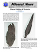
| secondary phosphate minerals. Although some pegmatite mining for feldspar still continues (Jacobson 1994). the...except for the Homestake mine, which has operated for more than 120 years, most mining in the area peaked in...and fewer chances to obtain any. However, some mining, mineral exploration, and mineral collecting continues...FiridofGt~rnSphultirite ut IIIP Bulinut Zinc Mine, St. Luwrence County, tditor of NPW b r k ” unrl iipptwwl...additions. Mlneral Index by Counties Brule County Elm Creek, IS mi. S. of Chamberlain, near junction with |
 | | Report (volume) |
| ATLANTIC GOLI) DISTRICT AND THE NORTH LARAMIE MOUNTAINS PAPERS BY ARTHUR C. SPENCER WASHINGTON GOVERNMENT...................... The Atlantic gold district, Fremont County, Wyo........................... Introduction........................ Geology of the Atlantic district......................................... Rocks...Magnetite schists in the northern part of the district.............. 16 Distribution and general character........................ General outlook for lode mining.................................... Planning of |
 | | Report (issue) |
| Sbcrbtary OF MINES VAN. H. MANNING. Director I HE MINING INDUSTRY IN THE TERRITORY OF ALASKA DURING THE... SMITH United States Mine Inspector for Alaska ENGINEERING \Y* WASHINGTON GOVERNMENT PRINTING 1917...Secretary OF MINES H. MANNING. Director THE MINING INDUSTRY IN THE TERRITORY OF ALASKA DURING THE...SUMNER S. SMITH United Stales Mine Inspector for Alaska WASHINGTON GOVERNMENT PRINTING 1917 OFFICE...Superintendent of Documents, Government Printing Office, Washington, D. C. The Superintendent of Documents is not |
 | | Report (issue) |
| RE is used for all rareearth elements); the mining district (Ransome and Kerns, 1954 (1C 7679)) in which... (Cosna R. tributaries) Tin(?) Hot Springs district Kantishna River Center part of quad. Summary:...southwest of the Tofty district." Unnamed occurrence Lead, Silver Kantishna district OF 77-169A, loc. 1...in quartz veins. (American Cr.) Gold Ruby district MF-405, loc. 37 Ruby (18.0, 2.8) 64°08'N, 153°39'W...low-grade schist and quartzite. No data on extent of mining (if any), which would have been before 1915. References |
 | | Report (issue) |
| ................................. Madison/Jack Creek Basin (1-549).......................................... Swift Creek (1-065)................................................. Needle Creek (1-066).............................................. Trapper Creek (1-06 3)................................................................................. Meadow Creek/Selway-Bitterroot Wilderness (1-845).................................................. Red Lodge Creek/Hellroaring (1-363)............................ |
 | | Report (volume) |
| THE FAIRBANKS DISTRICT BY L. M. PRINDLE AND F. J. KATZ AND AN ACCOUNT OF LODE MINING NEAR FAIRBANKS...FAIRBANKS BY PHILIP S. SMITH WASHINGTON GOVERNMENT FEINTING OFFICE 1913 CONTENTS. PREFACE, by ALFRED H....Pre-Qrdovician ( ?) rocks ________________ Birch Creek schist____._ _____________ Lithologic character...Geologic history_______ GEOLOGY OF THE FAIRBANKS DISTRICT, by L. M. PRINDLE and F. J. KATZ_ Descriptive..._____^________ ___ Pre-Ordovician rocks___________ Birch Creek schist- . _ General character_________ Quartzite |
 | | Report (issue) |
| LODE MINING NEAR FAIRBANKS. By THEODORE CHAPIN. INTRODUCTION. The occurrence of auriferous quartz veins...for a number of years, but until recently quartz mining has received relatively little attention. In the... 'The total lode production for the Fairbanks district is about S674,00Q. In 1911 the production was...1913 the writer spent a few days in the Fairbanks district to study the occurrence of lodes and to gather...a. measure reflects the progress made in quartz mining, which showed a marked advancement, particularly |
 | | Journal (article/letter/editorial) |
| Postcard view of the Tenderfoot mine (about 19131, Esterbrook copper district, Albany County. John Taylor collection...and Grace Dyck and wus titled “The Sunrise Iron Mine near Hartville, Wyoming”; it appeared in the MaylJune...titled “The Copper Mountain Pegmatite District, Freniont County, Wyoming” and was in the JulylAugust 2001...most notable ones. The localities are listed by county and then in alphabeticnl order. Where numerous...under the district name. District names are from Hausel (1986). Localities by County Albany County Allanite |
 | | Report (volume) |
| CRIPPLE CREEK DISTRICT, COLORADO BY WALDEMAR LINDGREN AND FREDERICK LESLIE RANSOME WASHINGTON GOVERNMENT..... ...:......................_...._....... 8 Mining and metallurgy ....................................^...... 11 First geological survey of the district ................................... Modifications............................. 32 Future of the district.................................................THE INTERIOR, UNITED STATES GEOLOGICAL SURVEY, Washington, D. C. , November 3, 1904- SIR: I have the honor |
 | | Report (issue) |
| advancement of the mining industry in the Territory. It affords a means of giving to the mining public the important...summaries of progress in various phases of the mining industry during the year, (2) preliminary accounts...is here made to cover the entire field of Alaska mining interests; but to do this it has been necessary...to the Alaska division to visit annually all the mining districts in the Territory and at the same time...considerable information in regard to the status of mining in the districts that were not visited by members |
 | | Report (issue) |
| Commission UNITED STATES GOVERNMENT PRINTING OFFICE, WASHINGTON : 1968 UNITED STATES DEPARTMENT OF THE INTERIOR...of Documents, U.S. Government Printing Office, Washington, D.C. 20402 CONTENTS Abstract._ _--------...ey Peak dome.__ _______________________ Spring Creek area--------------------------Minor structures __...Gravel secondary roads are common, and lumbering and mining trails cross areas between the secondary roads...Altitudes range from about 5,330 feet along French Creek in the southeastern part of the quadrangle to 7 |
 | | Report (issue) |
| BULLETIN 71 Mineral Resources of Taos County, New Mexico by JOHN H. SCHILLING Description of mineral...INSTITUTE OF MINING & TECHNOLOGY CAMPUS STATION SOCORRO, NEW MEXICO NEW MEXICO INSTITUTE OF MINING 8c TECHNOLOGY................................... 11 HISTORY OF MINING .................................................Primero and Canada Pinabete............. Cabresto Creek ........................................................................................ Jenkin's Lead-Zinc prospect ................................. |
 | | Report (issue) |
| is bisected by the northeastward-trending Shaw Creek fault, which, on the basis of aeromagnetic interpretation...much as 48 km. On the northwest side of the Shaw Creek fault, metamorphic rock units have a northwesterly...scientists. s Geochemical distribution of copper, lead, and molybdenum in the ash of willow leaves. Geochemical...Geochemical distribution and abundance of copper, lead, and zinc in the oxide residue. sediment. Geochemical...Geochemical distribution and abundance of copper, lead, and zinc in minus-80-mesh stream mineral concentrate |
 | | Journal (issue) |
| Albuquerque, New Mexico. Oct. 1-3 - - Cochise County Fair, Douglas, Arizona. Oct. 2-3—Apple Day, Julian...Julian, California. Oct. 2-3—Santa Cruz County Fair, Sonoita, Arizona. Volume 17 OCTOBER, 1954 COVER... Oct. 13-16 — Kiwanis International Southwest District Convention, Albuquerque, New Mexico. Oct. 16—Fall...days a week during winter. Oct. 16-17 — Graham County Fair. Safford, Arizona. Oct. 17—Tucson Fine Arts...Springs MEDICINE By EDMUND JAEGER, D.Sc 23 LOST MINE New Snake Bite Treatment 26 LETTERS Lost Black |
 | | Report (issue) |
| Commission. Washington, P. C., 1954 Free on application to the Geological Survey, Washington 25, D. C..... . . . . . . . . . . . . . . . . . Fairbanks district . . . . . . . . . . . . . . . . . . . . . Geology... . . . . . . . . . . . . . . CHAPTER B. -Grant Creek area, by · P. L. Killeen and M. G. White Abstract...sketch map of the Pedro Dome area., Fairbanks district. .................... ,. . . . . . . . . . . ... . . . . . . . . . . Drainage map of the Grant Creek area, Yukon region . . . . . . . . . . . . . . |
 | | Journal (issue) |
| THE Devoted OUTCROP. to the Mining and Development Vol. I., No. 27. members eariy. inthe | DINNER...Winder District) on Thesdayv nuniber and Peterboro fall of snow of to it will creek Friday...prospectors inet and mining men ed to visit the whostated Windermere they intend district next season with...’ said the Blach Bear vas Pnylis what??? ‘The Tenderfoot. es of extreme suspicion at the Dear Poe hal... leaving stadden Irreverent two Wuhil the creek stage oba off Phen thev : Perhaps 1 d |
 | | Book |
| Cities of Gold History of the Victor Cripple Creek Mining District by Brian Levine 7 j i : { i t } '...GOLD History and Tales of the Cripple Creek-Victor Mining District By Brian H. Levine 1981 Copyright...McCormick (President of the Chicago-Victor Gold Mining Company) Alice Ashley (Proprietor of Ye Olde Bottle...Ed Hunter (Head Mining Engineer for Texasgulf in the Cripple CreekVictor Mining District) Jim Keener (Editor...(Editor of the Cripple Creek Gold Rush) Dayton Lummis (Curator of the Cripple Creek Museum) Photo Credits: |


