 | | Report (volume) | | Director ' Bulletin 648 NOTES ON SOME MINING DISTRICTS IN EASTERN NEVADA BY JAMES M. HILL WASHINGTON GOVERNMENT................................................. Quartz monzonite........................................Clark County.......................................................'.. Gold Butte mining district.................... Lincoln mine........................................ Bennett mine.........................gneiss............................. Gold Butte Mining Co................................. New Era group | 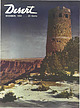 | | Journal (issue) | | 4—Palm Springs Desert Museum Field Trip to Dolomite Mine off Palms to Pines Highway, Palm Springs, California...near Raton. N.M. Dec. 19—Dons Travelcade to Vulture Mine. Wickenburg. From Phoenix, Arizona. D ec . 24 —...ether poems 13 FIELD TRIP Gem Hunting with a Nevada Prospector By HAROLD O. WEIGHT On the Trail of...NEWS 27 From Here and There on the Desert 29 MINING Current news of desert mines 33 LAPIDARY Amateur... Sierra Club members on the summit of Boundary Peak, highest point in Nevada. Front row, left to right: |  | | Report (volume) | | CHARLES D. WALCOTT, DIKECTOK DESCRIPTIVE GEOLOGY OF NEVADA SOUTH OF THE FORTIETH PARALLEL AND ADJACENT PORTIONS...limestone ....................'.....!.................. Nevada limestone.. .^.^.....................................-.......--..-.......-............------. White Pine shale ..................................................... Chapter I. Ranges of east-central Nevada. ...........-.............'.....'... Snake Range...- CONTENTS. Chapter I. Ranges of east-central Nevada Continued. Page. Cedar Range and Clover Valley |  | | Journal (article/letter/editorial) | | Identification of quartz and carbonate minerals across northern Nevada using ASTER thermal infrared emissivity... Denver Federal Center, Denver, Colorado 80225, USA ABSTRACT ASTER (Advanced Spaceborne Thermal Emission...imagery over a 389 km × 387 km area in northern Nevada (38.5°–42°N, 114°–118.5°W) was analyzed to evaluate...and cost-effective identification and mapping of quartz and carbonate minerals at regional to local scales...materials, many of which are composed primarily of quartz and carbonate minerals. This area is also endowed |  | | Report (issue) | | Iron-black, tarnishing brown; in polished section, gray-white; deep green to brown and red in thin slivers. Luster:...36.83 99.94 100.81 100.00 36.85 (1) Arizona, USA. (2) Sotkamo, Finland. (3) MnS. Polymorphism & Series:... tellurium, rhodochrosite, calcite, rhodonite, quartz. Distribution: Selected localities include: from...Yakumo and Inakuraishi mines, Hokkaido; the Taisei mine, Akita Prefecture; and many other localities in...Preciosa mine, Tlalchichuca, Puebla, and at Onovas, Sonora, Mexico. In the USA, in the Lucky Cuss mine, Tombstone |  | | Book | | f. MIMING DISTRICTS and MINERAL RESOURCES of NEVADA by FRANCIS CHURCH LINCOLN i r r i i ; %■... ; 'jxt . 1 — \ MINING DISTRICTS and MINERAL RESOURCES of NEVADA by FRANCIS CHURCH LINCOLN...LINCOLN 0 ll ; RENO NEVADA NEWSLETTER PUBLISHING COMPANY 1923 PREFACE Earlier Works. The object of...infor mation concerning the mining districts and mineral resources of Nevada. No comprehensive work of...peared for a number of years. In the early days of Nevada min ing, from 1866 to 1878, the field was covered |  | | Report (issue) | | wu OUTLINE OF NEVADA MINING HISTORY— Joseph V: Tingley a RobertC.Horton _ Francis C. Lincoln 3 . ...Publication of this new edition of “Outline of Nevada Mining History” was made — possible with the assistance...eh aa nearly 48 million acres of public land in Nevada. Most of the minerals, _ _ geothermal energy, and...ahij 4 = Wh A a ‘ a a y 4 Pte Es in Nevada comes from publicland. First edition, first printing...Leshendok, U.S. Bureau of Land Management Eric Moody, Nevada Historical Society é Jon Price, National Research |  | | Report (issue) | | RESOURCES OF ELKO COUNTY, NEVADA By Roscoe M. Smith Prepared in cooperation with Nevada Bureau of Mines...Acknowledgment -Mining districts Commodities Production Descriptions of mining districts . Alder district-Aura district...district -Beaver district Black Mountain district Bootstrap district Burner district Burns Basin district--...-Carlin district Cave Creek district ----Charleston district_--Coal Mine district~ Contact district Cornucopia...Cornucopia district - -Corral Creek district - Decoy district Delano district Delker districtDivide district |  | | Report (volume) | | BULLETIN 594 SOME MINING DISTRICTS IN NORTHEASTERN CALIFORNIA AND NORTHWESTERN NEVADA BY JAMES M. HILL...BULLETIN 594 SOME MINING DISTRICTS IN NORTHEASTERN CALIFORNIA AND NORTHWESTERN NEVADA BY JAMES M. HILL...of the ore deposits 2 27 30 Mining districts 2 Hayden Hill, Lassen County, Cal 2 30 30 Location and accessibility...filling 3 42 CONTENTS. Mining districts—Continued. Hayden Hill, Lassen County, Cal.—Continued. Ore deposits—Continued...shoots Milling High Grade district, Modoc County, Cal Location History of mining Accessibilty Previous descriptions |  | | Report (issue) | | of the Arizona Geological society, society for Mining, Metallurgy and Exploration Inc., and the U. s...We also want to thank collectively, all of the mining companies and staff who graciously allowed us to...ALONG THE 1-80 CORRIDOR, RENO TO BATTLE MOUNTAIN, NEVADA R. Cuffney, R. Atkinson and R. Buffa Revised 1990...north-south ranges of central and northeastern Nevada (Fig. I). These belts, or their extensions, contain...vast majority of precious metal deposits found in Nevada to date. Our trip begins in the Walker Lane mineral |  | | Journal (article/letter/editorial) | | Gold nugget, 7.67 troy ounces, Fairbanks mining region, Alaska, USA. Donated in 1977 by Arthur Sexaur. University...approximately 89 troy ounces, Ganes Creek, Iditarod district, Yukon-Koyukuk Borough, Alaska. This nugget shows...1985 nugget Alaska, Ganes Creek 2004 mass with quartz Alaska, Ganes Creek 1985 Alaska, Ganes Creek...ounces NAC Alaska, Ganes Creek 1905 mass with quartz 51.6 ounces Tisler specimen www.akmining.biz;...biz; 12/2016 Alaska, Ganes Creek 1905 mass with quartz 55 ounces Wiltz specimen www.akmining.biz; 12/2016 |  | | Report (issue) | | __ a-—™ UNIVERSITY OF NEVADA BULLETIN Y ol. XLI DECEMBER 1947 No. 9 G EOLOGY A N D M IN IN G...Engineer N evada State Bureau of Mines JNIVERSITY OF NEVADA BULLETIN Vol. XL I DECEMBER 1947 No. 9 GEOLOGY...Washoe Counties By D. O verton M ining Engineer Nevada State Bureau of Mines T heodore PR IC E F IF T...Topography, Geology and Mineral Resources.. Douglas County— Location and Topography.. Geology and Ore Deposits...Highways_____ Production............................... Mining Districts— Buckskin (Smith Valley). Gardnerville |  | | Report (volume) | | ........................ 5 5 Distribution of mining districts...................................................................................... Nevada.......................................................................... PART II. Catalogue of mining districts, by J. M. Hill..................................................... Classification of mining districts...................................................................................... Nevada............................................... |  | | Report (issue) | | Powell, United States geological survey Nevada with district Eureka of the Geology | | | title: director...Geology Arnold Hague | Washington Eureka | district [Vignette] | | Powell, director with an atlas...of 4. | | | | government printing | W. Nevada | xvii, (U. S. geological nuney). Monograph...Geology of the Eureka Arnold Hague [Vignette] district | | | ? S Washington 4. | xvii, 419 pp... J. | 8 W. Powell, director with an atlus Nevada | | | | by | | government printing [UNITED |  | | Book (volume) | | Most specimen collecting is done in the Lead-Zinc mining dists. of northwestern Illinois, the glacial drift...600 to 800 feet thick in the north. ALEXANDER COUNTY FAYVILLE, area stream gravels⎯agate, jasper, rare...⎯agate, jasper; d RR siding of Clay⎯agate. CALHOUN COUNTY AREA, shores of the Mississippi R., in the Warsaw...Amethysts, or Quartz crystals). CRAWFORD COUNTY PALESTINE, area deposits⎯Siderite. EDWARDS COUNTY AREA, T...deposits⎯Siderite. FULTON COUNTY FARMINGTON, W 6 mi. on Rte. 116 to the Rapatee No. 5 strip mine⎯pyritized gastropods |  | | Book (volume) | | Most specimen collecting is done in the Lead-Zinc mining dists. of northwestern Illinois, the glacial drift...600 to 800 feet thick in the north. ALEXANDER COUNTY FAYVILLE, area stream gravels⎯agate, jasper, rare...⎯agate, jasper; d RR siding of Clay⎯agate. CALHOUN COUNTY AREA, shores of the Mississippi R., in the Warsaw...Amethysts, or Quartz crystals). CRAWFORD COUNTY PALESTINE, area deposits⎯Siderite. EDWARDS COUNTY AREA, T...deposits⎯Siderite. FULTON COUNTY FARMINGTON, W 6 mi. on Rte. 116 to the Rapatee No. 5 strip mine⎯pyritized gastropods |  | | Report (volume) | | it helpful to refer to Survey Bulletin 507, "The mining districts of the western United States," and to...exhausted by mining or quarrying. Deposits of minerals of wide distribution, such as quartz and calcite...because they occur in sufficient quantity to warrant mining for their usual products but because they furnish...E. H. Barbour, University of Nebraska, Lincoln. Nevada...........Dr. W. S. Tangier Smith, Berkeley, Cal...Henry Landes, Seattle. West Virginia... .Dr. I. C. White, Morgantown. Wisconsin.........Prof. W. 0. Hotchkiss |  | | Report (volume) | | ....................................... 102 District of Columbia ............................................................................ 187 Nevada..................................................to refer to Geological Survey Bulletin 507, "The mining districts of the western United States," and to...exhausted by mining or quarrying. Deposits of minerals that are widely distributed, such as quartz and calcite...because they occur in sufficient quantity to warrant mining for their usual products, but because they furnish |  | | Book (volume) | | especially along the southern slopes and ridges of the Pine Ridge Escarpment and along Whiteclay Creek near...plants and vertebrate remains. The breaks of the White River north of Crawford in Dawes Co. and the rather...chalcedony, jasper and gem petrified wood. BUFFALO COUNTY KEARNEY, area gravel bars and pits along the Platte...townagate, chalcedony, jasper, petrified wood. CASS COUNTY WEEPING WATER, SE, on rd. to Nehawka, in the Snyderville...chalcedony, jasper, fossils. CHERRY COUNTY VALENTINE, in the Sandhills county along the Niobrara R. and Minnechaduza |  | | Report (issue) | | -AND THE EASTERN SLOPE OF THE .~OUTHERN SIERRA NEVADA, CALIFORN~A BY ADOLPH KNOPF ·WITH A SECTION ON...Inyo Range .............. ~ ........ . The Sierra Nevada ..................... . l)rainage ............... Mississippian series ..............·.... . 'White Pine shale ......... : ..·... . Pennsylvanian series...Zurich .................. ~ .. . Are~ south of Big Pine .............. . North of Owens River ........................ . Alluvial cones along the Sierra Nevada General features .......... .'. : .. . Dissection |  | | Book | | ath IO wns : POEL eieeet be eas, NN 419-3 Nevada; a 03 G ps 127)oO to the Silver state The...DUE TTT JA S = * aint Demgo = en ae NEVADA A Guide to the Silver State mv DA A GUIDE...the Work Projects Administration in the State of Nevada aa AMERICAN GUIDE SERIES LPR US BATENS = BY...PACIFIC Sponsored by Dr. Jeanne Elizabeth Wier, Nevada State Historical Society, Inc. FORDS & MORT :... COPYRIGHT, 1940, BY NEVADA STATE HISTORICAL SOCIETY, INC. FIRST PUBLISHED IN 1940 THE NEVADA STATE HISTORICAL |  | | Report (issue) | | resource areas in the Basin and Range Province of Nevada by George Wong Open-File Report 83-721 This...Appendix A **~""~~"* "* *** *"* * » Table Table 1. District descriptions . .-.-.-. . -.-. . . . .-. .-. <...resource areas in the Basin and Range Province of Nevada By George Wong The purpose of this map is to identify...Province. These areas include past and present mining and prospecting localities as well as areas of...map are not legal mining district boundaries and may include more than one district as well as adjacent |  | | Report (issue) | | to visit a number of widely separated mining districts in Nevada and northeastern California. The work...days of September were spent in the Yellow Pine district, Nevada's new and largest zinc camp. This report...and people of the district did much to expedite the work. The mining men of the district extended many courtesies...ACCESSIBILITY. The Yellow Pine mining district, sometimes called ,the Good Springs district, is in the southwestern...southwestern part of Clark County, Nev., near the California line. It covers the southern part of the Spring |  | | Journal (article/letter/editorial) | | Correlations at Buckskin Mountain, National District, Humboldt County, Nevada PETER G. VIKRE† U.S. Geological Survey...Sciences and Engineering, University of Nevada, Reno, Reno, Nevada 89557 Abstract At Buckskin Mountain...Mountain (elev 2,650 m, 8,743 ft), Humboldt County, Nevada, a hydrothermal system, imposed on a middle Miocene...sinter and silicified epiclastic deposits at the summit. Sinter and veins, correlated by common elements...in planar conduits caused deposition of banded quartz-silicate-selenide-sulfide veins ~270 to > 440 m |  | | Report (issue) | | IN THE TRIASSIC-JURASSIC MAGMATIC ARC OF WESTERN NEVADA AND EASTERN CALIFORNIA by David A. John1 , Richard...California ^Mackay School of Mines, University of Nevada, Reno, Nevada Introduction This paper is a chapter...the Triassic and Jurassic magmatic arc of western Nevada and eastern California. A summary of the report...focus of this study is an irregular area in western Nevada and eastern California centered at the latitude...northern Wassuk Range, (2) latest Early Jurassic in the Pine Grove Hills-Wassuk Range-Gillis Range, (3) Middle |
|


