| Locality type: | Quarry |
| Classification |
|---|
|
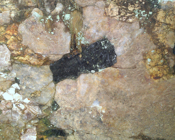
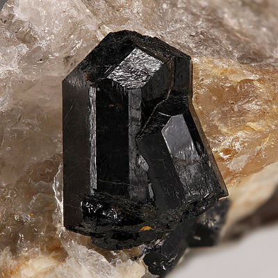
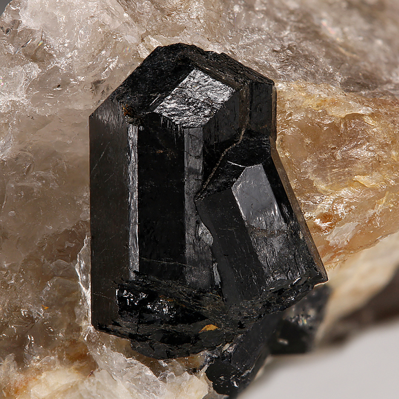
| Species: | Schorl |
| Formula: | NaFe32+Al6(Si6O18)(BO3)3(OH)3(OH) |
| Comments: | Very fragile crystals several cms across common, rarely well terminated thumbnail crystals in quartz. |
| Habit: | stubby prisms with simple rhombohedral terminations |
| Colour: | black |
| Abundance at site: | Common |
| Confirmation |
|---|
|
| Validity: | Confirmed |
| Confirmation Methods: | Visually Identified |
| Associated Minerals Based on Photo Data: |
|---|
|
| Quartz | ⓘ2 photos of Schorl associated with Quartz at this locality. |
| Albite | ⓘ2 photos of Schorl associated with Albite at this locality. |
| Microcline | ⓘ1 photo of Schorl associated with Microcline at this locality. |
| Data |
|---|
|
| Mineral Data: | Click here to view Schorl data |
| Locality Data: | Click here to view Civilian Conservation Corps Quarry (CCC Quarry; Smith Quarry; Turkey Hill quarry lot), Haddam, Middlesex County, Connecticut, USA |
| Photo Gallery | View Gallery (3 photos) |
| Data Identifiers |
|---|
|
| Mindat Occurrence Record ID: | 826897 |
| Long-form Identifier: | 1:3:826897:6 |
| GUID (UUID V4): | a045571c-c698-428a-b706-f43323c76872 |
| Nearest other occurrences of Schorl |
|---|
|
|
| 0.1km (0.1 miles) | ⓘCivilian Conservation Corps prospect (CCC prospect; Cook columbite prospect), Haddam, Middlesex County, Connecticut, USA |
| 0.7km (0.4 miles) | ⓘHewitt Gem Quarry (Herb's Gem Quarry; Sawmill Quarry), Haddam, Middlesex County, Connecticut, USA |
| 0.8km (0.5 miles) | ⓘGulf Quarry, Haddam, Middlesex County, Connecticut, USA |
| 1.1km (0.7 miles) | ⓘLong Hill prospects (Turkey Hill prospects), Haddam, Middlesex County, Connecticut, USA |
| 1.1km (0.7 miles) | ⓘState Route 9 Interchange 13 - Beaver Meadow Road, Haddam, Middlesex County, Connecticut, USA |
| 1.5km (0.9 miles) | ⓘState Route 9 rock cuts, Haddam, Middlesex County, Connecticut, USA |
| 1.5km (1.0 miles) | ⓘTimms Hill (Tim's Hill; Iolite Hill), Haddam, Middlesex County, Connecticut, USA |
| 1.6km (1.0 miles) | ⓘAlmandine schorl and sillimanite locality, Haddam, Middlesex County, Connecticut, USA |
| 1.6km (1.0 miles) | ⓘLong-lot Quarry, Haddam, Middlesex County, Connecticut, USA |
| 2.6km (1.6 miles) | ⓘHill above the parsonage (unnamed feldspar quarry), Haddam, Middlesex County, Connecticut, USA |
| References |
|---|
|
|


Civilian Conservation Corps Quarry, Haddam, Middlesex County, Connecticut, USA