 | | Report (issue) | | Landforms, Stratigraphy, and Tectonism in Kittitas Valley, Washington Late Cenozoic Deposits, Landforms...Landforms, Stratigraphy, and Tectonism in Kittitas Valley, Washington By RICHARD B. WAITT, JR. GEOLOGICAL SURVEY...STATES GOVERNMENT PRINTING OFFICE, PAPER 1127 WASHINGTON : 1979 UNITED STATES DEPARTMENT OF THE INTERIOR...of Documents, U.S. Government Printing Office Washington, D.C. 20402 Stock Number 024-001-03147-7 CONTENTS...Yakima Basalt Subgroup----------- — ---- — - — ----Ellensburg Formation----—------------------------------ |  | | Journal (article/letter/editorial) | | Agate in Washington State R O B E R T D. P A T T I E 4 3 1 6 N E 10th S t r e e t Renton, Washington 98059...most cases, the sites identified here by name and county occur on public lands, and currently no fees are...to collect there. The clubs are members of the Washington State Mineral Council, P . O . Box 236, Ren...you should first check with local clubs; local county, state, or federal land offices; or local rock...) 24. Clallam Bay, Clallam ( A ) 25. Jefferson County beaches, Jefferson ( A , J ) 26. Lake Crescent |  | Swanson, Donald A., Anderson, J.L., Bentley, R.D., Byerly, G.R., Camp, V.E., Gardner, J.N., Wright, T.L. (1979) Reconnaissance geologic map of the Columbia River Basalt Group in eastern Washington and northern Idaho. Open-File Report Vol. 1979 (79-1363) US Geological Survey doi:10.3133/ofr791363 | Report (issue) | | units. Includes Thorp Gravel (Waitt, 1979) in Kittitas Valley, Cowiche gravel of Smith (1903) in Cowiche...ancestral Snake River in Lewiston basin near Asotin, Washington. crysts as long as 10 mm. Some pheno- Similar...member. Interbedded with volcaniclastic rocks of Ellensburg Formation near Yakima Roza Member Basalt flows...sandstone and siltstone of Vantage Member of Ellensburg Formation (unmapped im most places) along Columbia...underlies unmapped diatomite (Squaw Creek Member of Ellensburg Formation). Occurs widely in southwest part |  | | Journal (article/letter/editorial) | | AMERICA JUNE 1965 GEOMORPHOLOGY OF SOUTH-CENTRAL WASHINGTON, ILLUSTRATED BY THE YAKIMA EAST QUADRANGLE BY...district has been neglected since publication of the Ellensburg and Mount Stuart folios (G. 0. Smith, 1903a;...that to the east and south the lower part of the Ellensburg formation interfingers with the Yakima basalt...modified and inter-, rupted deposition of the Ellensburg formation. Smith's conclusions that the great...Unsolved problems 666 Ellensburg-basalt stratigraphic relations.... 666 Ellensburg correlation problem |  | | Report (issue) | | COLUMBIA RIVER BASALT GROUP IN PARTS OF EASTERN WASHINGTON AND NORTHERN IDAHO By D.A. Swanson, R.D. Bentley...These maps, together with a map of southeast Washington (Swanson and others, 1977; updated version by...an overview of the basalt in much of eastern Washington and northern Idaho north of the Clearwater embayment...embayment. Large unmapped areas remain in Washington; these are scheduled to be completed in 1979, after...which a map of the basalt throughout eastern Washington will be prepared. The accompanying maps are preliminary |  | | Report (volume) | | y The Yakima Basalt and Ellensburg Formation of South-Central Washington By JAMES W. BINGHAM and MAURICE...STRATIGRAPHY BULLETIN Prepared in cooperation with the Washington Department of Conservation Division of Water...V UNITED STATES GOVERNMENT PRINTING OFFICE, WASHINGTON: 1966 For sale by the Superintendent of Documents...Documents, U.S. Government Printing Office Washington, D.C. 20402 - Price 10 cents CONTENTS Page Abs...Mountains Member.______________________________ Ellensburg Formation._____________________________________________ |  | | Report (volume) | | A GEOLOGICAL KECONNOISSANCE IN CENTRAL WASHINGTON ( WASHINGTON O () V K li N M K N T P R I N T I N (J...survey | no. 108 | [Seal of the department] | Washington | government printing office | 1893 Second title:...reconnoissance | in | central Washington | by | Israel Cook Russell | [Vignette] | Washington | goveruinent printing...reconnoissance | in | central Washington | by | Isral Cook Russell | [Vignette] | Washington | government printing...recpunoissance | in | central Washington | by | Israel Cook Russell | [Vignette] | Washington | government printing |  | Fuhrer, G.J., Cain, D.J., McKenzie, S.W., Rinella, J.F., Crawford, J.K., Skach, K.A., Hornberger, Michelle I., Gannett, M.W. (1996) Surface-water-quality assessment of the Yakima River Basin in Washington; spatial and temporal distribution of trace elements in water, sediment, and aquatic biota, 1987-91. Open-File Report Vol. 1996 (95-440) US Geological Survey doi:10.3133/ofr95440 | Report (issue) | | SURFACE-WATER-QUALITY ASSESSMENT OF THE YAKIMA RIVER BASIN IN WASHINGTON: SPATIAL AND TEMPORAL DISTRIBUTION OF TRACE :... SURFACE-WATER-QUALITY ASSESSMENT OF THE YAKIMA RIVER BASIN IN WASHINGTON: SPATIAL AND TEMPORAL DISTRIBUTION OF TRACE ELEMENTS... FIGURES 1. Map showing the Yakima River Basin, Washington ...............................................stream-gaging stations in the Yakima River Basin, Washington............................. 3. Elevation profile...distinctive hydrologic reaches of the Yakima River, Washington.................... 4. Map showing land use and |  | Walsh, Timothy J., Korosec, Michael A., Phillips, William M., Logan, Robert L., Schasse, Henry W., Digital database by Meagher, Karen L., Haugerud, Ralph A. (1999) Geological map of Washington: southwest quadrant (digital edition) Open-File Report Vol. 1999 (99-382) US Geological Survey doi:10.3133/ofr99382 | Report (issue) | | estuarine deposits. Includes parts of the Lakedale and Kittitas Drifts En Deposits of Continental Glaciers—Puget...Wilkes, and Dalles Formations and part of the Ellensburg Formation Continental sedimentary rocks, con...clasts of augite andesite; near Burnett in Pierce County, poorly sorted, unstratified, matrixsupported breccia...sandstone, lapillistone, and thin tuff; in the Kittitas Valley, mostly volcaniclastic sandstone and siltstone...1960) and, east of the Cascades, part of the Ellensburg Formation Tuff—Welded to nonwelded, vitric to |  | | Report (volume) | | OTIS SMITH, DIBECTOR BULLETIN 557 STATE OF WASHINGTON 1896 TO 1913, INCLUSIVE R. B. MARSHALL, CHIEF...WITH THE STATE HENRY LANDES, STATE GEOLOGIST WASHINGTON GOVERNMENT PRINTING OFFICE 1914 ELEVATION OF............................... 7 Cedar Lake, Ellensburg, Mount Stuart, Pasco, Prosser, Snoqualmie, Tacoma...Yakima, and Zillah quadrangles (Franklin, King, Kittitas, Pierce, and Walla Walla counties)..............Grant, and Kittitas counties).................................................... Ellensburg and Mount |  | | Report (issue) | | nomenclature 1/Yakima Valley Community College, Yakima, Washington CONTENTS Page Introduction ......................... .19 Ellensburg Formation ..................... 20 Lower part of the Ellensburg Formation .....Middle part of the Ellensburg Formation ......... 22 Upper part of the Ellensburg Formation ...........Snipes Mountain .......... .27 Upper part of the Ellensburg Formation undivided . . .28 Olivine basalt and...adjacent part of the Cascade Range in south-central Washington (fig. 1). Most of the reservation is underlain |  | | Report (volume) | | RESULTS OF SPIRIT LEVELING IN THE STATE OF WASHINGTON 1896 TO 1910, INCLUSIVE R. B. MARSHALL, CHIEF...COOPERATION WITH THE STATE DURING 1909 AND 1910 WASHINGTON : GOVERNMENT PRINTING OFFICE 1911 CONTENTS................................... Cedar Lake, Ellensburg, Mount Stuart, Pasco, Prosser, Snoqualmie, Tacoma...Yakima, and Zillah quadrangles (Franklin, King, Kittitas, Pierce, and Walla Walla counties)..............Grant, and Kittitas counties)....................................................... Ellensburg and Mount |  | | Report (volume) | | 1502-A UNITED STATES GOVERNMENT PRINTING OFFICE, WASHINGTON: 1980 UNITED STATES DEPARTMENT OF THE INTERIOR...of Documents, U.S. Government Printing Office Washington, D.C. 20402 CONTENTS PAGE New geologic time...River Basalt Group) middle Miocene southeastern Washington and northwestern Idaho Swanson, D. A., Wright...Beverly Member (age changed) (of Ellensburg Formation) middle Miocene Washington Swanson, D. A., Wright, T....Miocene northeastern Oregon and southwestern Washington CHANGES IN STRATIGRAPHIC NOMENCLATURE A11 |  | | Journal (article/letter/editorial) | | BUREAU OF SOILS, U. S. DEPARTMENT OF AGRICULTURE, WASHINGTON, D. C. . In a general study of American soils...Wauneta, Chase County, Wauneta Post Office, Chase County, Alma, Clay County, and Dawson County. Very light...Barbour, March, I899. No. dc93~. Neb.raska2 Frontier County. Volcanic ash. Very light in color. Collected.by...McPherson County. Volcanic dust. Subsoil. Co/or, very light. J.A. Udden, Collector. No. 993. Washington, Walla...Walla Walla County. Two miles west of Walla Walla. Soil IO-2O feet. No subsoil. Color, light brown. Bunch |  | | Report (issue) | | SURFACE-WATER-QUALITY ASSESSMENT OF THE YAKIMA RIVER BASIN, WASHINGTON: ANALYSIS OF AVAILABLE WATER-QUALITY DATA THROUGH...y, sampling sites in the Yakima River basin, Washington, 1940-85 water years. Page Figure 1. Map showing...features in the Yakima River basin in south-central Washington ------------------------------------------ 15...Yakima, and Sunnyside in the Yakima River basin, Washington, 1951-80 ------------- 21 3. Graph showing annual...Yakima, and Sunnyside in the Yakima River basin, Washington, 1951-80 ------------- 22 4. Map showing mean-annual |  | | Journal (article/letter/editorial) | | MOUNTAINS, WASHINGTON BY ROBERT J. FOSTER ABSTRACT The Central Cascade Mountains of Washington are composed...ILLUSTRATIONS 102 Flgure „. Pase 102 21- Index maP of Washington 100 - Teanaway dikes 109 102 3. Rampart Ridge...Geologic map and cross sections, Central Cascades Washington 126 108 108 110 TABLE 110 Table Page 110 1. Diagrammatic...CASCADE MTS., WASHINGTON INTRODUCTION Geologic Setting The Central Cascade Mountains of Washington are composed...A N A D A O R E G O N FIGURE 1.—INDEX MAP OF WASHINGTON Black indicates area mapped in this study. Outlined |  | | Report (issue) | | CoNTRIBUTIONS T·o THE GEoLOGY oF WASHINGTON Geology and Physiography of Central Washington By GEORGE OTIS SMITE-I... CONTRIBUTIONS TO THE GEOLOGY OF WASHINGTON GEOLOGY AND PHYSIOGRAPHY OF CENTRAL WASHINGTON HY GEORGE OTIS SJYIITH.................. _. _...... _.............. _ Ellensburg formatwn. . . ... _............................ . . . . . . . . . . . . . . . . . . . . . . Ellensburg quadrangle ....................................__________________ ____ IV Geolog1c map of a portwn of the Ellensburg quadrangle __________________________ 12 V |  | | Journal (article/letter/editorial) | | Autunite, realgar, quartz, and pyrite are but a few of an array of that occur in beautiful specimens...specimens in Washington. minerals Washington Mineral Locality Index L A N N Y R. R E A M P.O. Box 2043 C o e...spectacular specimens of several miner als (e.g., quartz, pyrite, and realgar) and some of the world's best...okanoganite-(Y), and zektzerite, all from Washington Pass in Okanogan County —which are known only from the state;...in Snohomish County, ferritungstite from Germania mine near Fruitland in Stevens County, and paulingite |  | | Journal (article/letter/editorial) | | a coarse, gray sand consisting chiefly of smoky quartz, whitish felspar, and black lustrous biotite. A...sample was a coarse brown sand, almost all brownish quartz, with some pale pinkish feldspar. Coral sand from...consisting entirely of nicely rounded colorless quartz. 274 "Silica sand from Ottawa, 111. Taken right...very fine grained gray sand consisting chiefly of quartz (colorless, smoky, brownish) with black biotite...grained brown sand consisting entirely of brown quartz (quartz stained brown by limonite). It comes from Hiway |  | | Report (issue) | | WASHINGTON . GEOLOGICAL SURVEY. HENRY LANDES, STA TE GEOLOGIST. VOLUME I. ANNUAL REPORT FOR 1901...McBRIDE, Governor of Washington. C. w. Secretary. MAYNA.R D, Treasurer of Washington. F. P. GRAVES,...President of the University of Washington. E. A. BRYAN, President of the Washington Agrtoultural College and...University of Washington. State Geologist. SOLON SHEDD, • Geologist. Professor of Geology, Washington Agrioultural...s. THYNG, . Professor of Mining Engineering, Washington Agrtoultural College and School of Science. D |  | | Report (volume) | | OTIS SMITH, Director Bulletin 674 STATE OF WASHINGTON 1896 TO 1917, INCLUSIVE R. B. MARSHALL, CHIEF...State of Washington from 1909 to 1916, inclusive Henry Landes, State Geologist WASHINGTON GOVERNMENT...rock. PLATE I SPIRIT LEVELING IN THE STATE OF WASHINGTON, 1896 TO 1917, INCLUSIVE. R. B. MARSHALL, Chief...Geographer. INTRODUCTION. Cooperation. The State of Washington contributed financially to the work from 1909...publication ft. All results of spirit, leveling in Washington previously published by the United. States Geological |  | Fuhrer, G.J., McKenzie, S.W., Rinella, J.F., Sanzolone, R.F., Skach, K.A. (1993) Surface-water-quality assessment of the Yakima River basin in Washington; analysis of major and minor elements in fine-grained streambed sediment, 1987. Open-File Report Vol. 1993 (93-30) US Geological Survey doi:10.3133/ofr9330 | Report (issue) | | SURFACE-WATER-QUALITY ASSESSMENT OF THE YAKIMA RIVER BASIN IN WASHINGTON: ANALYSIS OF MAJOR AND MINOR ELEMENTS IN FINE-GRAINED...generalizedsurf icial geology of the Yakima River Basin, Washington, 1987. Map showing concentrations of arsenic...urban-storm-water drains, Yakima River Basin, Washington, 1987. Map showing concentrations of cerium,...Yakima River Basin, Washington, 1987. Map showing the Yakima River Basin, Washington --------Graph showing...distinctive-hydrologic reaches (B) of the Yakima River, Washington -----------------------------------Map showing |  | | Journal (article/letter/editorial) | | of interbedded sedimentary ro&s, South-Central Washington By HANS-ULRICHSCHMINCKE,Heidelberg*) With 9 Figures...on the Columbia River Plateau in south-central Washington indicate rather uniform transport directions.... . . . . . . . . . . . . . . . Dispersal of Ellensburg sediments . . . . . . . . . . . . . . . . . ... . . Upper and undifferentiated parts of the Ellensburg Formation . . . . . . . Paleoslopes . . . . ...19, flows of the Yakima Basalt in southcentral Washington. Fluviatile cross-bedded sandstones are interbedded | 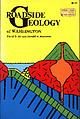 | | Book (edition) | | $9.95 045A ROADSIDE \ EOLOGY of WASHINGTON David D. Alt and Donald W. Hyndman 160 9 . 95 5917...5917 j j J j — ROADSIDE GEOLOGY OF WASHINGTON Y» W £tMl SSSaffi* JfefiBSWt, ~+ HM|KWHEral...>r.*;v *?It TOjSwwV. ROADSIDE GEOLOGY of Washington David D. Alt Donald W. Hyndman MOUNTAIN PRESS...David D. Roadside geology of Washington. 1. II. Geology — Washington (State) I. Hyndman, Donald W...know something about the rocks and landscapes of Washington. Those who are not geologists often find it difficult |  | | Journal (issue) | | native of Cheney, Washington, and attended the public schools of Spokane, Washington. He received formal...suggesting it was approximately correlative with the Ellensburg formation of Smith (1903) and Mascall formation...also the Rattlesnake and Selah members of the Ellensburg Formation of Schmincke (1964) where they project...Mascall Formation by Wells and Peck (1961) and as Ellensburg Formation by Waters (l968b). Waters (l968a,b)...Columbia River Basalt Group overlie interbeds of the Ellensburg Formation, those interbeds and their mappable |
|


Ellensburg, Kittitas County, Washington, USA